Wedgewood is an unincorporated community and census-designated place (CDP) in Wexford County in the U.S. state of Michigan. The population of the CDP was 227 at the 2020 census. Wedgewood is located within Cherry Grove Township.
| Name: | Wedgewood CDP |
|---|---|
| LSAD Code: | 57 |
| LSAD Description: | CDP (suffix) |
| State: | Michigan |
| County: | Wexford County |
| Elevation: | 1,266 ft (386 m) |
| Total Area: | 0.65 sq mi (1.69 km²) |
| Land Area: | 0.62 sq mi (1.61 km²) |
| Water Area: | 0.03 sq mi (0.08 km²) |
| Total Population: | 227 |
| Population Density: | 364.37/sq mi (140.63/km²) |
| Area code: | 231 |
| FIPS code: | 2685110 |
| GNISfeature ID: | 2583770 |
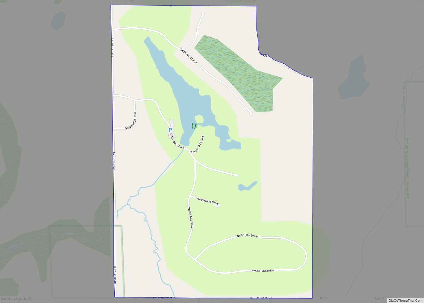
Online Interactive Map
Click on ![]() to view map in "full screen" mode.
to view map in "full screen" mode.
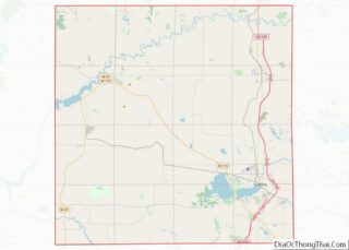
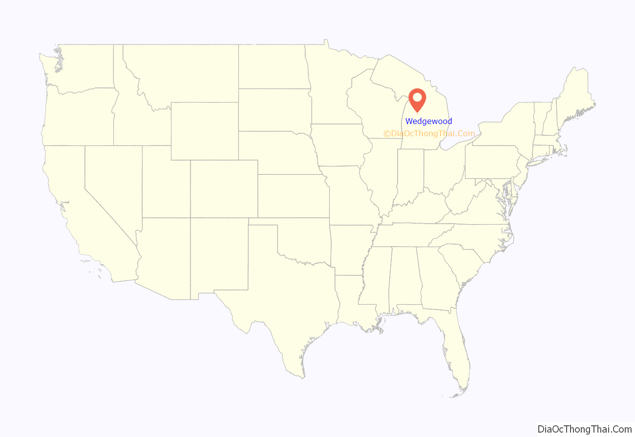
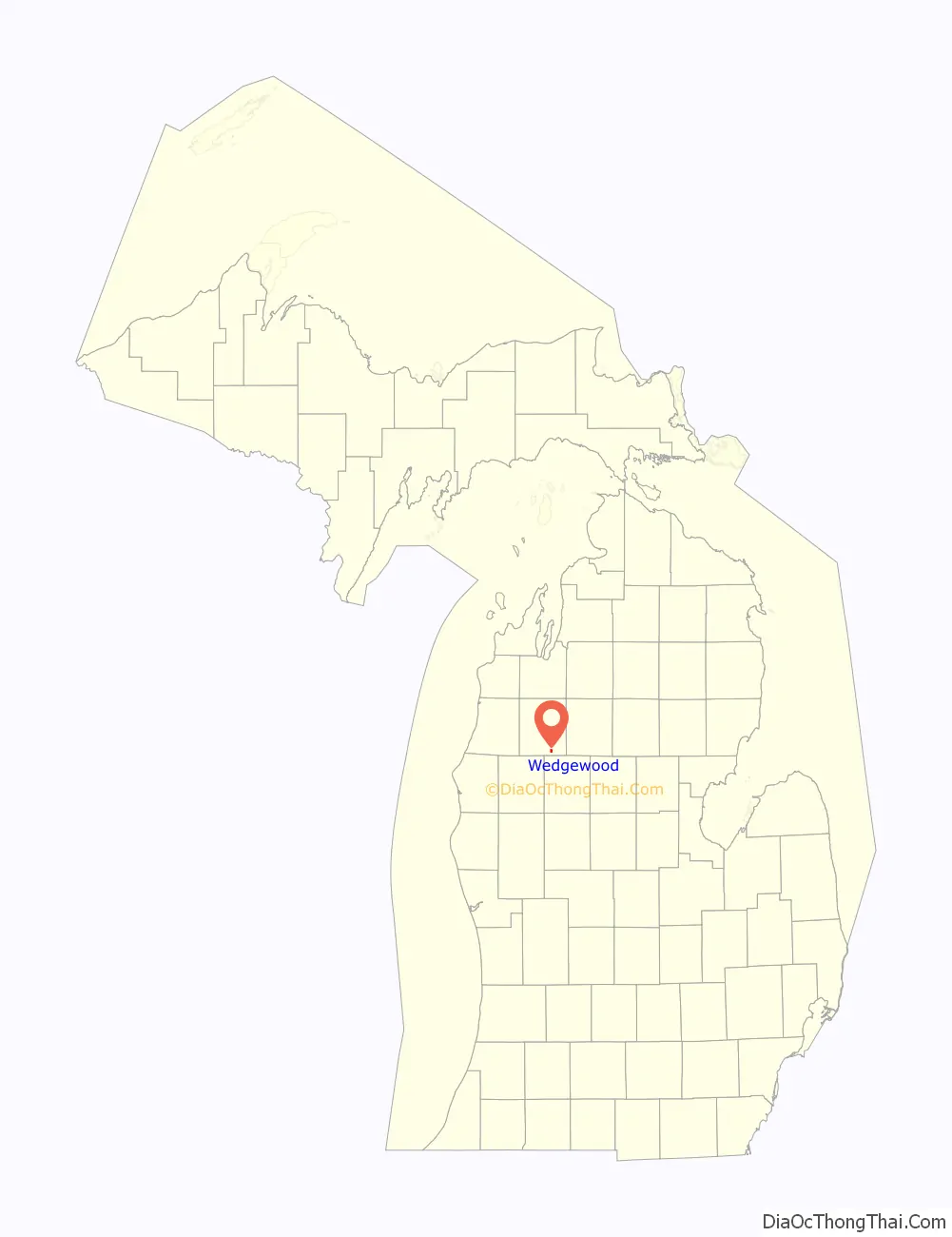
Wedgewood location map. Where is Wedgewood CDP?
History
The community of Wedgewood was listed as a newly-organized census-designated place for the 2010 census, meaning it now has officially defined boundaries and population statistics for the first time.
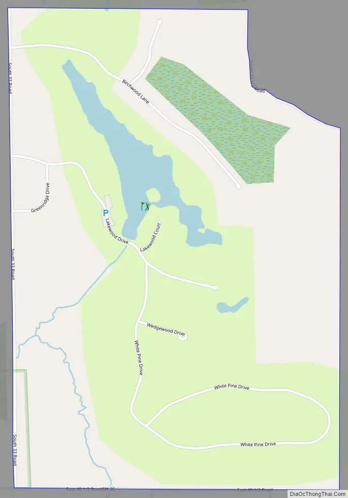
Wedgewood Road Map
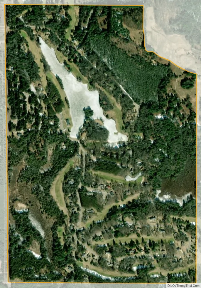
Wedgewood city Satellite Map
Geography
According to the U.S. Census Bureau, the community has an area of 0.65 square miles (1.68 km), of which 0.62 square miles (1.61 km) is land and 0.03 square miles (0.08 km) (4.62%) is water.
See also
Map of Michigan State and its subdivision:- Alcona
- Alger
- Allegan
- Alpena
- Antrim
- Arenac
- Baraga
- Barry
- Bay
- Benzie
- Berrien
- Branch
- Calhoun
- Cass
- Charlevoix
- Cheboygan
- Chippewa
- Clare
- Clinton
- Crawford
- Delta
- Dickinson
- Eaton
- Emmet
- Genesee
- Gladwin
- Gogebic
- Grand Traverse
- Gratiot
- Hillsdale
- Houghton
- Huron
- Ingham
- Ionia
- Iosco
- Iron
- Isabella
- Jackson
- Kalamazoo
- Kalkaska
- Kent
- Keweenaw
- Lake
- Lake Hurron
- Lake Michigan
- Lake St. Clair
- Lake Superior
- Lapeer
- Leelanau
- Lenawee
- Livingston
- Luce
- Mackinac
- Macomb
- Manistee
- Marquette
- Mason
- Mecosta
- Menominee
- Midland
- Missaukee
- Monroe
- Montcalm
- Montmorency
- Muskegon
- Newaygo
- Oakland
- Oceana
- Ogemaw
- Ontonagon
- Osceola
- Oscoda
- Otsego
- Ottawa
- Presque Isle
- Roscommon
- Saginaw
- Saint Clair
- Saint Joseph
- Sanilac
- Schoolcraft
- Shiawassee
- Tuscola
- Van Buren
- Washtenaw
- Wayne
- Wexford
- Alabama
- Alaska
- Arizona
- Arkansas
- California
- Colorado
- Connecticut
- Delaware
- District of Columbia
- Florida
- Georgia
- Hawaii
- Idaho
- Illinois
- Indiana
- Iowa
- Kansas
- Kentucky
- Louisiana
- Maine
- Maryland
- Massachusetts
- Michigan
- Minnesota
- Mississippi
- Missouri
- Montana
- Nebraska
- Nevada
- New Hampshire
- New Jersey
- New Mexico
- New York
- North Carolina
- North Dakota
- Ohio
- Oklahoma
- Oregon
- Pennsylvania
- Rhode Island
- South Carolina
- South Dakota
- Tennessee
- Texas
- Utah
- Vermont
- Virginia
- Washington
- West Virginia
- Wisconsin
- Wyoming