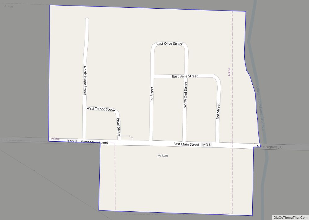
Arkoe is a village in Nodaway County, Missouri, United States. The population was 68 at the 2010 census.
| Name: | Arkoe town |
|---|---|
| LSAD Code: | 43 |
| LSAD Description: | town (suffix) |
| State: | Missouri |
| County: | Nodaway County |
| Elevation: | 984 ft (300 m) |
| Total Area: | 0.13 sq mi (0.33 km²) |
| Land Area: | 0.13 sq mi (0.33 km²) |
| Water Area: | 0.00 sq mi (0.00 km²) |
| Total Population: | 56 |
| Population Density: | 440.94/sq mi (170.01/km²) |
| FIPS code: | 2901864 |
| GNISfeature ID: | 2397438 |
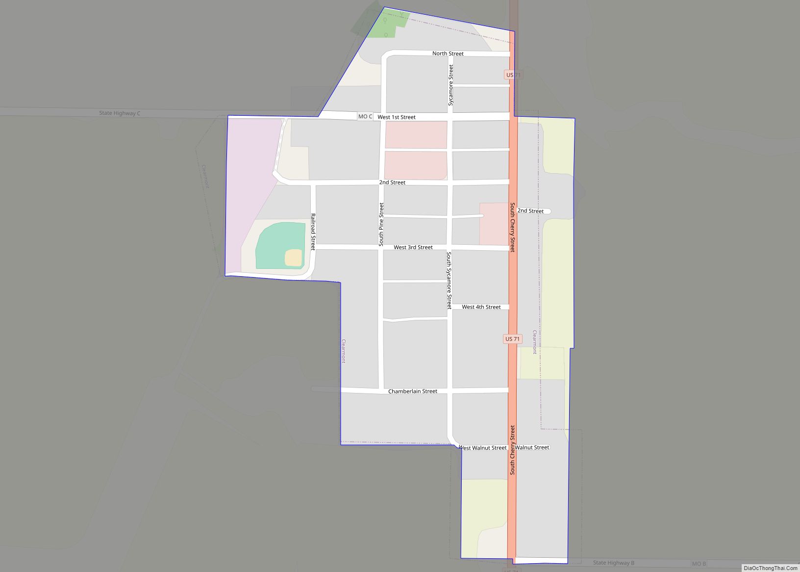
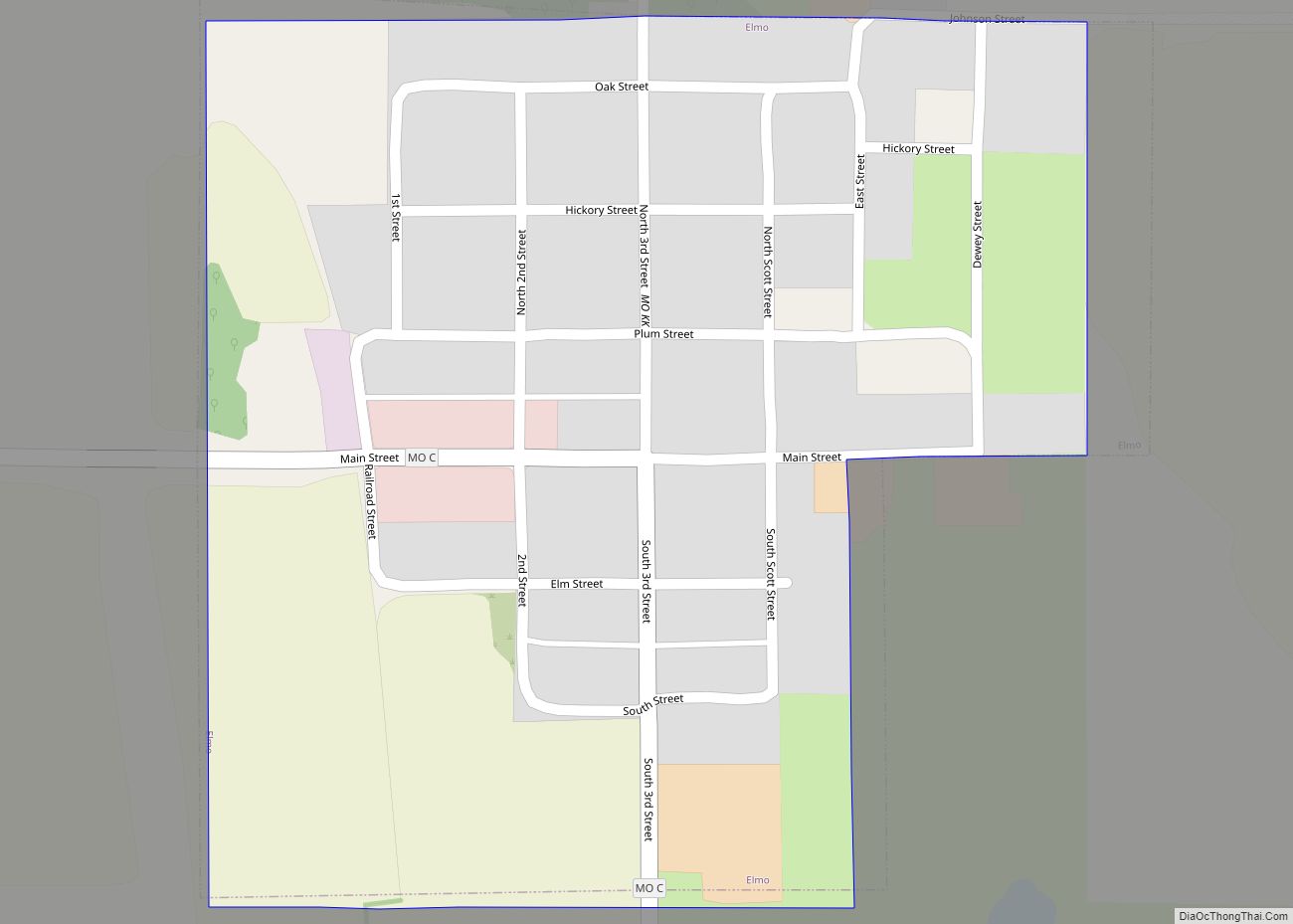
Online Interactive Map
Click on ![]() to view map in "full screen" mode.
to view map in "full screen" mode.
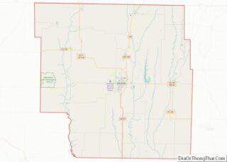
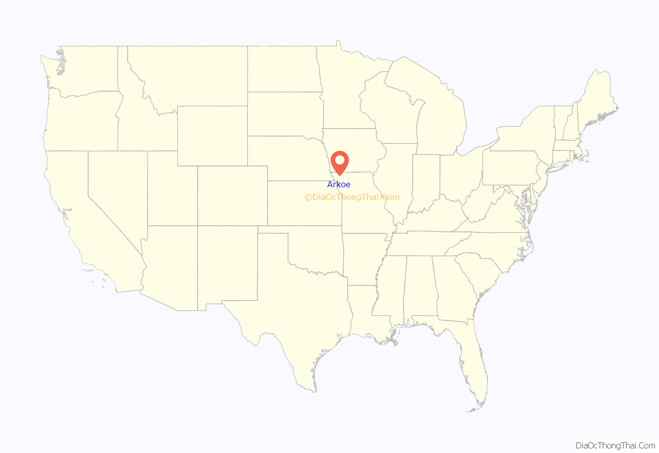
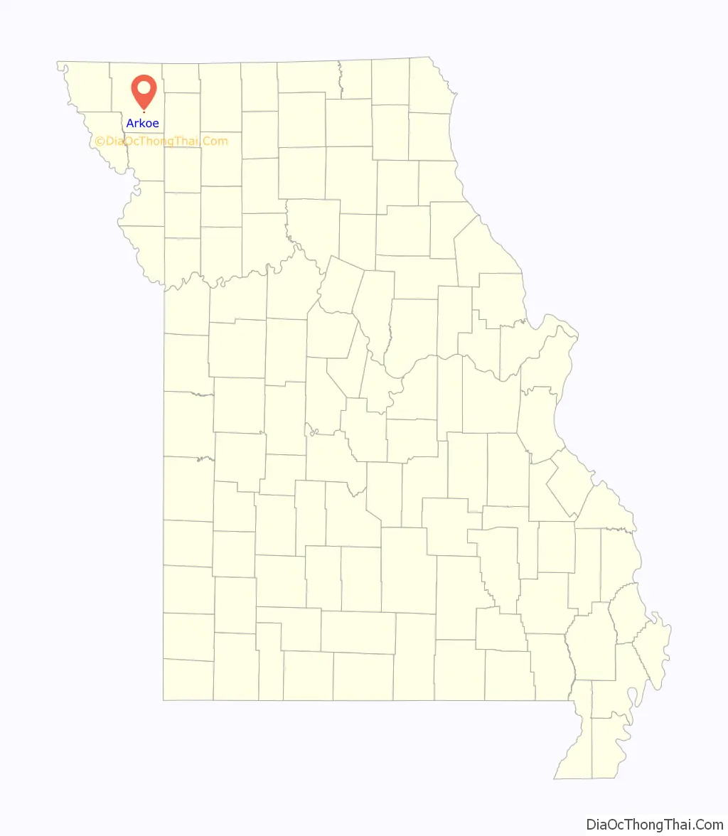
Arkoe location map. Where is Arkoe town?
History
The first community in the Arkoe immediate area was Bridgewater which was about a mile north of the current Arkoe. Nodaway County’s first railroad (starting out as the Missouri Valley Railroad before becoming the Kansas City, St. Joseph and Council Bluffs Railroad and ultimately becoming part of the Burlington Northern route) built two bridges across the 102 river within 1,000 feet of each on an elbow bend in the river and the county built a road bridge between the two in the same location. The railroad plotted the community of Bridgewater by the bridges in 1870 and the post office opened there. Dr. Perry H. Talbott who granted the right of way through much of the land in the area insisted that the town site be located on his property and on September 16, 1874, he and S.K. Snively laid out Arkoe. Nelson Wilson who had opened a merchandise store in Bridgewater in 1871 moved the building to Arkoe and became its first business in 1874. Other businesses followed including the railroad which moved its depot from Bridgewater to Arkoe.
On September 18, 1880, Dr. Talbott was shot and killed at his home. His wife, Belle, and his sons Charles Edward and Albert Perry were initially suspected and arrested for his murder. Eventually, Belle was released and the sons were tried for their father’s murder. Both were convicted and sentenced to hang. They were executed in the Beal Pasture (today Beal Park), on the east side of Maryville, on July 22, 1881. News accounts estimated the number of people present at the hanging at over 10,000. The Talbott brothers’ hanging is said to have been the first “legal” hanging in Nodaway County. The Talbott brothers are buried in a private family cemetery a half mile west of Arkoe. Dr. Talbbot and his sons are buried in the private Talbott cemetery plot near Arkoe. The tombstone for the sons says “We Died Innocent.”
Arkoe formally incorporated in 1906.
The Arkoe post office closed in 1953.
The Arkoe rail line closed by 1979.
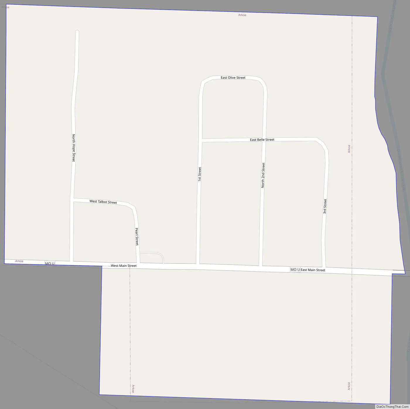
Arkoe Road Map
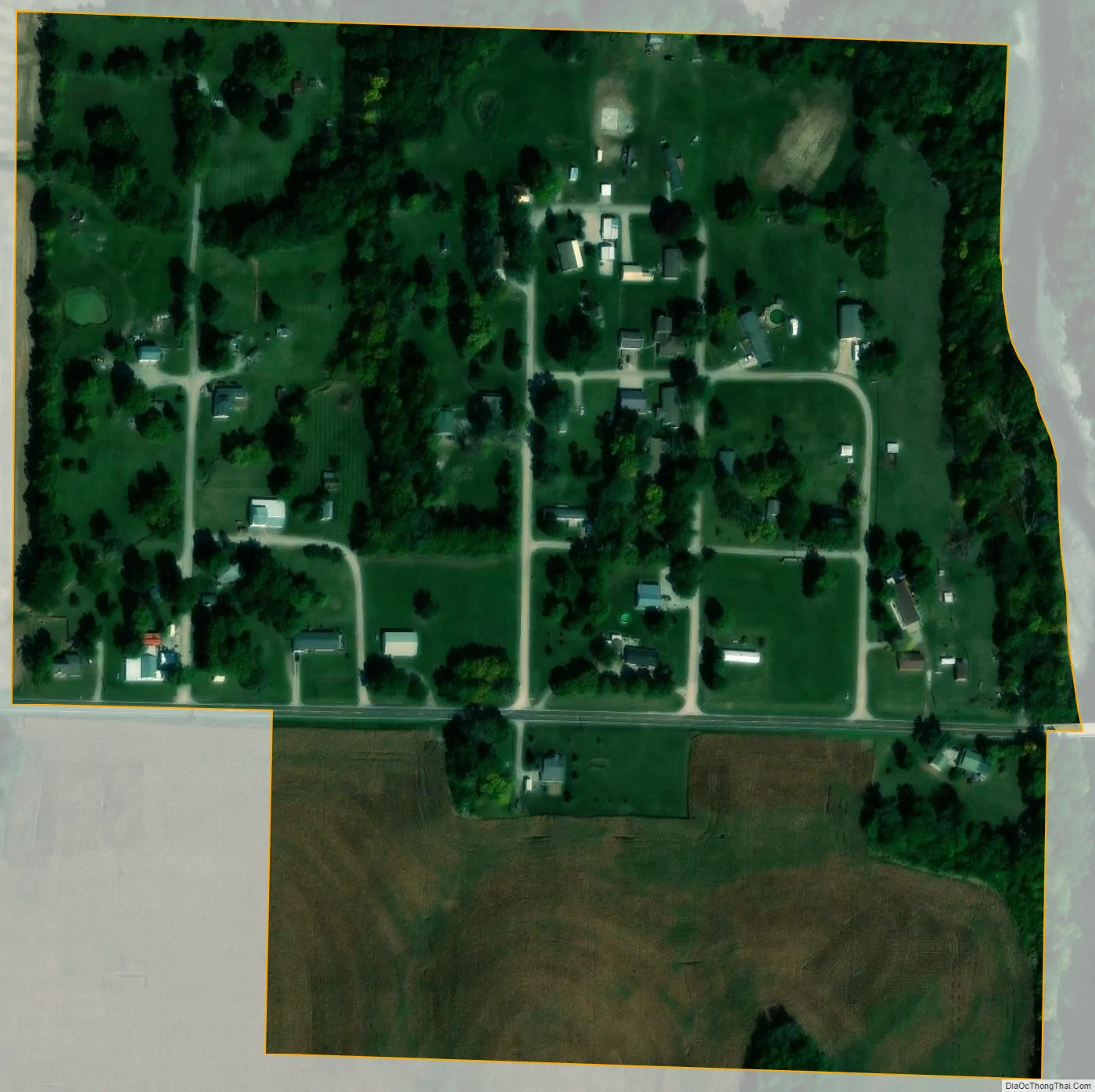
Arkoe city Satellite Map
Geography
According to the United States Census Bureau, the village has a total area of 0.14 square miles (0.36 km), all land.
See also
Map of Missouri State and its subdivision:- Adair
- Andrew
- Atchison
- Audrain
- Barry
- Barton
- Bates
- Benton
- Bollinger
- Boone
- Buchanan
- Butler
- Caldwell
- Callaway
- Camden
- Cape Girardeau
- Carroll
- Carter
- Cass
- Cedar
- Chariton
- Christian
- Clark
- Clay
- Clinton
- Cole
- Cooper
- Crawford
- Dade
- Dallas
- Daviess
- De Kalb
- Dent
- Douglas
- Dunklin
- Franklin
- Gasconade
- Gentry
- Greene
- Grundy
- Harrison
- Henry
- Hickory
- Holt
- Howard
- Howell
- Iron
- Jackson
- Jasper
- Jefferson
- Johnson
- Knox
- Laclede
- Lafayette
- Lawrence
- Lewis
- Lincoln
- Linn
- Livingston
- Macon
- Madison
- Maries
- Marion
- McDonald
- Mercer
- Miller
- Mississippi
- Moniteau
- Monroe
- Montgomery
- Morgan
- New Madrid
- Newton
- Nodaway
- Oregon
- Osage
- Ozark
- Pemiscot
- Perry
- Pettis
- Phelps
- Pike
- Platte
- Polk
- Pulaski
- Putnam
- Ralls
- Randolph
- Ray
- Reynolds
- Ripley
- Saint Charles
- Saint Clair
- Saint Francois
- Saint Louis
- Sainte Genevieve
- Saline
- Schuyler
- Scotland
- Scott
- Shannon
- Shelby
- Stoddard
- Stone
- Sullivan
- Taney
- Texas
- Vernon
- Warren
- Washington
- Wayne
- Webster
- Worth
- Wright
- Alabama
- Alaska
- Arizona
- Arkansas
- California
- Colorado
- Connecticut
- Delaware
- District of Columbia
- Florida
- Georgia
- Hawaii
- Idaho
- Illinois
- Indiana
- Iowa
- Kansas
- Kentucky
- Louisiana
- Maine
- Maryland
- Massachusetts
- Michigan
- Minnesota
- Mississippi
- Missouri
- Montana
- Nebraska
- Nevada
- New Hampshire
- New Jersey
- New Mexico
- New York
- North Carolina
- North Dakota
- Ohio
- Oklahoma
- Oregon
- Pennsylvania
- Rhode Island
- South Carolina
- South Dakota
- Tennessee
- Texas
- Utah
- Vermont
- Virginia
- Washington
- West Virginia
- Wisconsin
- Wyoming