Brentwood is an inner-ring suburb of St. Louis, located in St. Louis County, Missouri, United States. The population was 8,233 at the 2020 census.
| Name: | Brentwood city |
|---|---|
| LSAD Code: | 25 |
| LSAD Description: | city (suffix) |
| State: | Missouri |
| County: | St. Louis County |
| Elevation: | 492 ft (150 m) |
| Total Area: | 1.95 sq mi (5.06 km²) |
| Land Area: | 1.95 sq mi (5.06 km²) |
| Water Area: | 0.00 sq mi (0.00 km²) |
| Total Population: | 8,233 |
| Population Density: | 4,215.57/sq mi (1,627.48/km²) |
| ZIP code: | 63144 |
| Area code: | 314 |
| FIPS code: | 2908236 |
| GNISfeature ID: | 2393411 |
Online Interactive Map
Click on ![]() to view map in "full screen" mode.
to view map in "full screen" mode.
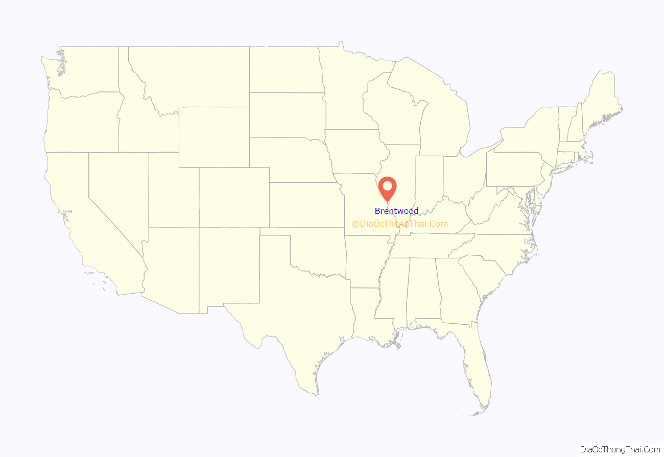
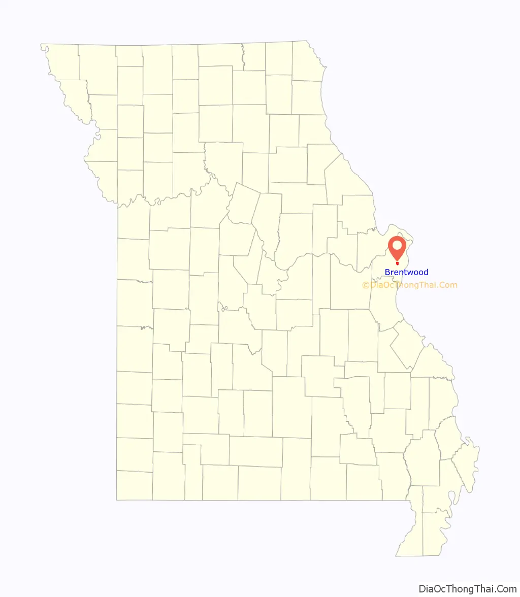
Brentwood location map. Where is Brentwood city?
History
The area that is Brentwood consists of three land purchases: that of Louis J. Bompart who acquired his lot first in 1804, that of the Gay family, and that of the Marshall family. In the 1870s, a man by the name of Thomas Madden arrived and soon became the businessman of the community. He operated a rock quarry, and constructed a tavern, a barbershop, a grocery store, and a blacksmith shop. Due to Madden’s prominence in the community, the town was then named Maddenville.
With a location on the Manchester Trail, a route that was mostly frequented by mail coaches and prairie schooners going west, Maddenville in the 1800s became a prosperous town on the outskirts of St. Louis, to which it was connected by a streetcar line.
In 1919, it was discovered by the residents of Maddenville that the inhabitants of the neighboring Maplewood were planning to elect whether or not to annex their town. To avoid annexation and to establish their own school district, the residents decided to incorporate Maddenville into a village. On December 15, 1919, the town of Maddenville officially became the village of Brentwood.
During the late 1920s, the village earned an unhealthy reputation for its numerous gambling houses and illegal activities that took place around the intersection of Manchester Road and Brentwood Boulevard. The first mayor, James L. Willingham (in office from 1929 to 1931), ran on the promise to clean Brentwood up and eliminate the casinos, along with the hoodlums who hung around them, which he did. The town then became once again attractive for families. On April 12, 1929, Willingham signed ordinance 1A, which established Brentwood as a city and determined its boundaries.
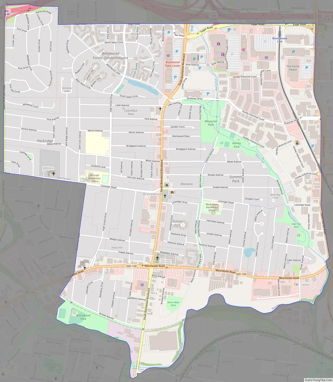
Brentwood Road Map
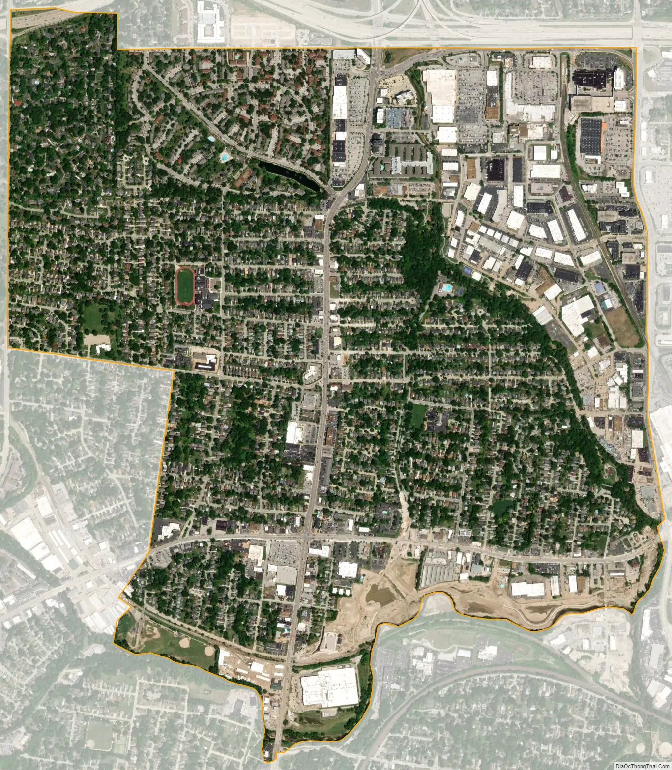
Brentwood city Satellite Map
Geography
According to the United States Census Bureau, the city has a total area of 1.96 square miles (5.08 km), all land.
See also
Map of Missouri State and its subdivision:- Adair
- Andrew
- Atchison
- Audrain
- Barry
- Barton
- Bates
- Benton
- Bollinger
- Boone
- Buchanan
- Butler
- Caldwell
- Callaway
- Camden
- Cape Girardeau
- Carroll
- Carter
- Cass
- Cedar
- Chariton
- Christian
- Clark
- Clay
- Clinton
- Cole
- Cooper
- Crawford
- Dade
- Dallas
- Daviess
- De Kalb
- Dent
- Douglas
- Dunklin
- Franklin
- Gasconade
- Gentry
- Greene
- Grundy
- Harrison
- Henry
- Hickory
- Holt
- Howard
- Howell
- Iron
- Jackson
- Jasper
- Jefferson
- Johnson
- Knox
- Laclede
- Lafayette
- Lawrence
- Lewis
- Lincoln
- Linn
- Livingston
- Macon
- Madison
- Maries
- Marion
- McDonald
- Mercer
- Miller
- Mississippi
- Moniteau
- Monroe
- Montgomery
- Morgan
- New Madrid
- Newton
- Nodaway
- Oregon
- Osage
- Ozark
- Pemiscot
- Perry
- Pettis
- Phelps
- Pike
- Platte
- Polk
- Pulaski
- Putnam
- Ralls
- Randolph
- Ray
- Reynolds
- Ripley
- Saint Charles
- Saint Clair
- Saint Francois
- Saint Louis
- Sainte Genevieve
- Saline
- Schuyler
- Scotland
- Scott
- Shannon
- Shelby
- Stoddard
- Stone
- Sullivan
- Taney
- Texas
- Vernon
- Warren
- Washington
- Wayne
- Webster
- Worth
- Wright
- Alabama
- Alaska
- Arizona
- Arkansas
- California
- Colorado
- Connecticut
- Delaware
- District of Columbia
- Florida
- Georgia
- Hawaii
- Idaho
- Illinois
- Indiana
- Iowa
- Kansas
- Kentucky
- Louisiana
- Maine
- Maryland
- Massachusetts
- Michigan
- Minnesota
- Mississippi
- Missouri
- Montana
- Nebraska
- Nevada
- New Hampshire
- New Jersey
- New Mexico
- New York
- North Carolina
- North Dakota
- Ohio
- Oklahoma
- Oregon
- Pennsylvania
- Rhode Island
- South Carolina
- South Dakota
- Tennessee
- Texas
- Utah
- Vermont
- Virginia
- Washington
- West Virginia
- Wisconsin
- Wyoming


