Clayton is a city in and the seat of St. Louis County, Missouri. It borders the independent city of St. Louis. The population was 17,355 at the 2020 census. Organized in 1877, the city was named after Ralph Clayton, who donated the land for the St. Louis County courthouse.
| Name: | Clayton city |
|---|---|
| LSAD Code: | 25 |
| LSAD Description: | city (suffix) |
| State: | Missouri |
| County: | St. Louis County |
| Incorporated: | 1913 |
| Elevation: | 551 ft (168 m) |
| Total Area: | 2.51 sq mi (6.49 km²) |
| Land Area: | 2.51 sq mi (6.49 km²) |
| Water Area: | 0.00 sq mi (0.00 km²) |
| Total Population: | 17,355 |
| Population Density: | 6,919.9/sq mi (2,671.8/km²) |
| ZIP code: | 63105 |
| Area code: | 314 |
| FIPS code: | 2914572 |
| GNISfeature ID: | 2393548 |
Online Interactive Map
Click on ![]() to view map in "full screen" mode.
to view map in "full screen" mode.
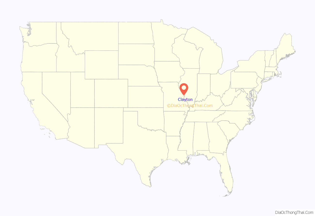
Clayton location map. Where is Clayton city?

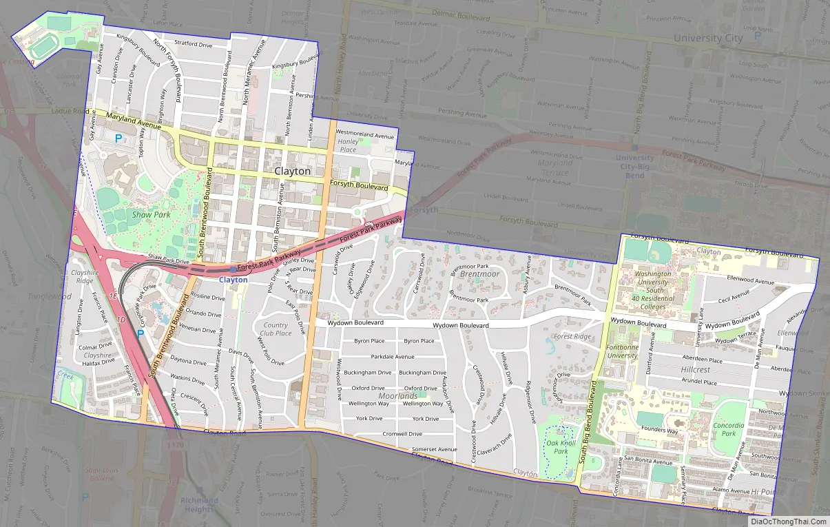
Clayton Road Map
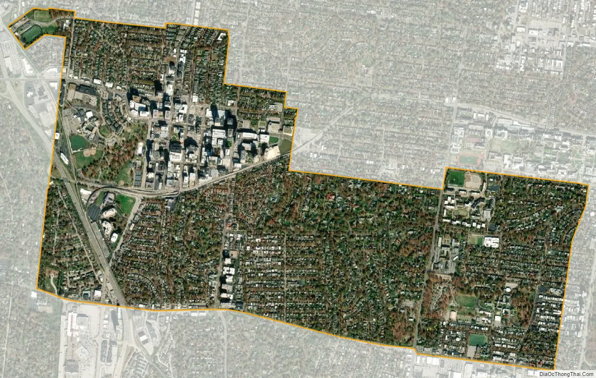
Clayton city Satellite Map
Geography
Cityscape
The architecture of central Clayton reflects its economic activity and eras of growth. An impressive collection of mid-century modern low and high rise structures contrast with earlier mansions, stores and flats. Its surrounding residential neighborhoods maintain a dense, walkable character and were largely developed in the prewar era. These neighborhoods consist of brick walkups, apartment buildings, mansions and modest single family homes centered around several small business districts.
Neighborhoods
Claverach Park is a residential neighborhood bounded by Wydown Boulevard on the north, Ridgemoor Drive and Big Bend Boulevard on the east, Clayton Road on the south, and Audubon Drive on the west. The neighborhood was planned in the early 1920s by Julius Pitzman who avoided a traditional street grid in favor of curvilinear streets lined by stately trees, one centrally located neighborhood park, and 9 pocket parks. Oak Knoll Park, Clayton’s second largest park and the former home to the St. Louis Academy of Science, is located in the neighborhood.
Clayshire is a suburban neighborhood bounded by Forest Park Parkway on the north, Interstate 170 on the east, Clayton Road on the south and the Ladue city limit to the west and includes the subdivision of Tanglewood. Unlike Clayton’s denser prewar residential neighborhoods, Clayshire is characterized by a more postwar suburban development pattern. Neighborhood parks include Anderson Park, Clayshire Park, and Whitburn Park as well as a pedestrian underpass beneath I-170 that connects to Shaw Park. There is a small commercial area at the intersection of Clayton Road and Brentwood Boulevard.
A large residential neighborhood, Davis Place is characterized primarily by single family homes with some apartment buildings along Hanley Road and Brentwood Boulevard. Its boundaries are Forest Park Parkway on the north, Hanley Road on the east, Clayton Road on the south, and Brentwood Boulevard on the west. The neighborhood includes the subdivisions Country Club Place, Country Club Court, and Remmerts. Davis Place is also home to the Shops of Clayton commercial corridor along Clayton Road.
Part of the Hi-Pointe–DeMun Historic District, DeMun is primarily a residential neighborhood on the eastern edge of Clayton. It is a dense and walkable neighborhood characterized by brick and limestone prewar apartment blocks, single family homes and small commercial areas centered around DeMun Avenue and Clayton Road. The neighborhood is also home to Concordia Seminary, the South Campus of Washington University, and three public parks (Concordia, DeMun, and Henry Wright).
The boundaries of DeMun in Clayton are Concordia Seminary’s northern property line and Northwood Avenue, the St. Louis city limit to the east, Clayton Road to the south, and Big Bend Boulevard to the west.
Downtown Clayton is the seat of St. Louis County government and home to its headquarters campus. In addition, downtown Clayton is home to three of the St. Louis region’s seven Fortune 500 headquarters; Centene Corporation, Graybar, and Olin Corporation. Commerce Bank, the Regional Business Council and the St. Louis Club are located in the neighborhood as well. Downtown Clayton is known for its many restaurants and cafes and hosts the St. Louis Art Fair along its streets during September each year. Recently, the neighborhood has entered a period of significant redevelopment and new construction with the opening of the Two Twelve Clayton and Ceylon apartment buildings in 2017, Centene Plaza C in 2019, and the groundbreaking of the two tower Forsyth Pointe development in 2020. As of 2022, downtown Clayton had seven projects, worth approximately $600 million, either in development or under construction.
The boundaries of downtown Clayton are Maryland Avenue on the north, the University City limit on the east, Forest Park Parkway on the south, and Brentwood Boulevard on the west. The neighborhood is served by MetroLink via the Blue Line at the Clayton and Forsyth stations.
Like Clayton’s other urban, walkable neighborhoods, the Moorlands is characterized by large, prewar masonry apartment buildings and single family homes with high-rise apartment buildings along Hanley Road and a small commercial district at the intersection of Hanley and Wydown Boulevard. Most of the single family homes are concentrated east of Glenridge Drive while most of the apartment buildings are concentrated to the west. The neighborhood’s boundaries are Wydown Boulevard on the north, Audubon Drive on the east, Clayton Road on the south, and Hanley Road on the west.
North Clayton is a dense, walkable set of neighborhoods that encompass all of Clayton north of Maryland Avenue. The area is mostly made up of densely packed single family homes with office, apartment and condo buildings located primarily between Meramec Avenue and Brentwood Boulevard. Commercial corridors include Meramec and Maryland avenues. The neighborhood is home to Kol Rinah synagogue, St. Joseph Catholic Church, the Mid County branch of the St. Louis County Library, and Centene’s corporate training center. Neighborhood parks include Taylor Park and Hanley Park which includes the historic Hanley House.
Subdivisions within North Clayton include the Bemiston additions, Clayton Gardens, Colonial Park, Hanley Place, and Maryland Terrace. Its boundaries to the north and east are the city limits with University City, its southern boundary is Maryland Avenue, and its western boundary is the Ladue city limit.
Other neighborhoods and subdivisions within Clayton include Brentmoor and Brentmoor Park, Carrswold, Ellenwood, Forest Ridge, Hillcrest, Parkside, Skinker Heights, Southmoor, Tesson, Tuscany Park, Wydown Forest, and Wydown Terrace.
See also
Map of Missouri State and its subdivision:- Adair
- Andrew
- Atchison
- Audrain
- Barry
- Barton
- Bates
- Benton
- Bollinger
- Boone
- Buchanan
- Butler
- Caldwell
- Callaway
- Camden
- Cape Girardeau
- Carroll
- Carter
- Cass
- Cedar
- Chariton
- Christian
- Clark
- Clay
- Clinton
- Cole
- Cooper
- Crawford
- Dade
- Dallas
- Daviess
- De Kalb
- Dent
- Douglas
- Dunklin
- Franklin
- Gasconade
- Gentry
- Greene
- Grundy
- Harrison
- Henry
- Hickory
- Holt
- Howard
- Howell
- Iron
- Jackson
- Jasper
- Jefferson
- Johnson
- Knox
- Laclede
- Lafayette
- Lawrence
- Lewis
- Lincoln
- Linn
- Livingston
- Macon
- Madison
- Maries
- Marion
- McDonald
- Mercer
- Miller
- Mississippi
- Moniteau
- Monroe
- Montgomery
- Morgan
- New Madrid
- Newton
- Nodaway
- Oregon
- Osage
- Ozark
- Pemiscot
- Perry
- Pettis
- Phelps
- Pike
- Platte
- Polk
- Pulaski
- Putnam
- Ralls
- Randolph
- Ray
- Reynolds
- Ripley
- Saint Charles
- Saint Clair
- Saint Francois
- Saint Louis
- Sainte Genevieve
- Saline
- Schuyler
- Scotland
- Scott
- Shannon
- Shelby
- Stoddard
- Stone
- Sullivan
- Taney
- Texas
- Vernon
- Warren
- Washington
- Wayne
- Webster
- Worth
- Wright
- Alabama
- Alaska
- Arizona
- Arkansas
- California
- Colorado
- Connecticut
- Delaware
- District of Columbia
- Florida
- Georgia
- Hawaii
- Idaho
- Illinois
- Indiana
- Iowa
- Kansas
- Kentucky
- Louisiana
- Maine
- Maryland
- Massachusetts
- Michigan
- Minnesota
- Mississippi
- Missouri
- Montana
- Nebraska
- Nevada
- New Hampshire
- New Jersey
- New Mexico
- New York
- North Carolina
- North Dakota
- Ohio
- Oklahoma
- Oregon
- Pennsylvania
- Rhode Island
- South Carolina
- South Dakota
- Tennessee
- Texas
- Utah
- Vermont
- Virginia
- Washington
- West Virginia
- Wisconsin
- Wyoming


