Ferguson is a city in St. Louis County, Missouri, United States. It is part of the Greater St. Louis metropolitan area. Per the 2020 census, the population was 18,527.
| Name: | Ferguson city |
|---|---|
| LSAD Code: | 25 |
| LSAD Description: | city (suffix) |
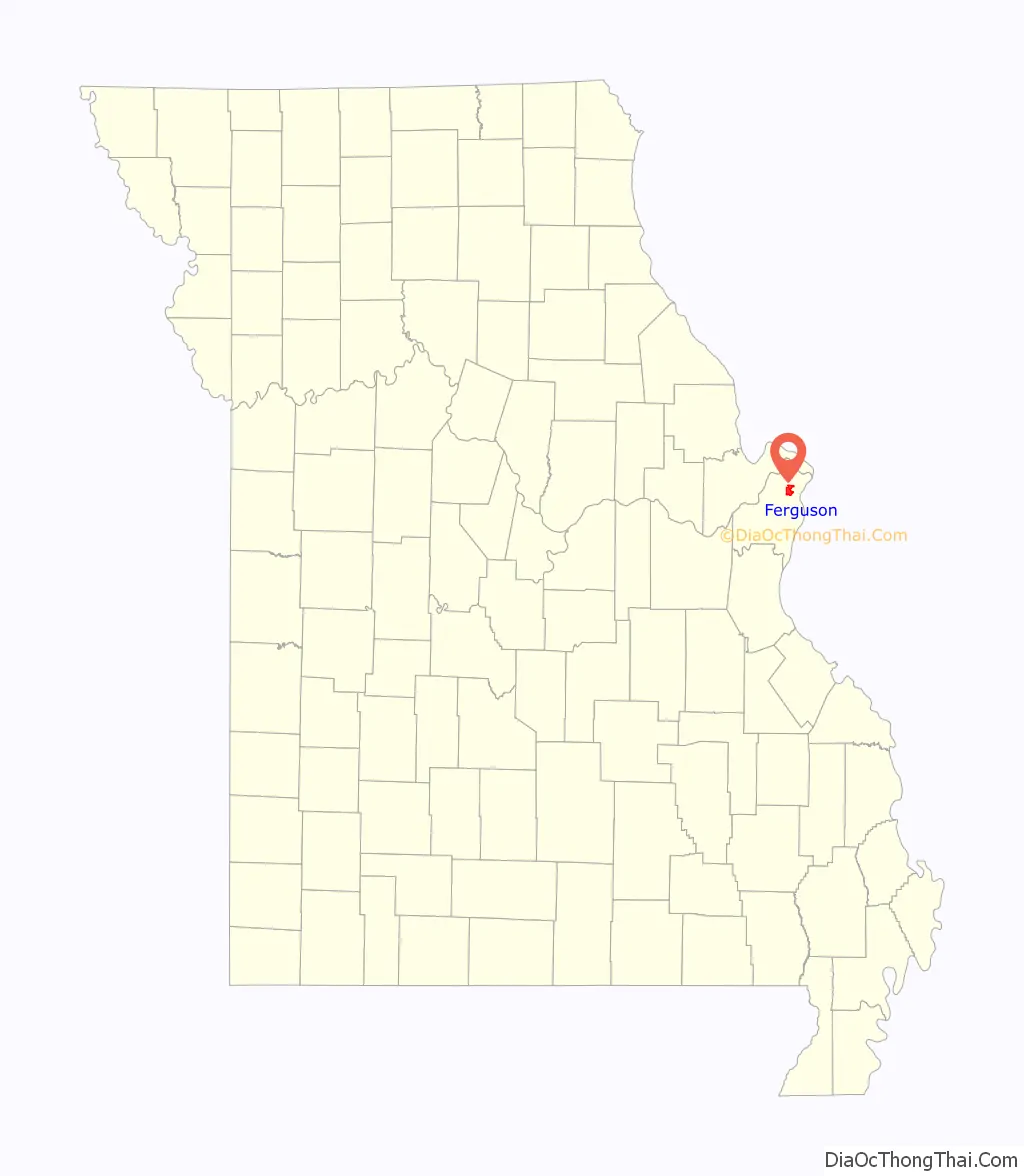
| State: | Missouri |
| County: | St. Louis County |
| Incorporated: | 1894 |
| Elevation: | 554 ft (169 m) |
| Total Area: | 6.18 sq mi (16.00 km²) |
| Land Area: | 6.17 sq mi (15.98 km²) |
| Water Area: | 0.01 sq mi (0.02 km²) |
| Total Population: | 18,527 |
| Population Density: | 3,003.24/sq mi (1,159.55/km²) |
| ZIP code: | 63135 |
| Area code: | 314 |
| FIPS code: | 2923986 |
| GNISfeature ID: | 2394760 |
Online Interactive Map
Click on ![]() to view map in "full screen" mode.
to view map in "full screen" mode.
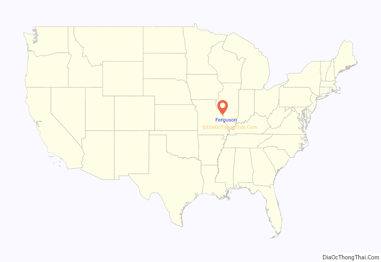
Ferguson location map. Where is Ferguson city?
History
What is now the city of Ferguson was founded in 1855, when William B. Ferguson deeded 10 acres (4.0 ha) of land to the Wabash Railroad in exchange for a new depot and naming rights. The settlement that sprang up around the depot was called Ferguson Station. Ferguson was the first railroad station connected directly to St. Louis. The station is a focal point of the city’s history and is depicted on the city flag, designed in 1994.
Ferguson’s first schoolhouse was built in 1878. Ferguson was incorporated as a city in 1894.
Emerson Electric moved its headquarters to Ferguson during the 20th century.
Until the 1960s, Ferguson was a sundown town where African Americans were not allowed to remain after nightfall.
Ferguson made frequent worldwide headlines for months following the 2014 killing of Michael Brown Jr. by a police officer and the ensuing civil unrest. The United States Department of Justice investigation which followed resulted in large legal fees for the town, in excess of $300,000 a year. The city now has a higher sales tax, utility gross receipts tax, and franchise tax for 2017/2018 to generate more revenue.
Ferguson elected its first black and first female mayor, Ella Jones, on June 2, 2020.
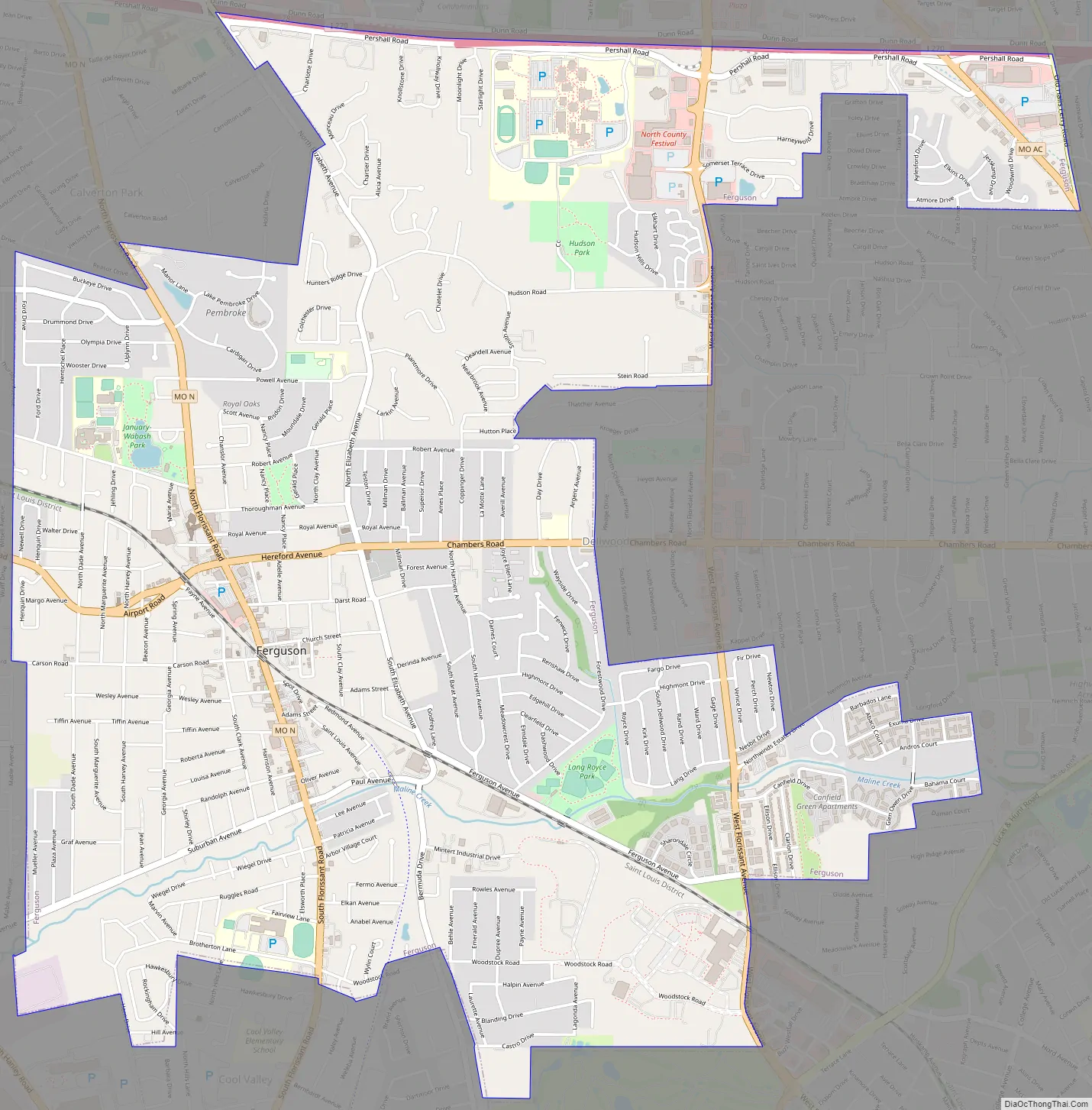
Ferguson Road Map
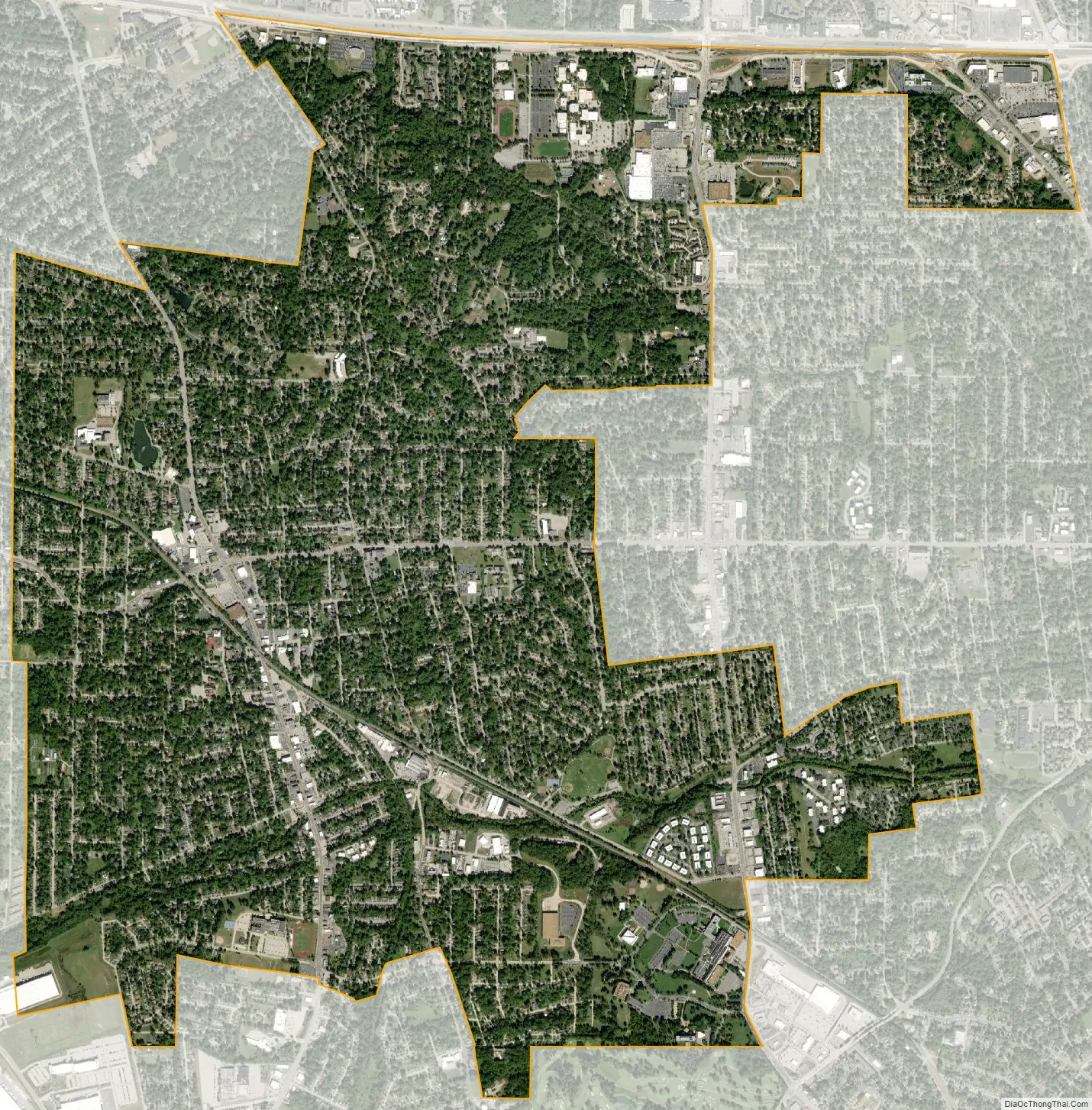
Ferguson city Satellite Map
Geography
According to the United States Census Bureau, the city has a total area of 6.20 square miles (16.06 km), of which 6.19 square miles (16.03 km) is land and 0.01 square miles (0.03 km) is water.
Climate
Ferguson has a humid subtropical-continental climate. Winters are cold, while summers are hot and humid. The record high is 115 °F, and the record low is −19 °F.
See also
Map of Missouri State and its subdivision:- Adair
- Andrew
- Atchison
- Audrain
- Barry
- Barton
- Bates
- Benton
- Bollinger
- Boone
- Buchanan
- Butler
- Caldwell
- Callaway
- Camden
- Cape Girardeau
- Carroll
- Carter
- Cass
- Cedar
- Chariton
- Christian
- Clark
- Clay
- Clinton
- Cole
- Cooper
- Crawford
- Dade
- Dallas
- Daviess
- De Kalb
- Dent
- Douglas
- Dunklin
- Franklin
- Gasconade
- Gentry
- Greene
- Grundy
- Harrison
- Henry
- Hickory
- Holt
- Howard
- Howell
- Iron
- Jackson
- Jasper
- Jefferson
- Johnson
- Knox
- Laclede
- Lafayette
- Lawrence
- Lewis
- Lincoln
- Linn
- Livingston
- Macon
- Madison
- Maries
- Marion
- McDonald
- Mercer
- Miller
- Mississippi
- Moniteau
- Monroe
- Montgomery
- Morgan
- New Madrid
- Newton
- Nodaway
- Oregon
- Osage
- Ozark
- Pemiscot
- Perry
- Pettis
- Phelps
- Pike
- Platte
- Polk
- Pulaski
- Putnam
- Ralls
- Randolph
- Ray
- Reynolds
- Ripley
- Saint Charles
- Saint Clair
- Saint Francois
- Saint Louis
- Sainte Genevieve
- Saline
- Schuyler
- Scotland
- Scott
- Shannon
- Shelby
- Stoddard
- Stone
- Sullivan
- Taney
- Texas
- Vernon
- Warren
- Washington
- Wayne
- Webster
- Worth
- Wright
- Alabama
- Alaska
- Arizona
- Arkansas
- California
- Colorado
- Connecticut
- Delaware
- District of Columbia
- Florida
- Georgia
- Hawaii
- Idaho
- Illinois
- Indiana
- Iowa
- Kansas
- Kentucky
- Louisiana
- Maine
- Maryland
- Massachusetts
- Michigan
- Minnesota
- Mississippi
- Missouri
- Montana
- Nebraska
- Nevada
- New Hampshire
- New Jersey
- New Mexico
- New York
- North Carolina
- North Dakota
- Ohio
- Oklahoma
- Oregon
- Pennsylvania
- Rhode Island
- South Carolina
- South Dakota
- Tennessee
- Texas
- Utah
- Vermont
- Virginia
- Washington
- West Virginia
- Wisconsin
- Wyoming


