Hopkins is a city in northern Nodaway County, Missouri, United States. The population was 532 at the 2010 Census.
| Name: | Hopkins city |
|---|---|
| LSAD Code: | 25 |
| LSAD Description: | city (suffix) |
| State: | Missouri |
| County: | Nodaway County |
| Elevation: | 1,053 ft (321 m) |
| Total Area: | 0.71 sq mi (1.85 km²) |
| Land Area: | 0.71 sq mi (1.85 km²) |
| Water Area: | 0.00 sq mi (0.00 km²) |
| Total Population: | 472 |
| Population Density: | 661.99/sq mi (255.46/km²) |
| ZIP code: | 64461 |
| Area code: | 660 |
| FIPS code: | 2933004 |
| GNISfeature ID: | 2394418 |
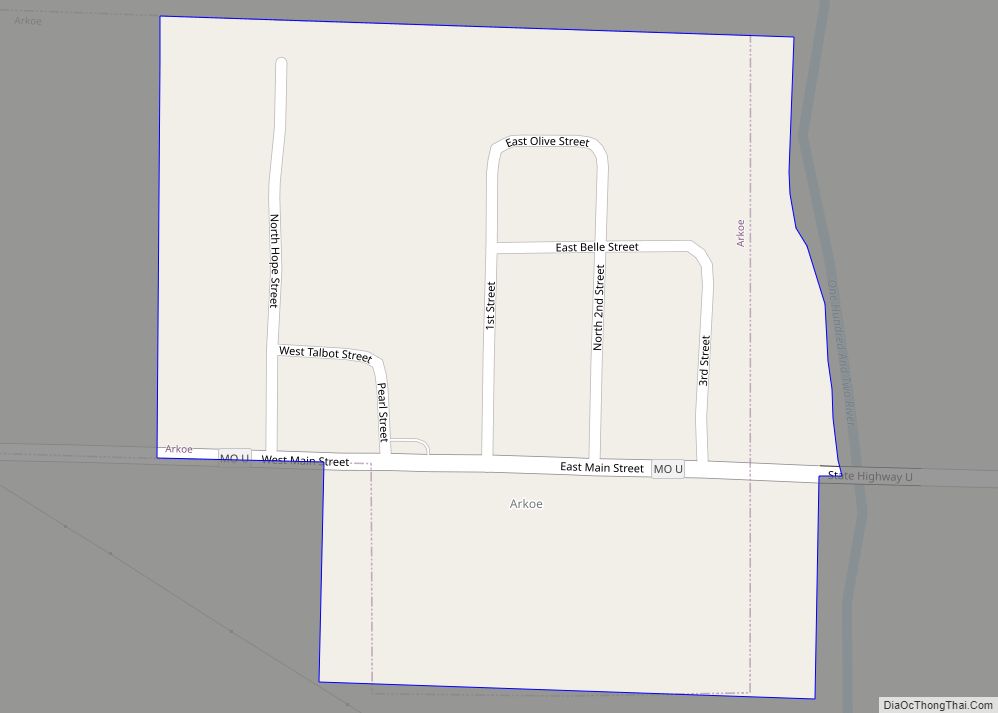
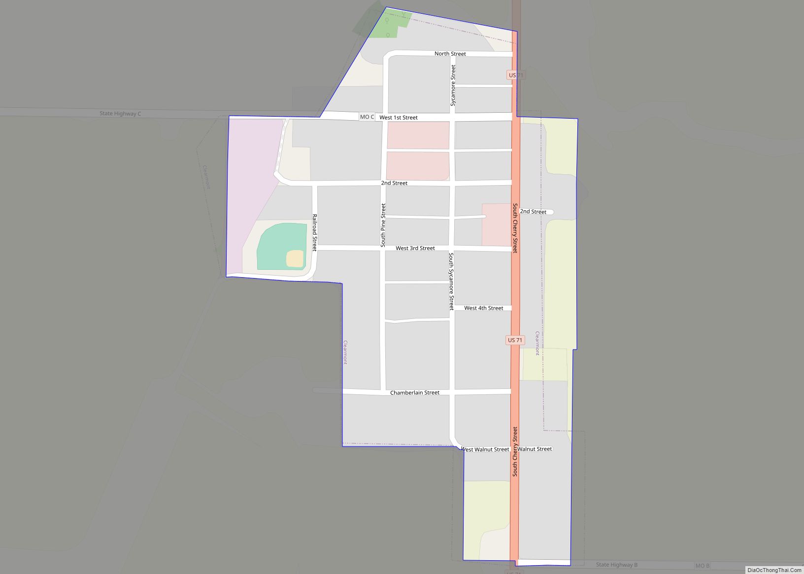
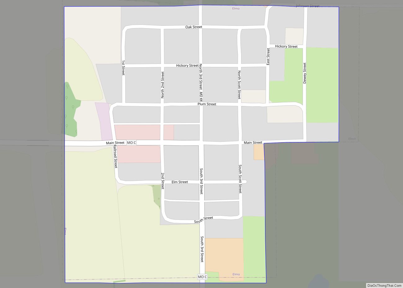
Online Interactive Map
Click on ![]() to view map in "full screen" mode.
to view map in "full screen" mode.
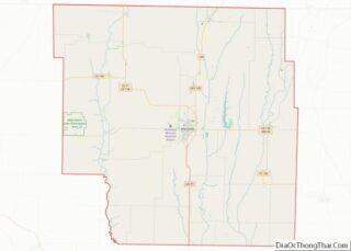
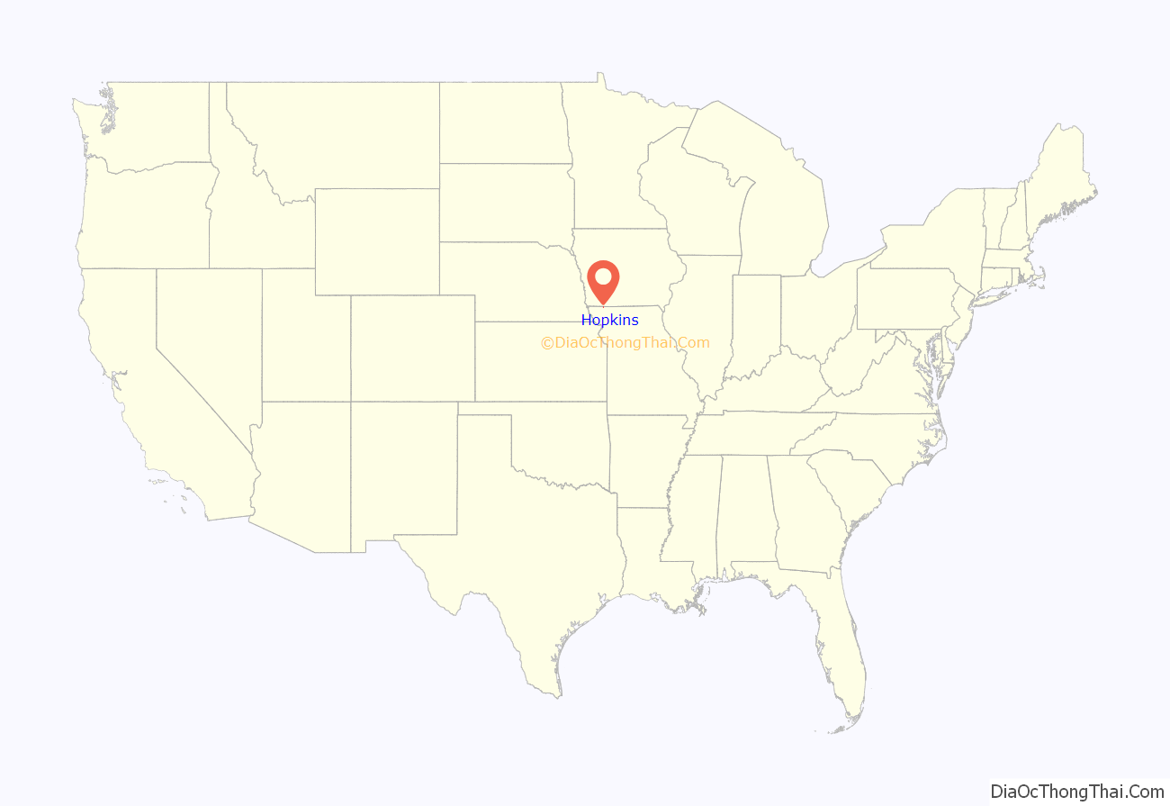
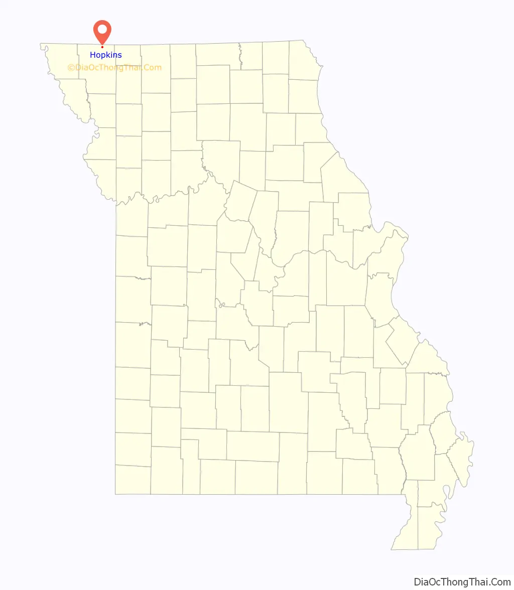
Hopkins location map. Where is Hopkins city?
History
Hopkins was laid out in 1870. The community has the name of A.L. Hopkins of the Kansas City, St. Joseph and Council Bluffs Railroad. The railroad later became the Chicago, Burlington and Quincy and finally the Burlington Northern before tracks were remove in 1983. A post office called Hopkins has been in operation since 1871.
Occult writer Grant Wallace was born in Hopkins in 1867.
The Hopkins Tornado of 1881 is believed to have been one of the first recorded F5 tornadoes.
On Sunday afternoon November 16, 1952, Hopkins was struck by a tornado which greatly damaged the downtown business district. Mary Jane Truman, sister of Harry S Truman, had appeared in the community almost to the day a year earlier. She contacted her brother who was on a yacht. Hopkins was the first town in the United States of under 1,000 people to receive federal disaster relief. The government sent the community $10,000 which was put under the administration of Wren Peve, a local businessman. Mr. Peve kept accurate track of the spending and when all the needs were met it was found that there was a surplus. Peve then wrote a check and sent that surplus back to Washington. The cleanup was under the direction of Landon Wallace; the local Ford salesman and also the Hopkins Fire Chief. During the three weeks of cleanup, most of the second floors of the downtown buildings were removed by his order.
In the first half the 20th century Rancho del Rayo which was at least 3,900 acres claimed to be the biggest hereford ranch in the state of Missouri.
In September, 1933, the Missouri Highway Patrol cornered and killed Harold B. Thornbrugh a Kansas outlaw, who at the time was living in New Market, Iowa. Thornbrugh was wanted for bank and postal robbery, the murder of Omaha Police Officer Otto Peterson and the attempted murder of Frankin County, Kansas Sheriff William Wantland. The day Harold Thornbrugh was killed in Hopkins, his brother Cecil stood before Judge Hopkins in Topeka, Kansas on the same charges pending against Harold. One officer was seriously wounded in the head during the brief gun battle.
During World War II Hopkins a town of less than 1,000 at the time lost fourteen men. This included two brothers Charles and George Russell who died in April, 1945 within twenty-four hours of each other. Charles drowned in the Pacific and George was accidentally shot in Germany while guarding prisoners of war. Carl Melvin went down with the USS Indianapolis, and Charles Pistole was killed at Tarawa while operating a landing craft. In other conflicts, Glenn Ulmer died in World War I, the American Legion Post is named in his honor and Gary Cross died in Vietnam. Hopkins suffered no deaths in Korea.
Hopkins was the final home of jockey Clive Dixon and his wife Betty June, who trained and owned the National Appaloosa Show Champion, Two-Eyed Sioux.
Each year the town celebrates the Hopkins Picnic the second weekend in July. This has been a yearly celebration since 1888.
The last electromechanical telephone switch in the U.S. was located in nearby North Hopkins, Iowa, served by the CO in Hopkins. This switch converted to digital on September 15, 1999.
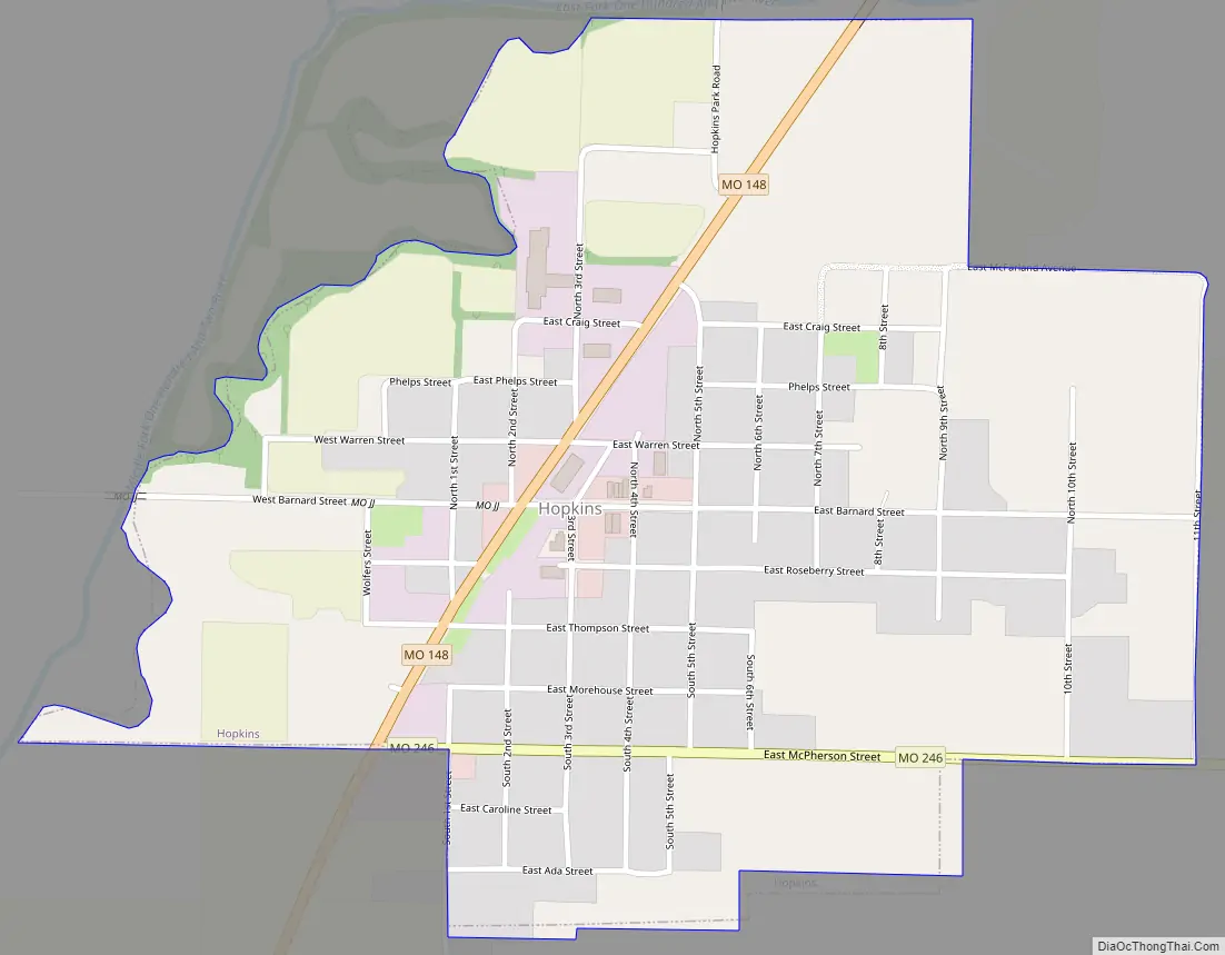
Hopkins Road Map
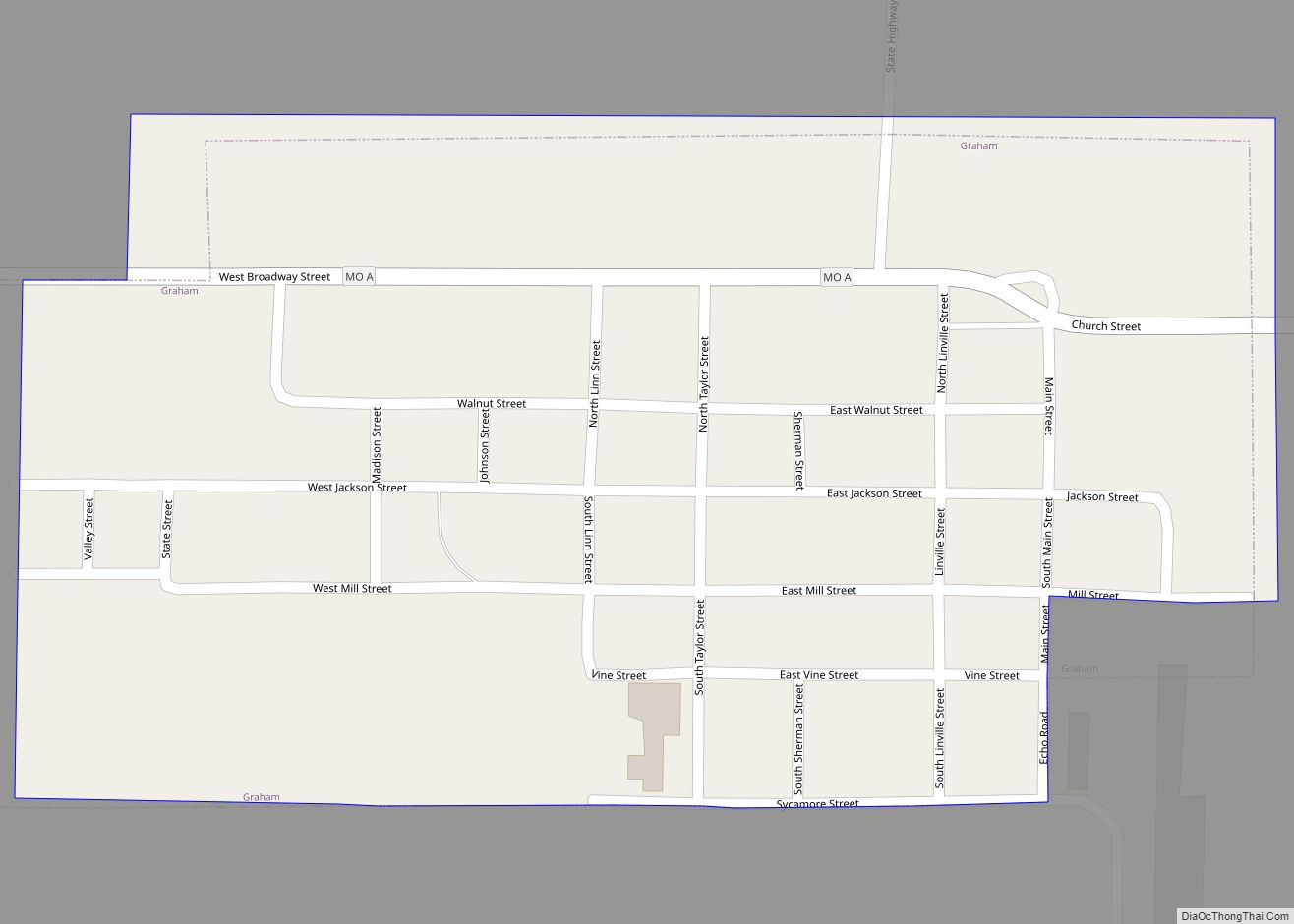
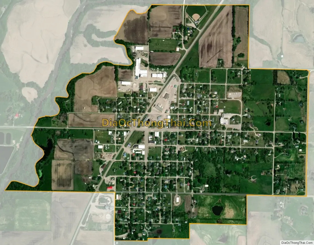
Hopkins city Satellite Map
Geography
Hopkins is located at the intersection of Missouri routes 148 and 246 approximately two miles south of the Missouri-Iowa border. The East Fork One Hundred and Two River flows past the north and west sides of the community and meets with the West Fork to form the One Hundred and Two River about three miles southwest of the community.
According to the United States Census Bureau, the city has a total area of 0.72 square miles (1.86 km), all land.
See also
Map of Missouri State and its subdivision:- Adair
- Andrew
- Atchison
- Audrain
- Barry
- Barton
- Bates
- Benton
- Bollinger
- Boone
- Buchanan
- Butler
- Caldwell
- Callaway
- Camden
- Cape Girardeau
- Carroll
- Carter
- Cass
- Cedar
- Chariton
- Christian
- Clark
- Clay
- Clinton
- Cole
- Cooper
- Crawford
- Dade
- Dallas
- Daviess
- De Kalb
- Dent
- Douglas
- Dunklin
- Franklin
- Gasconade
- Gentry
- Greene
- Grundy
- Harrison
- Henry
- Hickory
- Holt
- Howard
- Howell
- Iron
- Jackson
- Jasper
- Jefferson
- Johnson
- Knox
- Laclede
- Lafayette
- Lawrence
- Lewis
- Lincoln
- Linn
- Livingston
- Macon
- Madison
- Maries
- Marion
- McDonald
- Mercer
- Miller
- Mississippi
- Moniteau
- Monroe
- Montgomery
- Morgan
- New Madrid
- Newton
- Nodaway
- Oregon
- Osage
- Ozark
- Pemiscot
- Perry
- Pettis
- Phelps
- Pike
- Platte
- Polk
- Pulaski
- Putnam
- Ralls
- Randolph
- Ray
- Reynolds
- Ripley
- Saint Charles
- Saint Clair
- Saint Francois
- Saint Louis
- Sainte Genevieve
- Saline
- Schuyler
- Scotland
- Scott
- Shannon
- Shelby
- Stoddard
- Stone
- Sullivan
- Taney
- Texas
- Vernon
- Warren
- Washington
- Wayne
- Webster
- Worth
- Wright
- Alabama
- Alaska
- Arizona
- Arkansas
- California
- Colorado
- Connecticut
- Delaware
- District of Columbia
- Florida
- Georgia
- Hawaii
- Idaho
- Illinois
- Indiana
- Iowa
- Kansas
- Kentucky
- Louisiana
- Maine
- Maryland
- Massachusetts
- Michigan
- Minnesota
- Mississippi
- Missouri
- Montana
- Nebraska
- Nevada
- New Hampshire
- New Jersey
- New Mexico
- New York
- North Carolina
- North Dakota
- Ohio
- Oklahoma
- Oregon
- Pennsylvania
- Rhode Island
- South Carolina
- South Dakota
- Tennessee
- Texas
- Utah
- Vermont
- Virginia
- Washington
- West Virginia
- Wisconsin
- Wyoming