Loma Linda is a town in Newton County, Missouri, United States. The population was 725 at the 2010 census. It is part of the Joplin, Missouri Metropolitan Statistical Area.
| Name: | Loma Linda town |
|---|---|
| LSAD Code: | 43 |
| LSAD Description: | town (suffix) |
| State: | Missouri |
| County: | Newton County |
| Elevation: | 1,070 ft (330 m) |
| Total Area: | 3.56 sq mi (9.23 km²) |
| Land Area: | 3.56 sq mi (9.21 km²) |
| Water Area: | 0.01 sq mi (0.02 km²) |
| Total Population: | 943 |
| Population Density: | 265.19/sq mi (102.38/km²) |
| FIPS code: | 2943672 |
| GNISfeature ID: | 2396722 |
| Website: | http://www.lomalinda-mo.us/index.php |
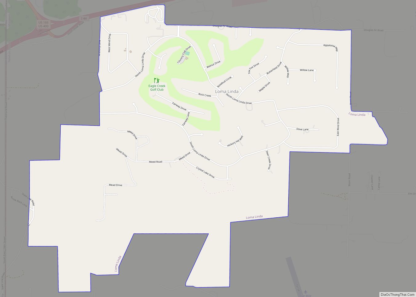
Online Interactive Map
Click on ![]() to view map in "full screen" mode.
to view map in "full screen" mode.
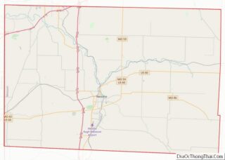
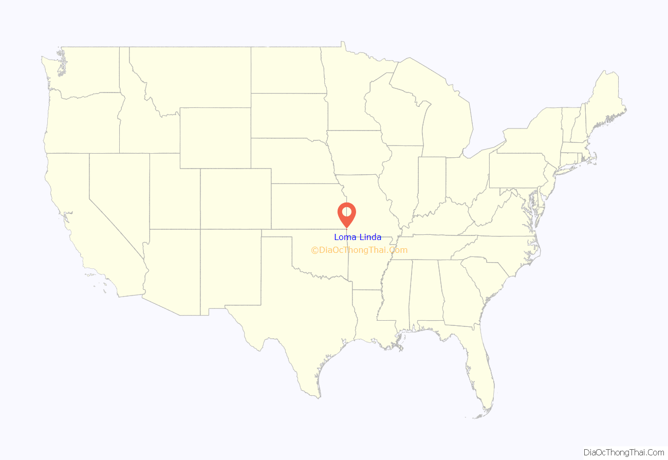
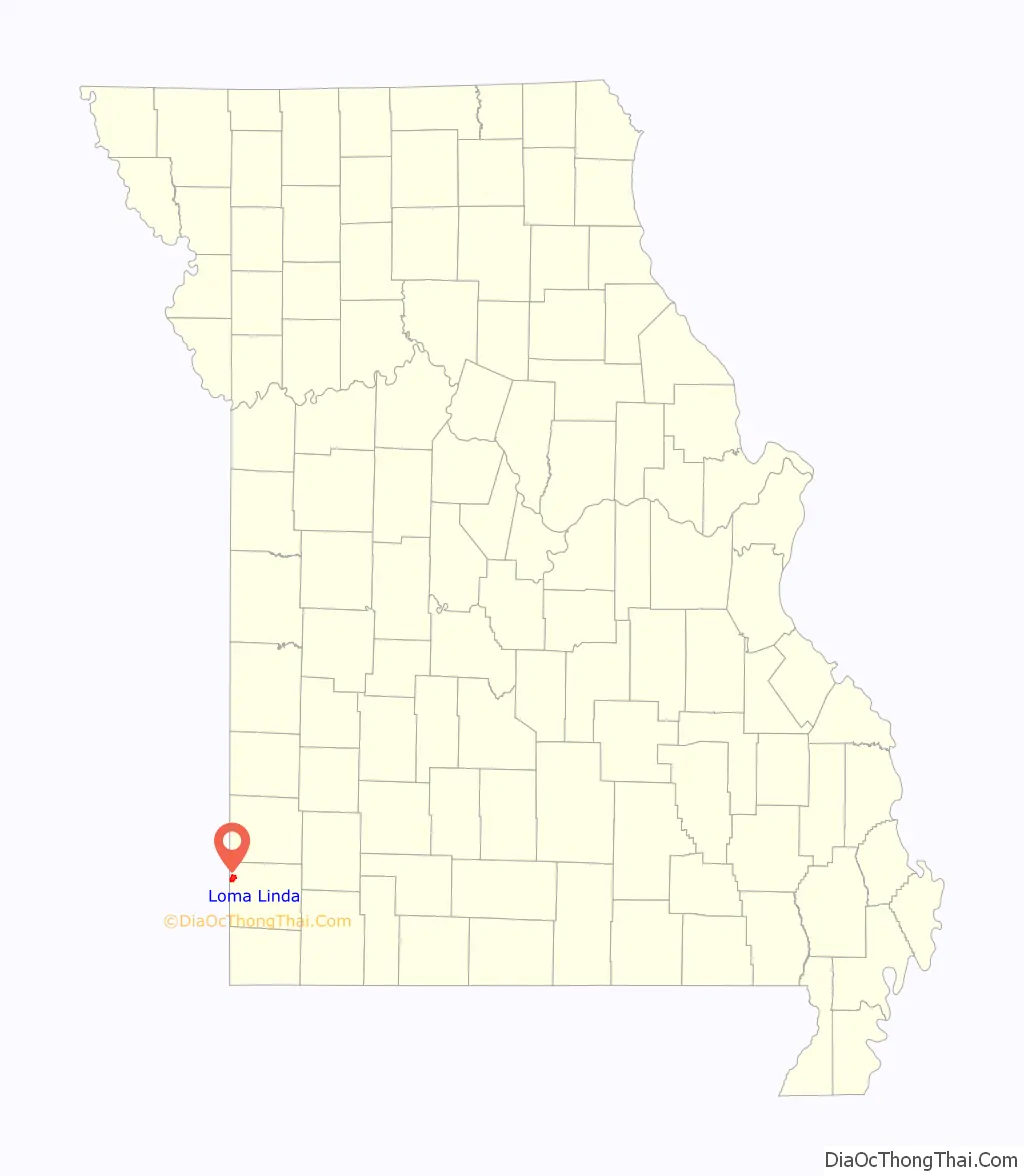
Loma Linda location map. Where is Loma Linda town?
History
The village, a collection of homes and properties surrounding the golf course and country club of the name, was incorporated in 1995. Loma Linda Country Club was created by Joe Blau of New York and the late Ted Hoffman in 1971. Until August 2005, the golf professional at Loma Linda was Benny Pell.
On January 1, 2006, the course, Village Water Company, and the surrounding 2,500 acres (10 km) area were sold to Joplin businessman Bobby Landis. Landis had acquired the resort and apartment complex of Loma Linda by the end of 2005. In 2007, the Country Club was sold to the Downstream Casino and Resort owned and operated by the Quapaw Tribe. The tribe also owns a casino less than a mile west of the Loma Linda property. The country club was split into three golf courses: The Eagle Creek Golf Club at Downstream Casino Resort, Bald Eagle Golf Course, and Golden Eagle Golf Courses.
Loma Linda is part of the Seneca R-7 school district.
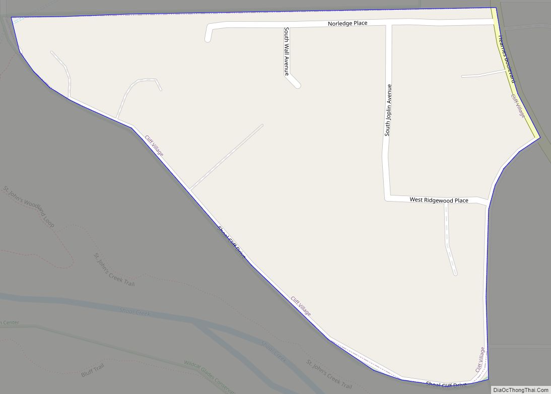
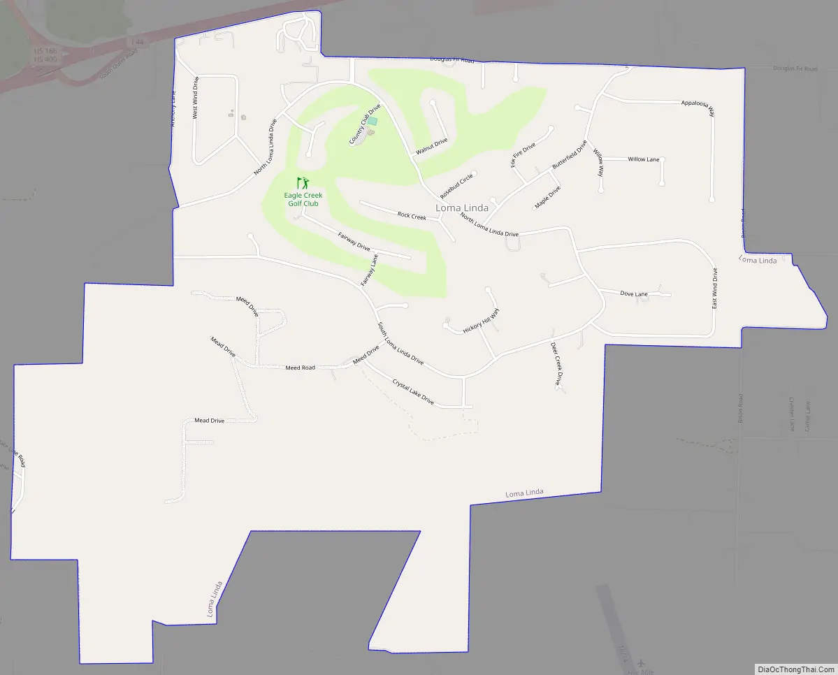
Loma Linda Road Map
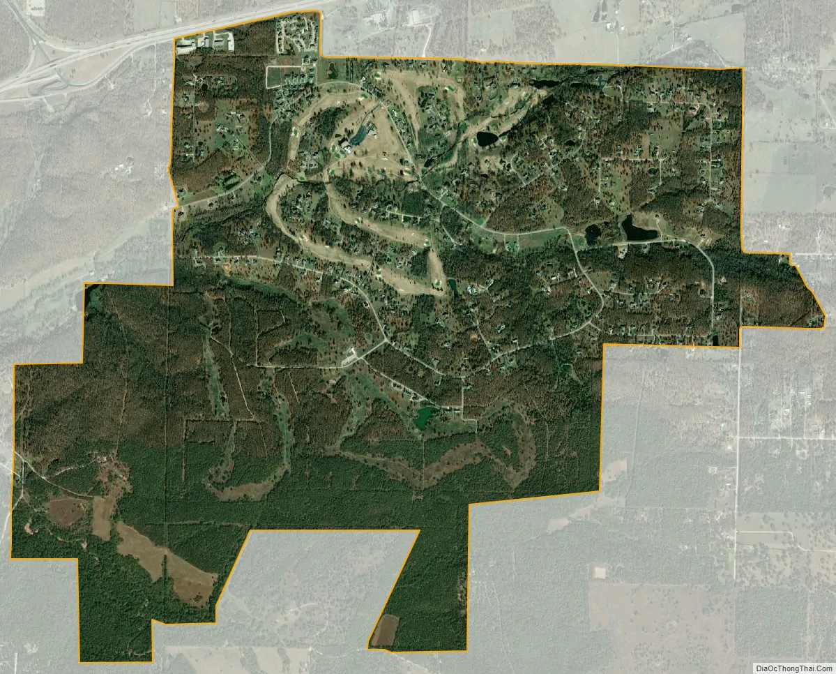
Loma Linda city Satellite Map
Geography
Loma Linda is located at 36°59′34″N 94°35′43″W / 36.99278°N 94.59528°W / 36.99278; -94.59528 (36.992874, -94.595228).
According to the United States Census Bureau, the village has a total area of 3.57 square miles (9.25 km), of which 3.56 square miles (9.22 km) is land and 0.01 square miles (0.03 km) is water.
See also
Map of Missouri State and its subdivision:- Adair
- Andrew
- Atchison
- Audrain
- Barry
- Barton
- Bates
- Benton
- Bollinger
- Boone
- Buchanan
- Butler
- Caldwell
- Callaway
- Camden
- Cape Girardeau
- Carroll
- Carter
- Cass
- Cedar
- Chariton
- Christian
- Clark
- Clay
- Clinton
- Cole
- Cooper
- Crawford
- Dade
- Dallas
- Daviess
- De Kalb
- Dent
- Douglas
- Dunklin
- Franklin
- Gasconade
- Gentry
- Greene
- Grundy
- Harrison
- Henry
- Hickory
- Holt
- Howard
- Howell
- Iron
- Jackson
- Jasper
- Jefferson
- Johnson
- Knox
- Laclede
- Lafayette
- Lawrence
- Lewis
- Lincoln
- Linn
- Livingston
- Macon
- Madison
- Maries
- Marion
- McDonald
- Mercer
- Miller
- Mississippi
- Moniteau
- Monroe
- Montgomery
- Morgan
- New Madrid
- Newton
- Nodaway
- Oregon
- Osage
- Ozark
- Pemiscot
- Perry
- Pettis
- Phelps
- Pike
- Platte
- Polk
- Pulaski
- Putnam
- Ralls
- Randolph
- Ray
- Reynolds
- Ripley
- Saint Charles
- Saint Clair
- Saint Francois
- Saint Louis
- Sainte Genevieve
- Saline
- Schuyler
- Scotland
- Scott
- Shannon
- Shelby
- Stoddard
- Stone
- Sullivan
- Taney
- Texas
- Vernon
- Warren
- Washington
- Wayne
- Webster
- Worth
- Wright
- Alabama
- Alaska
- Arizona
- Arkansas
- California
- Colorado
- Connecticut
- Delaware
- District of Columbia
- Florida
- Georgia
- Hawaii
- Idaho
- Illinois
- Indiana
- Iowa
- Kansas
- Kentucky
- Louisiana
- Maine
- Maryland
- Massachusetts
- Michigan
- Minnesota
- Mississippi
- Missouri
- Montana
- Nebraska
- Nevada
- New Hampshire
- New Jersey
- New Mexico
- New York
- North Carolina
- North Dakota
- Ohio
- Oklahoma
- Oregon
- Pennsylvania
- Rhode Island
- South Carolina
- South Dakota
- Tennessee
- Texas
- Utah
- Vermont
- Virginia
- Washington
- West Virginia
- Wisconsin
- Wyoming