Peculiar is a city in Cass County, Missouri and is part of the Kansas City metropolitan area within the United States. The population was 4,608 at the 2010 census. The town motto is “Where the ‘odds’ are with you.”
| Name: | Peculiar city |
|---|---|
| LSAD Code: | 25 |
| LSAD Description: | city (suffix) |
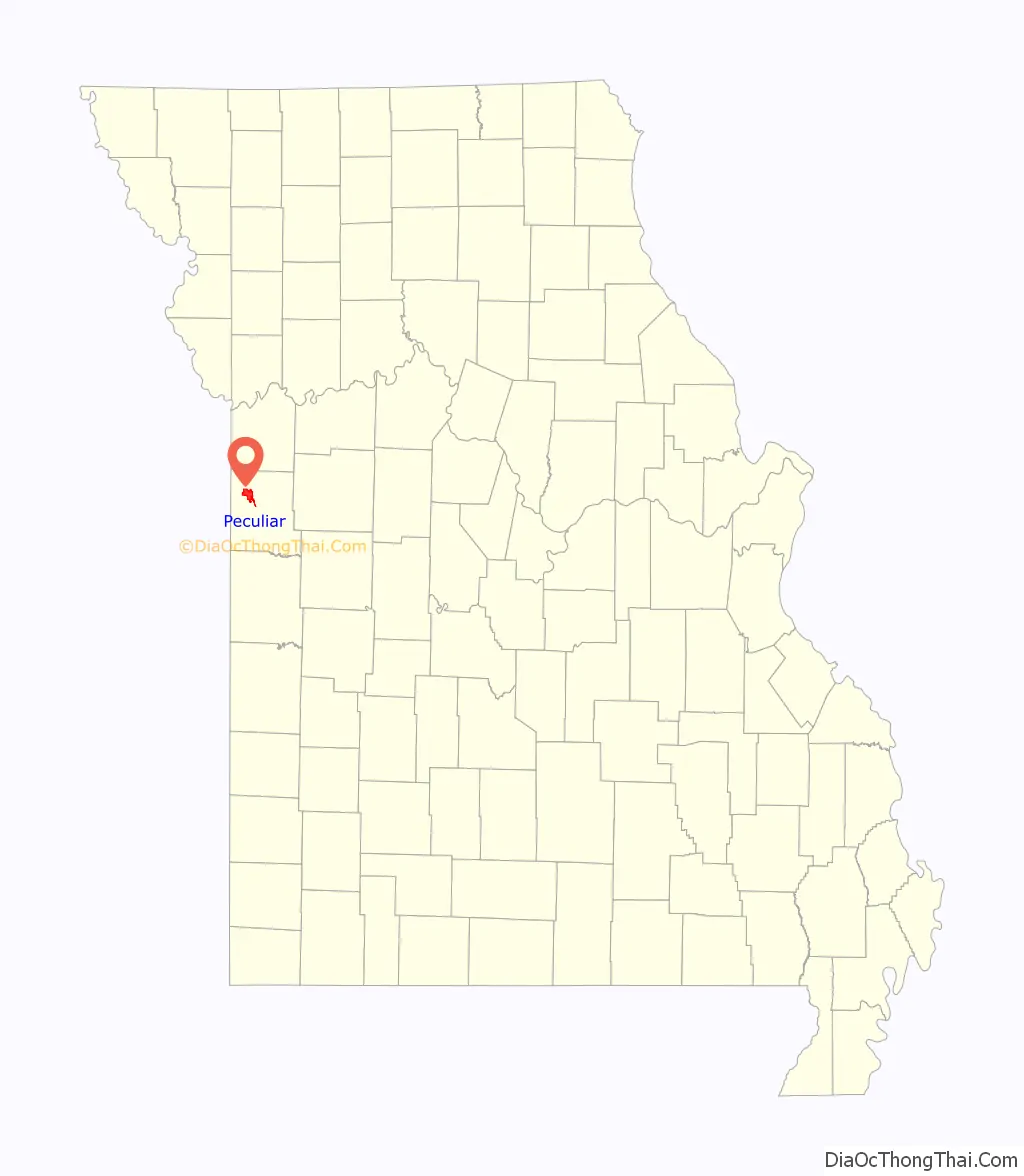
| State: | Missouri |
| County: | Cass County |
| Elevation: | 997 ft (304 m) |
| Total Area: | 9.11 sq mi (23.59 km²) |
| Land Area: | 9.06 sq mi (23.48 km²) |
| Water Area: | 0.04 sq mi (0.11 km²) |
| Total Population: | 5,621 |
| Population Density: | 620.08/sq mi (239.41/km²) |
| ZIP code: | 64078 |
| Area code: | 816 |
| FIPS code: | 2956756 |
| GNISfeature ID: | 2396171 |
Online Interactive Map
Click on ![]() to view map in "full screen" mode.
to view map in "full screen" mode.
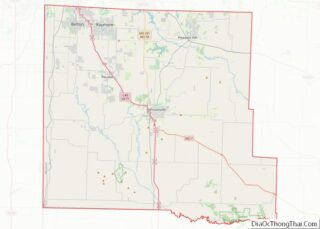
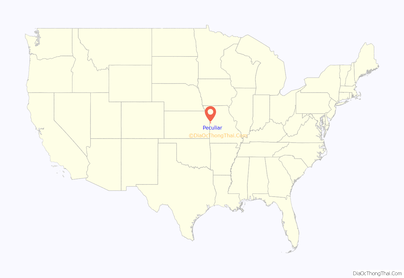
Peculiar location map. Where is Peculiar city?
History
Early settlers of the town came to Western Missouri by riverboat from Illinois, Iowa, Michigan, Pennsylvania, and Ohio. Peculiar also had families coming from Tennessee, Kentucky, and Virginia. On July 29, 1868, the county surveyor, Robert Cass, platted Peculiar and was filed as “The Town of Peculiar”.
There are at least two versions of the story on how Peculiar received its name. The first involves the community’s first postmaster, Edgar Thomson. His first choice for a town name, “Excelsior,” was rejected because it already existed in Atchison County, Missouri. Several other choices were also rejected. The story goes that the annoyed Thomson wrote to the Postmaster General himself to complain saying, among other things, “We don’t care what name you give us so long as it is sort of ‘peculiar’.” Thomson submitted the name “Peculiar” and the name was approved. The post office was established on June 22, 1868.
In an alternate version, according to Missouri folklorist Margot Ford McMillen, early settlers were searching for a location to farm. As they cleared a small rise and looked below, one remarked “Well that’s peculiar! It’s the very place I saw in a vision back in Connecticut.” The land was purchased and eventually a village sprang up on it, which was named “Peculiar”.
Peculiar incorporated as a village in the 1890s and became a fourth class city of the state of Missouri in 1953.
The city celebrated its centenary in July 1968. The celebrations continued for nine days and included an antique show and sale, a Lions Club championship rodeo, and an open class Western horse show.
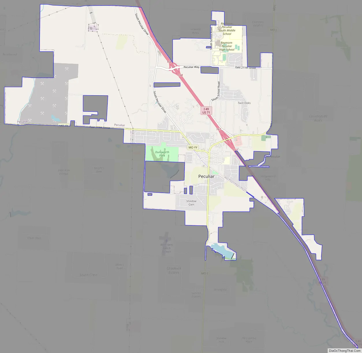
Peculiar Road Map
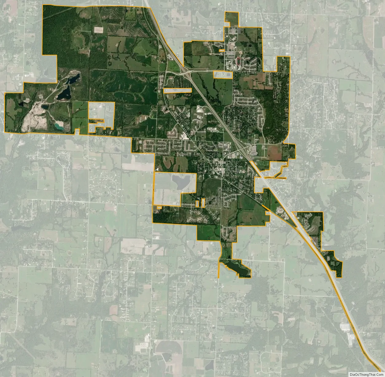
Peculiar city Satellite Map
Geography
Peculiar is located adjacent to U.S. Route 71 and the Burlington Northern Railway. Old Peculiar lies one mile to the east along the banks of the East Fork East Branch South Grand River.
According to the United States Census Bureau, the city has a total area of 8.45 square miles (21.89 km), of which 8.41 square miles (21.78 km) is land and 0.04 square miles (0.10 km) is water.
See also
Map of Missouri State and its subdivision:- Adair
- Andrew
- Atchison
- Audrain
- Barry
- Barton
- Bates
- Benton
- Bollinger
- Boone
- Buchanan
- Butler
- Caldwell
- Callaway
- Camden
- Cape Girardeau
- Carroll
- Carter
- Cass
- Cedar
- Chariton
- Christian
- Clark
- Clay
- Clinton
- Cole
- Cooper
- Crawford
- Dade
- Dallas
- Daviess
- De Kalb
- Dent
- Douglas
- Dunklin
- Franklin
- Gasconade
- Gentry
- Greene
- Grundy
- Harrison
- Henry
- Hickory
- Holt
- Howard
- Howell
- Iron
- Jackson
- Jasper
- Jefferson
- Johnson
- Knox
- Laclede
- Lafayette
- Lawrence
- Lewis
- Lincoln
- Linn
- Livingston
- Macon
- Madison
- Maries
- Marion
- McDonald
- Mercer
- Miller
- Mississippi
- Moniteau
- Monroe
- Montgomery
- Morgan
- New Madrid
- Newton
- Nodaway
- Oregon
- Osage
- Ozark
- Pemiscot
- Perry
- Pettis
- Phelps
- Pike
- Platte
- Polk
- Pulaski
- Putnam
- Ralls
- Randolph
- Ray
- Reynolds
- Ripley
- Saint Charles
- Saint Clair
- Saint Francois
- Saint Louis
- Sainte Genevieve
- Saline
- Schuyler
- Scotland
- Scott
- Shannon
- Shelby
- Stoddard
- Stone
- Sullivan
- Taney
- Texas
- Vernon
- Warren
- Washington
- Wayne
- Webster
- Worth
- Wright
- Alabama
- Alaska
- Arizona
- Arkansas
- California
- Colorado
- Connecticut
- Delaware
- District of Columbia
- Florida
- Georgia
- Hawaii
- Idaho
- Illinois
- Indiana
- Iowa
- Kansas
- Kentucky
- Louisiana
- Maine
- Maryland
- Massachusetts
- Michigan
- Minnesota
- Mississippi
- Missouri
- Montana
- Nebraska
- Nevada
- New Hampshire
- New Jersey
- New Mexico
- New York
- North Carolina
- North Dakota
- Ohio
- Oklahoma
- Oregon
- Pennsylvania
- Rhode Island
- South Carolina
- South Dakota
- Tennessee
- Texas
- Utah
- Vermont
- Virginia
- Washington
- West Virginia
- Wisconsin
- Wyoming