Quitman is an unincorporated community in west central Nodaway County, Missouri, United States. The population was 45 at the 2010 census.
| Name: | Quitman CDP |
|---|---|
| LSAD Code: | 57 |
| LSAD Description: | CDP (suffix) |
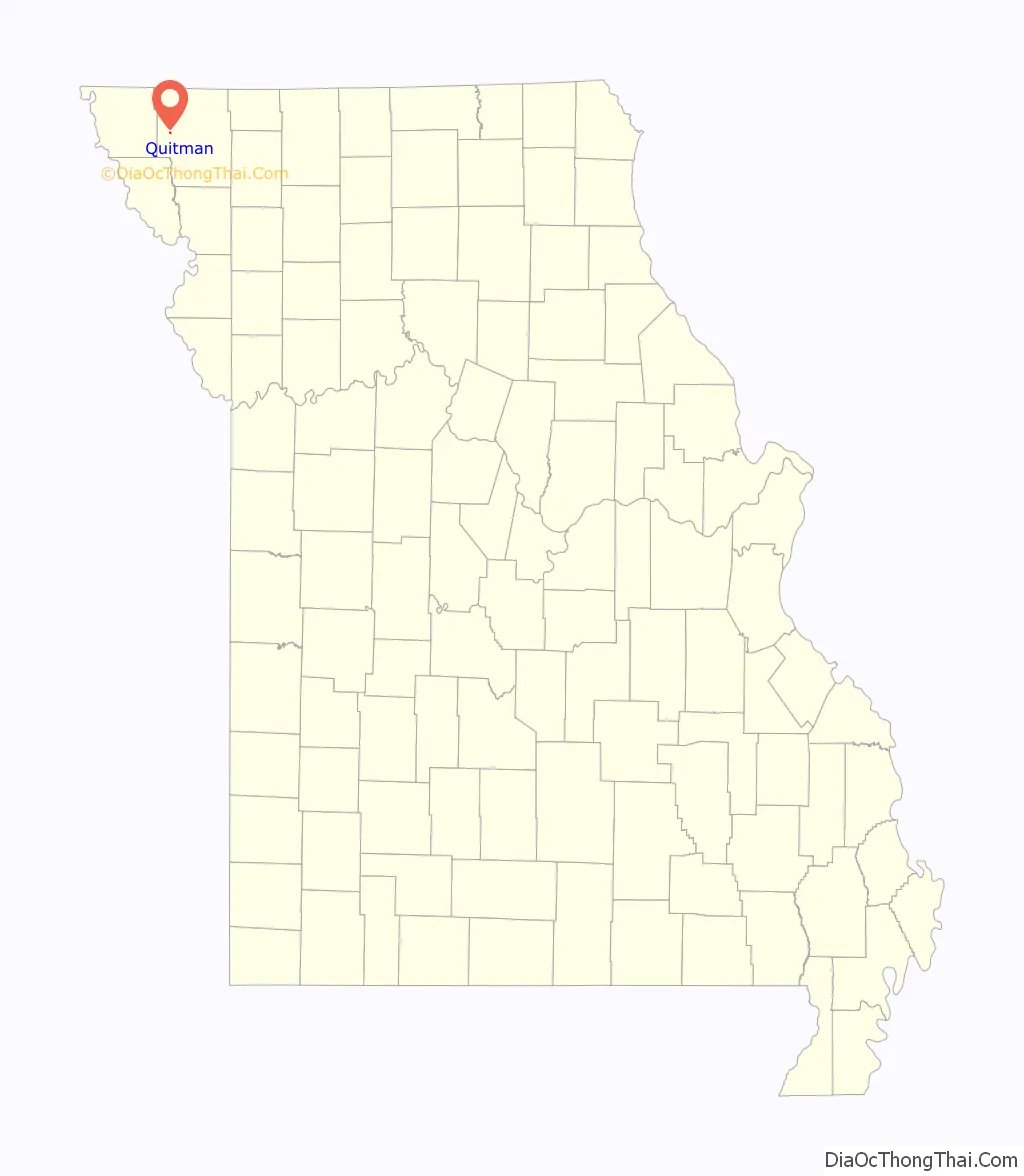
| State: | Missouri |
| County: | Nodaway County |
| Elevation: | 965 ft (294 m) |
| Total Area: | 0.16 sq mi (0.41 km²) |
| Land Area: | 0.16 sq mi (0.41 km²) |
| Water Area: | 0.00 sq mi (0.00 km²) |
| Total Population: | 42 |
| Population Density: | 267.52/sq mi (103.35/km²) |
| ZIP code: | 64478 |
| Area code: | 660 |
| FIPS code: | 2960410 |
| GNISfeature ID: | 2787909 |
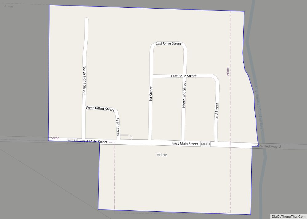
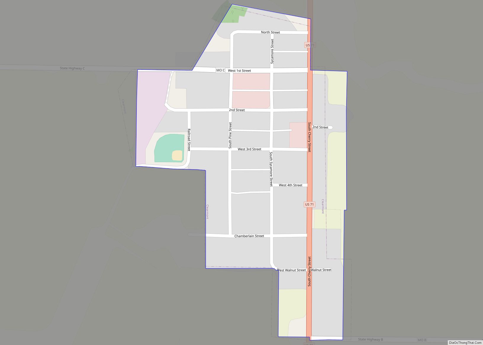
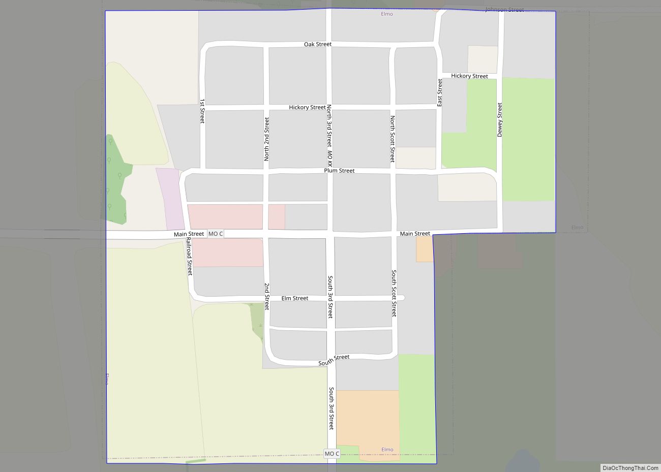
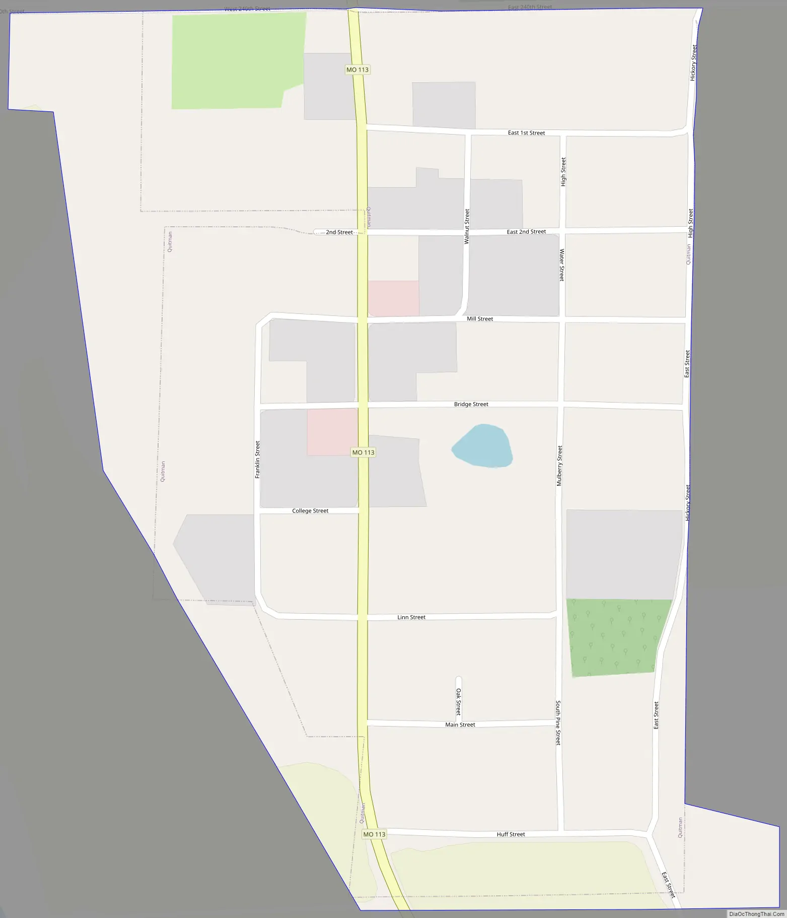
Online Interactive Map
Click on ![]() to view map in "full screen" mode.
to view map in "full screen" mode.
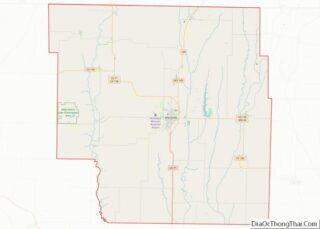
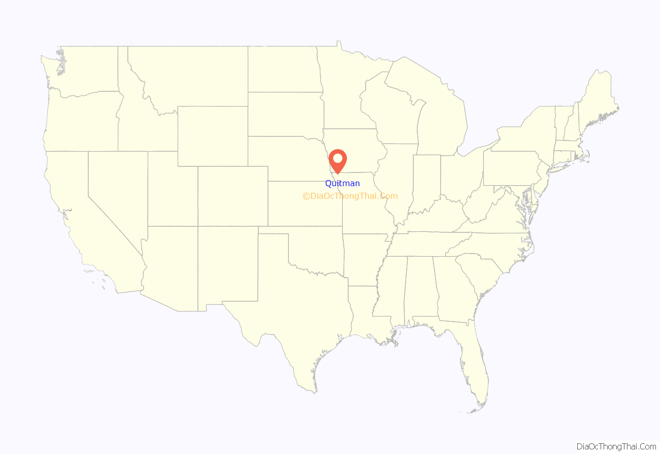
Quitman location map. Where is Quitman CDP?
History
Originally it was called Russellville which was first platted in 1856 by R. R. Russell. Later, the name was changed to Quitman in honor of John A. Quitman, a strongly pro-slavery former governor of Mississippi, leader of the Fire Eaters, and veteran in the Mexican–American War. The city was incorporated on February 8, 1881 when it was a stop on the Nodaway Valley Railroad (which was building the railroad for the Kansas City, St. Joseph and Council Bluffs Railroad that eventually became part of the Burlington Northern network. The railroad no longer continues.
In November 2012, the Nodaway County Commission voted to disincorporate Quitman after local residents asked for it.
Quitman Road Map
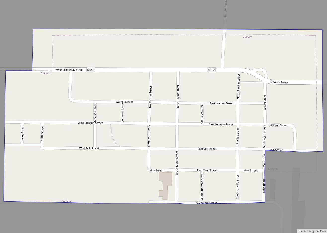
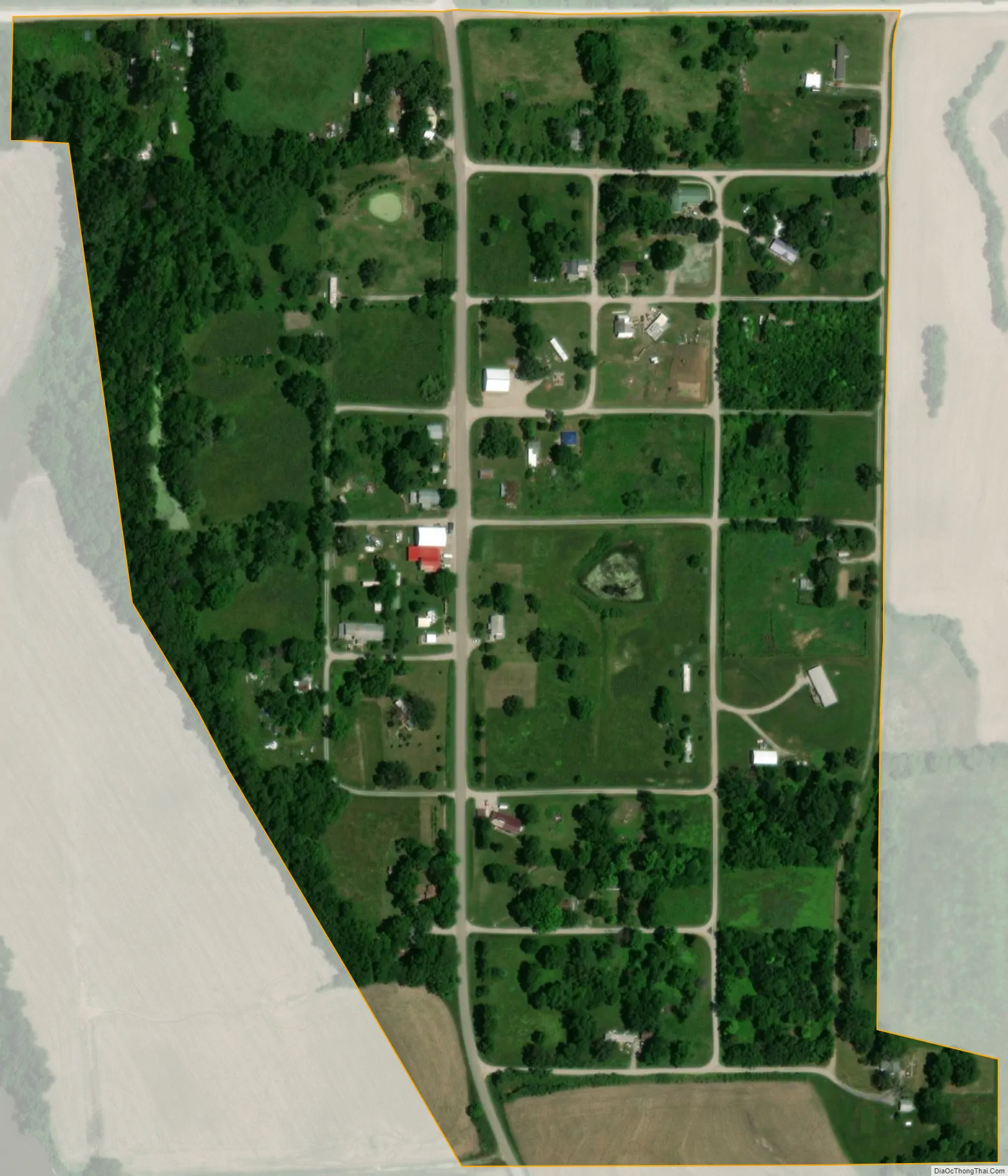
Quitman city Satellite Map
Geography
The community is located on Missouri Route 113 between Skidmore 5.5 miles to the south and Burlington Junction, Missouri 4.5 miles to the north. The Nodaway River flows past the west side of the community and the Bilby Ranch Lake Conservation Area is three miles to the west.
According to the United States Census Bureau, the city has a total area of 0.13 square miles (0.34 km), all land.
See also
Map of Missouri State and its subdivision:- Adair
- Andrew
- Atchison
- Audrain
- Barry
- Barton
- Bates
- Benton
- Bollinger
- Boone
- Buchanan
- Butler
- Caldwell
- Callaway
- Camden
- Cape Girardeau
- Carroll
- Carter
- Cass
- Cedar
- Chariton
- Christian
- Clark
- Clay
- Clinton
- Cole
- Cooper
- Crawford
- Dade
- Dallas
- Daviess
- De Kalb
- Dent
- Douglas
- Dunklin
- Franklin
- Gasconade
- Gentry
- Greene
- Grundy
- Harrison
- Henry
- Hickory
- Holt
- Howard
- Howell
- Iron
- Jackson
- Jasper
- Jefferson
- Johnson
- Knox
- Laclede
- Lafayette
- Lawrence
- Lewis
- Lincoln
- Linn
- Livingston
- Macon
- Madison
- Maries
- Marion
- McDonald
- Mercer
- Miller
- Mississippi
- Moniteau
- Monroe
- Montgomery
- Morgan
- New Madrid
- Newton
- Nodaway
- Oregon
- Osage
- Ozark
- Pemiscot
- Perry
- Pettis
- Phelps
- Pike
- Platte
- Polk
- Pulaski
- Putnam
- Ralls
- Randolph
- Ray
- Reynolds
- Ripley
- Saint Charles
- Saint Clair
- Saint Francois
- Saint Louis
- Sainte Genevieve
- Saline
- Schuyler
- Scotland
- Scott
- Shannon
- Shelby
- Stoddard
- Stone
- Sullivan
- Taney
- Texas
- Vernon
- Warren
- Washington
- Wayne
- Webster
- Worth
- Wright
- Alabama
- Alaska
- Arizona
- Arkansas
- California
- Colorado
- Connecticut
- Delaware
- District of Columbia
- Florida
- Georgia
- Hawaii
- Idaho
- Illinois
- Indiana
- Iowa
- Kansas
- Kentucky
- Louisiana
- Maine
- Maryland
- Massachusetts
- Michigan
- Minnesota
- Mississippi
- Missouri
- Montana
- Nebraska
- Nevada
- New Hampshire
- New Jersey
- New Mexico
- New York
- North Carolina
- North Dakota
- Ohio
- Oklahoma
- Oregon
- Pennsylvania
- Rhode Island
- South Carolina
- South Dakota
- Tennessee
- Texas
- Utah
- Vermont
- Virginia
- Washington
- West Virginia
- Wisconsin
- Wyoming