Valley Park is a city in St. Louis County, Missouri, United States. The population was 6,885 at the 2020 census.
| Name: | Valley Park city |
|---|---|
| LSAD Code: | 25 |
| LSAD Description: | city (suffix) |
| State: | Missouri |
| County: | St. Louis County |
| Elevation: | 423 ft (129 m) |
| Total Area: | 5.09 sq mi (13.19 km²) |
| Land Area: | 4.50 sq mi (11.66 km²) |
| Water Area: | 0.59 sq mi (1.53 km²) |
| Total Population: | 6,885 |
| Population Density: | 1,528.98/sq mi (590.38/km²) |
| ZIP code: | 63088 |
| Area code: | 636 |
| FIPS code: | 2975472 |
| GNISfeature ID: | 2397113 |
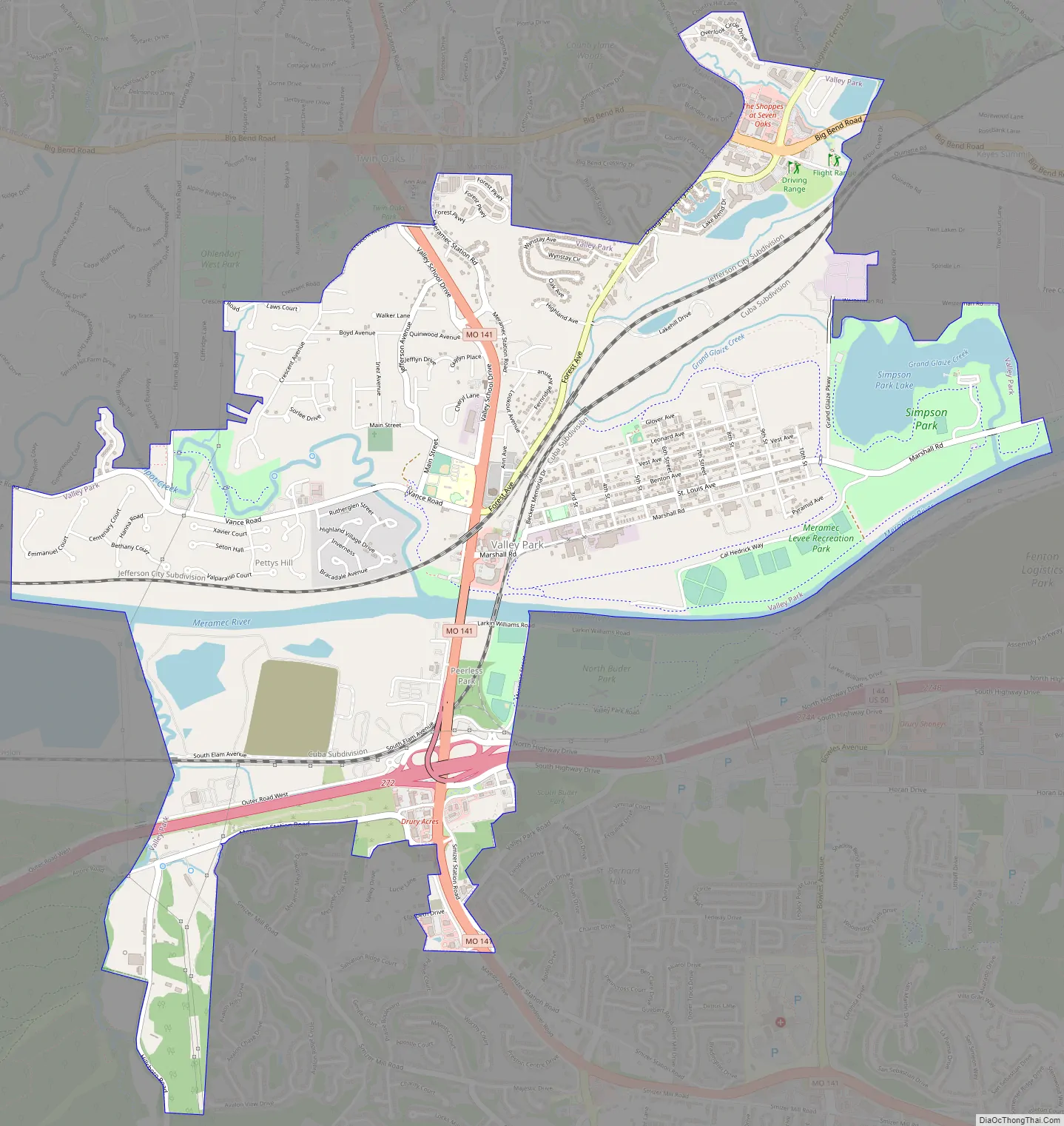
Online Interactive Map
Click on ![]() to view map in "full screen" mode.
to view map in "full screen" mode.
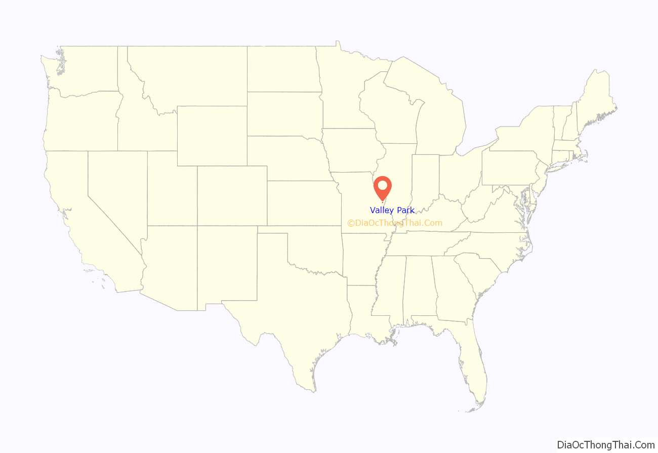
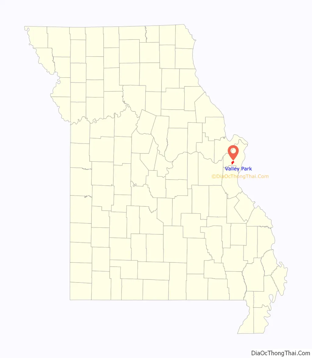
Valley Park location map. Where is Valley Park city?
History
Descendants of the Mississippian culture still had a settlement along the Meramec River in the mid-18th century, until the Native Americans were pushed out by colonial French and German immigrant farmers in the 1760s. The developing village over time was known as Nasby, Sulphur Springs, Quinette, Meramec, and finally Valley Park by circa 1890. It had one of the first post offices established in St. Louis County. It developed as a railroad hub for the Missouri Pacific and St. Louis-San Francisco rail lines.
In 1894, the town became the site of the first lynching in St. Louis County. A black man named John Buckner was lynched when accused of raping a local black woman and a white teenager. He was taken from the authorities by several local residents and farmers and hanged from the main bridge in town overlooking the Meramec River. The lynchers were never prosecuted.
Valley Park and Castlewood Park were developed as summer resorts. Castlewood Park is a short distance west on Big Bend. Castlewood Park became part of the Missouri State Park system.
However, Valley Park began to boom with development. It had railroads, the Meramec River, and what even then were considered main roads. Railroads played a big role in the town in the late 19th century and early 20th century. At the time, the St. Louis-San Francisco (Frisco) and Missouri Pacific served Valley Park; now it is Union Pacific and Burlington Northern Santa Fe. At one time, the Meramec River had barge traffic.
In 1917, the town became incorporated. As many as 70 trains passed through Valley Park on any given day. The town became a center for industry with the building of the glass factory and other industries. Grocery stores and restaurants opened up; churches went from being mission churches to being congregations. Valley Park had a Saddle and Paddle Club located at Marshall and what is now Highway 141.
In the Great Flood of 1913, the main bridge was destroyed along with several factories causing extensive damage to the city’s economy.
St. Louis families would board the trains for summer vacations, weekends, or second family homes along the Meramec River. Clubhouses were built on the banks of the Meramec. Some of those clubhouses stood until the 1990s. The 1992 and 1993 floods destroyed them beyond repair. The remains were removed in order to allow for construction of the Meramec Valley River Basin Levee. The levee had a major flood test in March 2008; it saved Valley Park from a devastating flood. Most of the town also survived major flooding of the Meramec in 2015 and 2017, which forced closings of interstate and state roads in the area, and flooded other small towns. The intersection of Highway 141 and Interstate 44 was flooded and closed from December to January 2016. This area flooded again in 2017, cutting off wide areas of cross-country traffic.
The Frisco Hotel is an historic building located at 24 Front Street which was adapted as the Frisco Train Store.
Several parks are within the city limits, including Vance Trails, Leonard, and Brignole parks, and Meramec Landing for anglers and boaters. Simpson St. Louis County Park and Lake and Lone Elk County Park (which also has a wild bird sanctuary) are also within the city limits. Completion of the levee will include trails on top, overlooking the Meramec River for hiking and biking, as part of the Ozark Greenway Trails. In 2010, Valley Park annexed Peerless Park, a former city that disincorporated in 1998.
Valley Park Road Map
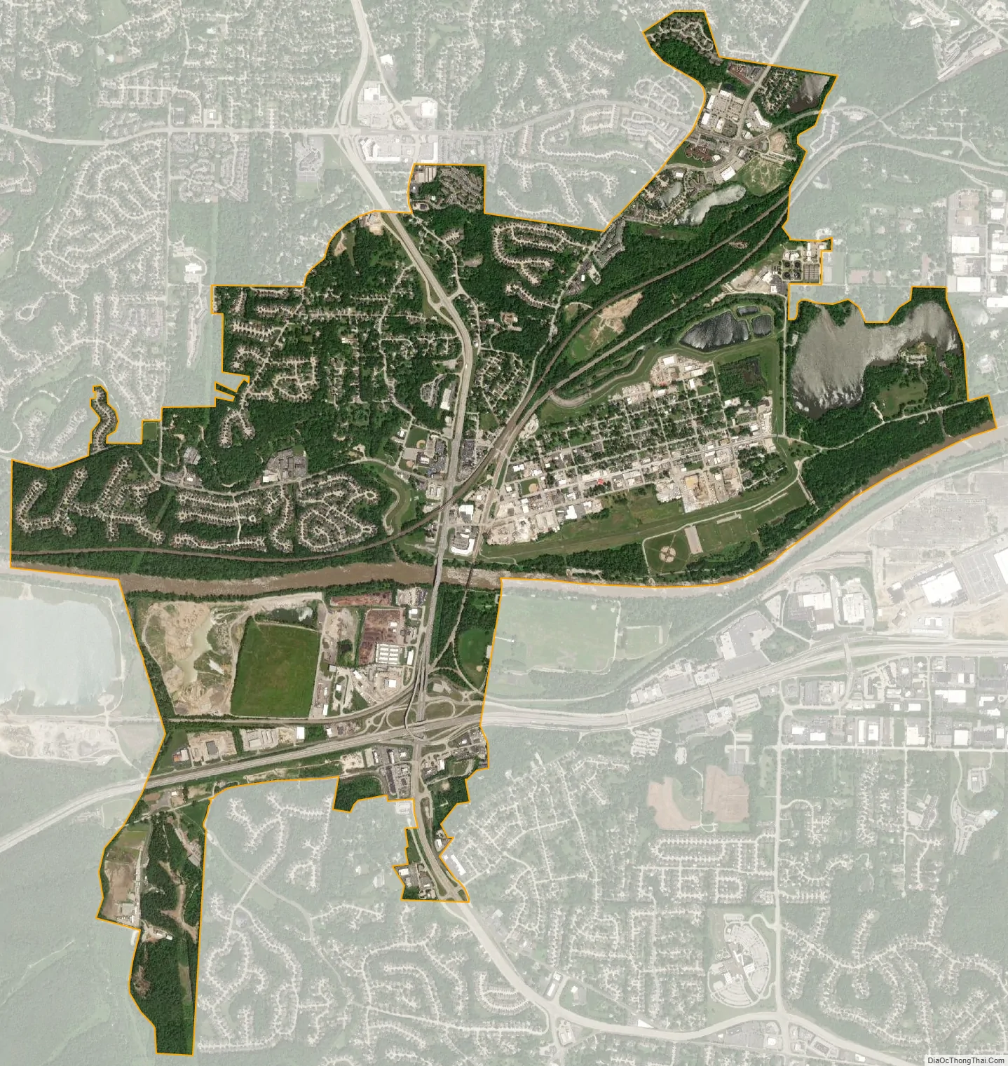
Valley Park city Satellite Map
Geography
The city is located on the north bank of the Meramec River and is served by Missouri Route 141 which connects to I-44 south of the Meramec.
According to the United States Census Bureau, the city has a total area of 4.02 square miles (10.41 km), of which 3.80 square miles (9.84 km) is land and 0.22 square miles (0.57 km) is water.
See also
Map of Missouri State and its subdivision:- Adair
- Andrew
- Atchison
- Audrain
- Barry
- Barton
- Bates
- Benton
- Bollinger
- Boone
- Buchanan
- Butler
- Caldwell
- Callaway
- Camden
- Cape Girardeau
- Carroll
- Carter
- Cass
- Cedar
- Chariton
- Christian
- Clark
- Clay
- Clinton
- Cole
- Cooper
- Crawford
- Dade
- Dallas
- Daviess
- De Kalb
- Dent
- Douglas
- Dunklin
- Franklin
- Gasconade
- Gentry
- Greene
- Grundy
- Harrison
- Henry
- Hickory
- Holt
- Howard
- Howell
- Iron
- Jackson
- Jasper
- Jefferson
- Johnson
- Knox
- Laclede
- Lafayette
- Lawrence
- Lewis
- Lincoln
- Linn
- Livingston
- Macon
- Madison
- Maries
- Marion
- McDonald
- Mercer
- Miller
- Mississippi
- Moniteau
- Monroe
- Montgomery
- Morgan
- New Madrid
- Newton
- Nodaway
- Oregon
- Osage
- Ozark
- Pemiscot
- Perry
- Pettis
- Phelps
- Pike
- Platte
- Polk
- Pulaski
- Putnam
- Ralls
- Randolph
- Ray
- Reynolds
- Ripley
- Saint Charles
- Saint Clair
- Saint Francois
- Saint Louis
- Sainte Genevieve
- Saline
- Schuyler
- Scotland
- Scott
- Shannon
- Shelby
- Stoddard
- Stone
- Sullivan
- Taney
- Texas
- Vernon
- Warren
- Washington
- Wayne
- Webster
- Worth
- Wright
- Alabama
- Alaska
- Arizona
- Arkansas
- California
- Colorado
- Connecticut
- Delaware
- District of Columbia
- Florida
- Georgia
- Hawaii
- Idaho
- Illinois
- Indiana
- Iowa
- Kansas
- Kentucky
- Louisiana
- Maine
- Maryland
- Massachusetts
- Michigan
- Minnesota
- Mississippi
- Missouri
- Montana
- Nebraska
- Nevada
- New Hampshire
- New Jersey
- New Mexico
- New York
- North Carolina
- North Dakota
- Ohio
- Oklahoma
- Oregon
- Pennsylvania
- Rhode Island
- South Carolina
- South Dakota
- Tennessee
- Texas
- Utah
- Vermont
- Virginia
- Washington
- West Virginia
- Wisconsin
- Wyoming


