Dobbins Heights is a town in Richmond County, North Carolina, United States. The population was 866 at the 2010 census.
| Name: | Dobbins Heights town |
|---|---|
| LSAD Code: | 43 |
| LSAD Description: | town (suffix) |
| State: | North Carolina |
| County: | Richmond County |
| Elevation: | 387 ft (118 m) |
| Total Area: | 0.88 sq mi (2.29 km²) |
| Land Area: | 0.88 sq mi (2.29 km²) |
| Water Area: | 0.00 sq mi (0.00 km²) |
| Total Population: | 687 |
| Population Density: | 778.03/sq mi (300.48/km²) |
| ZIP code: | 28345 |
| FIPS code: | 3717325 |
| GNISfeature ID: | 1027618 |
| Website: | www.dobbinsheights.com |
Online Interactive Map
Click on ![]() to view map in "full screen" mode.
to view map in "full screen" mode.
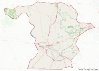
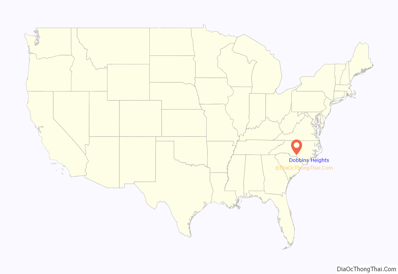
Dobbins Heights location map. Where is Dobbins Heights town?

History
Dobbins Heights was originally known as North Yard. It began as a largely black community in an unincorporated part of Richmond County near the city of Hamlet, with fewer than 1,000 residents. A black school, the Pee Dee Institute, was built in North Yard in 1908. Through the 1960s, many of the homes in the community were rented, and existed in poor condition with outdoor plumbing. Many streets remained unpaved through the 1980s. Due to its unincorporated status, North Yard’s residents received fewer government services than other municipal residents and lacked direct political representation. They usually paid taxes directly to Richmond County government, though occasionally levies were paid to Hamlet. There was little cohesive community identity in the area; collective social life, such as it existed, was centered around several churches.
In the mid-1960s, a local minister founded the North Yard Improvement Association, which raised money to install streetlights along some of the main roads in the community. From 1971 to 1972 United States Army engineers built a recreational area in the community. Lack of adequate coverage from neighboring fire departments led the community to create a volunteer fire department in 1974. Two years later residents appealed for the city of Hamlet to annex the community, but the municipal government rejected the proposal, citing the economically depressed nature of the area. Some locals suspected their lack of success was due to racism. Following the failure of the annexation request, residents began pushing for North Yard to be incorporated in its own right, and began calling the community Dobbins Heights in homage to Jim Dobbins, a minister who had owned a significant amount of the area’s land in the 1930s. In 1983 Representative Hugh Lee of Rockingham introduced a bill in the North Carolina General Assembly to authorize a local referendum to decide on incorporation. On May 8, 1984, the referendum was held which concluded narrowly in favor of incorporation, leading to the creation of the town of Dobbins Heights. A black mayor and all-black city council were elected, and the officials successfully secured state and federal grants to improve local infrastructure, including the rehabilitation of streets and parks and equipment acquisitions for the fire department.
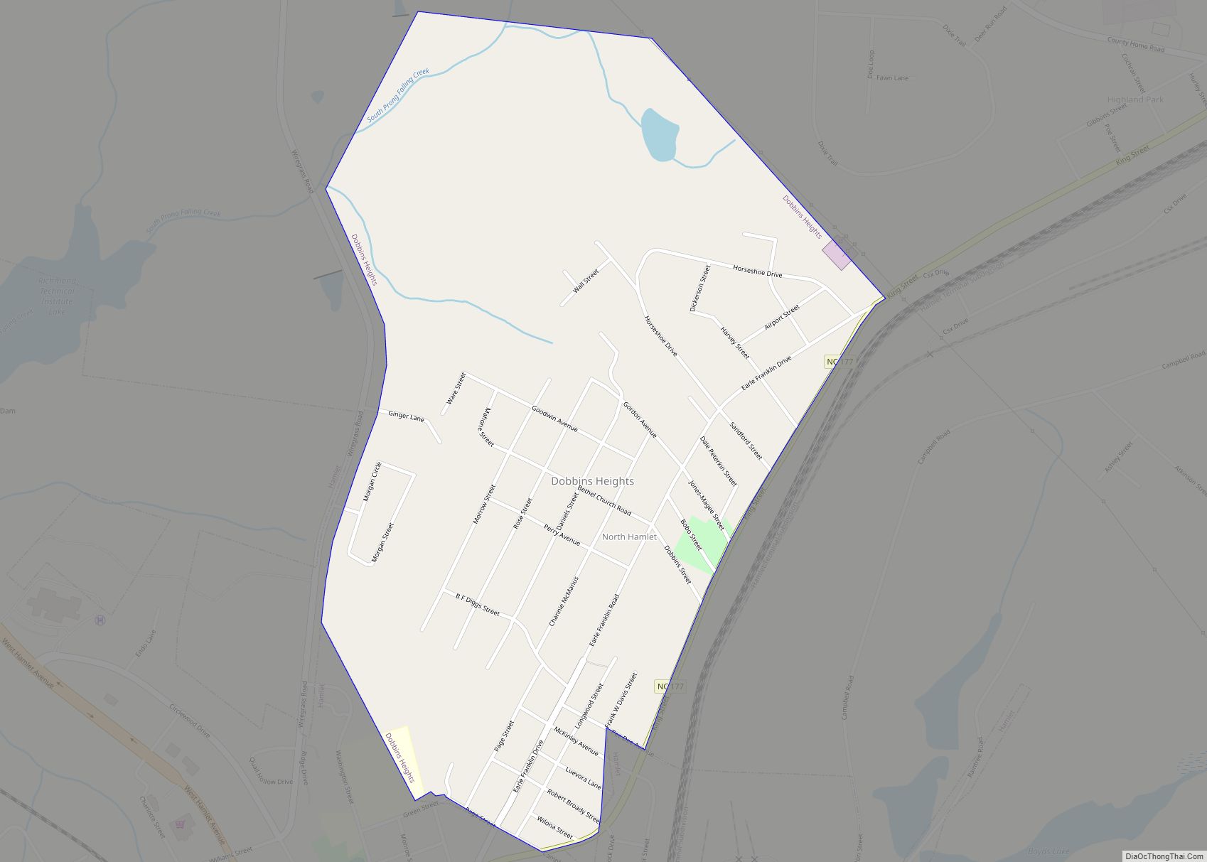
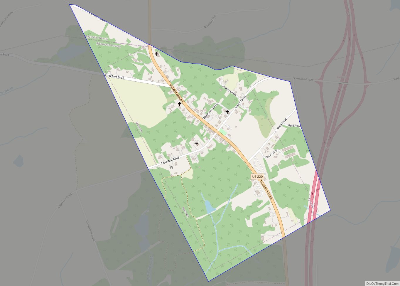
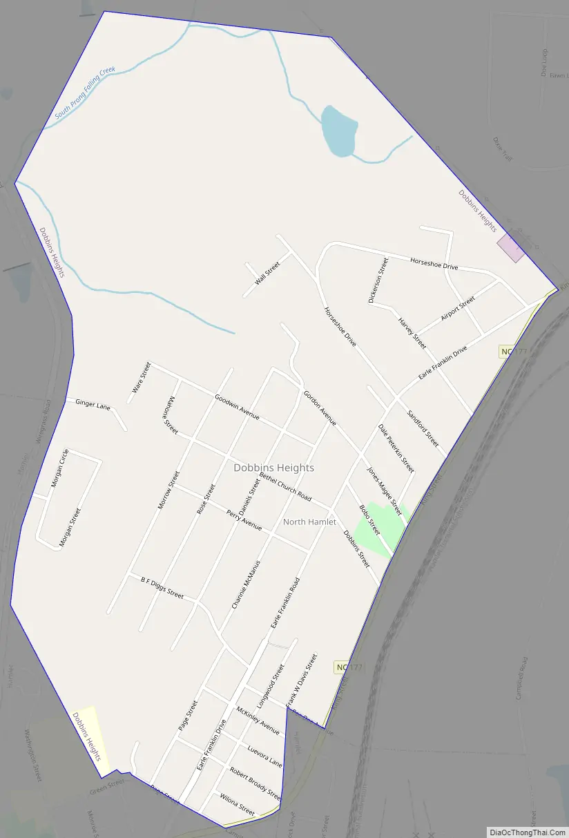
Dobbins Heights Road Map
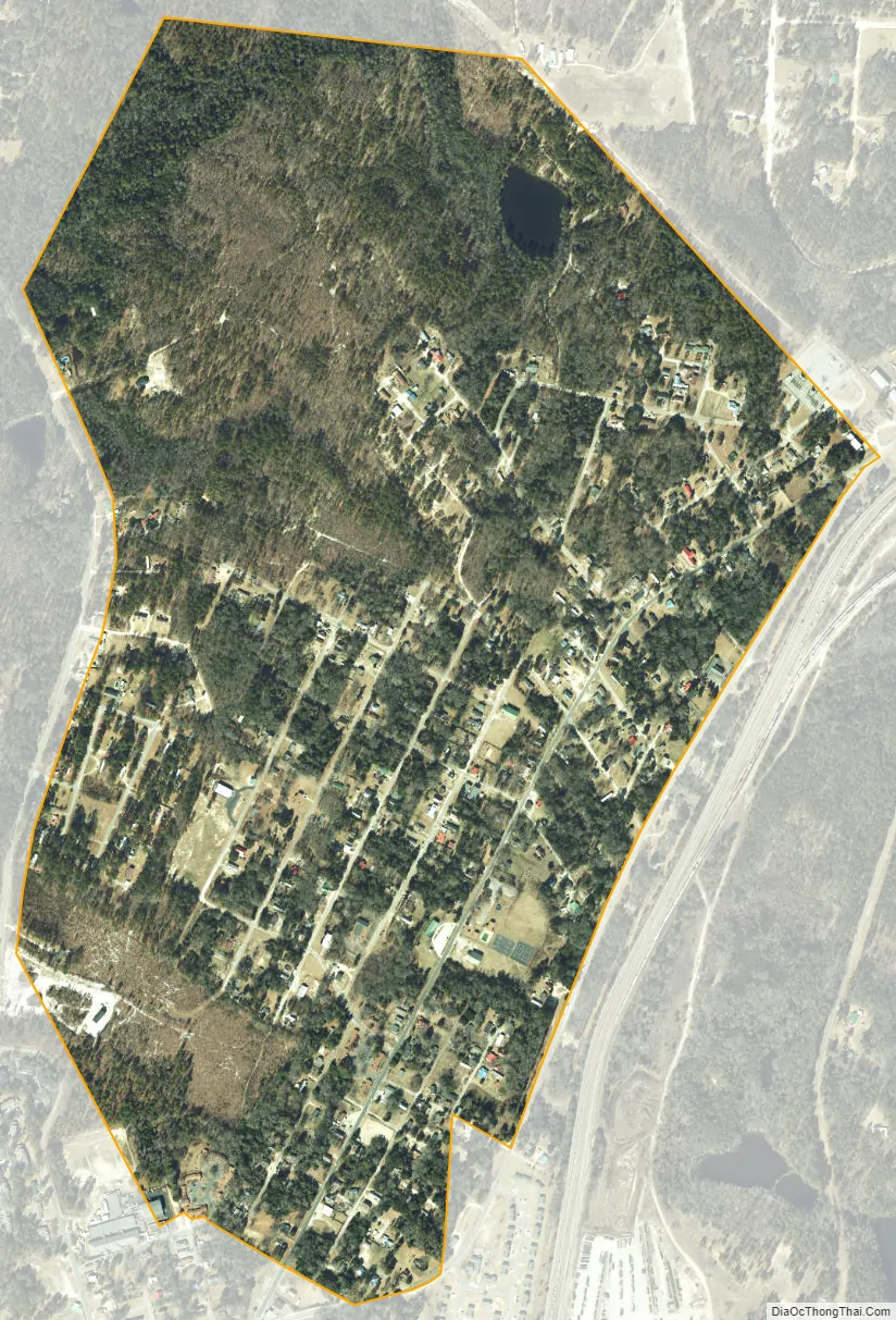
Dobbins Heights city Satellite Map
Geography
Dobbins Heights is located at 34°54′12″N 79°41′28″W / 34.90333°N 79.69111°W / 34.90333; -79.69111 (34.903388, -79.691220).
According to the United States Census Bureau, the town has a total area of 0.9 square miles (2.3 km), all land.
See also
Map of North Carolina State and its subdivision:- Alamance
- Alexander
- Alleghany
- Anson
- Ashe
- Avery
- Beaufort
- Bertie
- Bladen
- Brunswick
- Buncombe
- Burke
- Cabarrus
- Caldwell
- Camden
- Carteret
- Caswell
- Catawba
- Chatham
- Cherokee
- Chowan
- Clay
- Cleveland
- Columbus
- Craven
- Cumberland
- Currituck
- Dare
- Davidson
- Davie
- Duplin
- Durham
- Edgecombe
- Forsyth
- Franklin
- Gaston
- Gates
- Graham
- Granville
- Greene
- Guilford
- Halifax
- Harnett
- Haywood
- Henderson
- Hertford
- Hoke
- Hyde
- Iredell
- Jackson
- Johnston
- Jones
- Lee
- Lenoir
- Lincoln
- Macon
- Madison
- Martin
- McDowell
- Mecklenburg
- Mitchell
- Montgomery
- Moore
- Nash
- New Hanover
- Northampton
- Onslow
- Orange
- Pamlico
- Pasquotank
- Pender
- Perquimans
- Person
- Pitt
- Polk
- Randolph
- Richmond
- Robeson
- Rockingham
- Rowan
- Rutherford
- Sampson
- Scotland
- Stanly
- Stokes
- Surry
- Swain
- Transylvania
- Tyrrell
- Union
- Vance
- Wake
- Warren
- Washington
- Watauga
- Wayne
- Wilkes
- Wilson
- Yadkin
- Yancey
- Alabama
- Alaska
- Arizona
- Arkansas
- California
- Colorado
- Connecticut
- Delaware
- District of Columbia
- Florida
- Georgia
- Hawaii
- Idaho
- Illinois
- Indiana
- Iowa
- Kansas
- Kentucky
- Louisiana
- Maine
- Maryland
- Massachusetts
- Michigan
- Minnesota
- Mississippi
- Missouri
- Montana
- Nebraska
- Nevada
- New Hampshire
- New Jersey
- New Mexico
- New York
- North Carolina
- North Dakota
- Ohio
- Oklahoma
- Oregon
- Pennsylvania
- Rhode Island
- South Carolina
- South Dakota
- Tennessee
- Texas
- Utah
- Vermont
- Virginia
- Washington
- West Virginia
- Wisconsin
- Wyoming