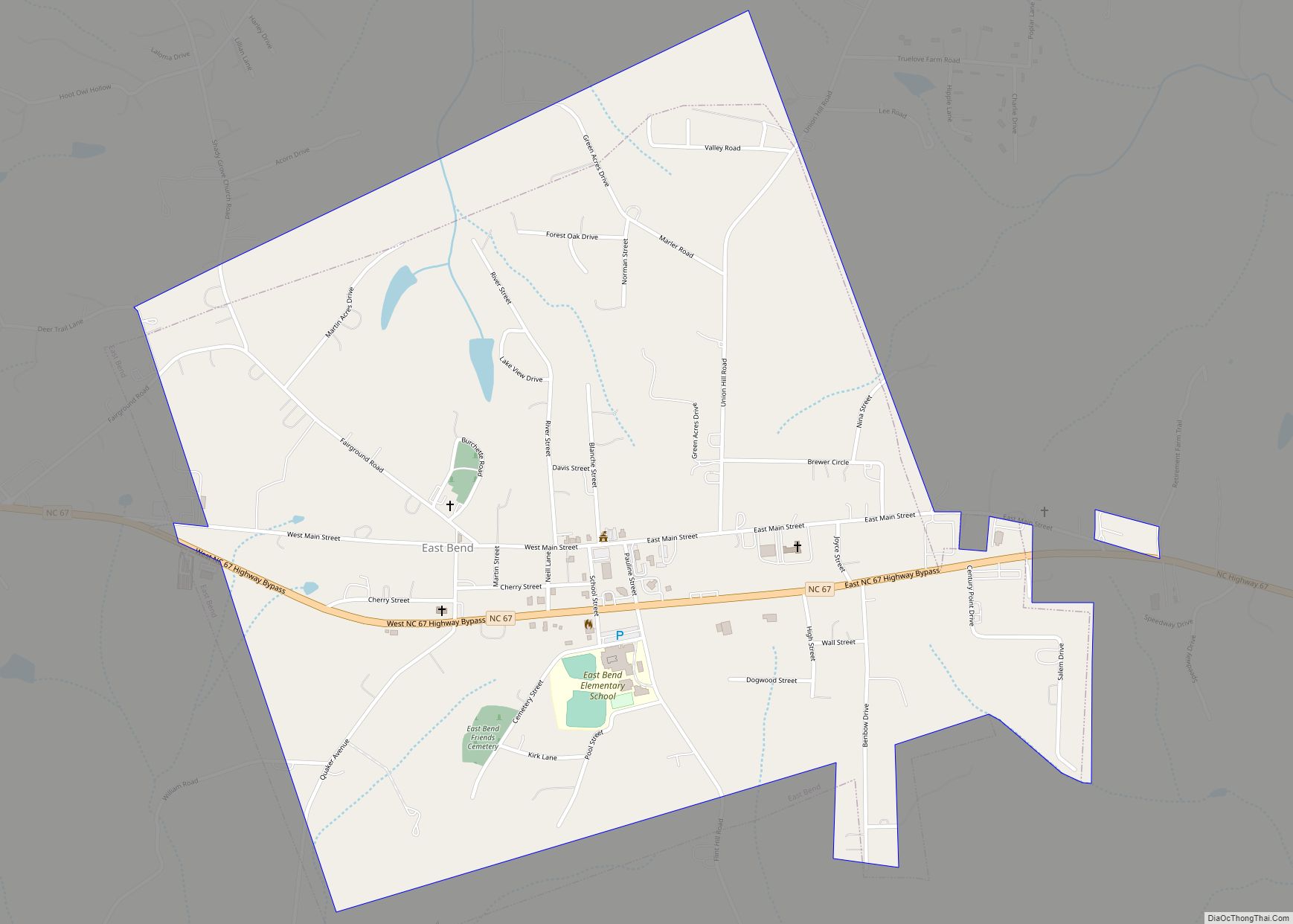
East Bend is a town in northeastern Yadkin County, North Carolina, United States. The population is 634 at the 2020 census. It is a Piedmont Triad community.
| Name: | East Bend town |
|---|---|
| LSAD Code: | 43 |
| LSAD Description: | town (suffix) |
| State: | North Carolina |
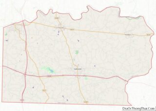
| County: | Yadkin County |
| Elevation: | 1,066 ft (325 m) |
| Total Area: | 1.31 sq mi (3.40 km²) |
| Land Area: | 1.31 sq mi (3.39 km²) |
| Water Area: | 0.01 sq mi (0.01 km²) |
| Total Population: | 634 |
| Population Density: | 484.34/sq mi (187.07/km²) |
| ZIP code: | 27018 |
| Area code: | 336 |
| FIPS code: | 3719320 |
| GNISfeature ID: | 1020076 |
| Website: | eastbendnc.com |
Online Interactive Map
Click on ![]() to view map in "full screen" mode.
to view map in "full screen" mode.
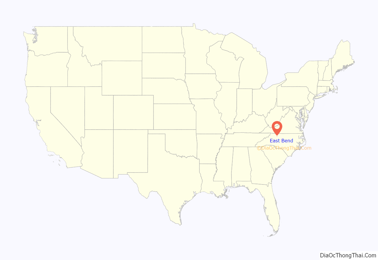
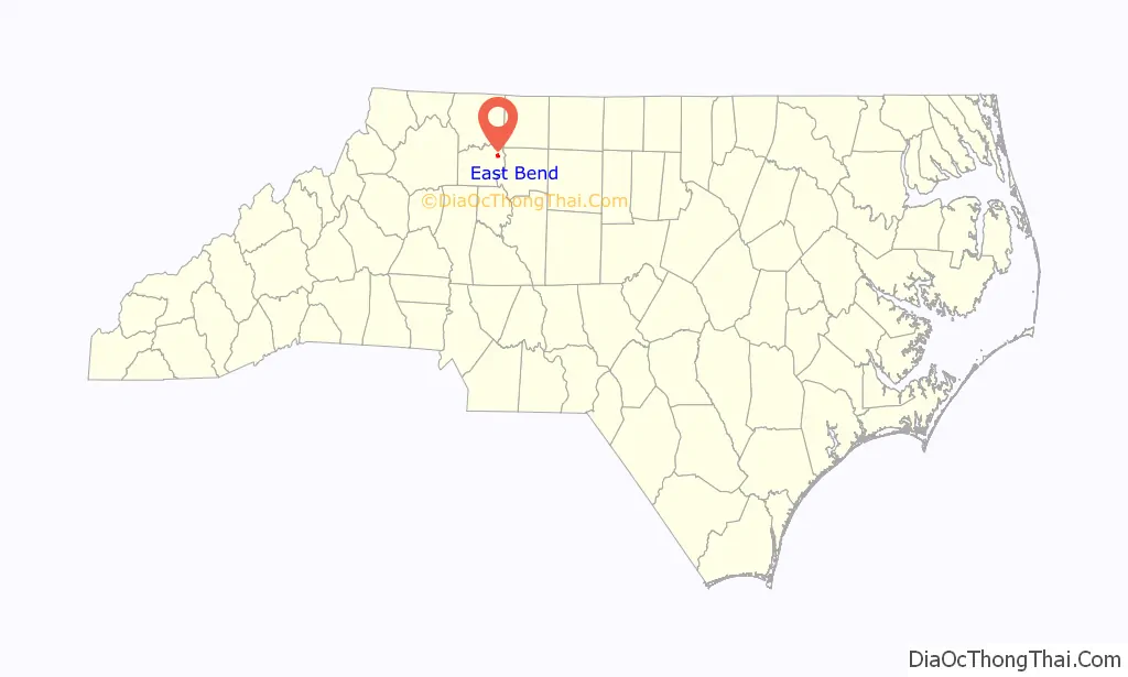
East Bend location map. Where is East Bend town?
History
Native American settlement
One of the most significant Native American excavation sites in North Carolina is located near the Yadkin River west of the town of Donnaha. Donnaha was listed in the National Register of Historic Places on December 6, 1978. Experts from Wake Forest University believe this was the site of a village of at least 100 Sioux Indians dating to the late Woodland Period.
Earl Norman, an East Bend artifact collector, donated 5,000 pieces of his collection of more than 10,000 relics to the North Carolina Department of Archives and History in 1960.
Establishment of town
East Bend was first known as Banner’s Store. It was named for merchant Martin Luther Banner. Early settler Martin Luther Banner later moved west and founded Banner Elk, North Carolina.
On March 7, 1887, the General Assembly incorporated the town of East Bend and named it after the east bend of the Yadkin River. Officers were mayor J.H Johnson; commissioners Dr. Evan Benbow, J.H. Jenkins, J.A. Martin, Dr. W.E. Benbow, and J.G. Huff; and constable J.M. Whittington.
J.G. Huff established the first buggy-manufacturing business in town in 1873. The Huff Buggy Factory, built in 1893, was said to be the largest buggy factory in the South. Huff closed the buggy works about 1920 and began operating a funeral home, which is still owned and operated by his heirs.
The Yadkin Ripple, a weekly newspaper still published in Yadkin County, began in East Bend in 1896.
In 1904, the town’s population was 444 and it boasted a hotel, two buggy factories, a tobacco bag factory, a bank, and several stores. However, a decision by the Southern Railroad to bypass the town 1890 put a damper on the town’s growth. Roger Moore, now a film critic for The Orlando Sentinel, compared East Bend to Lake Wobegon, “It’s a homey town with a lot of history and a few ‘might-have-beens,’ ” Moore wrote in The Winston-Salem Journal.
The Yadkin County Agricultural Fair was held in East Bend from 1914 until 1978. The fair was first held at the old schoolhouse and in later years was moved to a tract east of town on North Carolina Highway 67. The fairgrounds were later converted to a community softball park.
East Bend Road Map
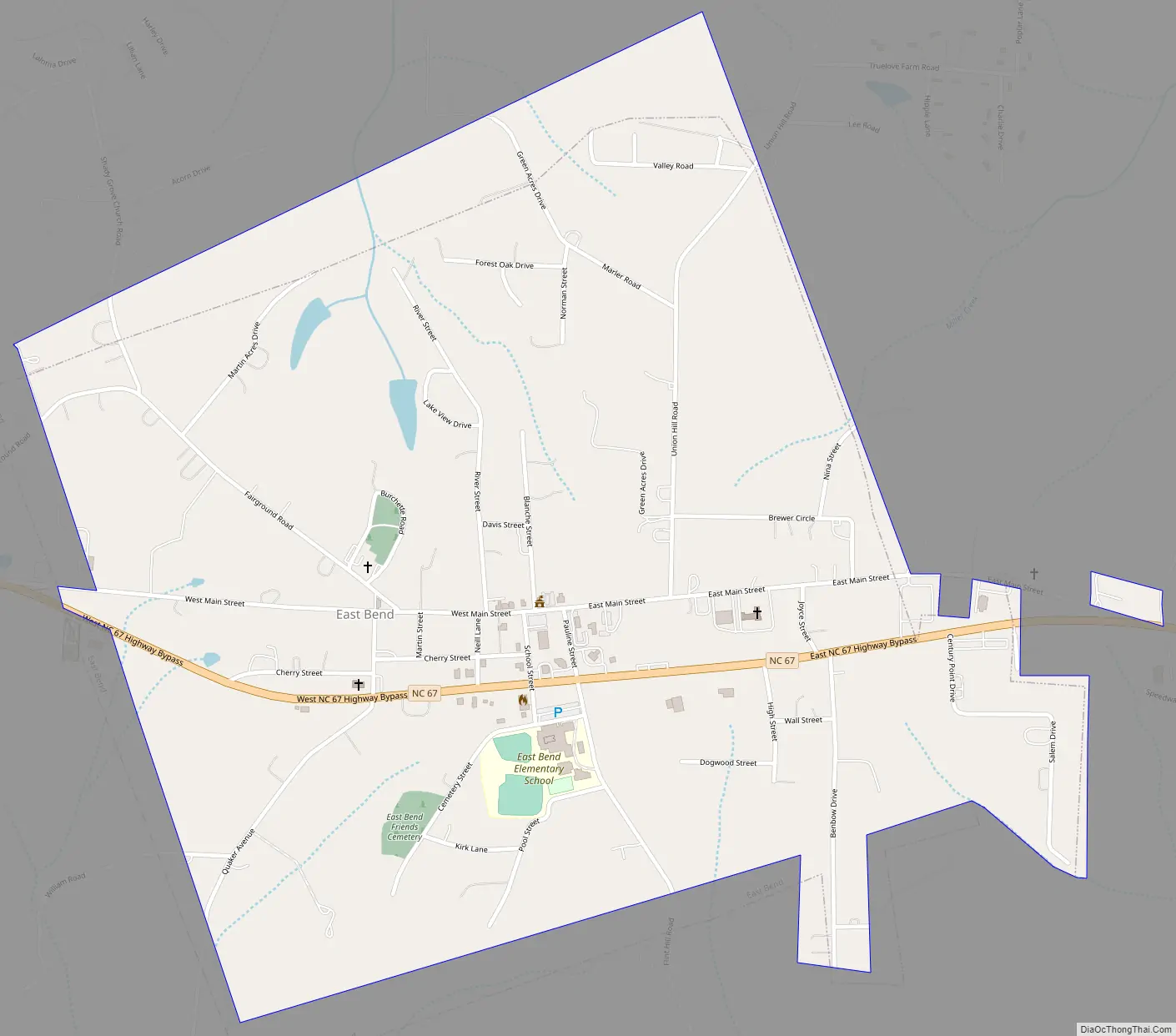
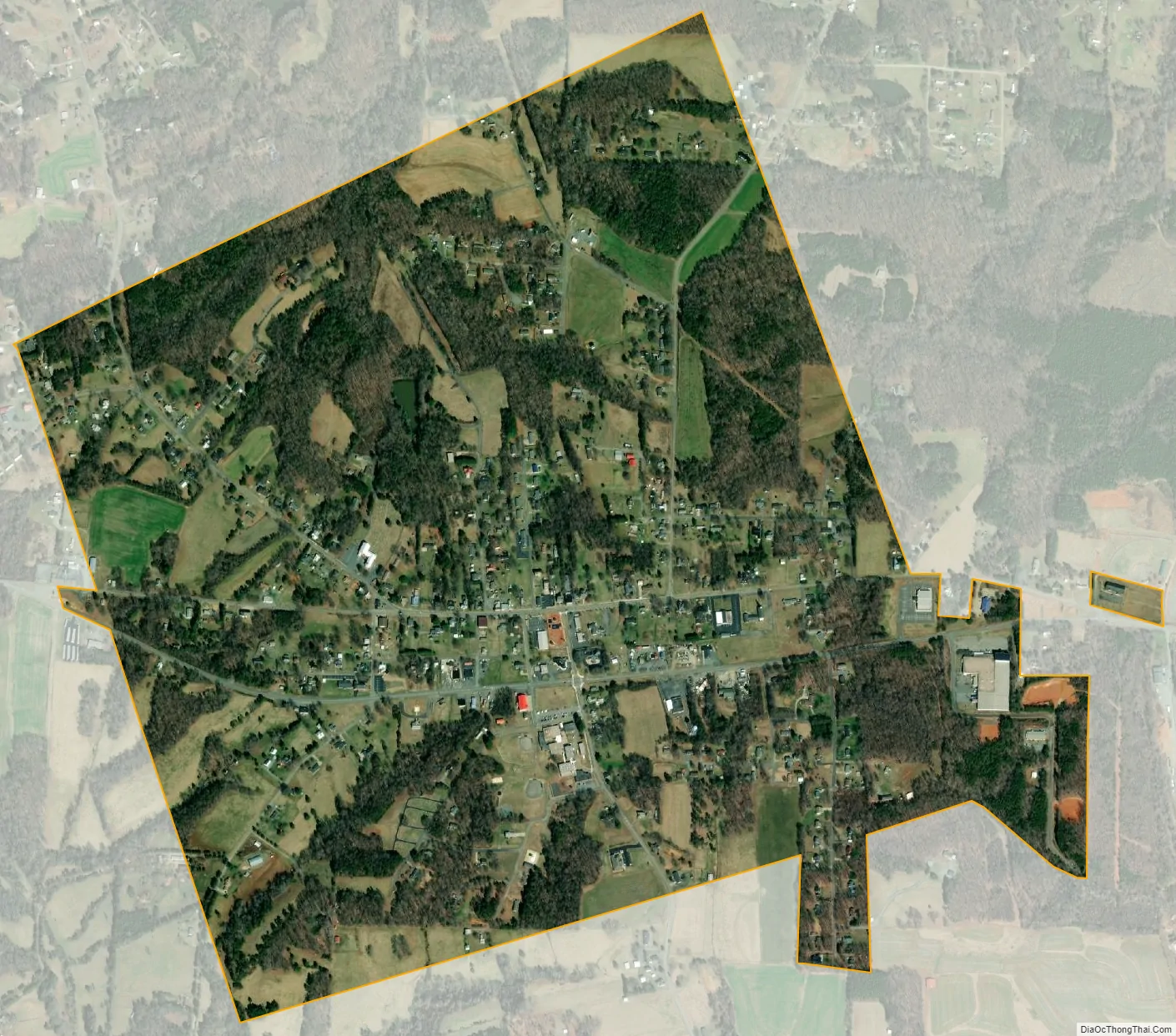
East Bend city Satellite Map
Geography
East Bend is located at 36°13′3″N 80°30′33″W / 36.21750°N 80.50917°W / 36.21750; -80.50917 (36.217471, -80.509064).
According to the United States Census Bureau, the town has a total area of 1.3 square miles (3.4 km), all land.
See also
Map of North Carolina State and its subdivision:- Alamance
- Alexander
- Alleghany
- Anson
- Ashe
- Avery
- Beaufort
- Bertie
- Bladen
- Brunswick
- Buncombe
- Burke
- Cabarrus
- Caldwell
- Camden
- Carteret
- Caswell
- Catawba
- Chatham
- Cherokee
- Chowan
- Clay
- Cleveland
- Columbus
- Craven
- Cumberland
- Currituck
- Dare
- Davidson
- Davie
- Duplin
- Durham
- Edgecombe
- Forsyth
- Franklin
- Gaston
- Gates
- Graham
- Granville
- Greene
- Guilford
- Halifax
- Harnett
- Haywood
- Henderson
- Hertford
- Hoke
- Hyde
- Iredell
- Jackson
- Johnston
- Jones
- Lee
- Lenoir
- Lincoln
- Macon
- Madison
- Martin
- McDowell
- Mecklenburg
- Mitchell
- Montgomery
- Moore
- Nash
- New Hanover
- Northampton
- Onslow
- Orange
- Pamlico
- Pasquotank
- Pender
- Perquimans
- Person
- Pitt
- Polk
- Randolph
- Richmond
- Robeson
- Rockingham
- Rowan
- Rutherford
- Sampson
- Scotland
- Stanly
- Stokes
- Surry
- Swain
- Transylvania
- Tyrrell
- Union
- Vance
- Wake
- Warren
- Washington
- Watauga
- Wayne
- Wilkes
- Wilson
- Yadkin
- Yancey
- Alabama
- Alaska
- Arizona
- Arkansas
- California
- Colorado
- Connecticut
- Delaware
- District of Columbia
- Florida
- Georgia
- Hawaii
- Idaho
- Illinois
- Indiana
- Iowa
- Kansas
- Kentucky
- Louisiana
- Maine
- Maryland
- Massachusetts
- Michigan
- Minnesota
- Mississippi
- Missouri
- Montana
- Nebraska
- Nevada
- New Hampshire
- New Jersey
- New Mexico
- New York
- North Carolina
- North Dakota
- Ohio
- Oklahoma
- Oregon
- Pennsylvania
- Rhode Island
- South Carolina
- South Dakota
- Tennessee
- Texas
- Utah
- Vermont
- Virginia
- Washington
- West Virginia
- Wisconsin
- Wyoming