Jonesville, originally called Allen’s Settlement, is the oldest town in Yadkin County, North Carolina, United States. The population was 2,285 at the 2010 census. The town grew by nearly 800 residents in 2001 when it merged with neighboring Arlington. Recognized as the Heart of the Yadkin Valley, Jonesville is a gateway to the Blue Ridge Mountains, the Yadkin Valley Heritage/Cultural Corridor and to local wineries in the Swan Creek AVA and the larger Yadkin Valley AVA, as well as offering access to the Yadkin river.
| Name: | Jonesville town |
|---|---|
| LSAD Code: | 43 |
| LSAD Description: | town (suffix) |
| State: | North Carolina |
| County: | Yadkin County |
| Elevation: | 945 ft (288 m) |
| Total Area: | 2.90 sq mi (7.51 km²) |
| Land Area: | 2.88 sq mi (7.47 km²) |
| Water Area: | 0.01 sq mi (0.04 km²) |
| Total Population: | 2,308 |
| Population Density: | 800.00/sq mi (308.91/km²) |
| ZIP code: | 28642 |
| Area code: | 336 |
| FIPS code: | 3734840 |
| GNISfeature ID: | 0987771 |
Online Interactive Map
Click on ![]() to view map in "full screen" mode.
to view map in "full screen" mode.
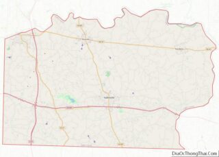
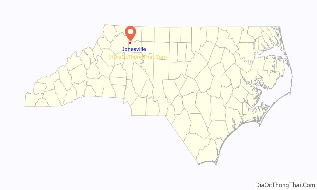
Jonesville location map. Where is Jonesville town?

History
Early history
Jonesville is Yadkin County’s oldest town and was at one time the largest town west of Raleigh, according to An Illustrated History of Yadkin County 1950-1980, by William E. Rutledge Jr. Initially called Allen’s Settlement, after the owner of an early iron ore forge, the settlement was established behind a towering, protective bluff above the south bank of the Yadkin River. It soon became a commercial hub for the region, featuring a trading post, a tannery, medical personnel, a school, grist and lumber mills, a cotton mill and a garrison overlooking the Yadkin Valley that served as an outpost for local militia during the Revolutionary and Civil Wars. Although a contemporary designation aligns the overmountain trail-head in an adjoining Surry County community, Allen’s Settlement—formerly located in Surry County—is now recognized as part of the OverMountain Trail. Based on family journals and oral history, Allen’s Settlement and historic Mineral Springs Park are identified as a mustering site for patriots who marched to defeat the British at Kings Mountain.
Allen’s Settlement was incorporated as Martinsborough in 1811, but the name was later changed to Jonesville in honor of Hardy Jones (1747–1819). Jones fought in the American Revolution and was instrumental in bringing the Jonesville Male and Female Academy to Jonesville. A marker to Hardy Jones is on the lawn of Jonesville United Methodist Church.
In addition to the timber and iron ore markets, the town also grew around the Jonesville Male and Female Academy, according to Rutledge. The Academy was affiliated with the North Carolina Conference of the Methodist Church. The Rev. William L. Van Eaton, who was born in Davie County, was principal of the school at its peak in 1859. In its history, the Academy attracted numerous scholars of the era, including Bishop Francis Asbury and Brantley York, subsequent founder of Trinity-Union Institute, which was later named Duke University.
On April 1, 1865, troops commanded by Union Brigadier General George Stoneman and Colonel Alvan C. Gillem devastated the town and the Academy in their search for Confederate soldiers and supplies. In the Academy, they broke chandeliers and destroyed school equipment. This marked the end of the school.
Gillem’s troops, known as “home Yankees,” also ransacked businesses and chased away teachers and military-aged men. Union troops had been told the town was a haven for Confederate spies and military supplies. They failed to find evidence of an underground railroad for escaping slaves and deserting soldiers, assumed to be located in private homes and the iron ore caves in Jonesville. The town never fully recovered.
One of the last pieces of early town history, a house once occupied by Van Eaton that dated back to the 1830s, was torn down in 1996. At the time, it was believed to be the oldest house in town.
On December 21, 1912, two elderly women and a young girl were killed and nearly 100 people were injured after the floor of the Jonesville High School auditorium collapsed during a Christmas concert. As the floor of the second-floor auditorium gave way in the center, the audience of at least 300 people dropped to the first floor. Killed were: Nancy Swaim, Mrs. William Smith and Lexie Luffman, a 12-year-old girl. Sam Ray extinguished a fire in a stove in the auditorium as the floor began to collapse, saving many lives (Winston-Salem Journal).
Recent history
The town experienced unprecedented growth after Interstate 77 opened in 1974. The intersection of Interstate 77 and N.C. 67 (Winston Road) on the east side of town is a popular stop for travelers. It is one of the most developed along the interstate between Statesville and Mount Airy.
In 1980, Jonesville was named a “Governor’s Community of Excellence” by Governor Jim Hunt for its economic development work.
Jonesville Police Sgt. Gregory Keith Martin was shot to death on October 5, 1996, on I-77. The case, which has been solved, received national attention on TV’s America’s Most Wanted in May 2005, January 2006 and June 2006. Martin was the town’s first police officer to be shot in the line of duty. On October 3, 2012, 36-year-old Scott Vincent Sica was arrested in Cape Coral, Florida, and charged with first-degree murder. In 2009 The town put up a memorial to Sgt. Martin in front of the new town Hall. Every year there is a memorial ride through Jonesville to honor Sgt. Martin.
In 2009, the town built a multimillion-dollar town hall.
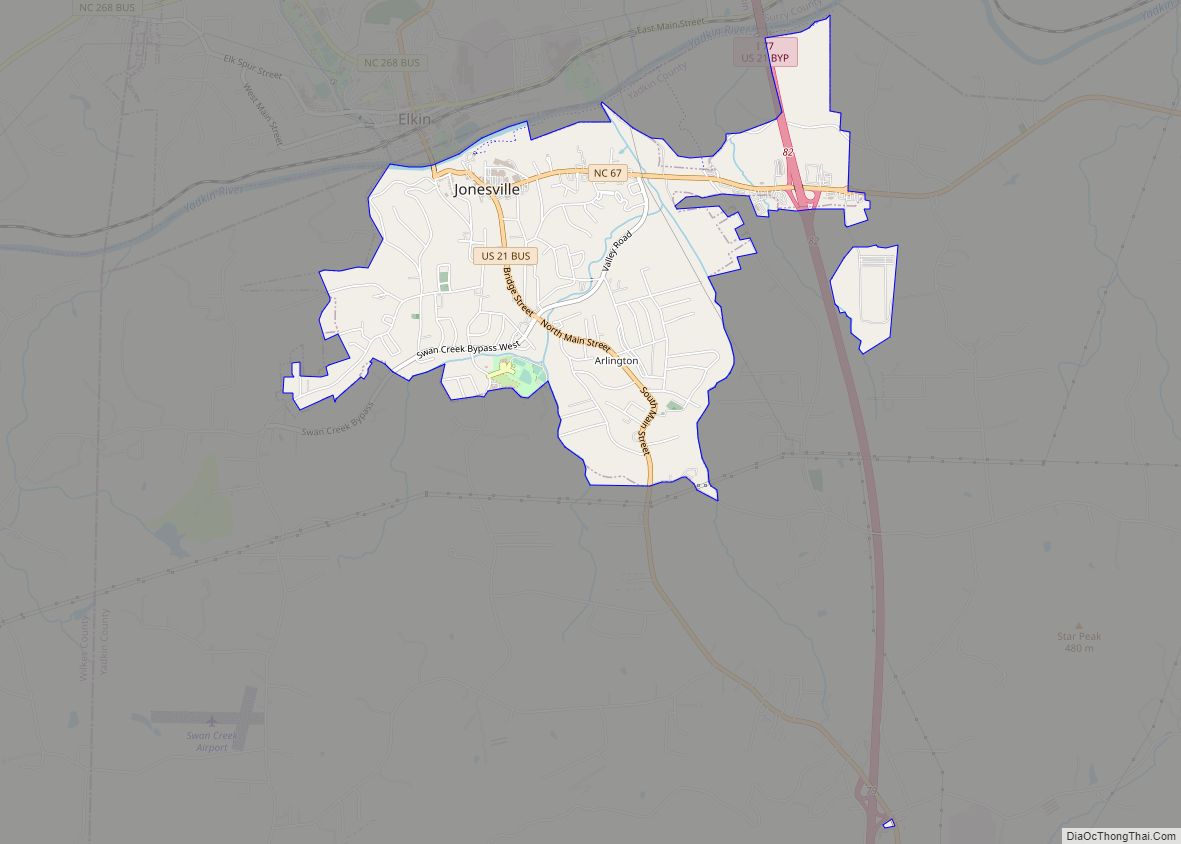
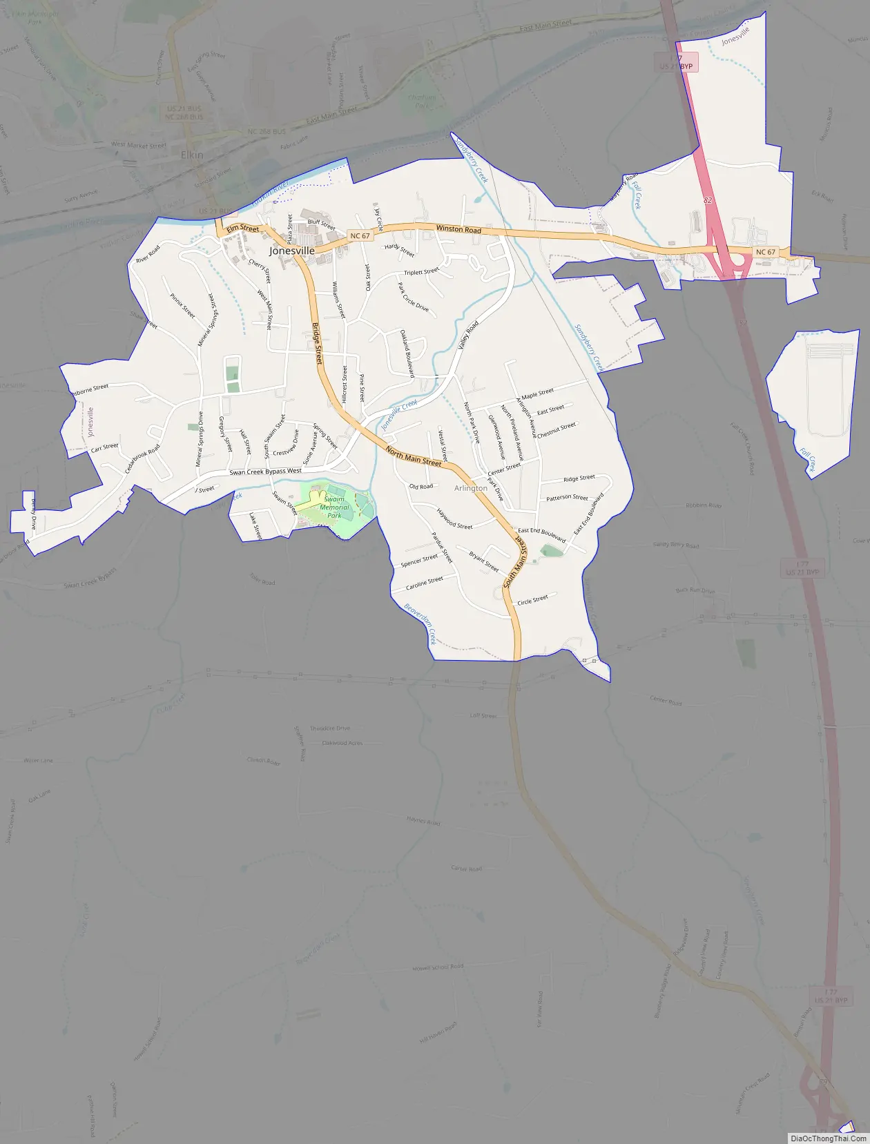
Jonesville Road Map
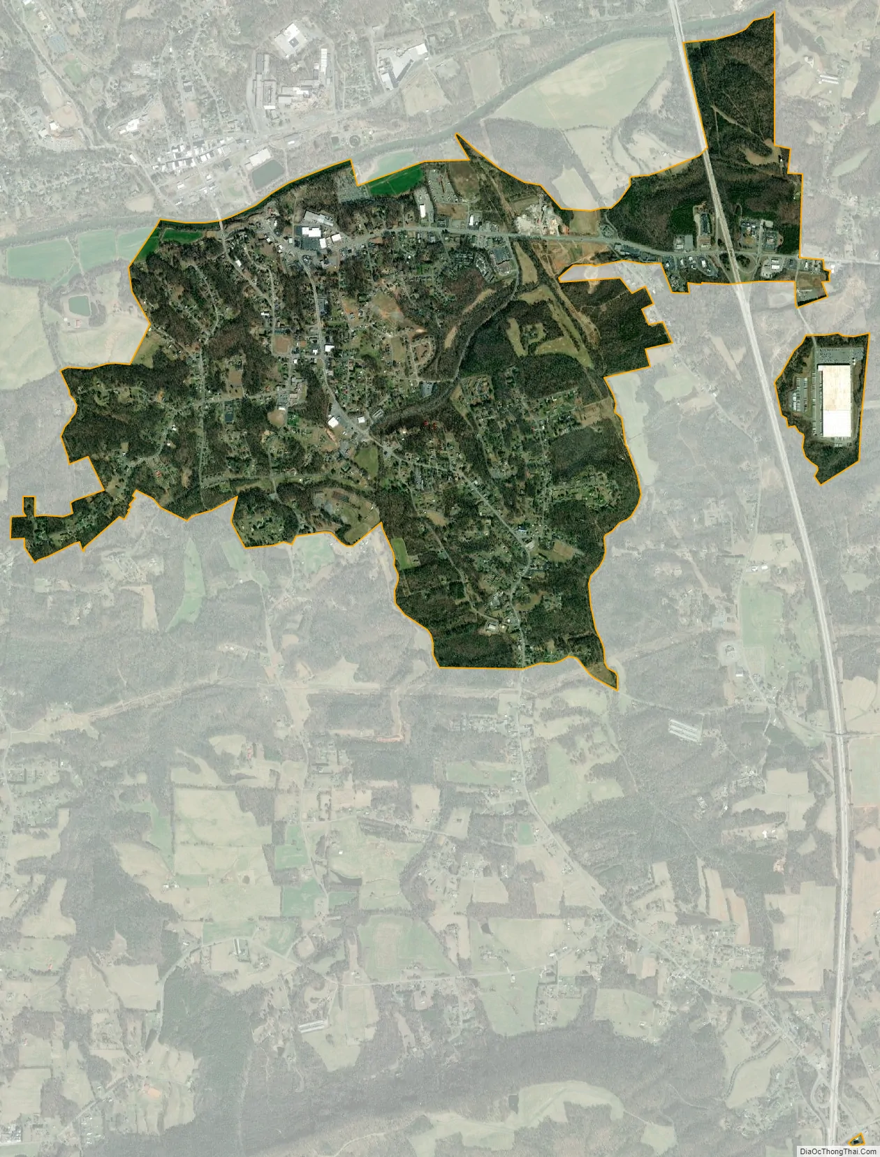
Jonesville city Satellite Map
Geography
According to the United States Census Bureau, the town has a total area of 1.9 square miles (4.9 km), of which 1.9 square miles (4.9 km) is land and 0.04 square miles (0.10 km) (1.05%) is water.
See also
Map of North Carolina State and its subdivision:- Alamance
- Alexander
- Alleghany
- Anson
- Ashe
- Avery
- Beaufort
- Bertie
- Bladen
- Brunswick
- Buncombe
- Burke
- Cabarrus
- Caldwell
- Camden
- Carteret
- Caswell
- Catawba
- Chatham
- Cherokee
- Chowan
- Clay
- Cleveland
- Columbus
- Craven
- Cumberland
- Currituck
- Dare
- Davidson
- Davie
- Duplin
- Durham
- Edgecombe
- Forsyth
- Franklin
- Gaston
- Gates
- Graham
- Granville
- Greene
- Guilford
- Halifax
- Harnett
- Haywood
- Henderson
- Hertford
- Hoke
- Hyde
- Iredell
- Jackson
- Johnston
- Jones
- Lee
- Lenoir
- Lincoln
- Macon
- Madison
- Martin
- McDowell
- Mecklenburg
- Mitchell
- Montgomery
- Moore
- Nash
- New Hanover
- Northampton
- Onslow
- Orange
- Pamlico
- Pasquotank
- Pender
- Perquimans
- Person
- Pitt
- Polk
- Randolph
- Richmond
- Robeson
- Rockingham
- Rowan
- Rutherford
- Sampson
- Scotland
- Stanly
- Stokes
- Surry
- Swain
- Transylvania
- Tyrrell
- Union
- Vance
- Wake
- Warren
- Washington
- Watauga
- Wayne
- Wilkes
- Wilson
- Yadkin
- Yancey
- Alabama
- Alaska
- Arizona
- Arkansas
- California
- Colorado
- Connecticut
- Delaware
- District of Columbia
- Florida
- Georgia
- Hawaii
- Idaho
- Illinois
- Indiana
- Iowa
- Kansas
- Kentucky
- Louisiana
- Maine
- Maryland
- Massachusetts
- Michigan
- Minnesota
- Mississippi
- Missouri
- Montana
- Nebraska
- Nevada
- New Hampshire
- New Jersey
- New Mexico
- New York
- North Carolina
- North Dakota
- Ohio
- Oklahoma
- Oregon
- Pennsylvania
- Rhode Island
- South Carolina
- South Dakota
- Tennessee
- Texas
- Utah
- Vermont
- Virginia
- Washington
- West Virginia
- Wisconsin
- Wyoming