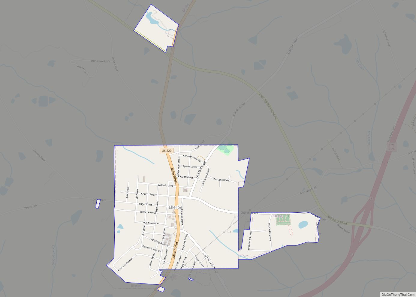
Ellerbe is a town in Richmond County, North Carolina, United States. The population was 1,054 at the 2010 census.
| Name: | Ellerbe town |
|---|---|
| LSAD Code: | 43 |
| LSAD Description: | town (suffix) |
| State: | North Carolina |
| County: | Richmond County |
| Elevation: | 584 ft (178 m) |
| Total Area: | 1.32 sq mi (3.42 km²) |
| Land Area: | 1.31 sq mi (3.41 km²) |
| Water Area: | 0.00 sq mi (0.01 km²) |
| Total Population: | 864 |
| Population Density: | 657.03/sq mi (253.60/km²) |
| ZIP code: | 28338 |
| FIPS code: | 3720840 |
| GNISfeature ID: | 1020134 |
Online Interactive Map
Click on ![]() to view map in "full screen" mode.
to view map in "full screen" mode.
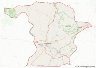
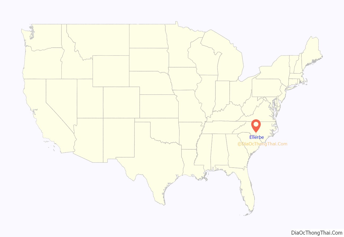
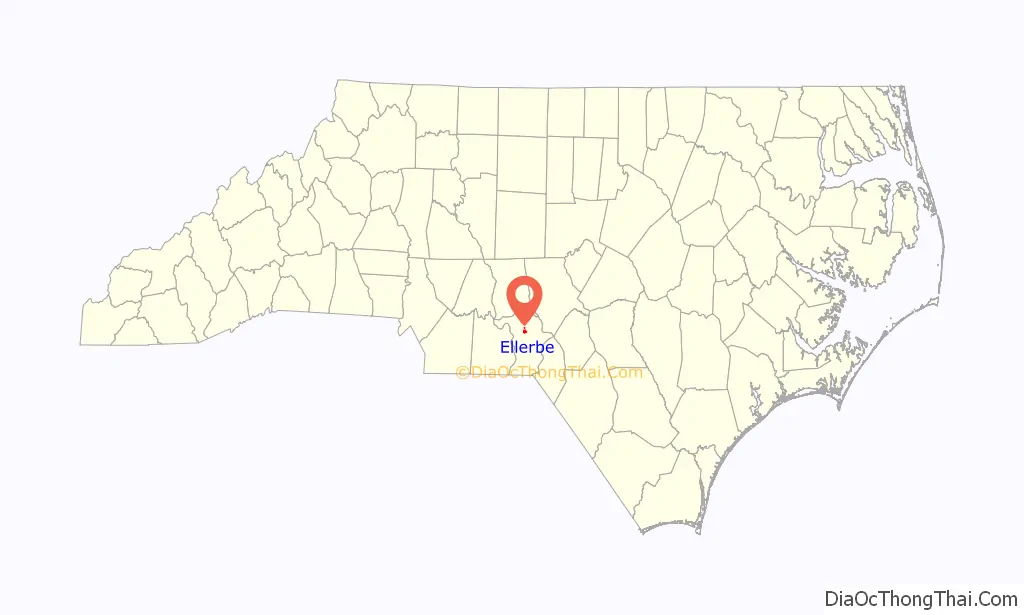
Ellerbe location map. Where is Ellerbe town?
History
In the 1700s Scottish settlers held a fair every May and November in the present location of Ellerbe, leading locals to dub the place “the Fair Grounds”. W. T. Ellerbe later developed a spa nearby called Ellerbe Springs, and thereafter the community took its name. A railroad was built to Ellerbe in 1910 and a depot was constructed. The town was incorporated the following year. At the time it only had a population of 50. By 1923 it had grown to a population of over 500, with several mills, two banks, three churches, a telephone exchange, and a hotel. The rail line remained in service until 1954, and the depot burnt down several years later.
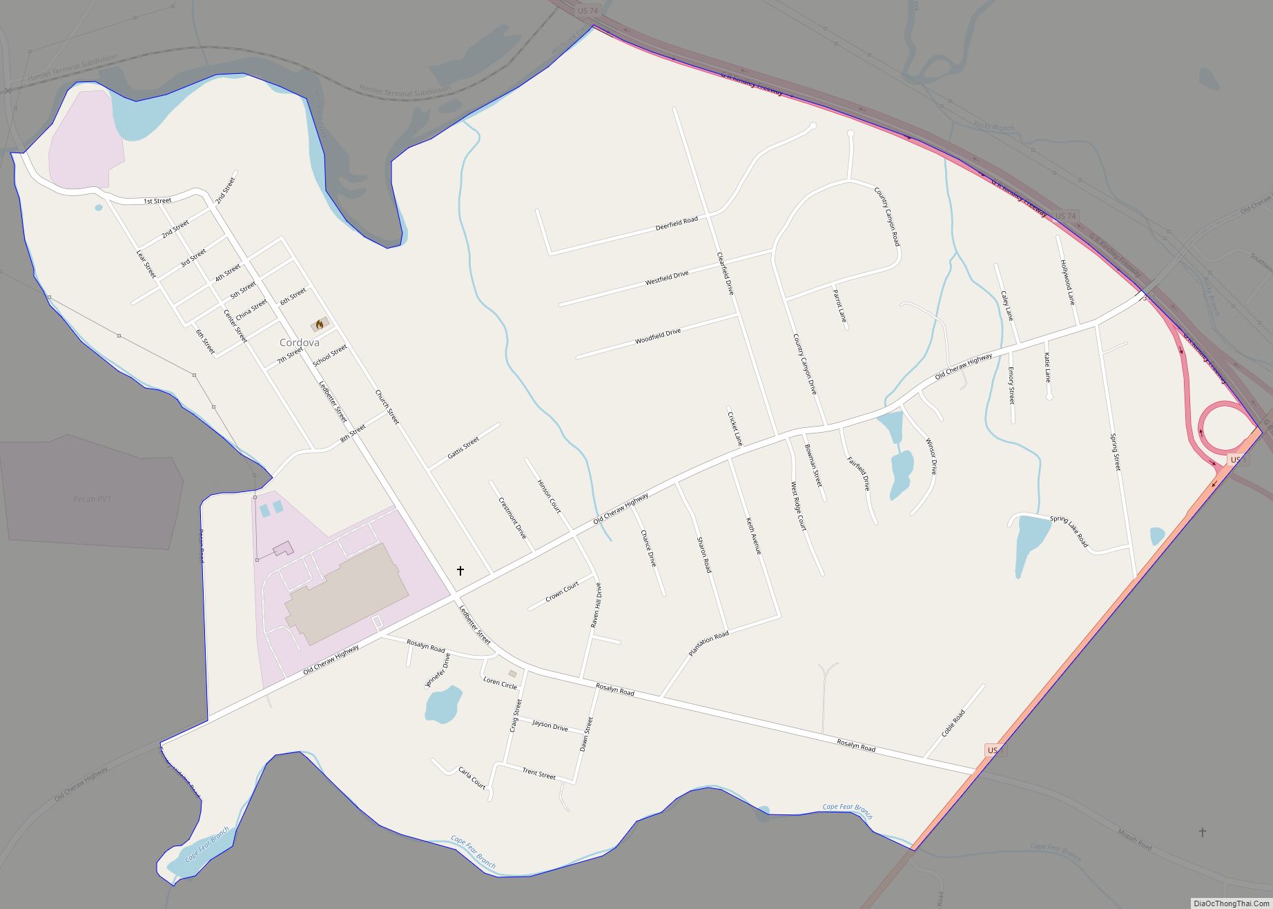
Ellerbe Road Map
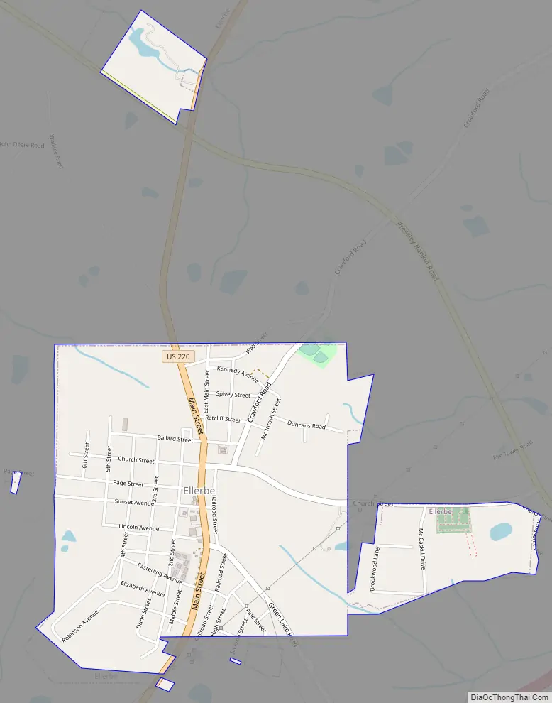
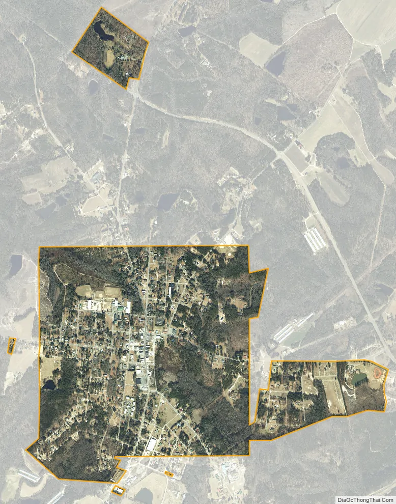
Ellerbe city Satellite Map
Geography
According to the United States Census Bureau, the town has a total area of 1.5 square miles (3.9 km), all land.
See also
Map of North Carolina State and its subdivision:- Alamance
- Alexander
- Alleghany
- Anson
- Ashe
- Avery
- Beaufort
- Bertie
- Bladen
- Brunswick
- Buncombe
- Burke
- Cabarrus
- Caldwell
- Camden
- Carteret
- Caswell
- Catawba
- Chatham
- Cherokee
- Chowan
- Clay
- Cleveland
- Columbus
- Craven
- Cumberland
- Currituck
- Dare
- Davidson
- Davie
- Duplin
- Durham
- Edgecombe
- Forsyth
- Franklin
- Gaston
- Gates
- Graham
- Granville
- Greene
- Guilford
- Halifax
- Harnett
- Haywood
- Henderson
- Hertford
- Hoke
- Hyde
- Iredell
- Jackson
- Johnston
- Jones
- Lee
- Lenoir
- Lincoln
- Macon
- Madison
- Martin
- McDowell
- Mecklenburg
- Mitchell
- Montgomery
- Moore
- Nash
- New Hanover
- Northampton
- Onslow
- Orange
- Pamlico
- Pasquotank
- Pender
- Perquimans
- Person
- Pitt
- Polk
- Randolph
- Richmond
- Robeson
- Rockingham
- Rowan
- Rutherford
- Sampson
- Scotland
- Stanly
- Stokes
- Surry
- Swain
- Transylvania
- Tyrrell
- Union
- Vance
- Wake
- Warren
- Washington
- Watauga
- Wayne
- Wilkes
- Wilson
- Yadkin
- Yancey
- Alabama
- Alaska
- Arizona
- Arkansas
- California
- Colorado
- Connecticut
- Delaware
- District of Columbia
- Florida
- Georgia
- Hawaii
- Idaho
- Illinois
- Indiana
- Iowa
- Kansas
- Kentucky
- Louisiana
- Maine
- Maryland
- Massachusetts
- Michigan
- Minnesota
- Mississippi
- Missouri
- Montana
- Nebraska
- Nevada
- New Hampshire
- New Jersey
- New Mexico
- New York
- North Carolina
- North Dakota
- Ohio
- Oklahoma
- Oregon
- Pennsylvania
- Rhode Island
- South Carolina
- South Dakota
- Tennessee
- Texas
- Utah
- Vermont
- Virginia
- Washington
- West Virginia
- Wisconsin
- Wyoming