Enochville is a census-designated place (CDP) in Rowan County, North Carolina, United States. The population was 2,851 at the 2000 census.
| Name: | Enochville CDP |
|---|---|
| LSAD Code: | 57 |
| LSAD Description: | CDP (suffix) |
| State: | North Carolina |
| County: | Rowan County |
| Elevation: | 866 ft (264 m) |
| Total Area: | 4.71 sq mi (12.20 km²) |
| Land Area: | 4.48 sq mi (11.60 km²) |
| Water Area: | 0.23 sq mi (0.60 km²) |
| Total Population: | 2,893 |
| Population Density: | 646.05/sq mi (249.47/km²) |
| FIPS code: | 3721500 |
| GNISfeature ID: | 0984805 |
Online Interactive Map
Click on ![]() to view map in "full screen" mode.
to view map in "full screen" mode.
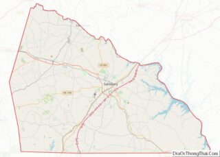
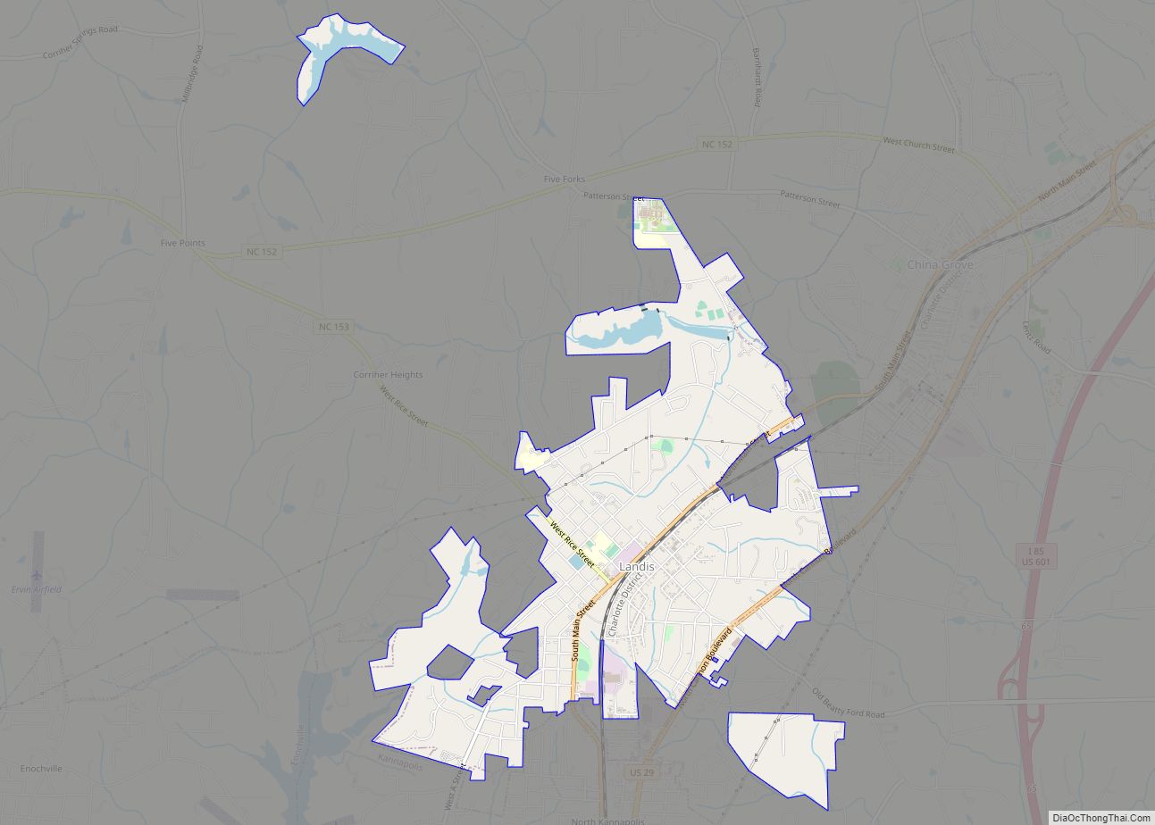
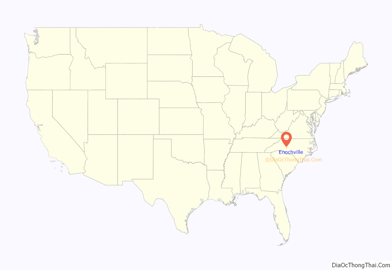
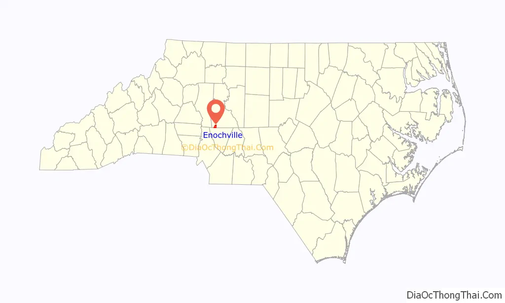
Enochville location map. Where is Enochville CDP?
History
The census-designated place had previously been an incorporated town, one of the oldest in Rowan County. It was originally chartered in 1877 but lost its incorporation in 1974. People assumed the town was not incorporated, but the charter was still active. After the Rowan County Board of Elections ordered election of town officials in 1973, the people asked to decide whether to remain incorporated, and they voted 84-41 against.
A movement to re-incorporate Enochville started in 2003, but it has been opposed by the nearby city of Kannapolis. A bill to incorporate the town was introduced in the state legislature in 2009, but it failed to make it out of committee.
Near Enochville is the Corriher Grange Hall, listed on the National Register of Historic Places (NRHP). The Gen. William Kerr House is another local property listed on the NRHP. Enochville is the birthplace of veteran 20th century radio and television actress Elvia Allman.
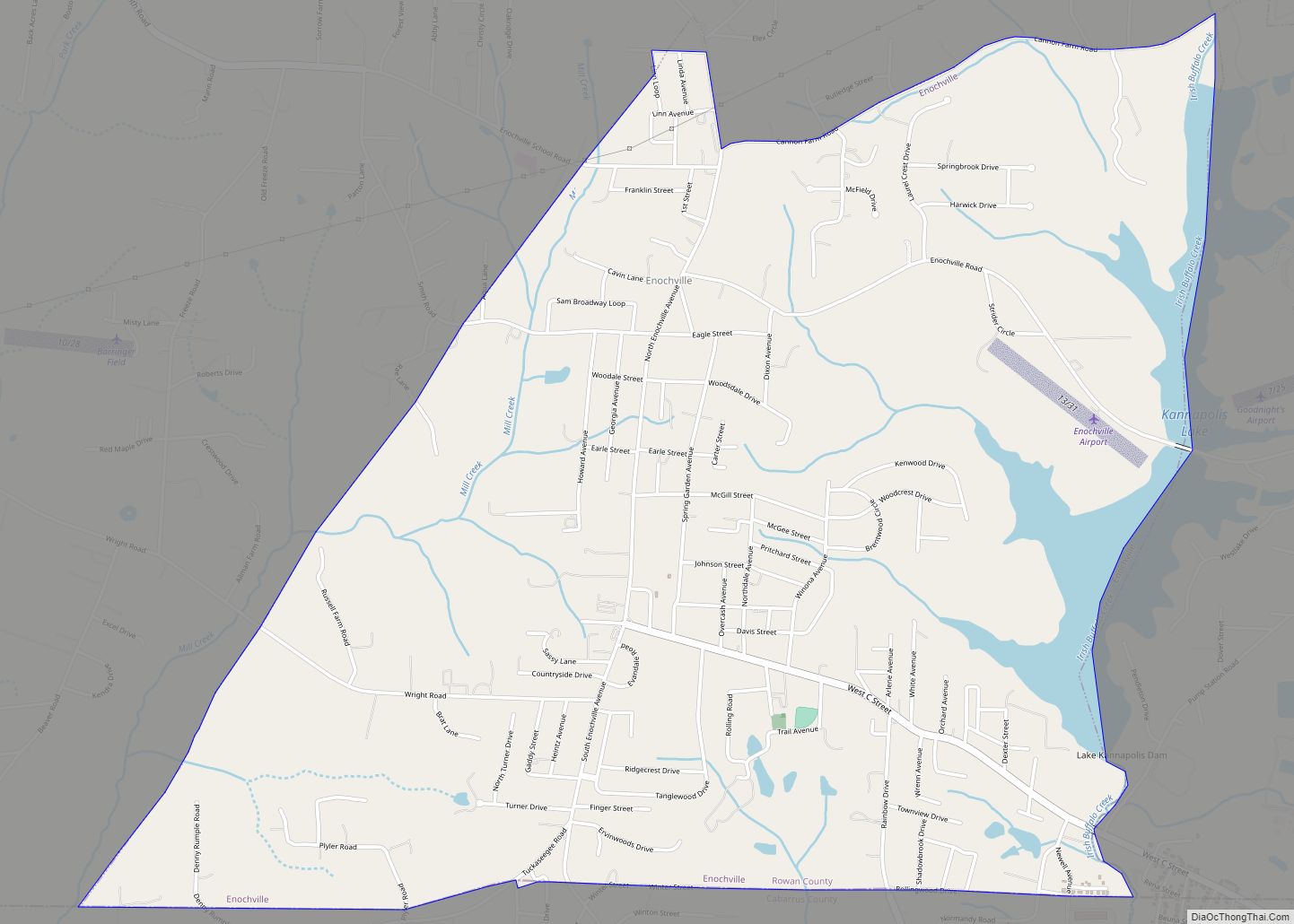
Enochville Road Map
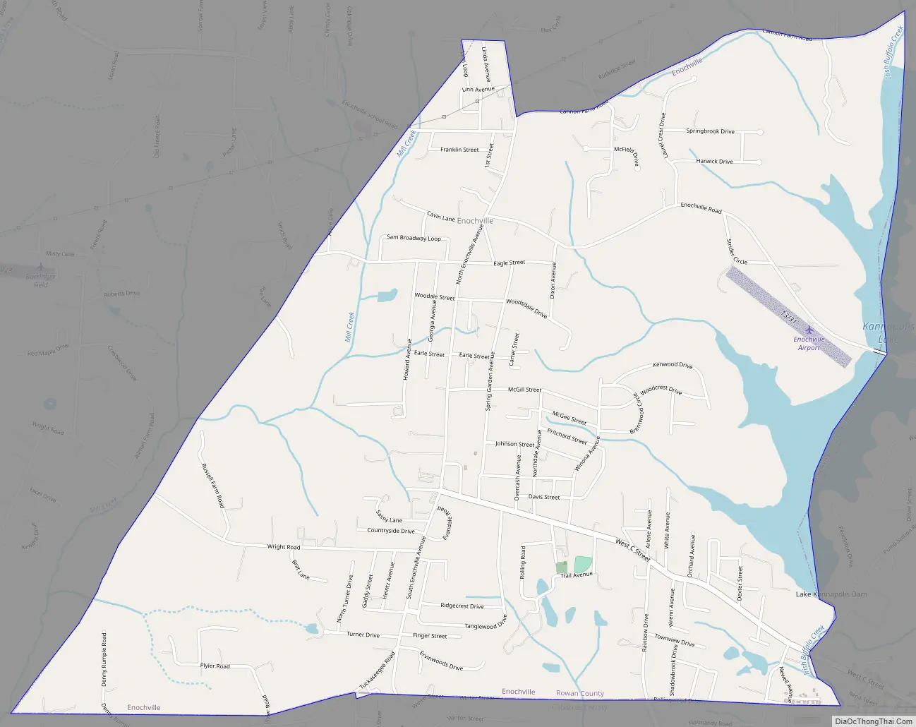
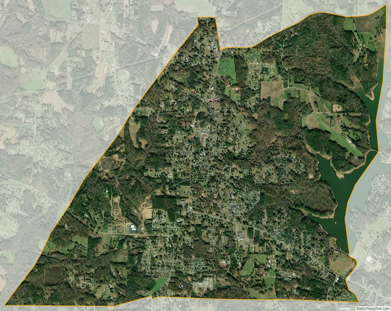
Enochville city Satellite Map
Geography
Enochville is located at 35°31′16″N 80°39′49″W / 35.52111°N 80.66361°W / 35.52111; -80.66361 (35.521048, -80.663579).
According to the United States Census Bureau, the CDP has a total area of 4.7 square miles (12 km), of which 4.4 square miles (11 km) is land and 0.2 square miles (0.52 km) (5.16%) is water.
See also
Map of North Carolina State and its subdivision:- Alamance
- Alexander
- Alleghany
- Anson
- Ashe
- Avery
- Beaufort
- Bertie
- Bladen
- Brunswick
- Buncombe
- Burke
- Cabarrus
- Caldwell
- Camden
- Carteret
- Caswell
- Catawba
- Chatham
- Cherokee
- Chowan
- Clay
- Cleveland
- Columbus
- Craven
- Cumberland
- Currituck
- Dare
- Davidson
- Davie
- Duplin
- Durham
- Edgecombe
- Forsyth
- Franklin
- Gaston
- Gates
- Graham
- Granville
- Greene
- Guilford
- Halifax
- Harnett
- Haywood
- Henderson
- Hertford
- Hoke
- Hyde
- Iredell
- Jackson
- Johnston
- Jones
- Lee
- Lenoir
- Lincoln
- Macon
- Madison
- Martin
- McDowell
- Mecklenburg
- Mitchell
- Montgomery
- Moore
- Nash
- New Hanover
- Northampton
- Onslow
- Orange
- Pamlico
- Pasquotank
- Pender
- Perquimans
- Person
- Pitt
- Polk
- Randolph
- Richmond
- Robeson
- Rockingham
- Rowan
- Rutherford
- Sampson
- Scotland
- Stanly
- Stokes
- Surry
- Swain
- Transylvania
- Tyrrell
- Union
- Vance
- Wake
- Warren
- Washington
- Watauga
- Wayne
- Wilkes
- Wilson
- Yadkin
- Yancey
- Alabama
- Alaska
- Arizona
- Arkansas
- California
- Colorado
- Connecticut
- Delaware
- District of Columbia
- Florida
- Georgia
- Hawaii
- Idaho
- Illinois
- Indiana
- Iowa
- Kansas
- Kentucky
- Louisiana
- Maine
- Maryland
- Massachusetts
- Michigan
- Minnesota
- Mississippi
- Missouri
- Montana
- Nebraska
- Nevada
- New Hampshire
- New Jersey
- New Mexico
- New York
- North Carolina
- North Dakota
- Ohio
- Oklahoma
- Oregon
- Pennsylvania
- Rhode Island
- South Carolina
- South Dakota
- Tennessee
- Texas
- Utah
- Vermont
- Virginia
- Washington
- West Virginia
- Wisconsin
- Wyoming