Fair Bluff is a town in Columbus County, North Carolina, United States that was devastated by coastal flooding from Hurricane Matthew in 2016 and inundated again by high water by Hurricane Florence in 2018.
Before the two events, the population was 951 at the 2010 census but is believed to be lower following the two disasters, some estimates going as low as 450 people. The shrinking of town’s size, and damage from the storms has led to a rapid decline in tax base.
| Name: | Fair Bluff town |
|---|---|
| LSAD Code: | 43 |
| LSAD Description: | town (suffix) |
| State: | North Carolina |
| County: | Columbus County |
| Elevation: | 66 ft (20 m) |
| Total Area: | 2.36 sq mi (6.11 km²) |
| Land Area: | 2.36 sq mi (6.11 km²) |
| Water Area: | 0.00 sq mi (0.00 km²) |
| Total Population: | 709 |
| Population Density: | 300.55/sq mi (116.04/km²) |
| ZIP code: | 28439 |
| FIPS code: | 3722240 |
| GNISfeature ID: | 1020187 |
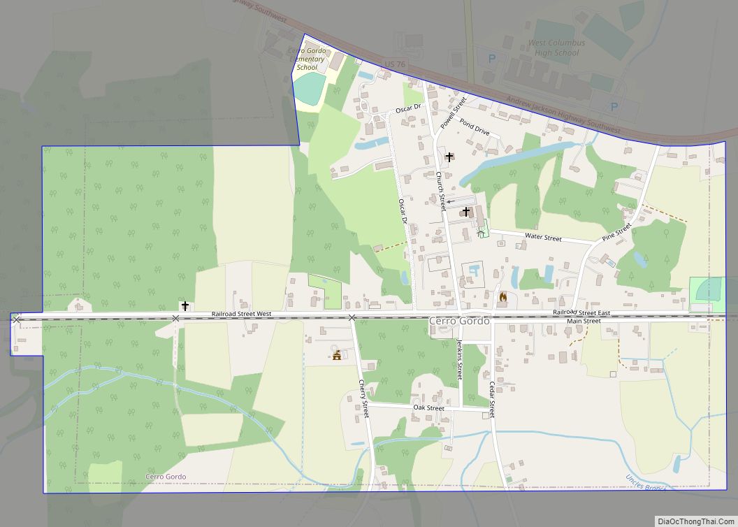
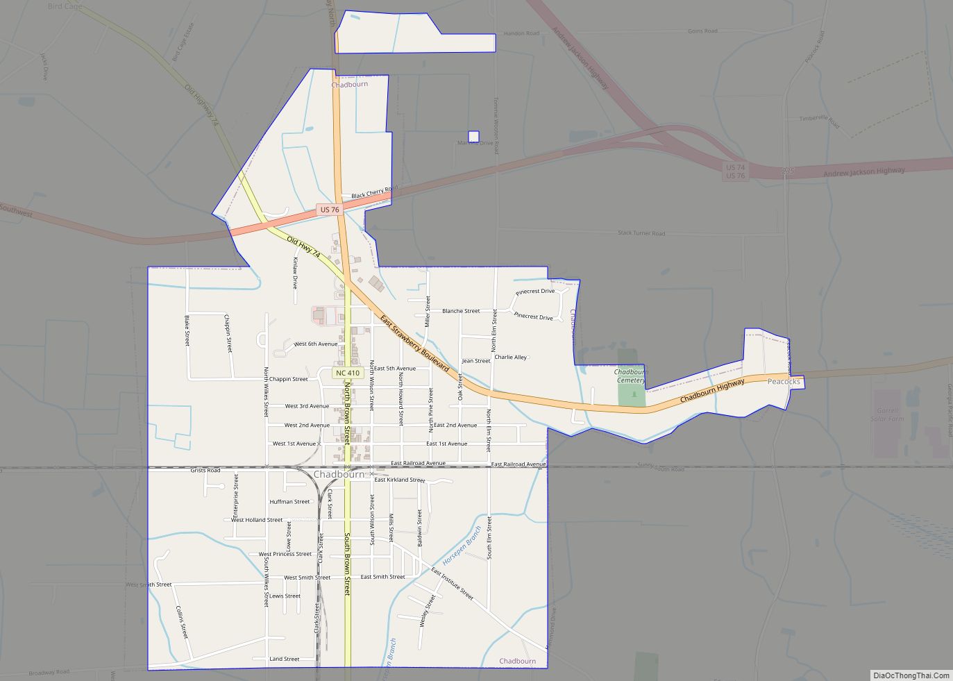
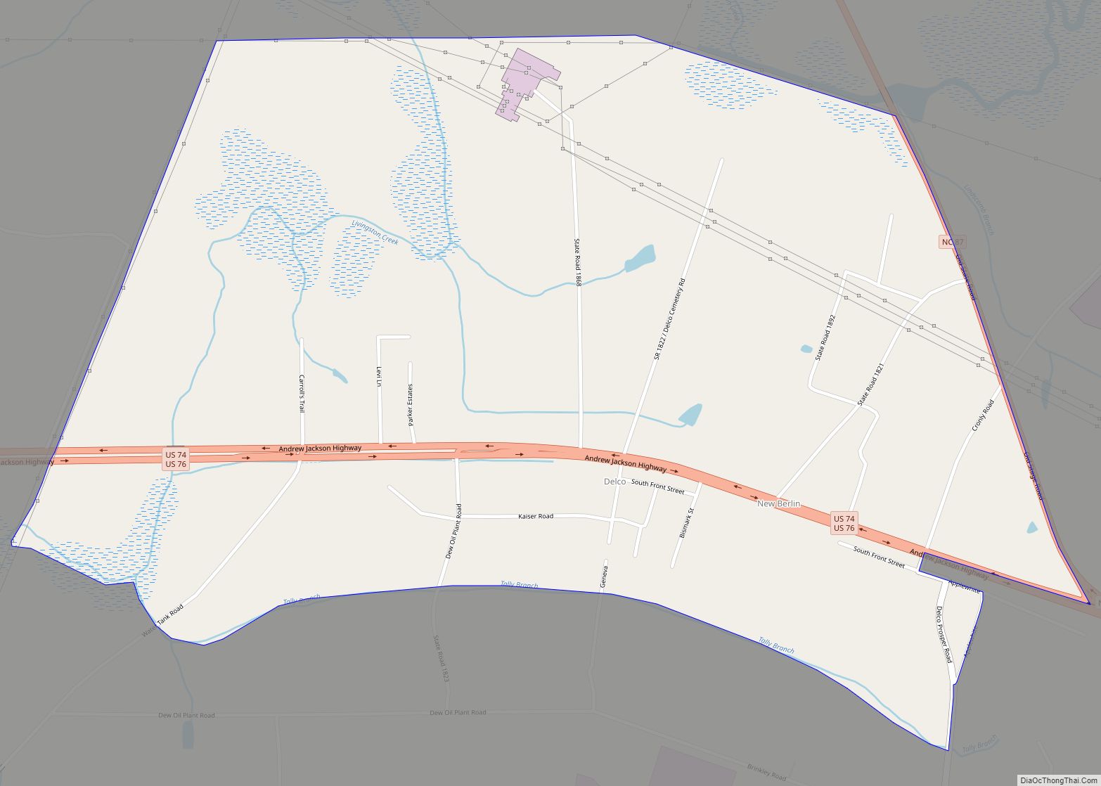
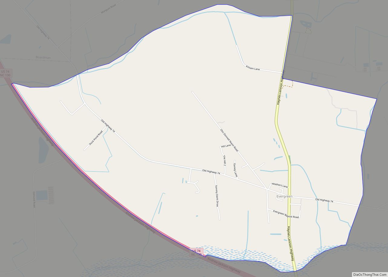
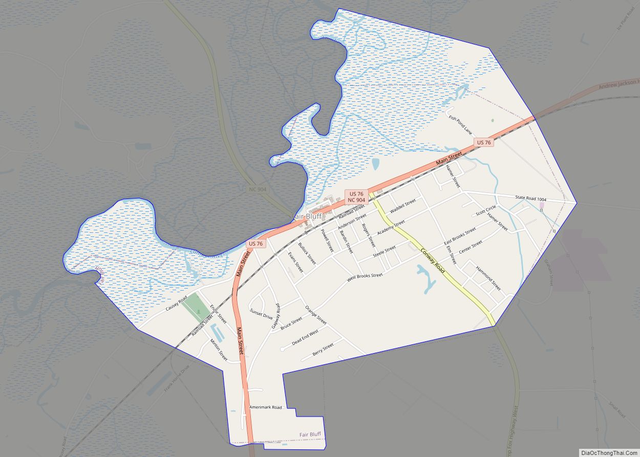
Online Interactive Map
Click on ![]() to view map in "full screen" mode.
to view map in "full screen" mode.
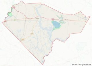
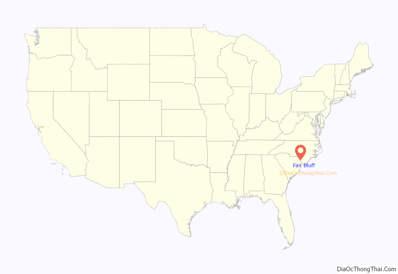
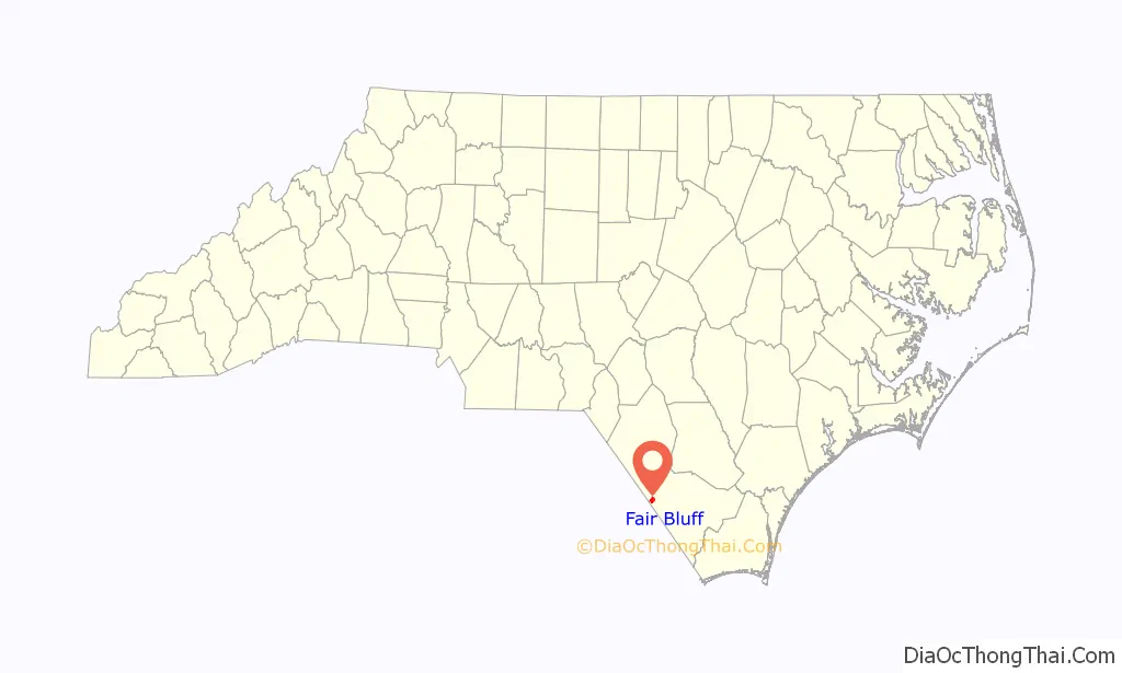
Fair Bluff location map. Where is Fair Bluff town?
History
Fair Bluff was the name originally given to a bluff overlooking the Lumber River. In 1807 plans were made to build a town upon the lands of John Wooton at the bluff to be known as Wootonton. The town was established but the name was never changed. The community was reincorporated in 1873.
The Powell House was listed on the National Register of Historic Places in 1978.
Agriculture has always been a mainstay of the economy in the town. Tobacco was a major commodity grown in the area. By the eighties, tobacco growing subsided. This caused a shift for the town and its citizens. The downtown continued to thrive until the late 1980s when a car dealership moved from the business district to another location. Haphazard town planning saw a mixture of residential, business, and industry all over town. Tens of millions in US government grants poured into the city beginning in the mid-1980s until present day. But the town continued to decline and people left for better opportunities elsewhere. The decline in Fair Bluff was similar to neighboring towns of Tabor City, Broadman, Brunswick, Cerro Gordo, and Chadbourn. A town manager was hired to handle administrative duties of the town,
In 1999, Fair Bluff experienced a devastating flood event.
In 2012, the Police Chief of Fair Bluff Marty Lewis was arrested, tried and convicted for selling and delivering oxycodone and possession with the intent to sell and conspiracy to traffic while acting as police chief. He was sentenced to a minimum of seven years in prison and fined $100,000. On April 9, 2015, Marty Lewis filled an appeal of his case. On November 3, 2015, the verdict was unanimously affirmed by the North Carolina Court of Appeals, leaving in place the 90 to 117-month prison sentence originally imposed. Lewis will not be eligible for parole before November 2022.
In 2016, the town was devastated by flooding on the Lumber River caused by Hurricane Matthew, prompting the evacuation of hundreds of residents. Floodwaters reached the town hall, police department, fire department, a grocery store, and a school. As of June 2018, the rebuilding effort was still underway but several hundred residents who had fled rising floodwaters never returned and a number of businesses remained shuttered.
In September 2018 Fair Bluff was flooded again by the impact of Hurricane Florence, again forcing evacuations and leaving the downtown area under water again, and destroying 72 homes. After Florence, many buildings in the downtown area of the town lay abandoned, with no plans to reoccupy or fix them. The town’s only factory closed several months later, and hundreds of residents moved away. The federal government bought out some residents’ properties, straining the municipal government’s tax base. The town government drew up plans to level the historic business district and turn it into a park, and build a new business district further away from the river.
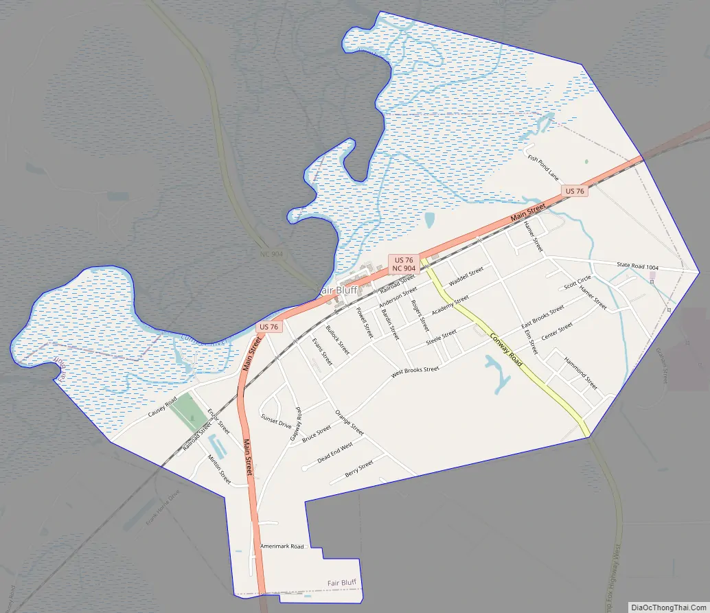
Fair Bluff Road Map
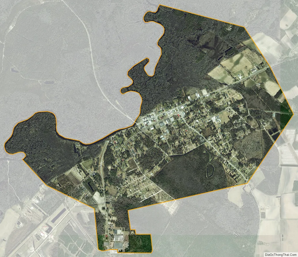
Fair Bluff city Satellite Map
Geography
Fair Bluff is located at 34°18′40″N 79°1′57″W / 34.31111°N 79.03250°W / 34.31111; -79.03250 (34.311212, -79.032387), The town lies within the Carolina Border Belt, a regional network of tobacco markets and warehouses along both sides of the North Carolina-South Carolina border.
According to the United States Census Bureau, the town has a total area of 2.2 square miles (5.7 km), all land.
See also
Map of North Carolina State and its subdivision:- Alamance
- Alexander
- Alleghany
- Anson
- Ashe
- Avery
- Beaufort
- Bertie
- Bladen
- Brunswick
- Buncombe
- Burke
- Cabarrus
- Caldwell
- Camden
- Carteret
- Caswell
- Catawba
- Chatham
- Cherokee
- Chowan
- Clay
- Cleveland
- Columbus
- Craven
- Cumberland
- Currituck
- Dare
- Davidson
- Davie
- Duplin
- Durham
- Edgecombe
- Forsyth
- Franklin
- Gaston
- Gates
- Graham
- Granville
- Greene
- Guilford
- Halifax
- Harnett
- Haywood
- Henderson
- Hertford
- Hoke
- Hyde
- Iredell
- Jackson
- Johnston
- Jones
- Lee
- Lenoir
- Lincoln
- Macon
- Madison
- Martin
- McDowell
- Mecklenburg
- Mitchell
- Montgomery
- Moore
- Nash
- New Hanover
- Northampton
- Onslow
- Orange
- Pamlico
- Pasquotank
- Pender
- Perquimans
- Person
- Pitt
- Polk
- Randolph
- Richmond
- Robeson
- Rockingham
- Rowan
- Rutherford
- Sampson
- Scotland
- Stanly
- Stokes
- Surry
- Swain
- Transylvania
- Tyrrell
- Union
- Vance
- Wake
- Warren
- Washington
- Watauga
- Wayne
- Wilkes
- Wilson
- Yadkin
- Yancey
- Alabama
- Alaska
- Arizona
- Arkansas
- California
- Colorado
- Connecticut
- Delaware
- District of Columbia
- Florida
- Georgia
- Hawaii
- Idaho
- Illinois
- Indiana
- Iowa
- Kansas
- Kentucky
- Louisiana
- Maine
- Maryland
- Massachusetts
- Michigan
- Minnesota
- Mississippi
- Missouri
- Montana
- Nebraska
- Nevada
- New Hampshire
- New Jersey
- New Mexico
- New York
- North Carolina
- North Dakota
- Ohio
- Oklahoma
- Oregon
- Pennsylvania
- Rhode Island
- South Carolina
- South Dakota
- Tennessee
- Texas
- Utah
- Vermont
- Virginia
- Washington
- West Virginia
- Wisconsin
- Wyoming