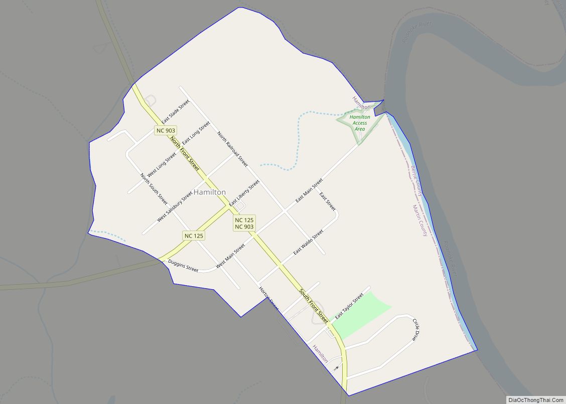
Hamilton is a town in Martin County, North Carolina, United States. The population was 408 at the 2010 census.
| Name: | Hamilton town |
|---|---|
| LSAD Code: | 43 |
| LSAD Description: | town (suffix) |
| State: | North Carolina |
| County: | Martin County |
| Elevation: | 72 ft (22 m) |
| Total Area: | 0.49 sq mi (1.28 km²) |
| Land Area: | 0.49 sq mi (1.28 km²) |
| Water Area: | 0.00 sq mi (0.00 km²) |
| Total Population: | 306 |
| Population Density: | 619.43/sq mi (239.11/km²) |
| ZIP code: | 27840 |
| Area code: | 252 |
| FIPS code: | 3729120 |
| GNISfeature ID: | 1020597 |
Online Interactive Map
Click on ![]() to view map in "full screen" mode.
to view map in "full screen" mode.
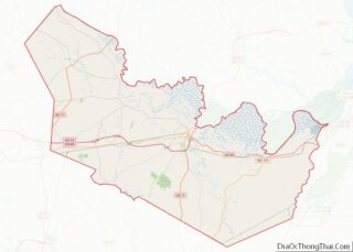
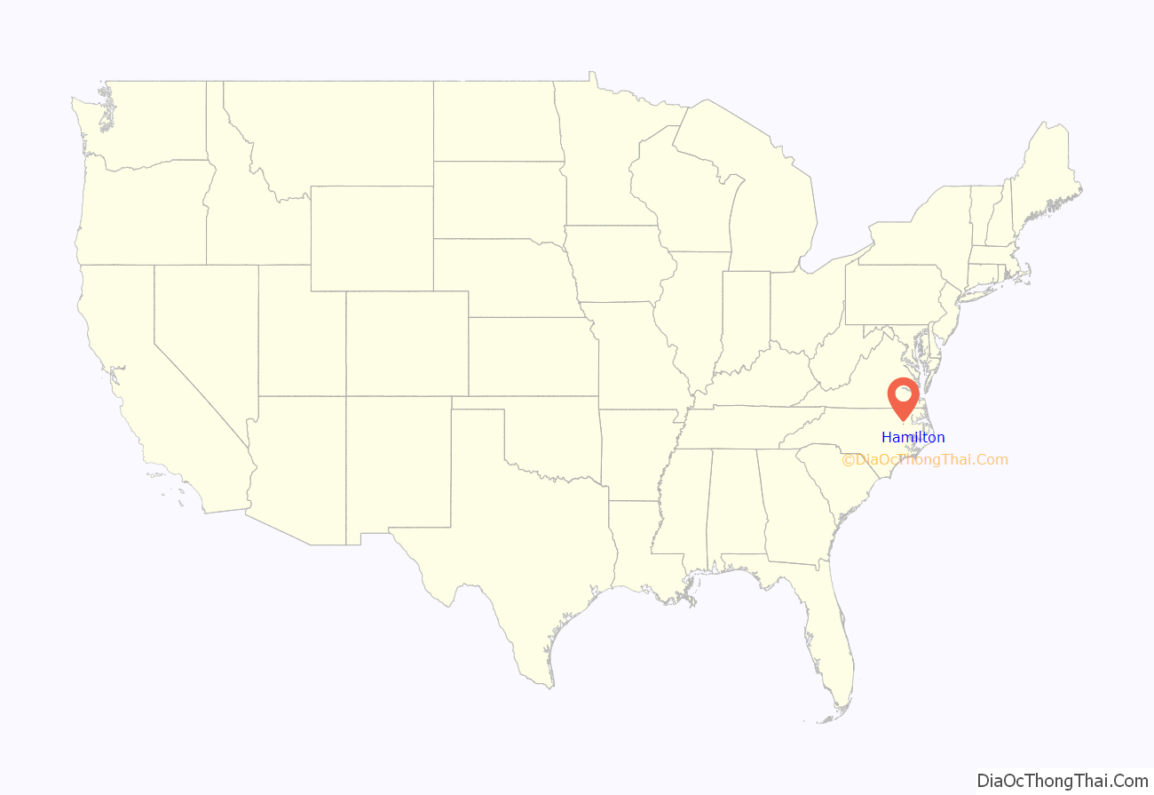
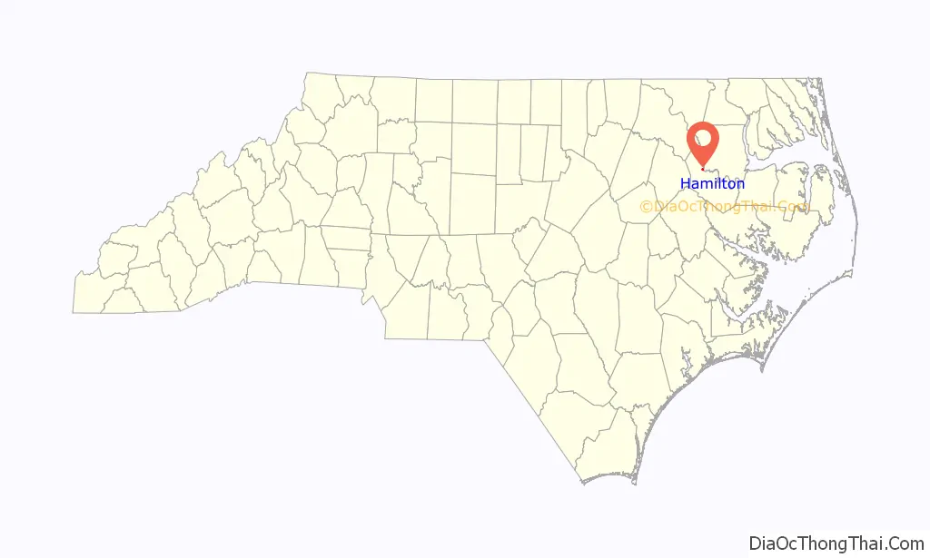
Hamilton location map. Where is Hamilton town?
History
The town was founded in 1804 on the highest point of the Roanoke River.
The most significant historical event of early Hamilton was the battle and fall of Fort Branch, when Union vessels and troops came upriver from Plymouth (see Plymouth, North Carolina History) in an attempt to reach Weldon to cut off supplies to General Robert E. Lee during the Civil War. The fort protected Weldon until the day after the General Lee surrendered at Appomattox Court House, whereupon the railroad line over the Weldon bridge had no more military significance. Afterwards, the fort was abandoned and the cannons were dumped into the Roanoke River by departing Confederate troops, and were only recently discovered. In July 1972, a group of men from Alabama came and began pulling cannons from the river. The group was accused of violating North Carolina’s antiquities laws in an effort to keep the cannons in Martin County. The courts officially decided that the cannons belong to the state under the North Carolina Department of Archives and History. The department decided to permanently loan the artifact to Fort Branch.
The Historic Hamilton Commission, started in 1976, is in charge of 52 other historic sites in the county, including St. Martin’s Episcopal Church. The church was established as a missionary station of the Episcopalian church in 1868. It was founded primarily by members of the Boyle family, such as Francis Atherton Boyle and Mary A. Boyle. St. Martin’s was admitted to the Episcopal convention in 1873. Building began in 1879. All of the construction materials were from local suppliers, except the bell and stained glass, which were imported from Wales. The church was consecrated on 17 May 1882. The Rev. Dr. Watson preached the sermon; Bishop Lyman celebrated Holy Communion. The church is now inactive, but is still owned by the Episcopal Diocese of East Carolina. This means it is still a consecrated church.
Another important site in Hamilton is the Rosenwald School. A black school funded by Julius Rosenwald, president of Sears, Roebuck and Co.,. During segregation, white schools had approximately five times the funding of the former. The Rosenwald Fund sought to provide support for these underprivileged schools. According to the Roanoke River Partners, The Rosenwald school will be remodeled and used as their headquarters. Hamilton is in the exact middle of the Roanoke River, making it a sensible location. Despite this, and years of taxpayer funding of the Roanoke River Partners, no concrete action has been taken to restore the building which is currently dilapidated.
Hamilton, once a thriving, beautiful Victorian port town with many of its homes listed in the National Historic Registry, had been in decline in recent years.
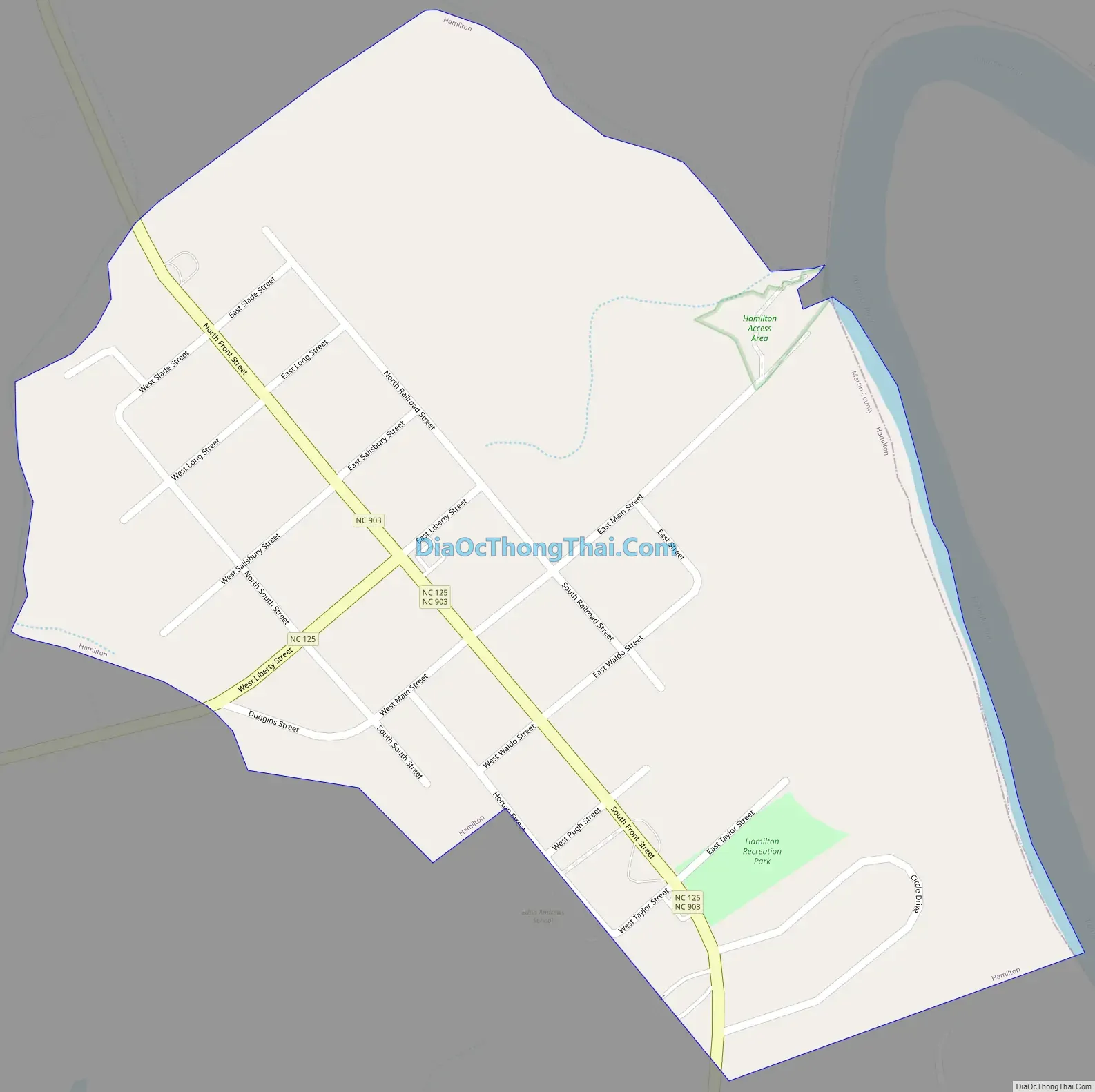
Hamilton Road Map
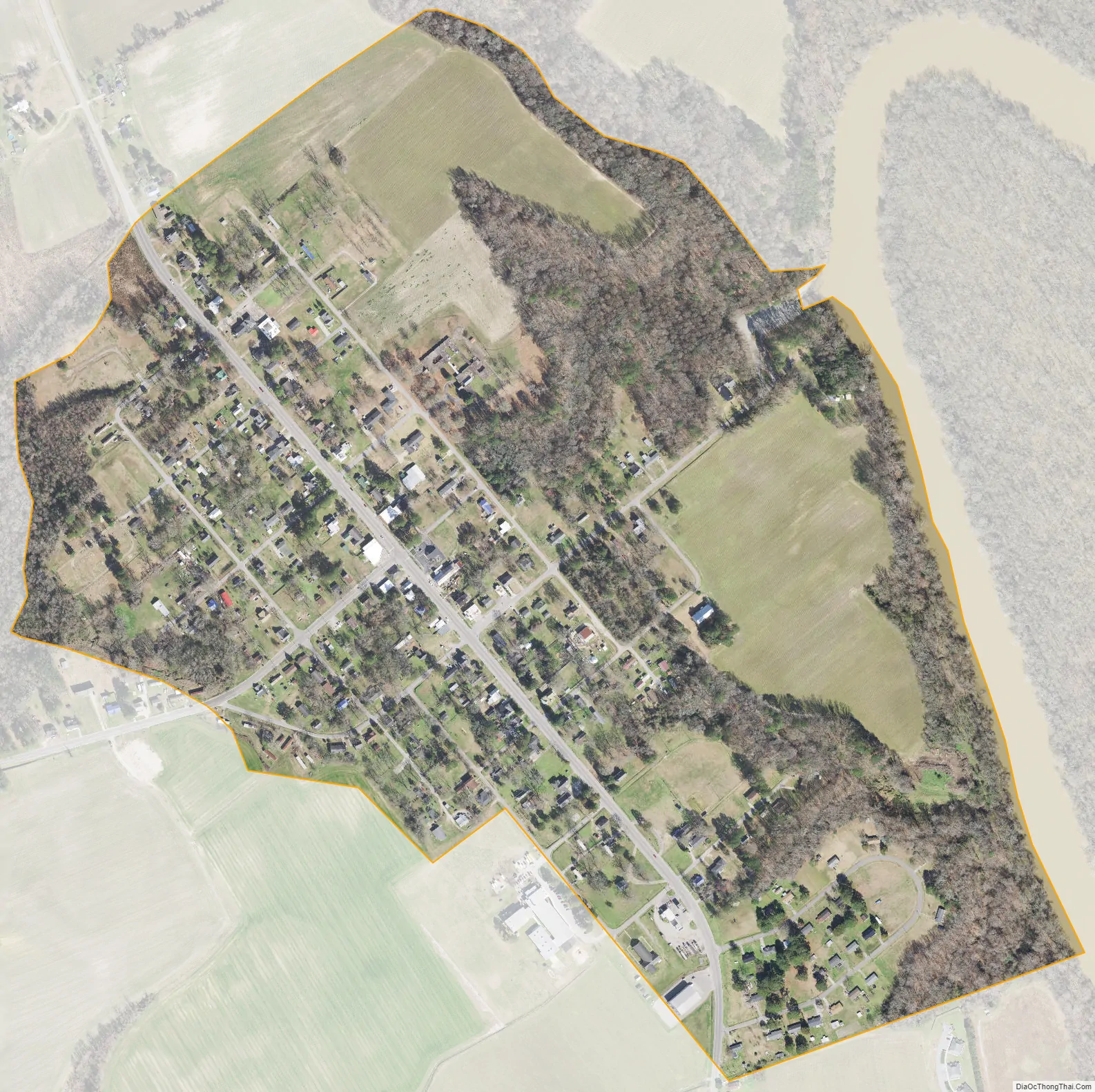
Hamilton city Satellite Map
Geography
Hamilton is located at 35°56′39″N 77°12′28″W / 35.94417°N 77.20778°W / 35.94417; -77.20778 (35.944116, -77.207772).
According to the United States Census Bureau, the town has a total area of 0.5 square miles (1.3 km), all land. It is located on the Roanoke River at the 60 Mile Mark.
See also
Map of North Carolina State and its subdivision:- Alamance
- Alexander
- Alleghany
- Anson
- Ashe
- Avery
- Beaufort
- Bertie
- Bladen
- Brunswick
- Buncombe
- Burke
- Cabarrus
- Caldwell
- Camden
- Carteret
- Caswell
- Catawba
- Chatham
- Cherokee
- Chowan
- Clay
- Cleveland
- Columbus
- Craven
- Cumberland
- Currituck
- Dare
- Davidson
- Davie
- Duplin
- Durham
- Edgecombe
- Forsyth
- Franklin
- Gaston
- Gates
- Graham
- Granville
- Greene
- Guilford
- Halifax
- Harnett
- Haywood
- Henderson
- Hertford
- Hoke
- Hyde
- Iredell
- Jackson
- Johnston
- Jones
- Lee
- Lenoir
- Lincoln
- Macon
- Madison
- Martin
- McDowell
- Mecklenburg
- Mitchell
- Montgomery
- Moore
- Nash
- New Hanover
- Northampton
- Onslow
- Orange
- Pamlico
- Pasquotank
- Pender
- Perquimans
- Person
- Pitt
- Polk
- Randolph
- Richmond
- Robeson
- Rockingham
- Rowan
- Rutherford
- Sampson
- Scotland
- Stanly
- Stokes
- Surry
- Swain
- Transylvania
- Tyrrell
- Union
- Vance
- Wake
- Warren
- Washington
- Watauga
- Wayne
- Wilkes
- Wilson
- Yadkin
- Yancey
- Alabama
- Alaska
- Arizona
- Arkansas
- California
- Colorado
- Connecticut
- Delaware
- District of Columbia
- Florida
- Georgia
- Hawaii
- Idaho
- Illinois
- Indiana
- Iowa
- Kansas
- Kentucky
- Louisiana
- Maine
- Maryland
- Massachusetts
- Michigan
- Minnesota
- Mississippi
- Missouri
- Montana
- Nebraska
- Nevada
- New Hampshire
- New Jersey
- New Mexico
- New York
- North Carolina
- North Dakota
- Ohio
- Oklahoma
- Oregon
- Pennsylvania
- Rhode Island
- South Carolina
- South Dakota
- Tennessee
- Texas
- Utah
- Vermont
- Virginia
- Washington
- West Virginia
- Wisconsin
- Wyoming