Lewiston Woodville is a town in Bertie County, North Carolina, United States. The population was 549 at the 2010 census. It is the location of Perdue Farms, one of the largest chicken-producing companies in North Carolina.
| Name: | Lewiston Woodville town |
|---|---|
| LSAD Code: | 43 |
| LSAD Description: | town (suffix) |
| State: | North Carolina |
| County: | Bertie County |
| Elevation: | 75 ft (23 m) |
| Total Area: | 1.97 sq mi (5.10 km²) |
| Land Area: | 1.96 sq mi (5.07 km²) |
| Water Area: | 0.01 sq mi (0.03 km²) |
| Total Population: | 426 |
| Population Density: | 217.79/sq mi (84.09/km²) |
| ZIP code: | 27849 |
| Area code: | 252 |
| FIPS code: | 3738030 |
| GNISfeature ID: | 0988405 |
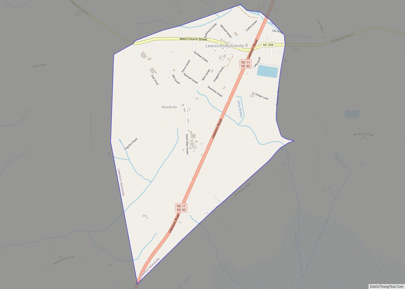
Online Interactive Map
Click on ![]() to view map in "full screen" mode.
to view map in "full screen" mode.
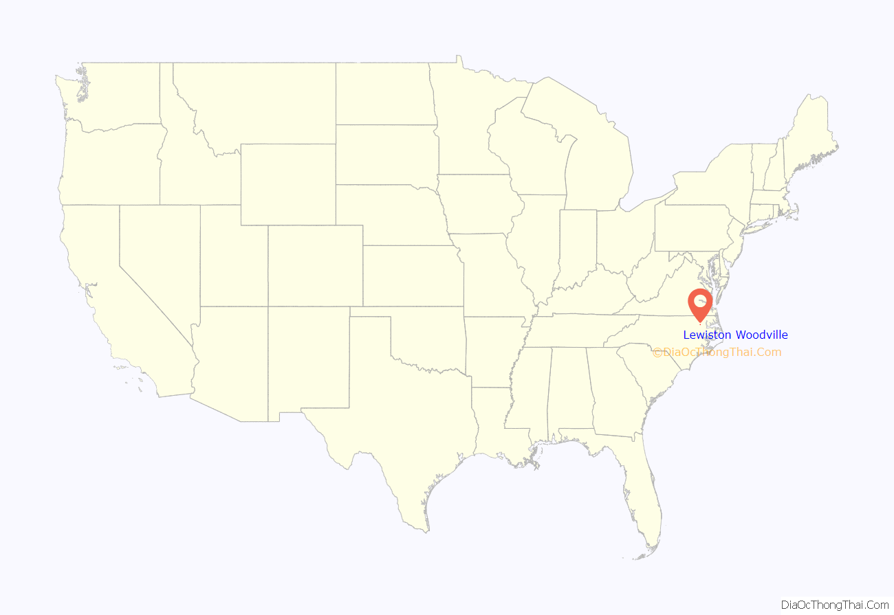
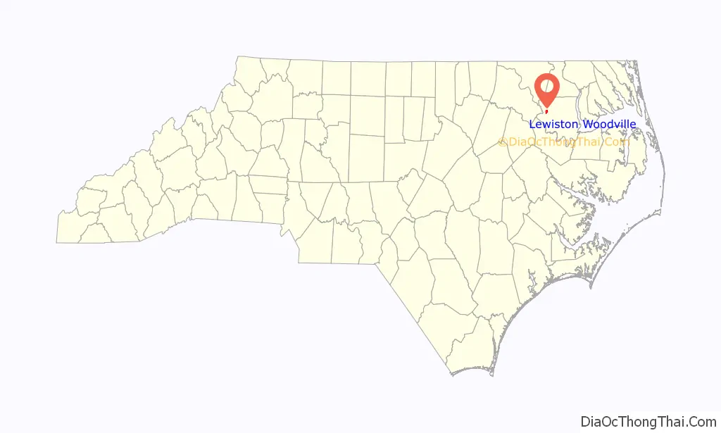
Lewiston Woodville location map. Where is Lewiston Woodville town?
History
Lewiston was named for an early settler. Lewiston and Woodville were formerly separate towns.
The St. Frances Methodist Church, Woodville Historic District, and William H. Lee House are listed on the National Register of Historic Places.
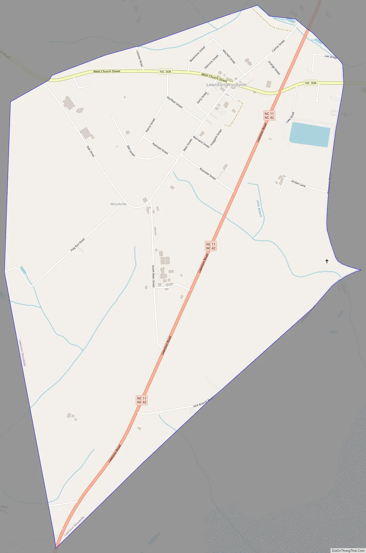
Lewiston Woodville Road Map
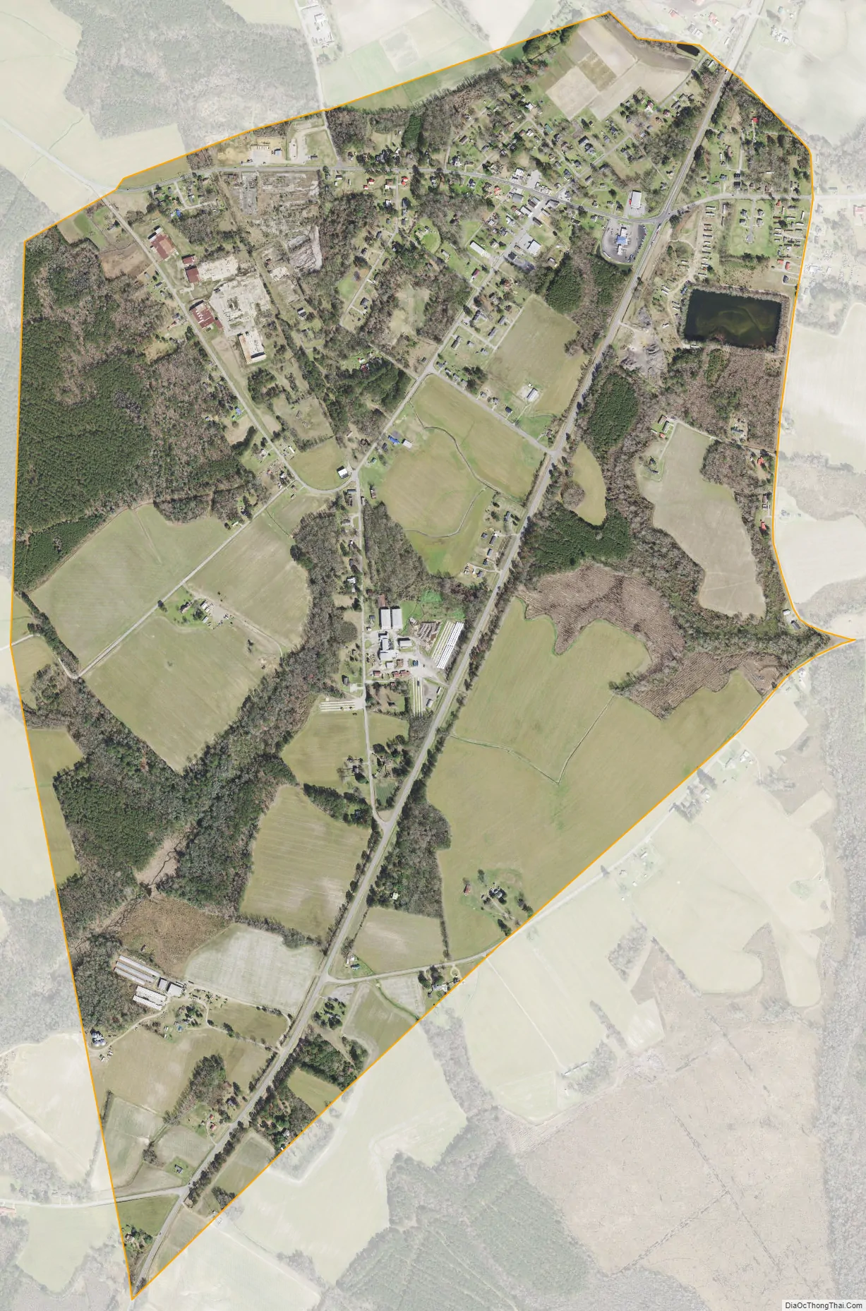
Lewiston Woodville city Satellite Map
Geography
Lewiston Woodville is located at 36°7′8″N 77°10′56″W / 36.11889°N 77.18222°W / 36.11889; -77.18222 (36.118944, -77.182245).
According to the United States Census Bureau, the town has a total area of 2.0 square miles (5.1 km), of which 0.012 square miles (0.03 km), or 0.65%, is water.
See also
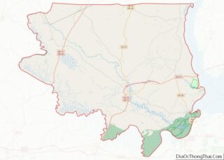
Map of North Carolina State and its subdivision:- Alamance
- Alexander
- Alleghany
- Anson
- Ashe
- Avery
- Beaufort
- Bertie
- Bladen
- Brunswick
- Buncombe
- Burke
- Cabarrus
- Caldwell
- Camden
- Carteret
- Caswell
- Catawba
- Chatham
- Cherokee
- Chowan
- Clay
- Cleveland
- Columbus
- Craven
- Cumberland
- Currituck
- Dare
- Davidson
- Davie
- Duplin
- Durham
- Edgecombe
- Forsyth
- Franklin
- Gaston
- Gates
- Graham
- Granville
- Greene
- Guilford
- Halifax
- Harnett
- Haywood
- Henderson
- Hertford
- Hoke
- Hyde
- Iredell
- Jackson
- Johnston
- Jones
- Lee
- Lenoir
- Lincoln
- Macon
- Madison
- Martin
- McDowell
- Mecklenburg
- Mitchell
- Montgomery
- Moore
- Nash
- New Hanover
- Northampton
- Onslow
- Orange
- Pamlico
- Pasquotank
- Pender
- Perquimans
- Person
- Pitt
- Polk
- Randolph
- Richmond
- Robeson
- Rockingham
- Rowan
- Rutherford
- Sampson
- Scotland
- Stanly
- Stokes
- Surry
- Swain
- Transylvania
- Tyrrell
- Union
- Vance
- Wake
- Warren
- Washington
- Watauga
- Wayne
- Wilkes
- Wilson
- Yadkin
- Yancey
- Alabama
- Alaska
- Arizona
- Arkansas
- California
- Colorado
- Connecticut
- Delaware
- District of Columbia
- Florida
- Georgia
- Hawaii
- Idaho
- Illinois
- Indiana
- Iowa
- Kansas
- Kentucky
- Louisiana
- Maine
- Maryland
- Massachusetts
- Michigan
- Minnesota
- Mississippi
- Missouri
- Montana
- Nebraska
- Nevada
- New Hampshire
- New Jersey
- New Mexico
- New York
- North Carolina
- North Dakota
- Ohio
- Oklahoma
- Oregon
- Pennsylvania
- Rhode Island
- South Carolina
- South Dakota
- Tennessee
- Texas
- Utah
- Vermont
- Virginia
- Washington
- West Virginia
- Wisconsin
- Wyoming