Windsor is a town in Bertie County, North Carolina, United States. The population was 3,630 at the 2010 census, up from 2,283 in 2000. It is the county seat of Bertie County, which is also the homeland of the Southern Band Tuscarora Tribe that remained in North Carolina post Colonialism. Windsor is located in North Carolina’s Inner Banks region.
| Name: | Windsor town |
|---|---|
| LSAD Code: | 43 |
| LSAD Description: | town (suffix) |
| State: | North Carolina |
| County: | Bertie County |
| Elevation: | 3 ft (1 m) |
| Total Area: | 2.81 sq mi (7.29 km²) |
| Land Area: | 2.81 sq mi (7.29 km²) |
| Water Area: | 0.00 sq mi (0.00 km²) |
| Total Population: | 3,582 |
| Population Density: | 1,272.47/sq mi (491.22/km²) |
| ZIP code: | 27983 27959 |
| Area code: | 252 |
| FIPS code: | 3774680 |
| GNISfeature ID: | 1023279 |
| Website: | windsornc.com |
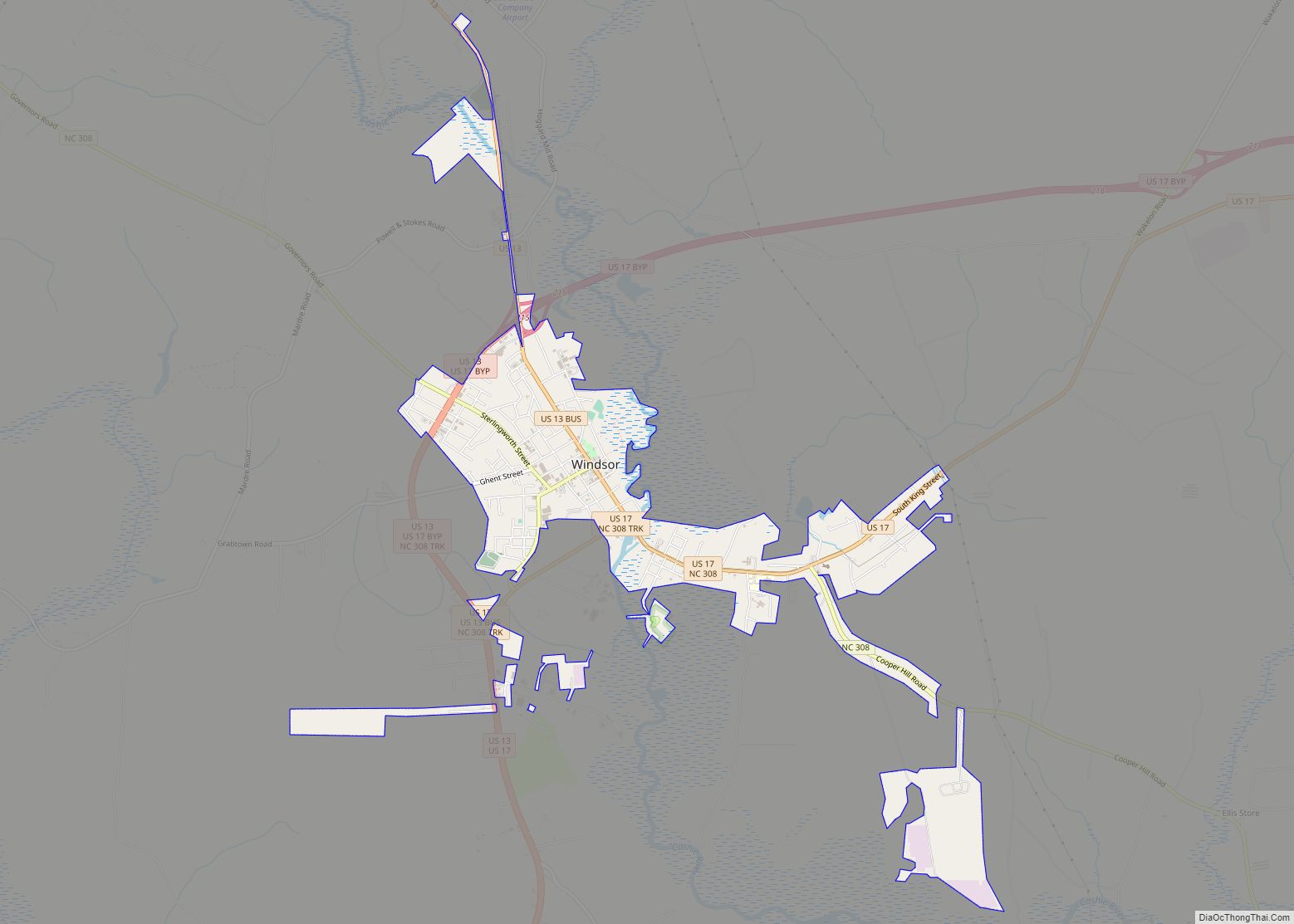
Online Interactive Map
Click on ![]() to view map in "full screen" mode.
to view map in "full screen" mode.
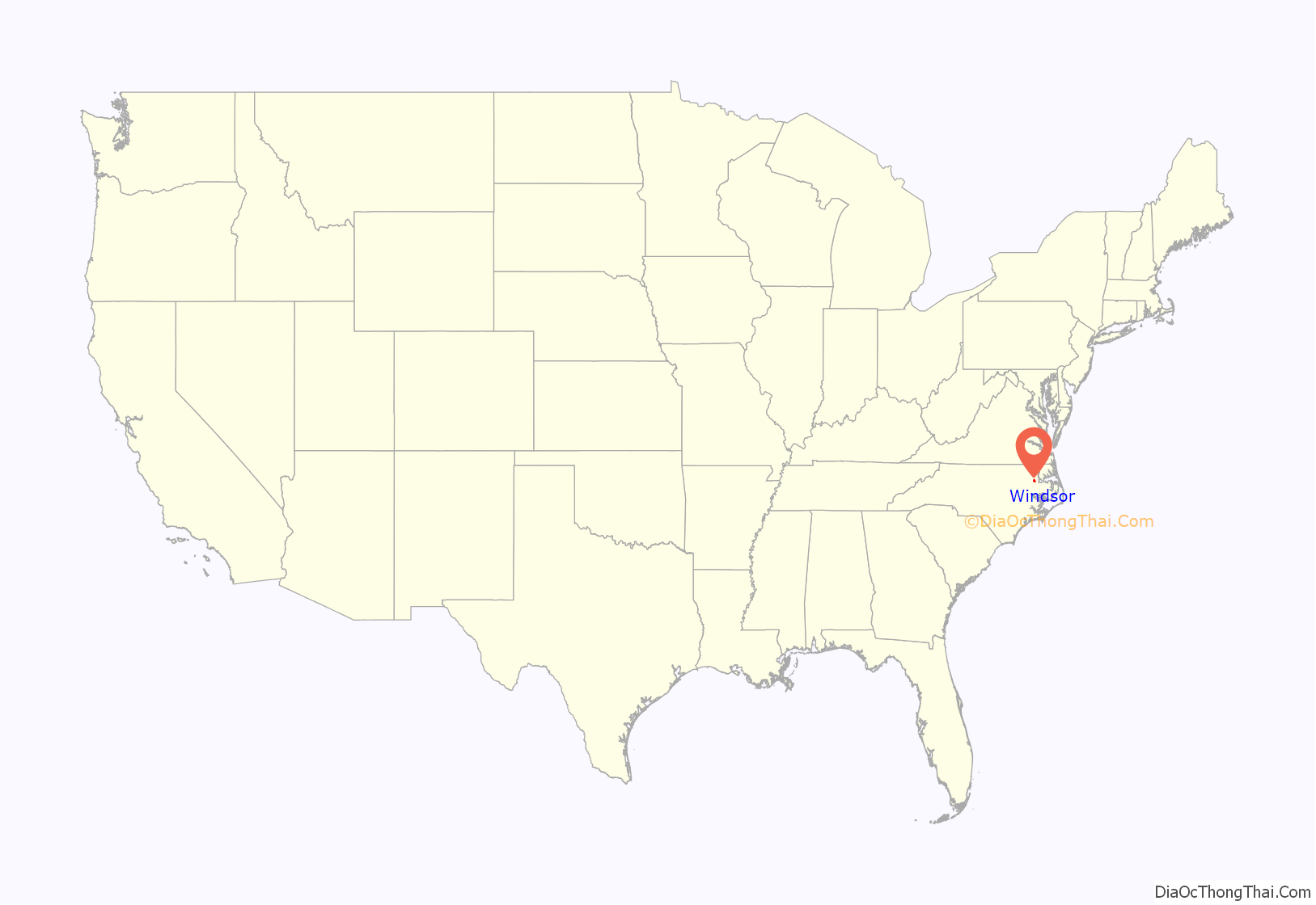
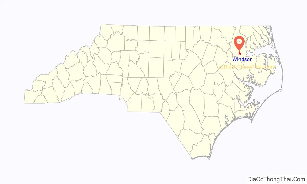
Windsor location map. Where is Windsor town?
History
The land was historically the home of the Tuscarora people. Today, there are Tuscarora residents living in the village of Tandequemuc, now called Merry Hill.
Bertie County Courthouse, Bertie Memorial Hospital, Elmwood, Freeman Hotel, Hope Plantation, Jordan House, King House, Liberty Hall, Rosefield, and Windsor Historic District are listed on the National Register of Historic Places.
In the early morning hours of August 4, 2020, an EF3 tornado spawned by Hurricane Isaias struck areas just outside of Windsor. The twister obliterated 12 mobile homes within a mobile home park outside of town, and flattened another poorly built house. The tornado killed 2 people and injured 14 others. The tornado would the strongest tropical cyclone spawned tornado since 2005. Governor Roy Cooper toured the damage area in the days following the event.
Windsor Road Map
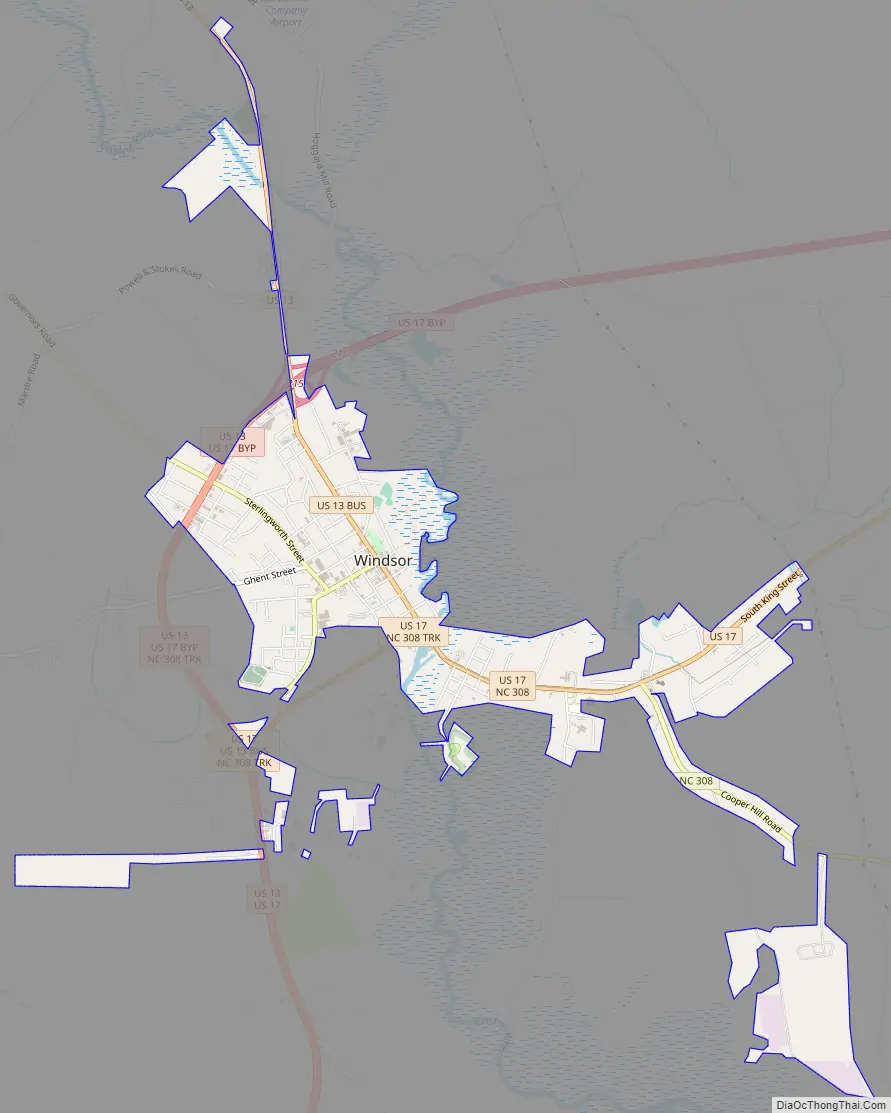
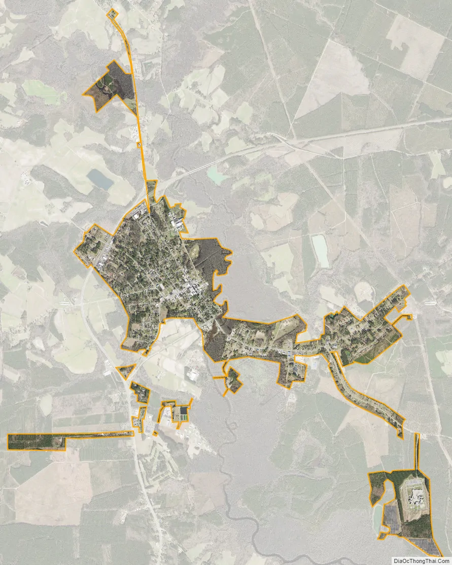
Windsor city Satellite Map
Geography
Windsor is located at 35°59′53″N 76°56′56″W / 35.99806°N 76.94889°W / 35.99806; -76.94889 (35.998145, -76.948973).
According to the United States Census Bureau, the town has a total area of 2.8 square miles (7.3 km), all of it land.
See also
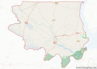
Map of North Carolina State and its subdivision:- Alamance
- Alexander
- Alleghany
- Anson
- Ashe
- Avery
- Beaufort
- Bertie
- Bladen
- Brunswick
- Buncombe
- Burke
- Cabarrus
- Caldwell
- Camden
- Carteret
- Caswell
- Catawba
- Chatham
- Cherokee
- Chowan
- Clay
- Cleveland
- Columbus
- Craven
- Cumberland
- Currituck
- Dare
- Davidson
- Davie
- Duplin
- Durham
- Edgecombe
- Forsyth
- Franklin
- Gaston
- Gates
- Graham
- Granville
- Greene
- Guilford
- Halifax
- Harnett
- Haywood
- Henderson
- Hertford
- Hoke
- Hyde
- Iredell
- Jackson
- Johnston
- Jones
- Lee
- Lenoir
- Lincoln
- Macon
- Madison
- Martin
- McDowell
- Mecklenburg
- Mitchell
- Montgomery
- Moore
- Nash
- New Hanover
- Northampton
- Onslow
- Orange
- Pamlico
- Pasquotank
- Pender
- Perquimans
- Person
- Pitt
- Polk
- Randolph
- Richmond
- Robeson
- Rockingham
- Rowan
- Rutherford
- Sampson
- Scotland
- Stanly
- Stokes
- Surry
- Swain
- Transylvania
- Tyrrell
- Union
- Vance
- Wake
- Warren
- Washington
- Watauga
- Wayne
- Wilkes
- Wilson
- Yadkin
- Yancey
- Alabama
- Alaska
- Arizona
- Arkansas
- California
- Colorado
- Connecticut
- Delaware
- District of Columbia
- Florida
- Georgia
- Hawaii
- Idaho
- Illinois
- Indiana
- Iowa
- Kansas
- Kentucky
- Louisiana
- Maine
- Maryland
- Massachusetts
- Michigan
- Minnesota
- Mississippi
- Missouri
- Montana
- Nebraska
- Nevada
- New Hampshire
- New Jersey
- New Mexico
- New York
- North Carolina
- North Dakota
- Ohio
- Oklahoma
- Oregon
- Pennsylvania
- Rhode Island
- South Carolina
- South Dakota
- Tennessee
- Texas
- Utah
- Vermont
- Virginia
- Washington
- West Virginia
- Wisconsin
- Wyoming