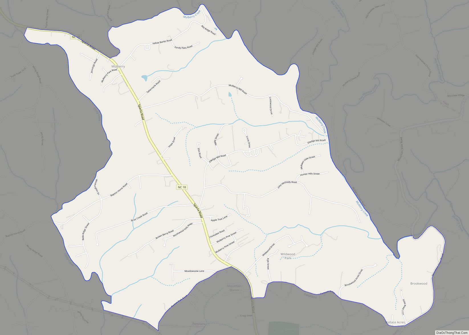
Mulberry is a census-designated place (CDP) in Wilkes County, North Carolina, United States. The population was 2,332 at the 2010 U.S. Census. The community was given its name by the first European pioneers to settle the area in the 1750s. These settlers called the region “Mulberry Fields”, after the many mulberry trees in the area. Mulberry Creek, one of the largest streams in Wilkes County, takes its name from the community of Mulberry, and flows through the area.
| Name: | Mulberry CDP |
|---|---|
| LSAD Code: | 57 |
| LSAD Description: | CDP (suffix) |
| State: | North Carolina |
| County: | Wilkes County |
| Elevation: | 1,322 ft (403 m) |
| Total Area: | 5.09 sq mi (13.19 km²) |
| Land Area: | 5.09 sq mi (13.19 km²) |
| Water Area: | 0.00 sq mi (0.00 km²) |
| Total Population: | 2,275 |
| Population Density: | 446.60/sq mi (172.44/km²) |
| ZIP code: | 28659 |
| Area code: | 336 |
| FIPS code: | 3745560 |
| GNISfeature ID: | 1021582 |
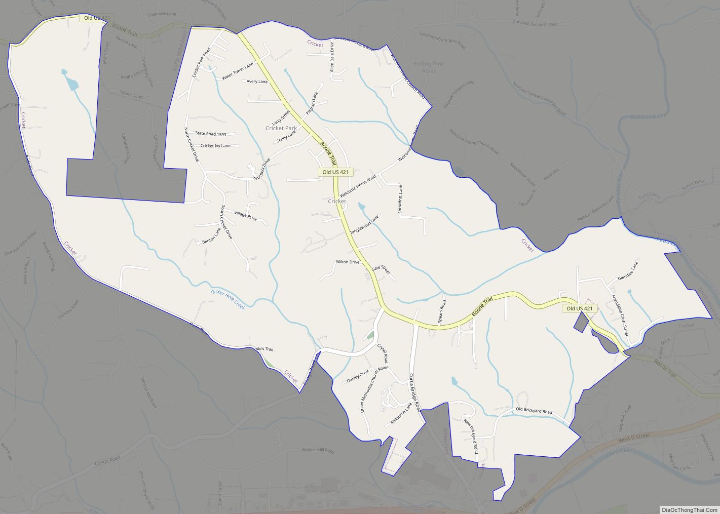
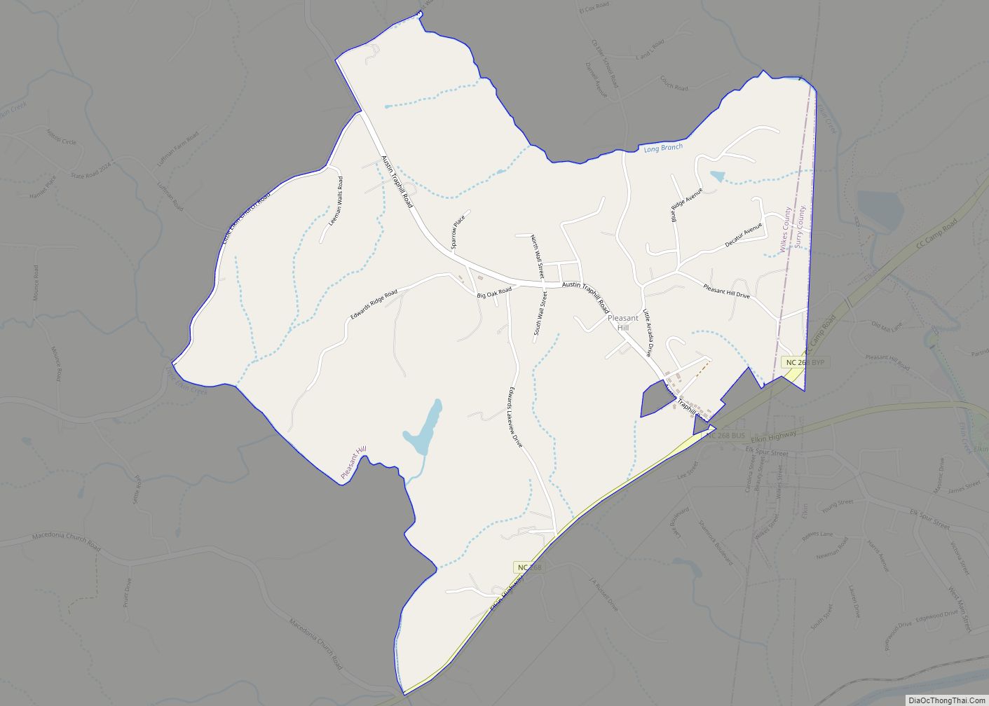
Online Interactive Map
Click on ![]() to view map in "full screen" mode.
to view map in "full screen" mode.
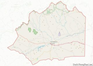
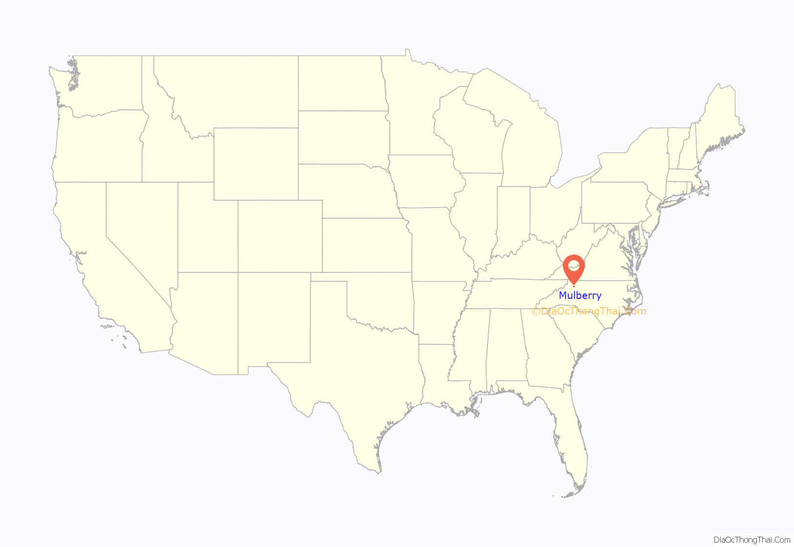
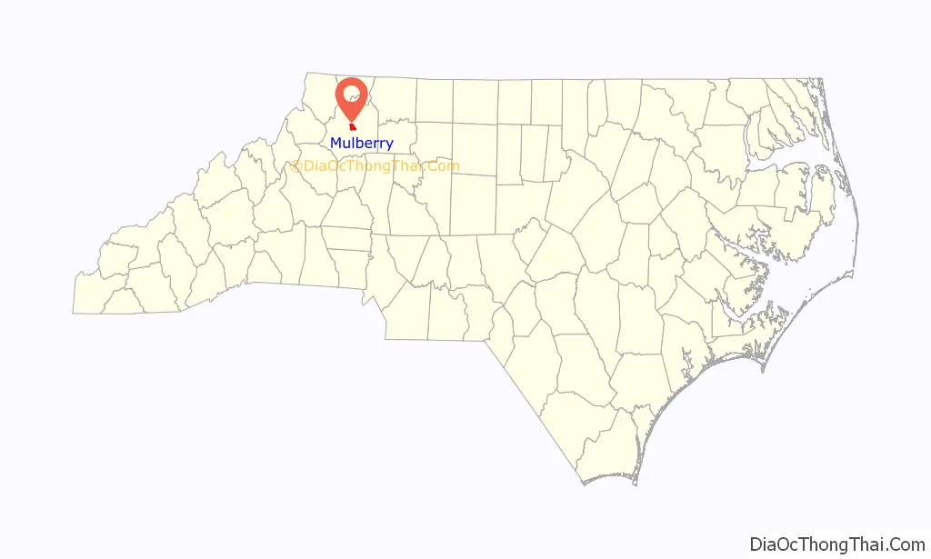
Mulberry location map. Where is Mulberry CDP?
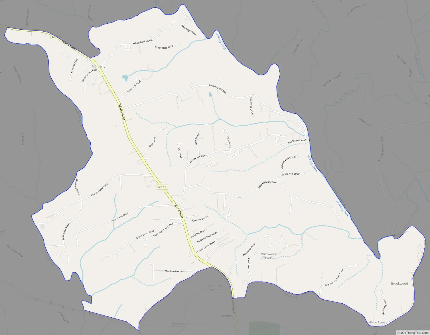
Mulberry Road Map
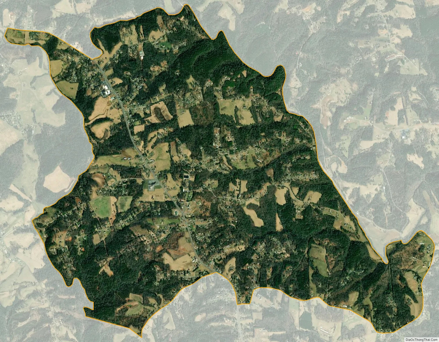
Mulberry city Satellite Map
Geography
Mulberry is located at 36°13′40″N 81°9′57″W / 36.22778°N 81.16583°W / 36.22778; -81.16583 (36.227844, -81.165944).
According to the United States Census Bureau, the CDP has a total area of 5.1 square miles (13.2 km), all land. Mulberry is located where the foothills of the Blue Ridge Mountains level off to the rolling countryside and small valleys of North Carolina’s Piedmont region. The area is heavily forested, with numerous small cattle and poultry farms, as well as housing developments.
See also
Map of North Carolina State and its subdivision:- Alamance
- Alexander
- Alleghany
- Anson
- Ashe
- Avery
- Beaufort
- Bertie
- Bladen
- Brunswick
- Buncombe
- Burke
- Cabarrus
- Caldwell
- Camden
- Carteret
- Caswell
- Catawba
- Chatham
- Cherokee
- Chowan
- Clay
- Cleveland
- Columbus
- Craven
- Cumberland
- Currituck
- Dare
- Davidson
- Davie
- Duplin
- Durham
- Edgecombe
- Forsyth
- Franklin
- Gaston
- Gates
- Graham
- Granville
- Greene
- Guilford
- Halifax
- Harnett
- Haywood
- Henderson
- Hertford
- Hoke
- Hyde
- Iredell
- Jackson
- Johnston
- Jones
- Lee
- Lenoir
- Lincoln
- Macon
- Madison
- Martin
- McDowell
- Mecklenburg
- Mitchell
- Montgomery
- Moore
- Nash
- New Hanover
- Northampton
- Onslow
- Orange
- Pamlico
- Pasquotank
- Pender
- Perquimans
- Person
- Pitt
- Polk
- Randolph
- Richmond
- Robeson
- Rockingham
- Rowan
- Rutherford
- Sampson
- Scotland
- Stanly
- Stokes
- Surry
- Swain
- Transylvania
- Tyrrell
- Union
- Vance
- Wake
- Warren
- Washington
- Watauga
- Wayne
- Wilkes
- Wilson
- Yadkin
- Yancey
- Alabama
- Alaska
- Arizona
- Arkansas
- California
- Colorado
- Connecticut
- Delaware
- District of Columbia
- Florida
- Georgia
- Hawaii
- Idaho
- Illinois
- Indiana
- Iowa
- Kansas
- Kentucky
- Louisiana
- Maine
- Maryland
- Massachusetts
- Michigan
- Minnesota
- Mississippi
- Missouri
- Montana
- Nebraska
- Nevada
- New Hampshire
- New Jersey
- New Mexico
- New York
- North Carolina
- North Dakota
- Ohio
- Oklahoma
- Oregon
- Pennsylvania
- Rhode Island
- South Carolina
- South Dakota
- Tennessee
- Texas
- Utah
- Vermont
- Virginia
- Washington
- West Virginia
- Wisconsin
- Wyoming