Norwood is a town in Stanly County, North Carolina, United States. The population was 2,379 at the 2010 census.
| Name: | Norwood town |
|---|---|
| LSAD Code: | 43 |
| LSAD Description: | town (suffix) |
| State: | North Carolina |
| County: | Stanly County |
| Elevation: | 407 ft (124 m) |
| Total Area: | 4.55 sq mi (11.78 km²) |
| Land Area: | 4.54 sq mi (11.75 km²) |
| Water Area: | 0.01 sq mi (0.03 km²) |
| Total Population: | 2,367 |
| Population Density: | 521.60/sq mi (201.39/km²) |
| ZIP code: | 28128 |
| Area code: | 704 |
| FIPS code: | 3747980 |
| GNISfeature ID: | 1021677 |
| Website: | norwoodgov.com |
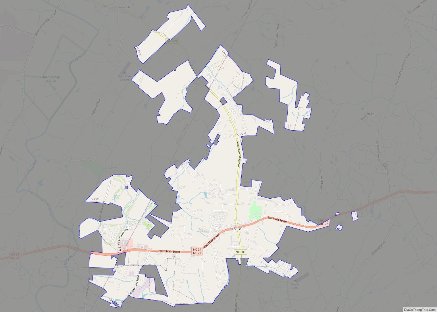
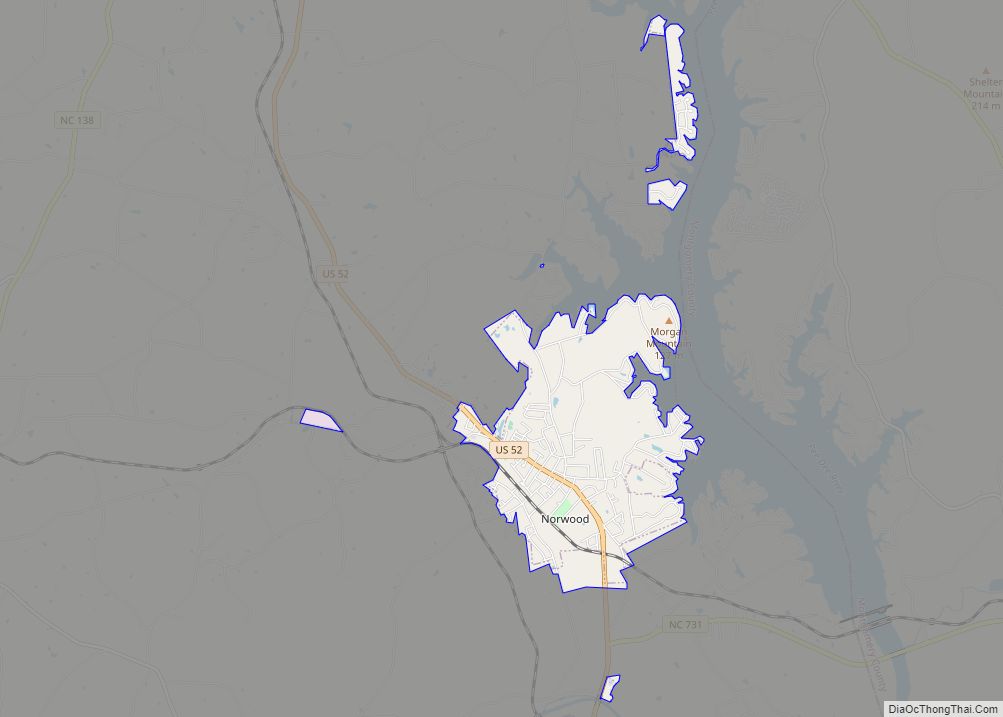
Online Interactive Map
Click on ![]() to view map in "full screen" mode.
to view map in "full screen" mode.
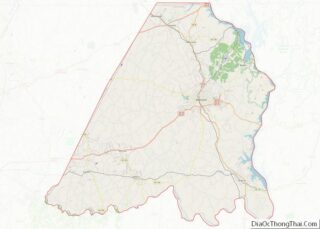
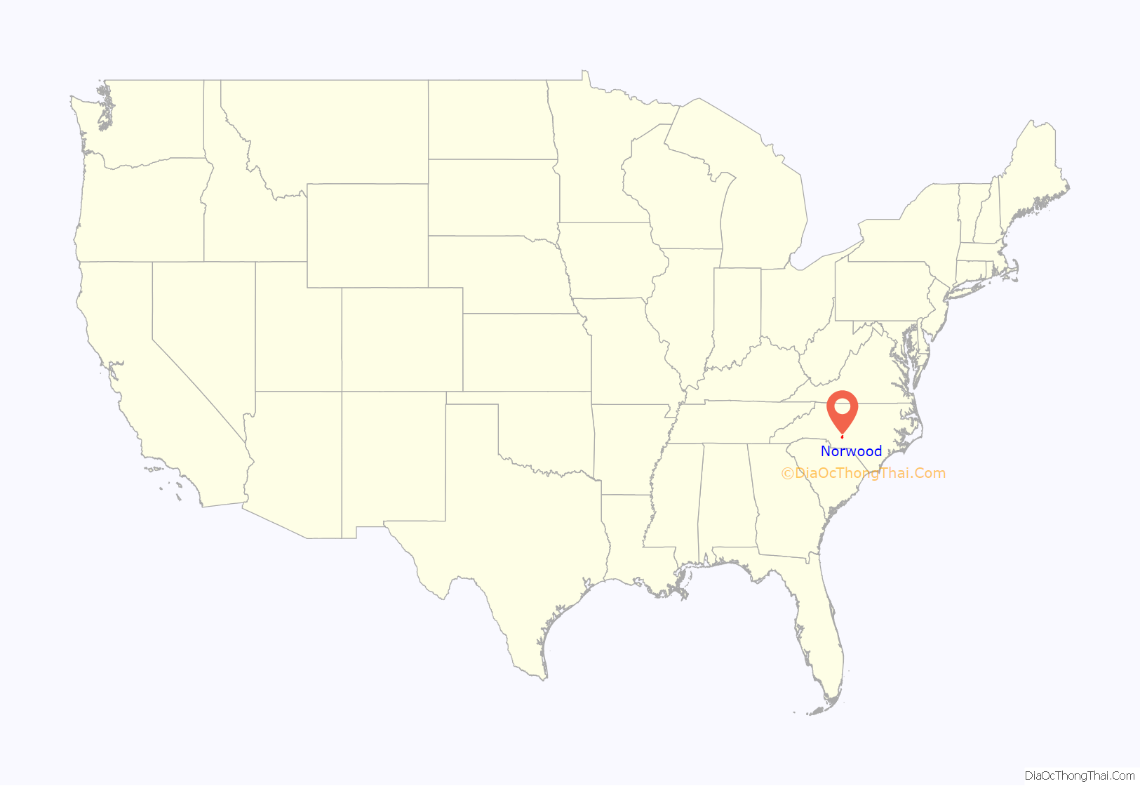
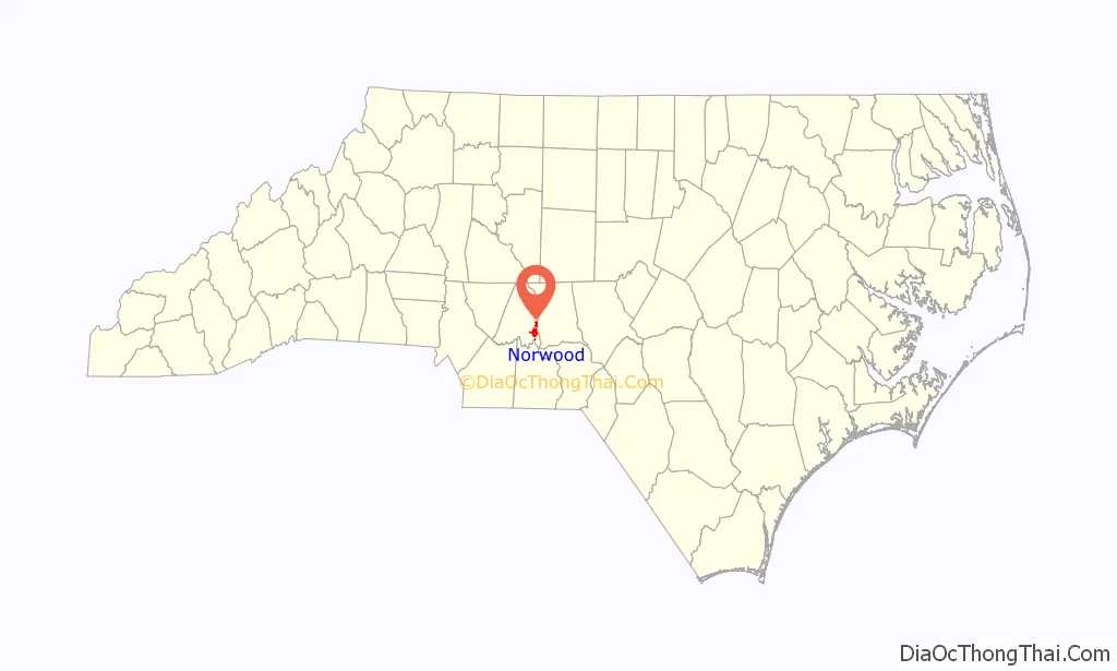
Norwood location map. Where is Norwood town?
History
The first settlements in the Norwood area began in the 1740s with settlers from Delaware and other middle Atlantic colonies following Indian trails and rivers. These early settlements were along the local river valleys. One family, the Colsons, chose to settle near the confluence of the Rocky and Pee Dee rivers and built an ordinary, a tavern serving food and providing lodging. The Colsons also operated a mill and a ferry. Anson County granted a permit for Colson’s Ordinary in the mid-18th century, at that time Stanly County was part of Anson. That permit may have been the first such granted in North Carolina. During the Revolutionary War Colson’s land was the site of a patriot victory over local Tory forces. This is sometimes referred to as the Battle of Colson’s Mill, the Battle of Colson’s Ordinary or the Fight at Colson’s. This area is now known as The Fork, named for the fork of the two rivers.
In the early 19th century at the centerline between the Rocky River and the Pee Dee River a camp meeting place was created. The area became known as Center. In 1826 Methodists built the first church on the camp meeting grounds. More activity and building occurred and the Center area became a trading center. The town of Norwood was incorporated in 1881 and named after the Norwood brothers’ store, an early establishment in the Center community that housed the area’s post office.
The local economy in the 19th century was primarily agricultural and Norwood was a commercial center. Mercantile stores (Wal-Marts of their day) in the town sold farm implements and most other necessities for every day life. Norwood’s first high school, a private school, was built in 1879. Industries came to town in the late 1890s beginning with Norwood Manufacturing Company, a cotton mill which built the town’s first mill and mill village. In the mid-1940s that facility was purchased and modernized by Collins & Aikman.
As with many communities, railroads changed the face of Norwood. The arrival of the Yadkin Railroad in 1891 allowed greater access to larger markets across the state and nation. Eventually two other railroads would serve Norwood; the original Norfolk Southern and the Winston-Salem Southbound. Until 1928 one could ride from Norwood to Albemarle and Badin in a rail car on the Yadkin Railroad. The Winston-Salem Southbound in the early 20th century saw a large number of passengers until improved roads and competition from the automobile ended that service in 1933.
In the early 20th century Norwood’s business district suffered a major disaster. A downtown fire spread up the east side of Main Street consuming all of the wooden buildings until it stopped at the two-story brick building housing Harris-McAulay Mercantile (now M. B. Irvin Unlimited). The fire was so intense that it blew out all the showcase windows of the U.B. Blalock building across the street (where the Family Dollar building now stands). When the downtown was rebuilt most buildings were built in brick. Norwood’s first public school was built in 1913 on the site of the present Norwood Elementary School.
The Pee Dee River was a natural resource to be tapped for producing electricity. The Yadkin had already been developed in the prior decade by Alcoa to produce electricity for their smelting facility in Badin. Carolina Power & Light Company began construction of the Tillery Hydroelectric development in 1926 and started producing electricity in the spring of 1928.
The Great Depression affected the town into the 1940s. Businesses and farms failed and property was sold at the courthouse steps for delinquent taxes. Norwood’s only bank at the time failed also. Some businesses that did survive the depression operated only on a part-time basis.
In the 1950s a new town hall and police station was built on the corner of Pee Dee Avenue and Campbell Street where the Norwood Library and the Norwood Museum are now located. The police station has been moved to North Main Street in what was France Byrd’s Pure service station. Town Hall is now on South Main Street, in what was originally the First National Bank of Albemarle.
The Randle House was listed on the National Register of Historic Placesin 1992.
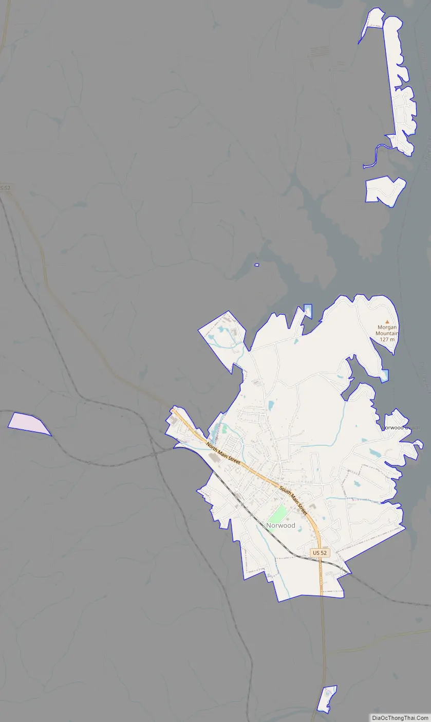
Norwood Road Map
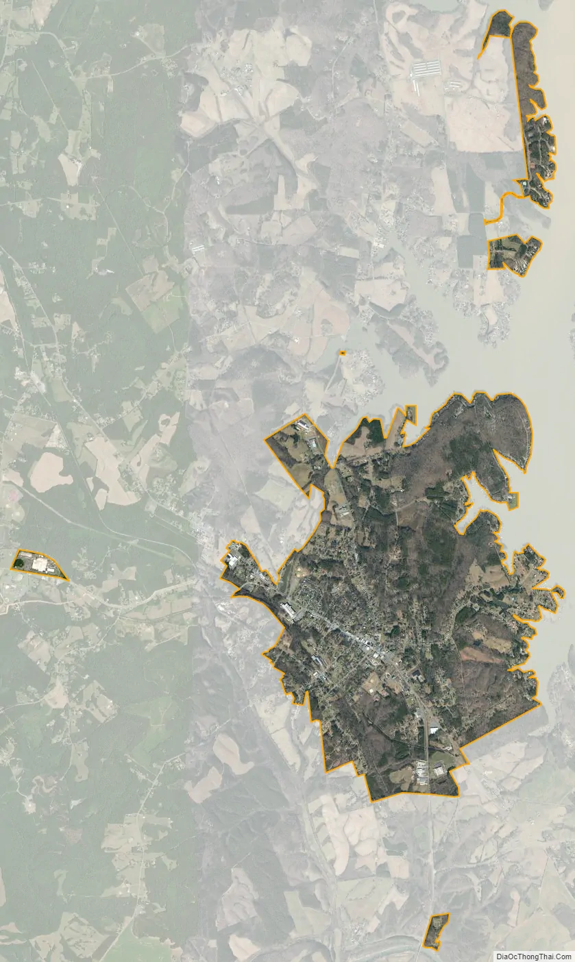
Norwood city Satellite Map
Geography
Norwood is located at 35°13′32″N 80°7′12″W / 35.22556°N 80.12000°W / 35.22556; -80.12000 (35.225574, -80.120042).
According to the United States Census Bureau, the town has a total area of 2.4 square miles (6.2 km), all land.
U.S. Route 52 passes through the town between Wadesboro and Albemarle.
See also
Map of North Carolina State and its subdivision:- Alamance
- Alexander
- Alleghany
- Anson
- Ashe
- Avery
- Beaufort
- Bertie
- Bladen
- Brunswick
- Buncombe
- Burke
- Cabarrus
- Caldwell
- Camden
- Carteret
- Caswell
- Catawba
- Chatham
- Cherokee
- Chowan
- Clay
- Cleveland
- Columbus
- Craven
- Cumberland
- Currituck
- Dare
- Davidson
- Davie
- Duplin
- Durham
- Edgecombe
- Forsyth
- Franklin
- Gaston
- Gates
- Graham
- Granville
- Greene
- Guilford
- Halifax
- Harnett
- Haywood
- Henderson
- Hertford
- Hoke
- Hyde
- Iredell
- Jackson
- Johnston
- Jones
- Lee
- Lenoir
- Lincoln
- Macon
- Madison
- Martin
- McDowell
- Mecklenburg
- Mitchell
- Montgomery
- Moore
- Nash
- New Hanover
- Northampton
- Onslow
- Orange
- Pamlico
- Pasquotank
- Pender
- Perquimans
- Person
- Pitt
- Polk
- Randolph
- Richmond
- Robeson
- Rockingham
- Rowan
- Rutherford
- Sampson
- Scotland
- Stanly
- Stokes
- Surry
- Swain
- Transylvania
- Tyrrell
- Union
- Vance
- Wake
- Warren
- Washington
- Watauga
- Wayne
- Wilkes
- Wilson
- Yadkin
- Yancey
- Alabama
- Alaska
- Arizona
- Arkansas
- California
- Colorado
- Connecticut
- Delaware
- District of Columbia
- Florida
- Georgia
- Hawaii
- Idaho
- Illinois
- Indiana
- Iowa
- Kansas
- Kentucky
- Louisiana
- Maine
- Maryland
- Massachusetts
- Michigan
- Minnesota
- Mississippi
- Missouri
- Montana
- Nebraska
- Nevada
- New Hampshire
- New Jersey
- New Mexico
- New York
- North Carolina
- North Dakota
- Ohio
- Oklahoma
- Oregon
- Pennsylvania
- Rhode Island
- South Carolina
- South Dakota
- Tennessee
- Texas
- Utah
- Vermont
- Virginia
- Washington
- West Virginia
- Wisconsin
- Wyoming