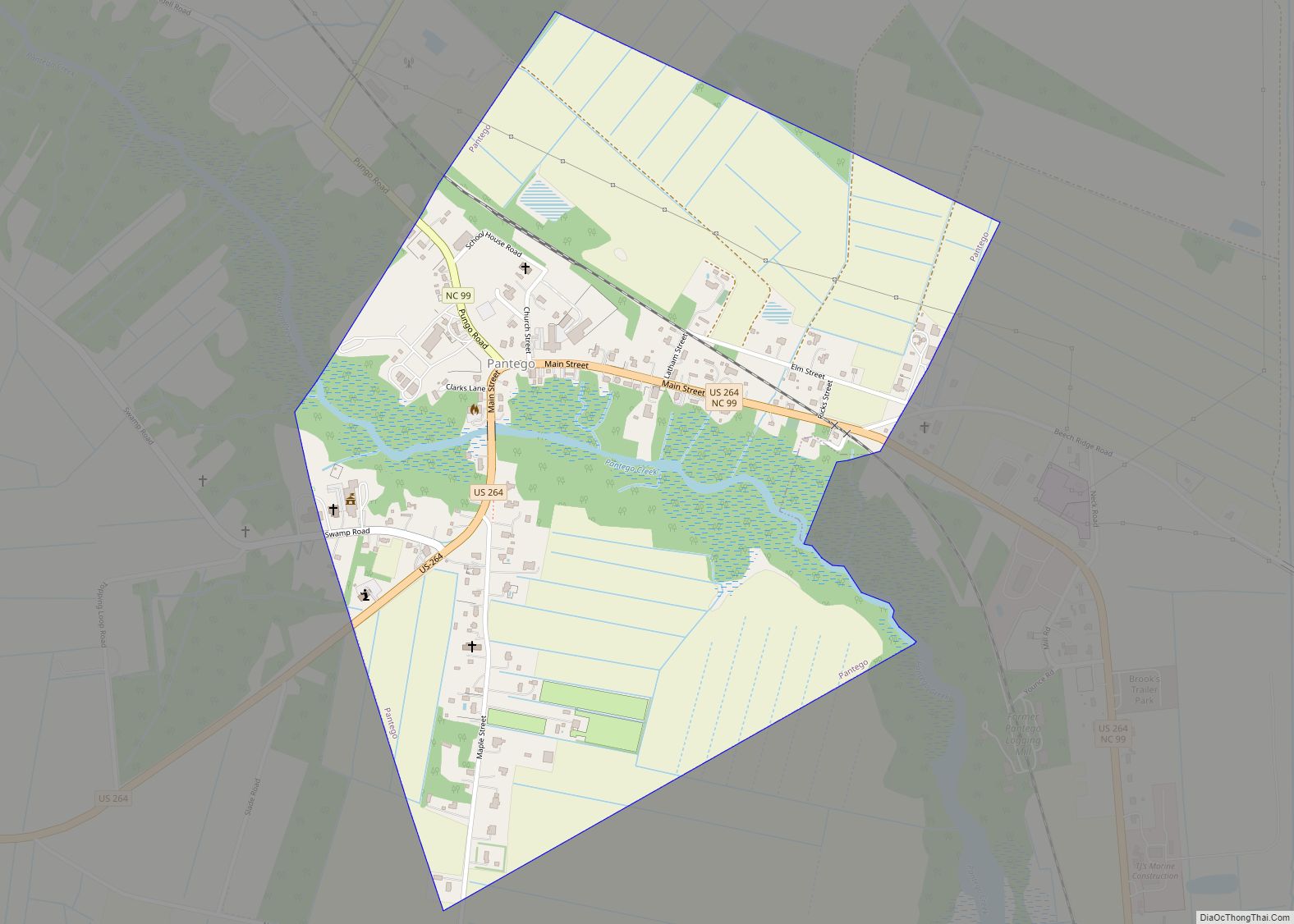
Pantego is a town in Beaufort County, North Carolina, United States. The population was 179 at the 2010 Census.
| Name: | Pantego town |
|---|---|
| LSAD Code: | 43 |
| LSAD Description: | town (suffix) |
| State: | North Carolina |
| County: | Beaufort County |
| Elevation: | 3 ft (1 m) |
| Total Area: | 0.80 sq mi (2.08 km²) |
| Land Area: | 0.80 sq mi (2.08 km²) |
| Water Area: | 0.00 sq mi (0.00 km²) |
| Total Population: | 164 |
| Population Density: | 204.23/sq mi (78.88/km²) |
| ZIP code: | 27860 |
| Area code: | 252 |
| FIPS code: | 3750080 |
| GNISfeature ID: | 0991817 |
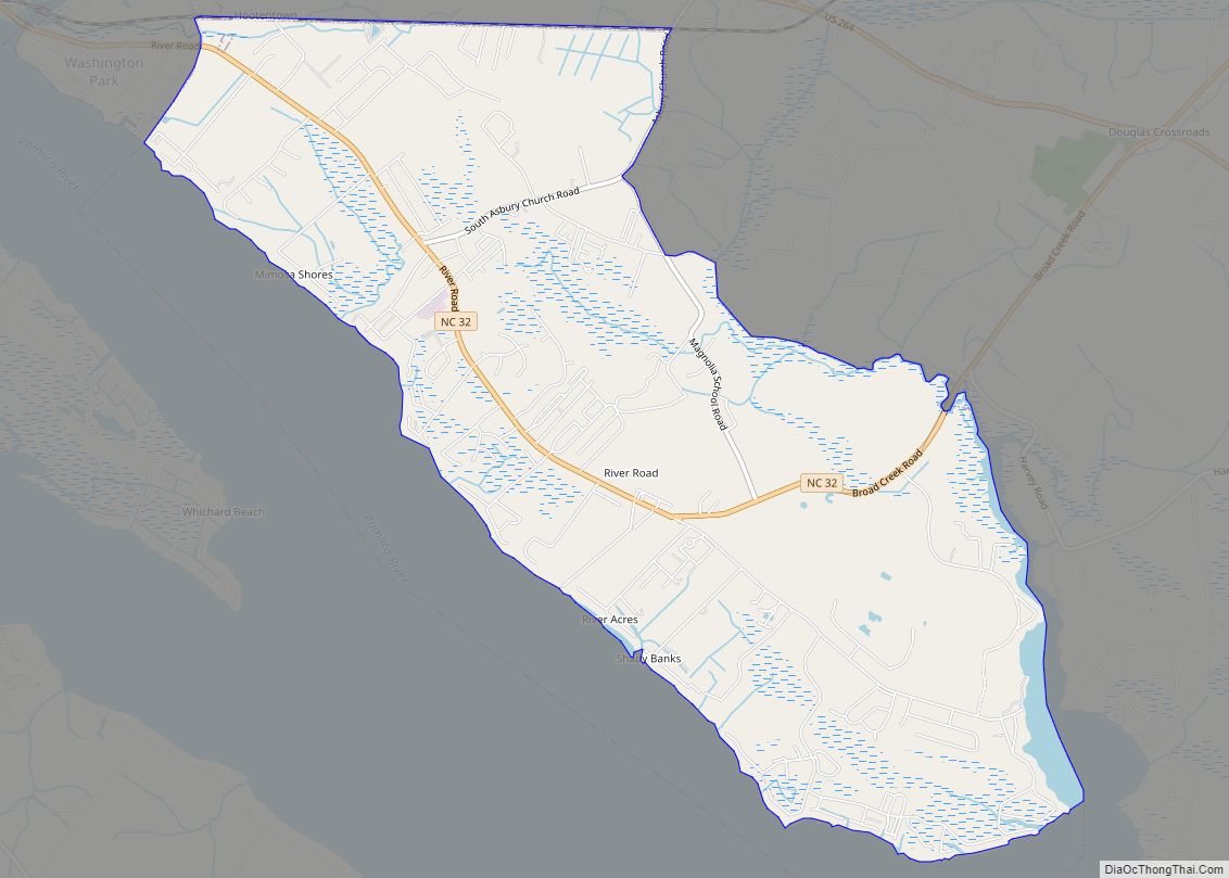
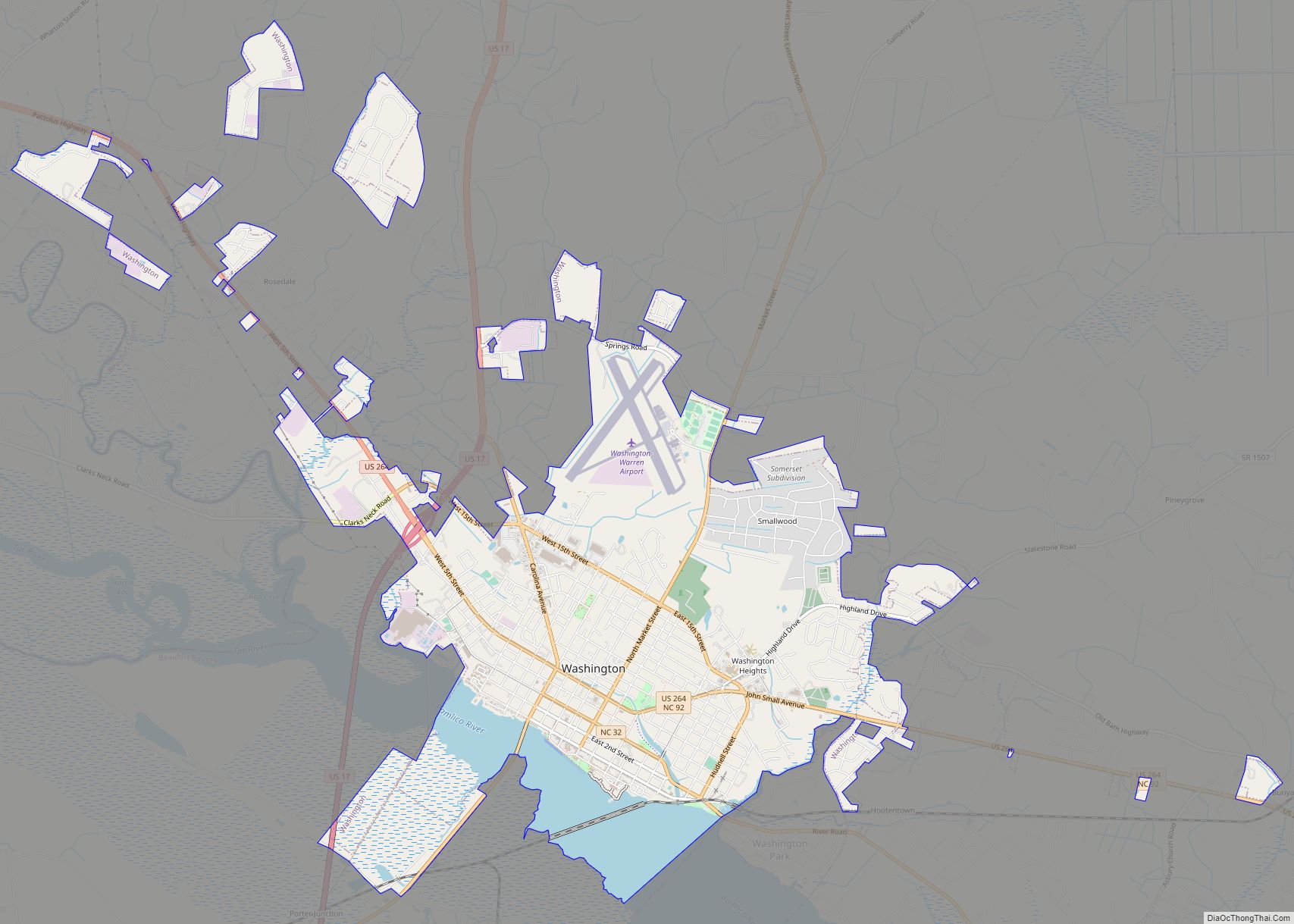
Online Interactive Map
Click on ![]() to view map in "full screen" mode.
to view map in "full screen" mode.
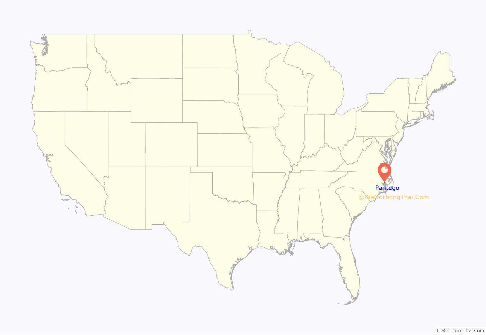
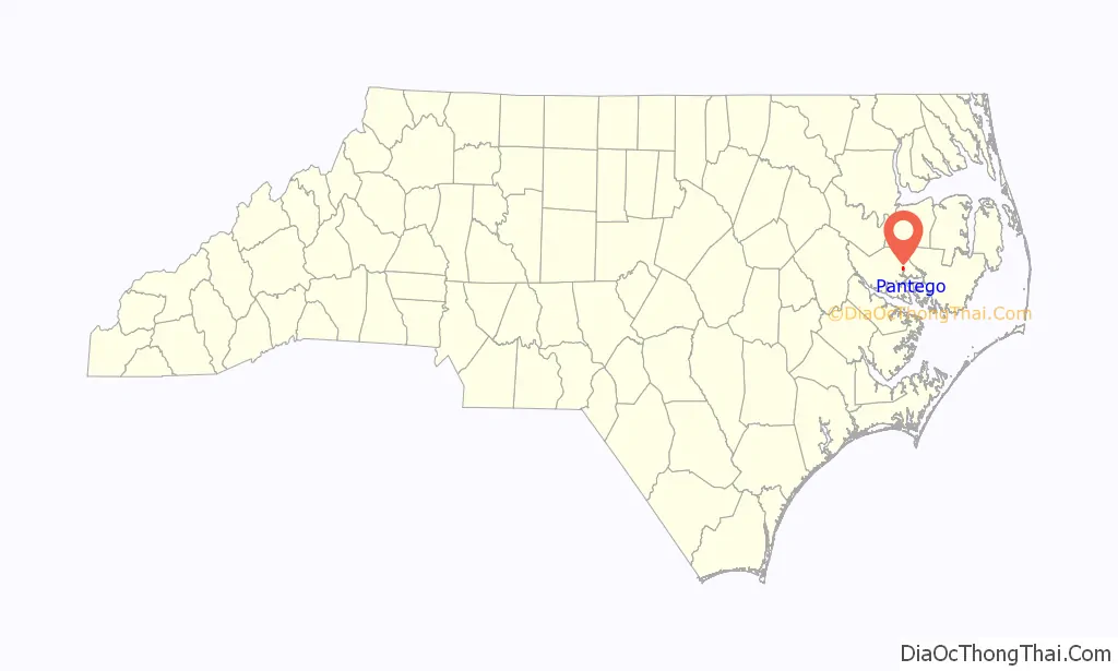
Pantego location map. Where is Pantego town?
History
The town formerly had a school named Pantego High School. The town was hit by a tornado in 1991, and another on October 11, 2002, the latter an F2 tornado that was spawned by Hurricane Kyle, and destroyed two houses and a farm. The most recent tornado, rated EF2, was on April 7, 2014. It rolled along Pantego Creek, ran along one of its canals, Cuckold’s Creek, and almost hit a railroad bridge and Highway 264, it took a turn, hit through a small marsh, split a house in half, and threw a truck over 40 feet high and threw it in a nearby field, the two occurred five feet from each other, the tornado then curved into a forest, destroying a Hardee’s billboard, and rolled across the Cuckold’s Creek again, and it slid along a field, until it curved into four houses on one side of the road, turned, hit another house across the street, hit another field. A man in a plane flew over the field it crossed, and he saw curved and grooves in the dirt, revealing “arcs” in the field suggesting it was a multiple-vortex tornado. It also hit a two-story house, taking the top floor off the house, and leaving the bottom floor, continued until it hit a house in Ponzer, approximately 15 miles from Pantego, and leveled that house. Marc Van Essendelf, his seven children, and his wife, who was eight months pregnant, hid in a ditch; the house was splintered and obliterated. There was a near-miss with another tornado that hit Whichard’s Beach and Washington. It was the first EF-3 tornado of the 2014 season, and it almost continued into Pantego.
The Pantego Academy was listed on the National Register of Historic Places in 1984.
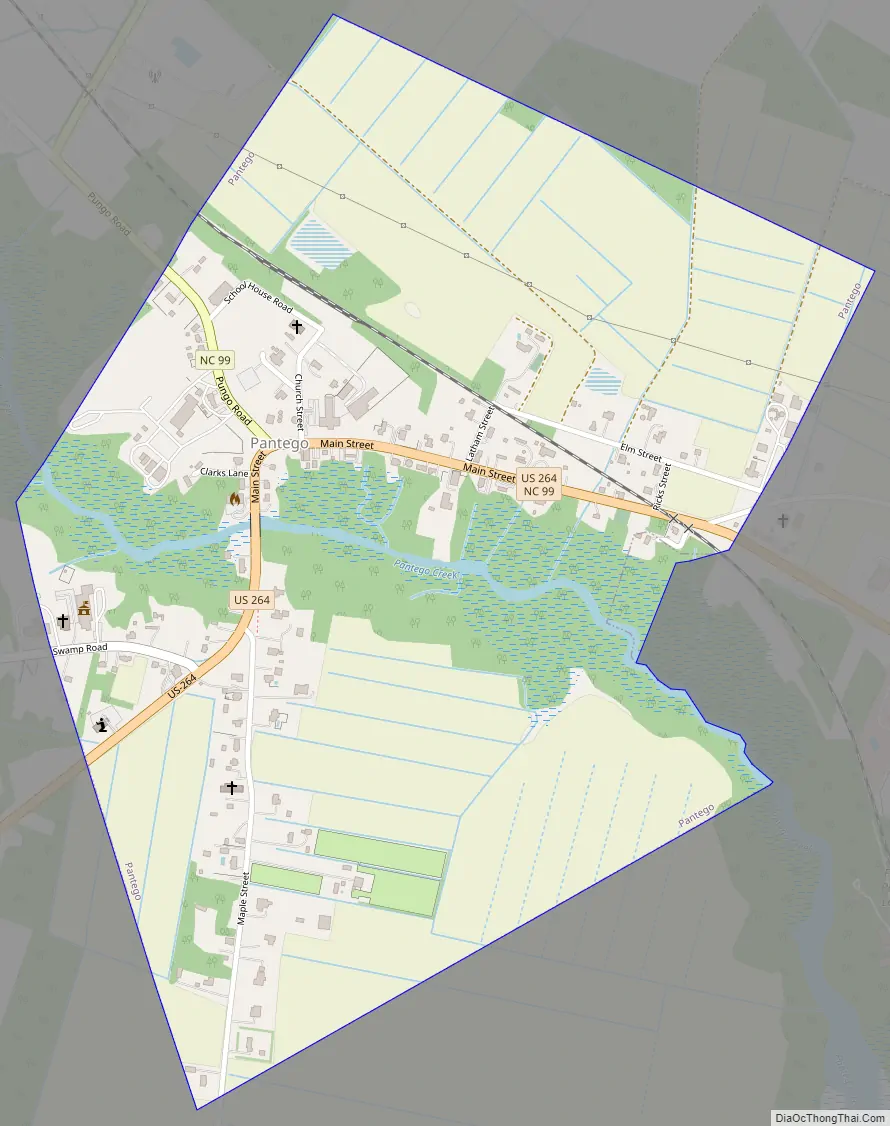
Pantego Road Map
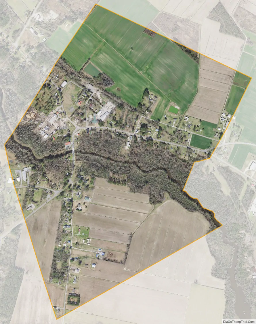
Pantego city Satellite Map
Geography
Pantego is located at 35°35′9″N 76°39′35″W / 35.58583°N 76.65972°W / 35.58583; -76.65972 (35.585917, -76.659755).
According to the United States Census Bureau, the town has a total area of 0.8 square miles (2.1 km), all land.
See also
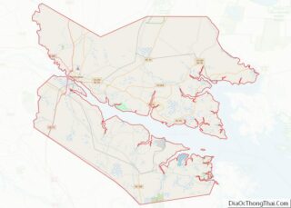
Map of North Carolina State and its subdivision:- Alamance
- Alexander
- Alleghany
- Anson
- Ashe
- Avery
- Beaufort
- Bertie
- Bladen
- Brunswick
- Buncombe
- Burke
- Cabarrus
- Caldwell
- Camden
- Carteret
- Caswell
- Catawba
- Chatham
- Cherokee
- Chowan
- Clay
- Cleveland
- Columbus
- Craven
- Cumberland
- Currituck
- Dare
- Davidson
- Davie
- Duplin
- Durham
- Edgecombe
- Forsyth
- Franklin
- Gaston
- Gates
- Graham
- Granville
- Greene
- Guilford
- Halifax
- Harnett
- Haywood
- Henderson
- Hertford
- Hoke
- Hyde
- Iredell
- Jackson
- Johnston
- Jones
- Lee
- Lenoir
- Lincoln
- Macon
- Madison
- Martin
- McDowell
- Mecklenburg
- Mitchell
- Montgomery
- Moore
- Nash
- New Hanover
- Northampton
- Onslow
- Orange
- Pamlico
- Pasquotank
- Pender
- Perquimans
- Person
- Pitt
- Polk
- Randolph
- Richmond
- Robeson
- Rockingham
- Rowan
- Rutherford
- Sampson
- Scotland
- Stanly
- Stokes
- Surry
- Swain
- Transylvania
- Tyrrell
- Union
- Vance
- Wake
- Warren
- Washington
- Watauga
- Wayne
- Wilkes
- Wilson
- Yadkin
- Yancey
- Alabama
- Alaska
- Arizona
- Arkansas
- California
- Colorado
- Connecticut
- Delaware
- District of Columbia
- Florida
- Georgia
- Hawaii
- Idaho
- Illinois
- Indiana
- Iowa
- Kansas
- Kentucky
- Louisiana
- Maine
- Maryland
- Massachusetts
- Michigan
- Minnesota
- Mississippi
- Missouri
- Montana
- Nebraska
- Nevada
- New Hampshire
- New Jersey
- New Mexico
- New York
- North Carolina
- North Dakota
- Ohio
- Oklahoma
- Oregon
- Pennsylvania
- Rhode Island
- South Carolina
- South Dakota
- Tennessee
- Texas
- Utah
- Vermont
- Virginia
- Washington
- West Virginia
- Wisconsin
- Wyoming