Ronda is a town in Wilkes County, North Carolina, United States. The population was 417 at the 2010 census, and 413 at the 2020 census. Ronda was named after a nearby estate called “Roundabout”, which was the residence of Benjamin Cleveland, a locally prominent planter and a colonel in the North Carolina militia during the Revolutionary War. The town is home to East Wilkes High School, one of Wilkes County’s five public high schools.
Claymont Hill was listed on the National Register of Historic Places in 1985.
Ronda was the home of NASCAR pioneer and Hall of Famer Junior Johnson.
| Name: | Ronda town |
|---|---|
| LSAD Code: | 43 |
| LSAD Description: | town (suffix) |
| State: | North Carolina |
| County: | Wilkes County |
| Elevation: | 958 ft (292 m) |
| Total Area: | 1.08 sq mi (2.81 km²) |
| Land Area: | 1.08 sq mi (2.81 km²) |
| Water Area: | 0.00 sq mi (0.00 km²) |
| Total Population: | 438 |
| Population Density: | 404.06/sq mi (156.00/km²) |
| ZIP code: | 28670 |
| Area code: | 336 |
| FIPS code: | 3757700 |
| GNISfeature ID: | 0993667 |
Online Interactive Map
Click on ![]() to view map in "full screen" mode.
to view map in "full screen" mode.
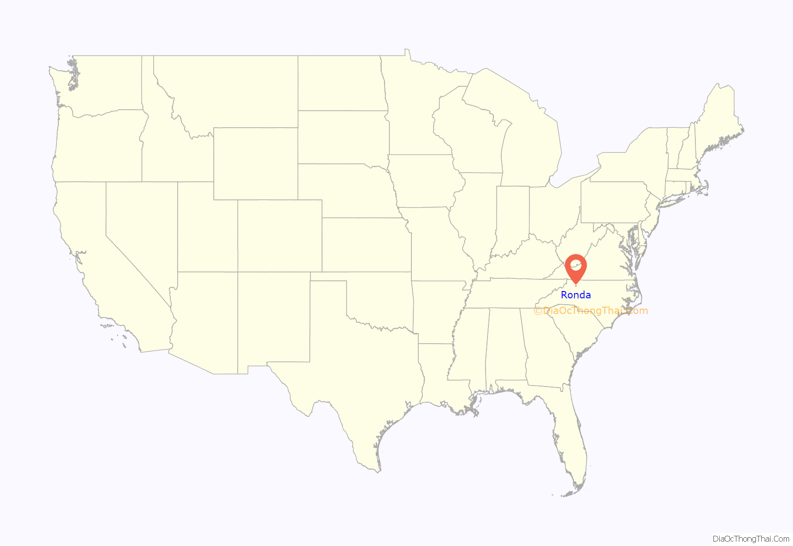
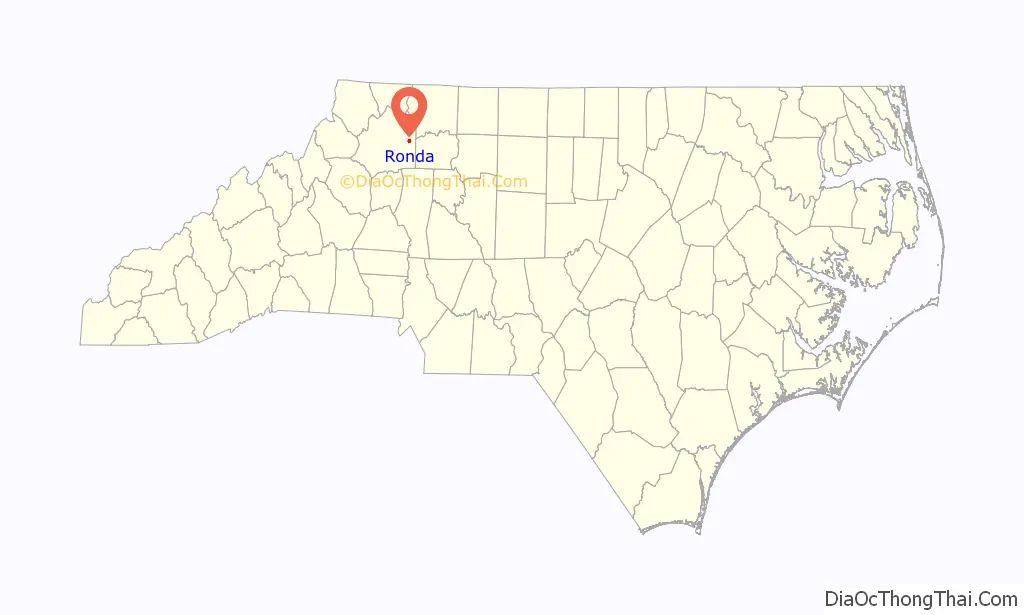
Ronda location map. Where is Ronda town?
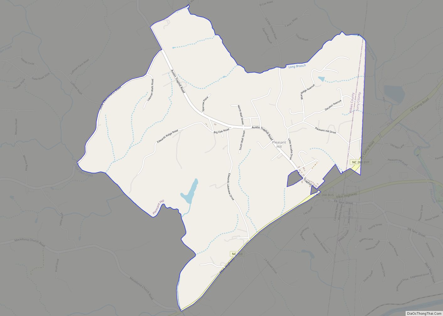
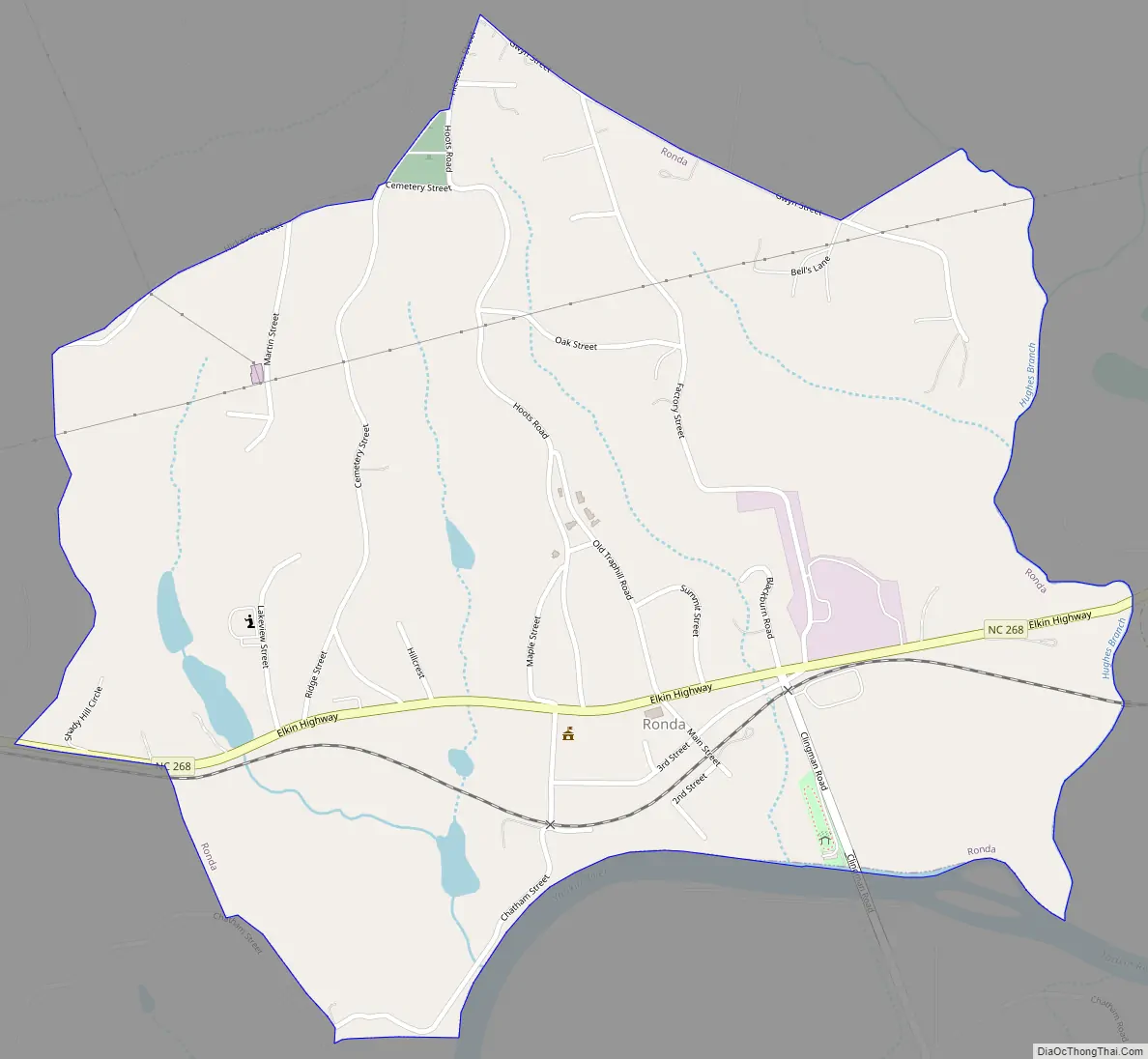
Ronda Road Map
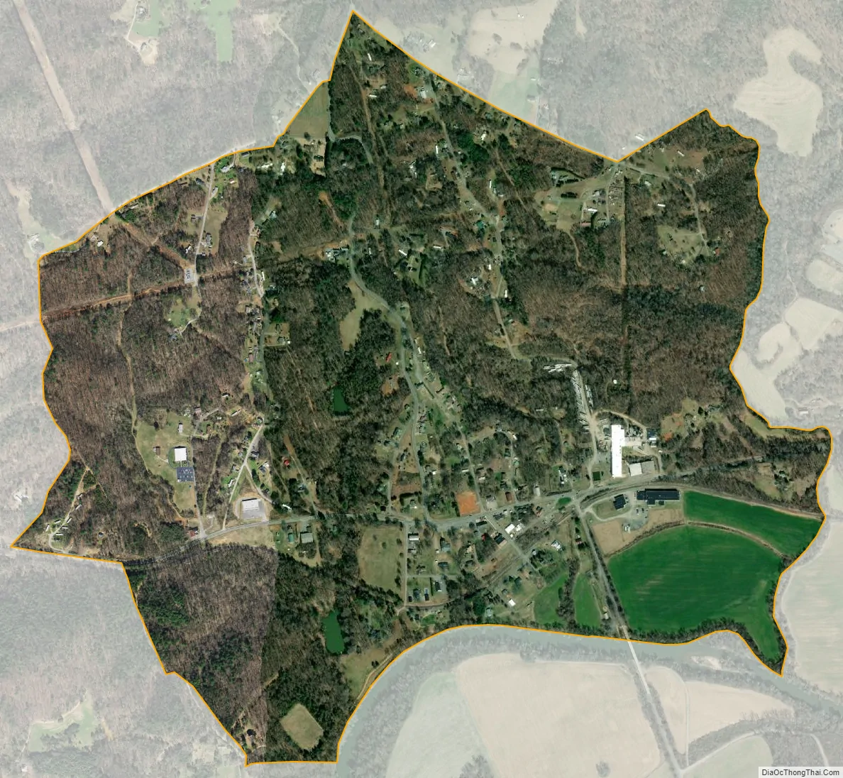
Ronda city Satellite Map
Geography
Ronda is located at 36°13′11″N 80°56′33″W / 36.21972°N 80.94250°W / 36.21972; -80.94250 (36.219746, -80.942490).
According to the United States Census Bureau, the town has a total area of 1.1 square miles (2.8 km), all land. Ronda is located on the north bank of the Yadkin River, Wilkes County’s largest river and one of the major rivers of North Carolina’s Piedmont region.
See also
Map of North Carolina State and its subdivision:- Alamance
- Alexander
- Alleghany
- Anson
- Ashe
- Avery
- Beaufort
- Bertie
- Bladen
- Brunswick
- Buncombe
- Burke
- Cabarrus
- Caldwell
- Camden
- Carteret
- Caswell
- Catawba
- Chatham
- Cherokee
- Chowan
- Clay
- Cleveland
- Columbus
- Craven
- Cumberland
- Currituck
- Dare
- Davidson
- Davie
- Duplin
- Durham
- Edgecombe
- Forsyth
- Franklin
- Gaston
- Gates
- Graham
- Granville
- Greene
- Guilford
- Halifax
- Harnett
- Haywood
- Henderson
- Hertford
- Hoke
- Hyde
- Iredell
- Jackson
- Johnston
- Jones
- Lee
- Lenoir
- Lincoln
- Macon
- Madison
- Martin
- McDowell
- Mecklenburg
- Mitchell
- Montgomery
- Moore
- Nash
- New Hanover
- Northampton
- Onslow
- Orange
- Pamlico
- Pasquotank
- Pender
- Perquimans
- Person
- Pitt
- Polk
- Randolph
- Richmond
- Robeson
- Rockingham
- Rowan
- Rutherford
- Sampson
- Scotland
- Stanly
- Stokes
- Surry
- Swain
- Transylvania
- Tyrrell
- Union
- Vance
- Wake
- Warren
- Washington
- Watauga
- Wayne
- Wilkes
- Wilson
- Yadkin
- Yancey
- Alabama
- Alaska
- Arizona
- Arkansas
- California
- Colorado
- Connecticut
- Delaware
- District of Columbia
- Florida
- Georgia
- Hawaii
- Idaho
- Illinois
- Indiana
- Iowa
- Kansas
- Kentucky
- Louisiana
- Maine
- Maryland
- Massachusetts
- Michigan
- Minnesota
- Mississippi
- Missouri
- Montana
- Nebraska
- Nevada
- New Hampshire
- New Jersey
- New Mexico
- New York
- North Carolina
- North Dakota
- Ohio
- Oklahoma
- Oregon
- Pennsylvania
- Rhode Island
- South Carolina
- South Dakota
- Tennessee
- Texas
- Utah
- Vermont
- Virginia
- Washington
- West Virginia
- Wisconsin
- Wyoming