Troy is a town in Montgomery County, North Carolina, United States. The population was 3,188 at the 2010 census. It is the county seat of Montgomery County. A short story by Charles W. Chesnutt, The Sheriff’s Children, is set in Troy.
| Name: | Troy town |
|---|---|
| LSAD Code: | 43 |
| LSAD Description: | town (suffix) |
| State: | North Carolina |
| County: | Montgomery County |
| Elevation: | 659 ft (201 m) |
| Total Area: | 3.70 sq mi (9.59 km²) |
| Land Area: | 3.66 sq mi (9.48 km²) |
| Water Area: | 0.04 sq mi (0.11 km²) |
| Total Population: | 2,850 |
| Population Density: | 778.69/sq mi (300.68/km²) |
| ZIP code: | 27371 |
| FIPS code: | 3768520 |
| GNISfeature ID: | 1024364 |
| Website: | troy.nc.us |
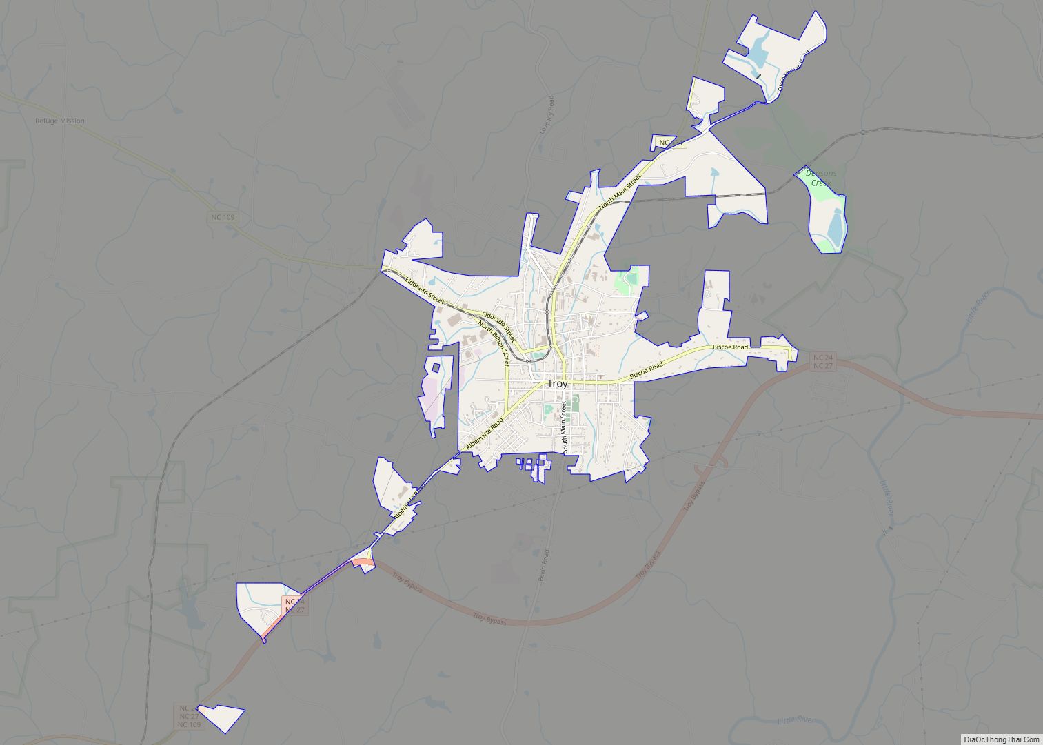
Online Interactive Map
Click on ![]() to view map in "full screen" mode.
to view map in "full screen" mode.
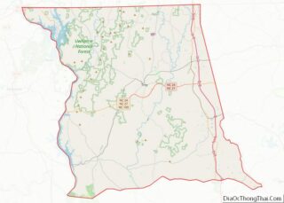
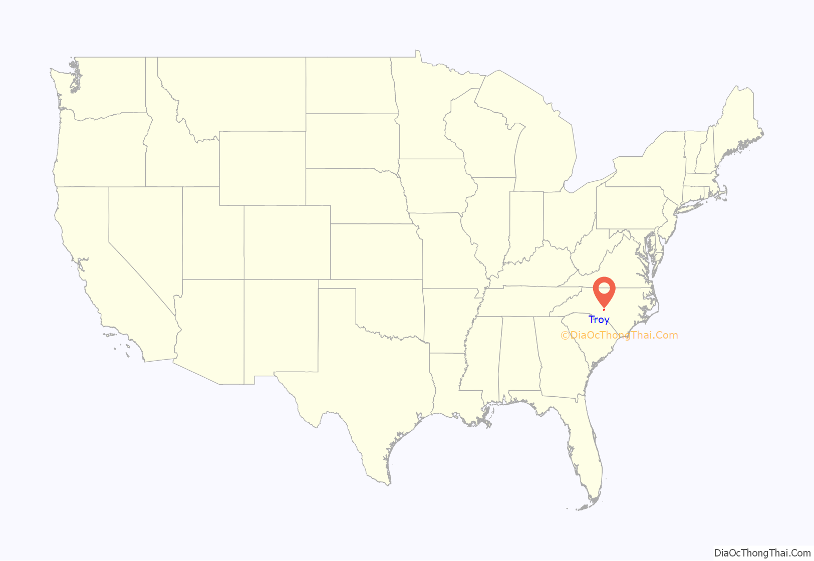
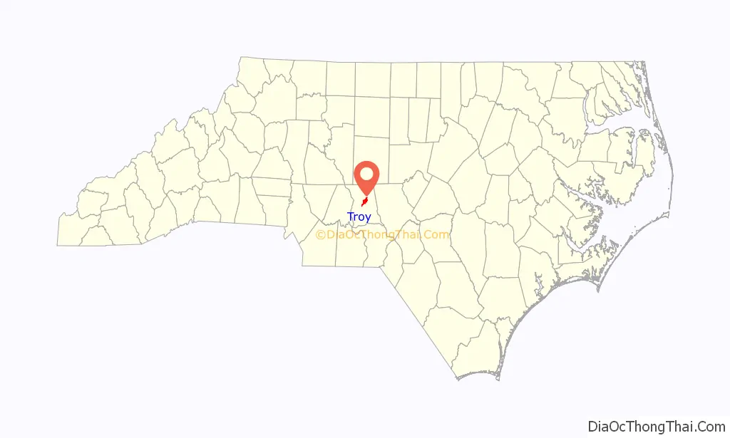
Troy location map. Where is Troy town?
History
Troy lies in an area once known for its vast longleaf pine forests; much of the town’s early development came from the harvesting of those trees for lumber and turpentine. Originally known as West Old Fields, the name was changed to Troy in 1843 when the county seat of Montgomery County was moved there from Old Lawrenceville. The town was incorporated in 1853.
The coming of the Asheboro and Aberdeen railroad as well as the gold mining industry surrounding the town accelerated growth in the late 19th century. By the 20th century textile mills and lumber mills were contributing heavily to Troy’s economy.
The Hotel Troy, Montgomery County Courthouse, and Troy Residential Historic District are listed on the National Register of Historic Places.
Troy Road Map
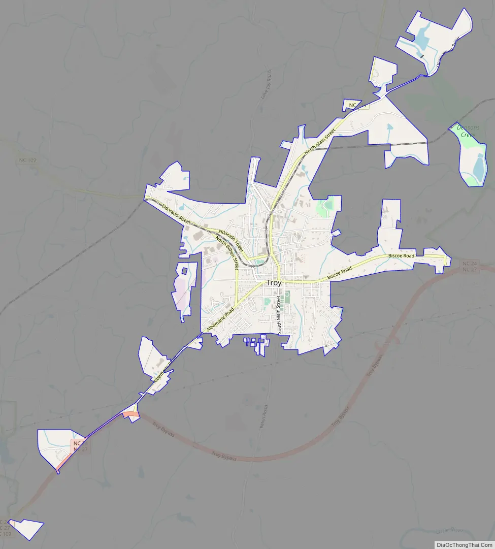
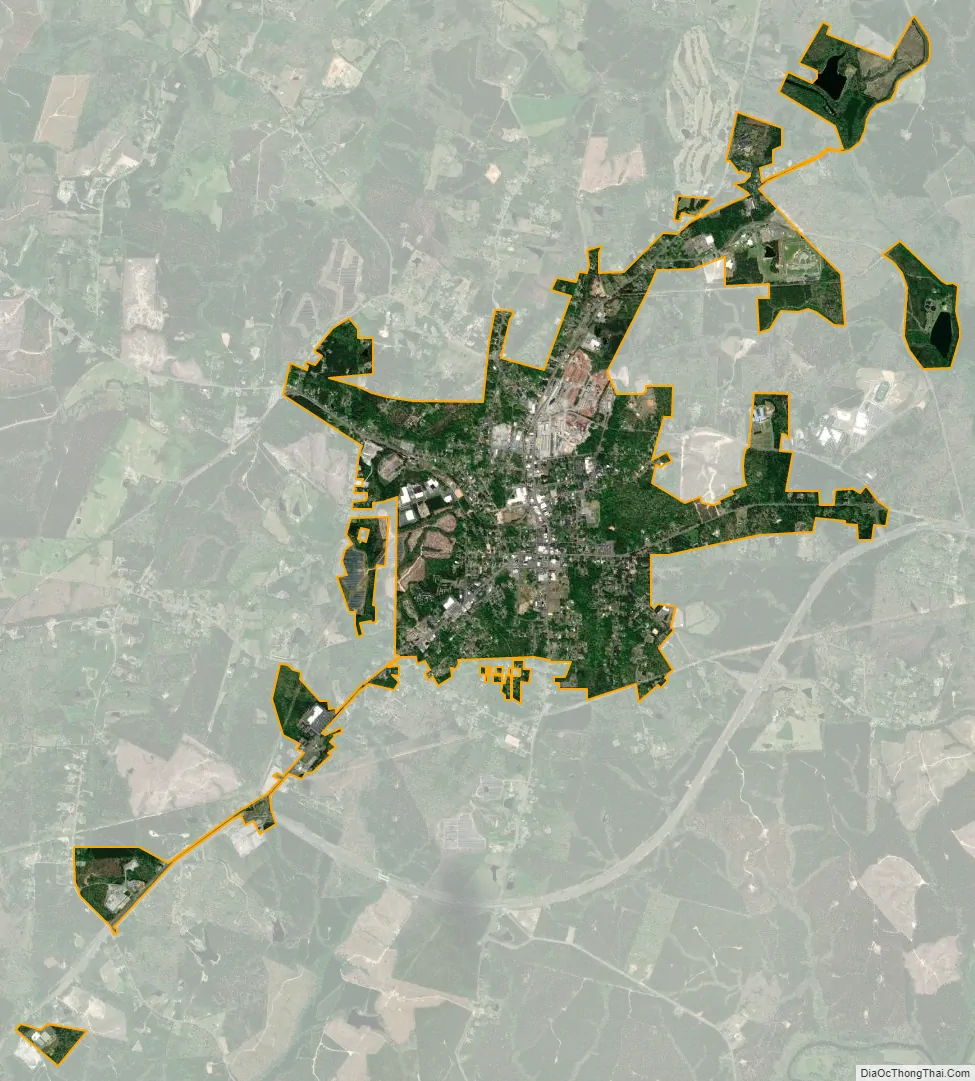
Troy city Satellite Map
Geography
Troy is located at 35°21′38″N 79°53′47″W / 35.36056°N 79.89639°W / 35.36056; -79.89639 (35.360420, -79.896412).
According to the United States Census Bureau, the town has a total area of 3.0 square miles (7.8 km), of which 3.0 square miles (7.8 km) is land and 0.34% is water.
Troy, along with most of Montgomery County, lies within the Uwharrie National Forest.
See also
Map of North Carolina State and its subdivision:- Alamance
- Alexander
- Alleghany
- Anson
- Ashe
- Avery
- Beaufort
- Bertie
- Bladen
- Brunswick
- Buncombe
- Burke
- Cabarrus
- Caldwell
- Camden
- Carteret
- Caswell
- Catawba
- Chatham
- Cherokee
- Chowan
- Clay
- Cleveland
- Columbus
- Craven
- Cumberland
- Currituck
- Dare
- Davidson
- Davie
- Duplin
- Durham
- Edgecombe
- Forsyth
- Franklin
- Gaston
- Gates
- Graham
- Granville
- Greene
- Guilford
- Halifax
- Harnett
- Haywood
- Henderson
- Hertford
- Hoke
- Hyde
- Iredell
- Jackson
- Johnston
- Jones
- Lee
- Lenoir
- Lincoln
- Macon
- Madison
- Martin
- McDowell
- Mecklenburg
- Mitchell
- Montgomery
- Moore
- Nash
- New Hanover
- Northampton
- Onslow
- Orange
- Pamlico
- Pasquotank
- Pender
- Perquimans
- Person
- Pitt
- Polk
- Randolph
- Richmond
- Robeson
- Rockingham
- Rowan
- Rutherford
- Sampson
- Scotland
- Stanly
- Stokes
- Surry
- Swain
- Transylvania
- Tyrrell
- Union
- Vance
- Wake
- Warren
- Washington
- Watauga
- Wayne
- Wilkes
- Wilson
- Yadkin
- Yancey
- Alabama
- Alaska
- Arizona
- Arkansas
- California
- Colorado
- Connecticut
- Delaware
- District of Columbia
- Florida
- Georgia
- Hawaii
- Idaho
- Illinois
- Indiana
- Iowa
- Kansas
- Kentucky
- Louisiana
- Maine
- Maryland
- Massachusetts
- Michigan
- Minnesota
- Mississippi
- Missouri
- Montana
- Nebraska
- Nevada
- New Hampshire
- New Jersey
- New Mexico
- New York
- North Carolina
- North Dakota
- Ohio
- Oklahoma
- Oregon
- Pennsylvania
- Rhode Island
- South Carolina
- South Dakota
- Tennessee
- Texas
- Utah
- Vermont
- Virginia
- Washington
- West Virginia
- Wisconsin
- Wyoming