Star is a town in Montgomery County, North Carolina, United States. The population was 876 at the 2010 census.
| Name: | Star town |
|---|---|
| LSAD Code: | 43 |
| LSAD Description: | town (suffix) |
| State: | North Carolina |
| County: | Montgomery County |
| Elevation: | 643 ft (196 m) |
| Total Area: | 1.29 sq mi (3.35 km²) |
| Land Area: | 1.29 sq mi (3.35 km²) |
| Water Area: | 0.00 sq mi (0.00 km²) |
| Total Population: | 806 |
| Population Density: | 623.84/sq mi (240.82/km²) |
| ZIP code: | 27356 |
| FIPS code: | 3764580 |
| GNISfeature ID: | 1015791 |
Online Interactive Map
Click on ![]() to view map in "full screen" mode.
to view map in "full screen" mode.
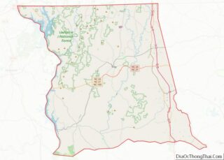
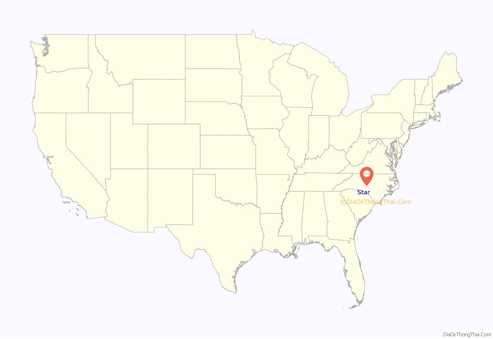
Star location map. Where is Star town?

History
The town of Star was incorporated in 1897. It was originally called Hunsucker’s Store, after a trading post operated by the original landowner, Mr. Martin Hunsucker. After the Civil War, a man named Angus Leach moved to Hunsucker’s Store and helped to found the present Town of Star, serving as postmaster, hotel operator, and general merchandise store owner. Gold was discovered in the area around 1866, and by 1874 there were extensive gold mining operations in this part of the state, particularly around the Little River area of Star. When the Aberdeen and West End Railroad (owned by the Page family of Aberdeen, NC), completed a branch to Star from Filo, NC (Biscoe, North Carolina) in 1895, it was only a short period later before Star was incorporated into a town.
Star was a major shipping point for lumber, turpentine, and bricks beginning in 1896 with the completion of the Asheboro and Montgomery Railroad, also built by the Page family. In 1896, the Leach Family erected a large wooden hotel to accommodate the travelers and workers of the railroad, and the hotel (The Star Hotel Bed and Breakfast) is still standing today and is owned by Gary Spivey. In 1897, the Aberdeen and West End Railroad merged with the Asheboro and Montgomery Railroad to form the Aberdeen and Asheboro Railroad, thus opening the area to a whole new range of shipping. The timber industry was the first major factor in the growth of Star. The Star Lumber Company, headed by Z.T. Wright, J.B. Shamburger, and W.T. Harper, had built a tramway in 1896 to haul logs to the mills in town. The tramway was removed in 1901 when the Durham and Charlotte Railroad was built to Star. The Durham and Charlotte Railroad was to connect the two cities of Durham and Charlotte. Because The town of Star was the junction and crossroads for the Aberdeen & Asheboro Railroad and the Durham & Charlotte Railroad, business in the town began to pick up.
Sometime around 1900, a bottling plant was established in Star by J.R. Ingrahm to bottle sodas for the area. This company preceded the Coca-Cola Plant in Star, which was later moved to Biscoe, North Carolina. Also in 1900, the Montgomery Roller Mill was incorporated with a capital stock of $4700 by Braxton Auman, who also operated a whiskey distillery and chair factory. In 1907, Star’s first undertaker, Mr. H.D. Phillips, established a funeral parlor. This was the beginning of a long and successful business for the Phillips family who still operate the Phillips Funeral Home today. Interesting to note was the organization of a “Carolina Collegiate and Agricultural Institute” around 1910 in Star by Dr. Edward F. Green that cooperated with the North Carolina A & M College in Raleigh. The town saw massive growth between the years of 1912 and 1950 when the Norfolk Southern Railway (former) purchased the old lines of the Aberdeen and Asheboro Railroad and the Durham and Charlotte Railroad. The operation held a depot, water tank, and coal chute in Star. This new era saw the introduction of the hosiery mill industry, a boom in lumber production, various new stores and products, and a huge surge in population. In 1914–1915, Boy Scout Troop 111 was established in Star, one of the earliest in North Carolina. Since that point, the town continued to slowly grow into a prosperous community. In the 1960s the town undertook the task of erecting some of the first public housing units in the state. On March 14, 1969, Lancer Inc., one of the nation’s Top 50 upholstered furniture manufacturers, started its operations in Star and continues to be one of Star’s largest employers, having expanded its operations six times. Since then, the hosiery mills experienced a decline and eventually left Star. This left hundreds unemployed and the once prosperous town of Star began to wither away. The buildings that once employed many now mostly sit empty. In September 2013, downtown Star was honored by being listed on the National Register of Historic Places as the Star Historic District.
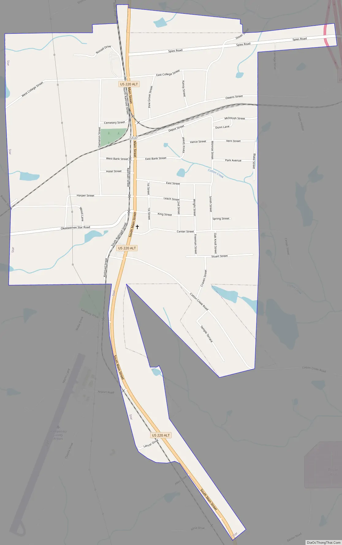
Star Road Map
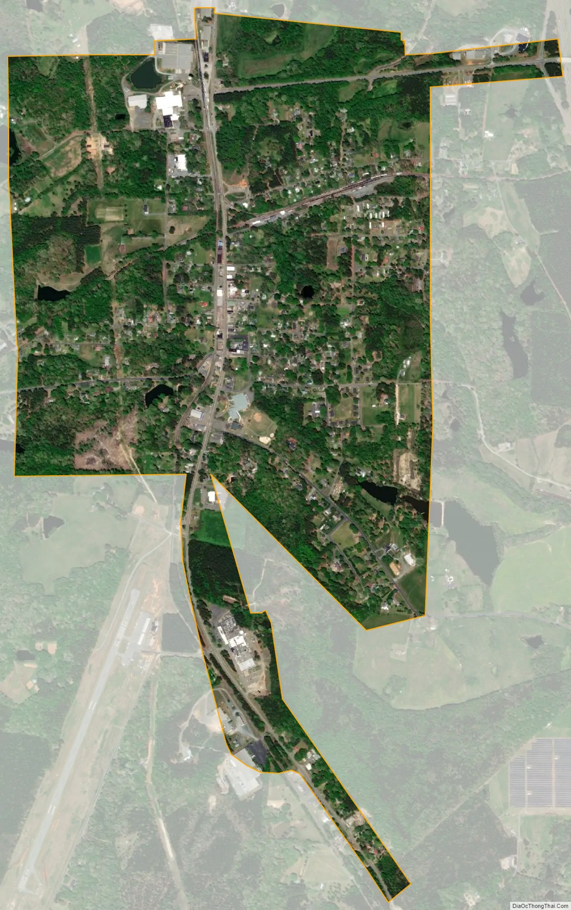
Star city Satellite Map
Geography
Star is known as the geographic center of North Carolina as measured via satellite, according to the Army Corps of Engineers. A plaque marking the exact center was placed at 35°23′59″N 79°46′00″W / 35.399756°N 79.766613°W / 35.399756; -79.766613Coordinates: 35°23′59″N 79°46′00″W / 35.399756°N 79.766613°W / 35.399756; -79.766613 (35.399756, -79.766613). The plaque is on private land and not open to visitors. According to the United States Census Bureau, the town has a total area of 1.2 square miles (3.1 km), all land.
See also
Map of North Carolina State and its subdivision:- Alamance
- Alexander
- Alleghany
- Anson
- Ashe
- Avery
- Beaufort
- Bertie
- Bladen
- Brunswick
- Buncombe
- Burke
- Cabarrus
- Caldwell
- Camden
- Carteret
- Caswell
- Catawba
- Chatham
- Cherokee
- Chowan
- Clay
- Cleveland
- Columbus
- Craven
- Cumberland
- Currituck
- Dare
- Davidson
- Davie
- Duplin
- Durham
- Edgecombe
- Forsyth
- Franklin
- Gaston
- Gates
- Graham
- Granville
- Greene
- Guilford
- Halifax
- Harnett
- Haywood
- Henderson
- Hertford
- Hoke
- Hyde
- Iredell
- Jackson
- Johnston
- Jones
- Lee
- Lenoir
- Lincoln
- Macon
- Madison
- Martin
- McDowell
- Mecklenburg
- Mitchell
- Montgomery
- Moore
- Nash
- New Hanover
- Northampton
- Onslow
- Orange
- Pamlico
- Pasquotank
- Pender
- Perquimans
- Person
- Pitt
- Polk
- Randolph
- Richmond
- Robeson
- Rockingham
- Rowan
- Rutherford
- Sampson
- Scotland
- Stanly
- Stokes
- Surry
- Swain
- Transylvania
- Tyrrell
- Union
- Vance
- Wake
- Warren
- Washington
- Watauga
- Wayne
- Wilkes
- Wilson
- Yadkin
- Yancey
- Alabama
- Alaska
- Arizona
- Arkansas
- California
- Colorado
- Connecticut
- Delaware
- District of Columbia
- Florida
- Georgia
- Hawaii
- Idaho
- Illinois
- Indiana
- Iowa
- Kansas
- Kentucky
- Louisiana
- Maine
- Maryland
- Massachusetts
- Michigan
- Minnesota
- Mississippi
- Missouri
- Montana
- Nebraska
- Nevada
- New Hampshire
- New Jersey
- New Mexico
- New York
- North Carolina
- North Dakota
- Ohio
- Oklahoma
- Oregon
- Pennsylvania
- Rhode Island
- South Carolina
- South Dakota
- Tennessee
- Texas
- Utah
- Vermont
- Virginia
- Washington
- West Virginia
- Wisconsin
- Wyoming