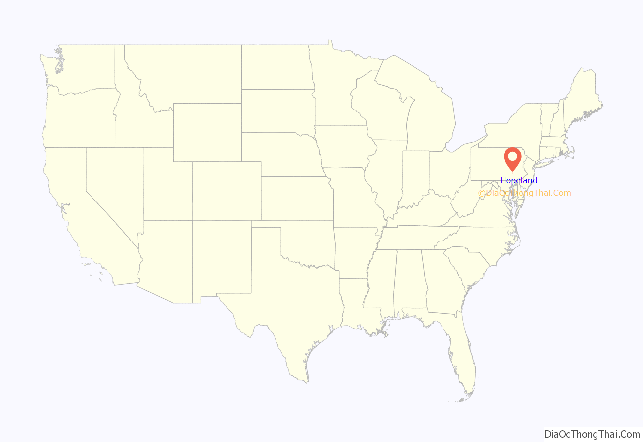
Hopeland is a small unincorporated hamlet and census-designated place (CDP) in Lancaster County in the south of the U.S. state of Pennsylvania. The hamlet’s ZIP code is 17533. As of the 2010 census the population was 738.
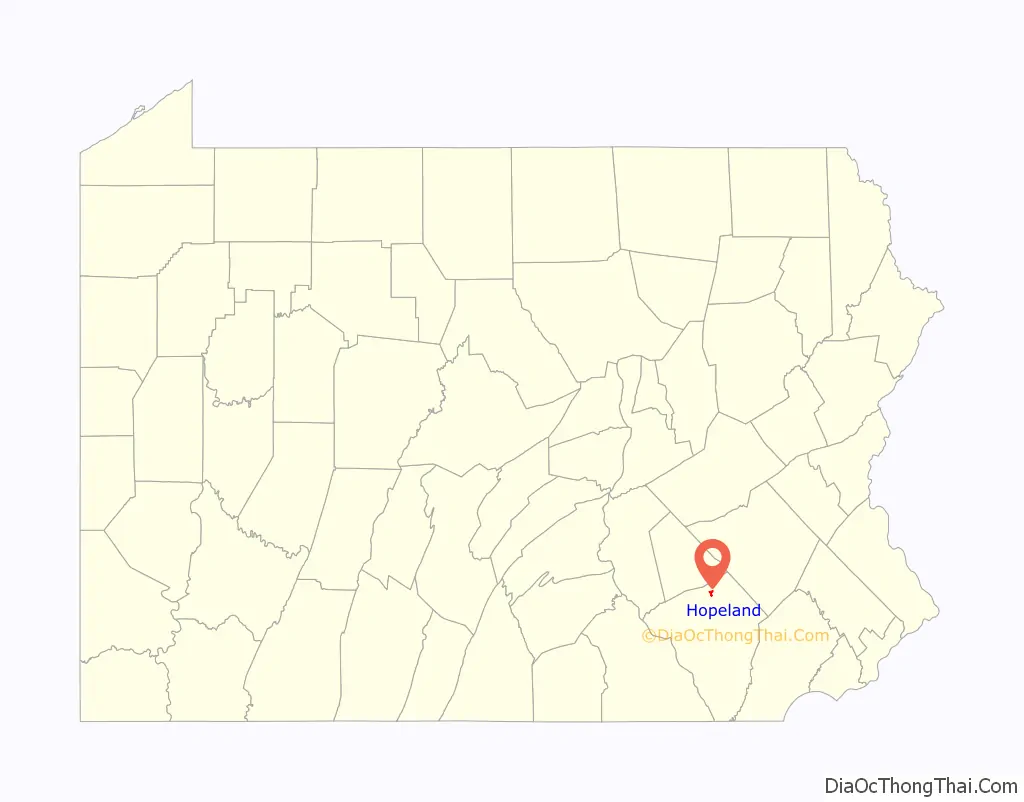
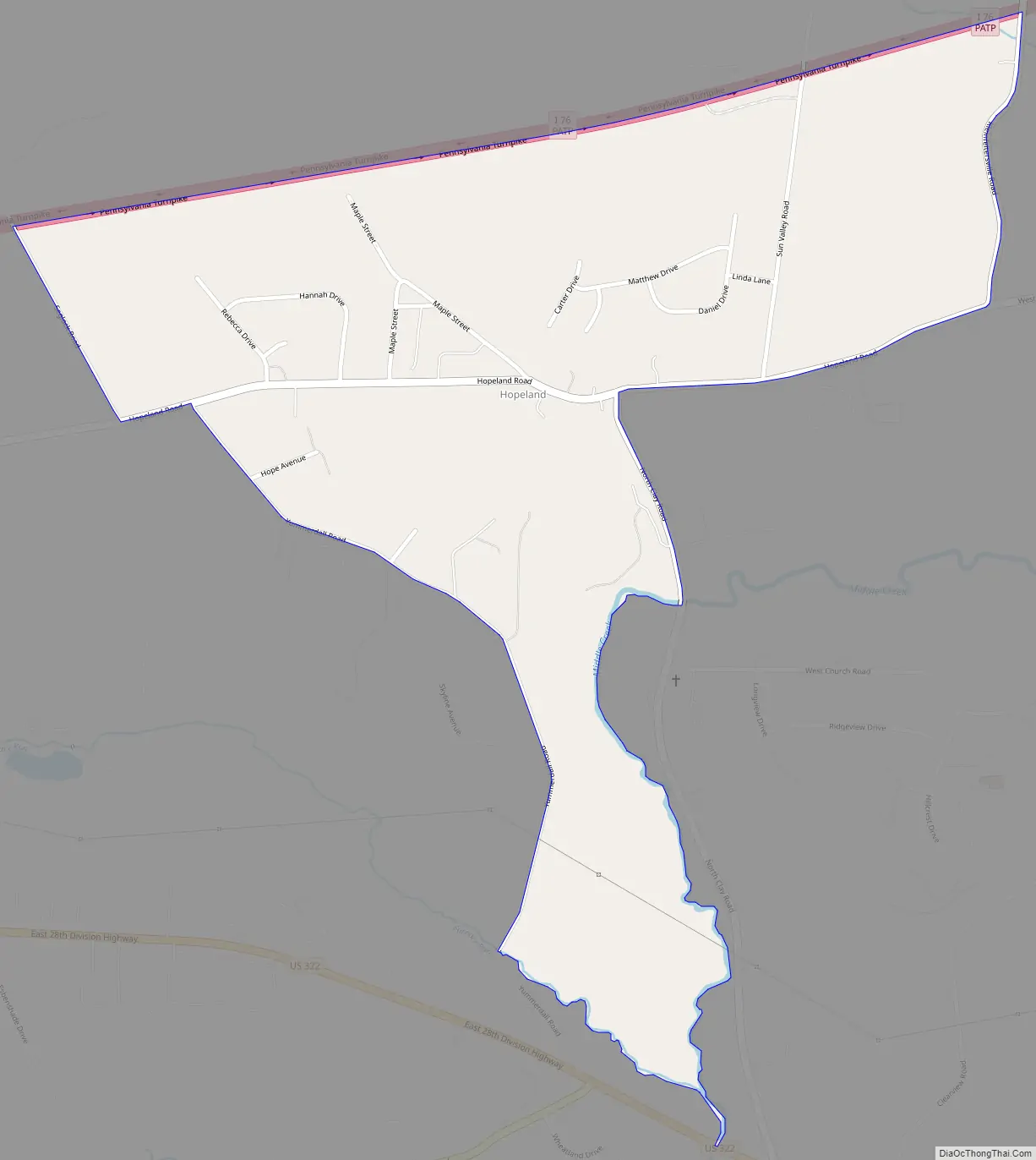
The community is in northern Lancaster County, in western Clay Township. A small portion extends south into Elizabeth Township. It is bordered to the southwest by Brickerville and to the southeast by Clay, both unincorporated. U.S. Route 322 (28th Division Highway) passes through the south end of the community, leading northwest 12 miles (19 km) to Quentin and southeast 5 miles (8 km) to Ephrata. Lititz is 7 miles (11 km) to the southwest. Interstate 76, the Pennsylvania Turnpike, forms the northern edge of Hopeland, with the closest access being Exit 266 to the west or Exit 286 to the east, both 11 miles (18 km) away.
| Name: | Hopeland CDP |
|---|---|
| LSAD Code: | 57 |
| LSAD Description: | CDP (suffix) |
| State: | Pennsylvania |
| County: | Lancaster County |
| Elevation: | 400 ft (100 m) |
| Total Area: | 0.67 sq mi (1.73 km²) |
| Land Area: | 0.66 sq mi (1.71 km²) |
| Water Area: | 0.01 sq mi (0.03 km²) |
| Total Population: | 641 |
| Population Density: | 971.21/sq mi (375.25/km²) |
| ZIP code: | 17533 |
| FIPS code: | 4235632 |
| GNISfeature ID: | 1177388 |
Online Interactive Map
Click on ![]() to view map in "full screen" mode.
to view map in "full screen" mode.
Hopeland location map. Where is Hopeland CDP?
Hopeland Road Map
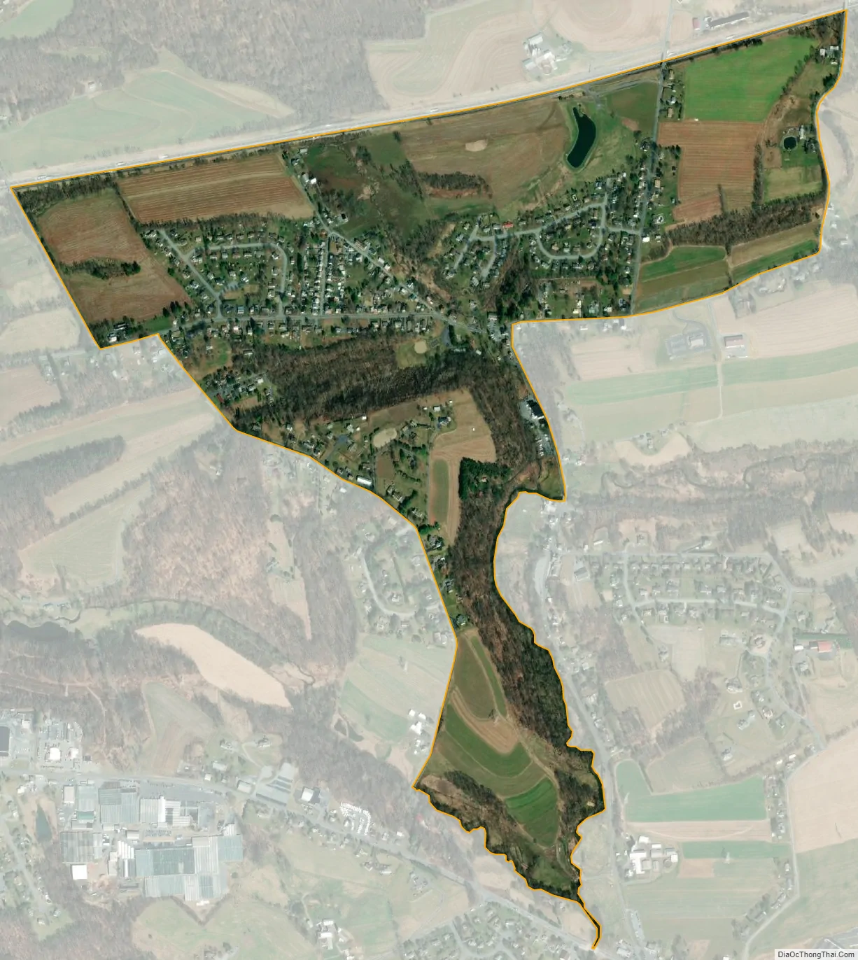
Hopeland city Satellite Map
Geography
According to the U.S. Census Bureau, the Hopeland CDP has a total area of 0.67 square miles (1.74 km), of which 0.01 square miles (0.03 km), or 1.56%, are water. The community is drained by Middle Creek and its tributary Furnace Run, flowing south to Cocalico Creek and part of the Conestoga River watershed leading to the Susquehanna River.
See also
Map of Pennsylvania State and its subdivision:- Adams
- Allegheny
- Armstrong
- Beaver
- Bedford
- Berks
- Blair
- Bradford
- Bucks
- Butler
- Cambria
- Cameron
- Carbon
- Centre
- Chester
- Clarion
- Clearfield
- Clinton
- Columbia
- Crawford
- Cumberland
- Dauphin
- Delaware
- Elk
- Erie
- Fayette
- Forest
- Franklin
- Fulton
- Greene
- Huntingdon
- Indiana
- Jefferson
- Juniata
- Lackawanna
- Lancaster
- Lawrence
- Lebanon
- Lehigh
- Luzerne
- Lycoming
- Mc Kean
- Mercer
- Mifflin
- Monroe
- Montgomery
- Montour
- Northampton
- Northumberland
- Perry
- Philadelphia
- Pike
- Potter
- Schuylkill
- Snyder
- Somerset
- Sullivan
- Susquehanna
- Tioga
- Union
- Venango
- Warren
- Washington
- Wayne
- Westmoreland
- Wyoming
- York
- Alabama
- Alaska
- Arizona
- Arkansas
- California
- Colorado
- Connecticut
- Delaware
- District of Columbia
- Florida
- Georgia
- Hawaii
- Idaho
- Illinois
- Indiana
- Iowa
- Kansas
- Kentucky
- Louisiana
- Maine
- Maryland
- Massachusetts
- Michigan
- Minnesota
- Mississippi
- Missouri
- Montana
- Nebraska
- Nevada
- New Hampshire
- New Jersey
- New Mexico
- New York
- North Carolina
- North Dakota
- Ohio
- Oklahoma
- Oregon
- Pennsylvania
- Rhode Island
- South Carolina
- South Dakota
- Tennessee
- Texas
- Utah
- Vermont
- Virginia
- Washington
- West Virginia
- Wisconsin
- Wyoming


