Nazareth is a borough in Northampton County, Pennsylvania, United States. The borough’s population was 6,053 at the 2020 census. Nazareth is part of the Lehigh Valley metropolitan area, which had a population of 861,899 and was the 68th-most populous metropolitan area in the U.S. as of 2020.
| Name: | Nazareth borough |
|---|---|
| LSAD Code: | 21 |
| LSAD Description: | borough (suffix) |
| State: | Pennsylvania |
| County: | Northampton County |
| Founded: | 1740 |
| Elevation: | 492 ft (150 m) |
| Land Area: | 1.58 sq mi (4.11 km²) |
| Water Area: | 0.08 sq mi (0.22 km²) |
| Population Density: | 3,818.93/sq mi (1,474.26/km²) |
| ZIP code: | 18064 |
| FIPS code: | 4252808 |
| Website: | www.nazarethboroughpa.com |
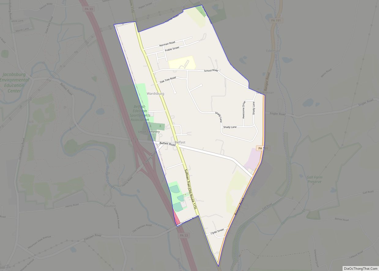
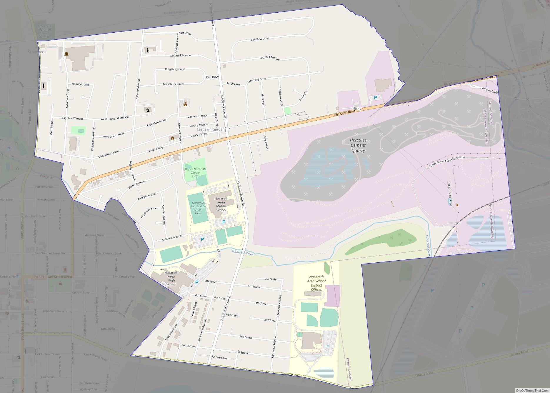
Online Interactive Map
Click on ![]() to view map in "full screen" mode.
to view map in "full screen" mode.
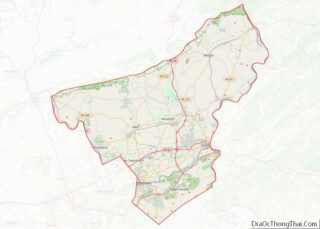
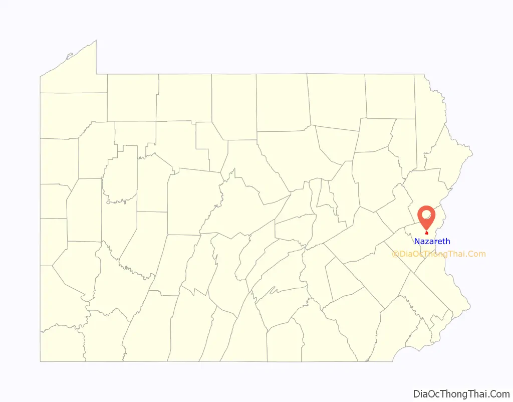
Nazareth location map. Where is Nazareth borough?

History
Etymology
The borough is named for the Biblical town of Nazareth in Israel, where Jesus spent his youth. The names of a number of other places in the Lehigh Valley area of Pennsylvania are similarly inspired, including Bethlehem, Emmaus, Egypt, and Allentown‘s Jordan Creek.
18th and 19th centuries
Nazareth was founded in 1740 by Moravian immigrants from Germany. The property was purchased from George Whitefield after the construction of the Whitefield House. Initially, Nazareth was specifically Moravian by charter. Outside faiths were not allowed to purchase property within Nazareth, a German Protestant community. It was one of the four leading Moravian communities in the Northeastern United States (Bethlehem, Emmaus, and Lititz, each in Pennsylvania, were the three others).
In 1735, a small group of the Moravian missionaries had begun work in the newly settled community of Savannah, Georgia. Their intent was to evangelize the Native American tribes and minister to the settlers. Governor James Oglethorpe, founder of Georgia, and John Wesley and Charles Wesley, founders of the Methodist Church and deeply interested in Moravian ideals, came along on the same boat. The Brethren settled along the Savannah River in Georgia. Like the Quakers, the Brethren refused to take part in the war with the Spanish and, as a result, they were evicted from Georgia in 1739.
George Whitefield, a widely known itinerant preacher who had served for a time as chaplain of Savannah, brought the group of evicted Georgia Brethren north to Philadelphia in his sloop. Whitefield had grandiose plans, and one of them was for a school for Negro children to be established on his tract of 5,000 acres (20 km) called the Barony of Nazareth. He invited the Brethren who accompanied him to Philadelphia to settle at this location for the time being and hired them to build his school. By the end of June, 1739, the first log dwelling was erected. The workers struggled, the weather proved difficult, and winter soon arrived. They quickly erected a second log house. After its completion, word came that Whitefield had returned to Pennsylvania, bristling and angered by theological disputes with certain Moravians, particularly on the issue of predestination. He evicted the Moravian Brethren.
While evicted from the Barony, Moravian leaders in England were negotiating to buy the entire Barony. When Whitefield’s business manager suddenly died, Whitefield discovered that his finances, shaky on more than one occasion, would not allow him to proceed with his Nazareth plan. He was forced to sell the whole tract. On July 16, 1741, it officially became Moravian property.
Nazareth was originally planned as a central English-speaking church village. But in October 1742, its 18 English inhabitants departed for Philadelphia. Meanwhile, the Nazareth tract was largely in the hand of Captain John, a Lenape chieftain who (along with his followers) refused to leave, even though they no longer owned the land. In December 1742, Count Zinzendorf, a Moravian benefactor, made a settlement with Captain John, and whose tribe moved back into the hinterland. During 1743, the still unfinished Whitefield House was put in readiness for 32 young married couples who were to arrive from Europe. On the second day of the new year, 1744, the couples went overland to Nazareth to settle in the nearly completed Whitefield House. The Whitefield House and adjacent Gray Cottage now belong to the Moravian Historical Society.
The result was that Nazareth began to increase in population. Enough visitors were attracted to the town that the Rose Inn was built in 1752 on an additional tract to the north. Finally, in 1754, Nazareth Hall was built in hopes that Count Zinzendorf would return from Europe and settle in Nazareth permanently, but he never returned to the Americas. However, in 1759 Nazareth Hall became the central boarding school for sons of Moravian parents. It later attained wide fame as a “classical academy.” This eventually led to the founding, in 1807, of Moravian College and Theological Seminary, now located in Bethlehem. The Nazareth Hall Tract was added to the National Register of Historic Places in 1980.
20th and 21st centuries
Up until the mid-1900s, a large part of Nazareth’s population was of German origin, better known as the Pennsylvania Dutch. “Dutch” is a corruption of the word “Deutsch”, which is German for “German.” The Pennsylvania Dutch were spread throughout many counties of southern and central Pennsylvania. Many Pennsylvania Dutch also came from Switzerland and the Alsace region of France, in addition to the modern nation of Germany,
Nazareth’s residents’ religion reflected a largely German background in evangelical churches of fairly large sizes for such a small town, divided among the Moravian, Lutheran, Reformed (now part of the United Church of Christ), and Roman Catholic worship centers of the town. The town also hosted a fairly sizable Italian and Polish population, which largely attended Holy Family Catholic Church, in the area.
During a great immigration to the eastern Pennsylvania counties of the late 1900s from New Jersey and New York, the population expanded significantly. Developers from the New Jersey area were responding to tighter controls and regulations on new construction in the state of New Jersey by moving their enterprises to Pennsylvania.
This new expansion and housing boom was enabled by the local completion of the interstate system of highways, first begun by former U.S. President Dwight Eisenhower in the 1950s. In the Nazareth area, this was caused by the completion of the nearby Pennsylvania Route 33, which ran north and south, thereby connecting Interstate 78, U.S. Route 22, and Interstate 80, all of which ran east–west, and the completion of the Interstate 78 southern Lehigh Valley corridor high speed interstate, which connected the Lehigh Valley to New Jersey and New York City to the east and Harrisburg and Pittsburgh to the west.
The Nazareth Historic District was added to the National Register of Historic Places in 1988.
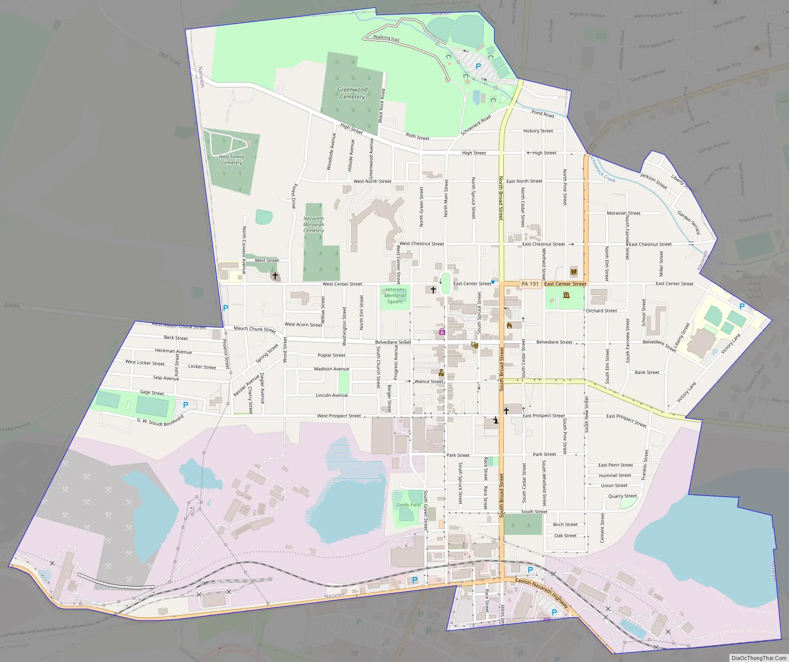
Nazareth Road Map
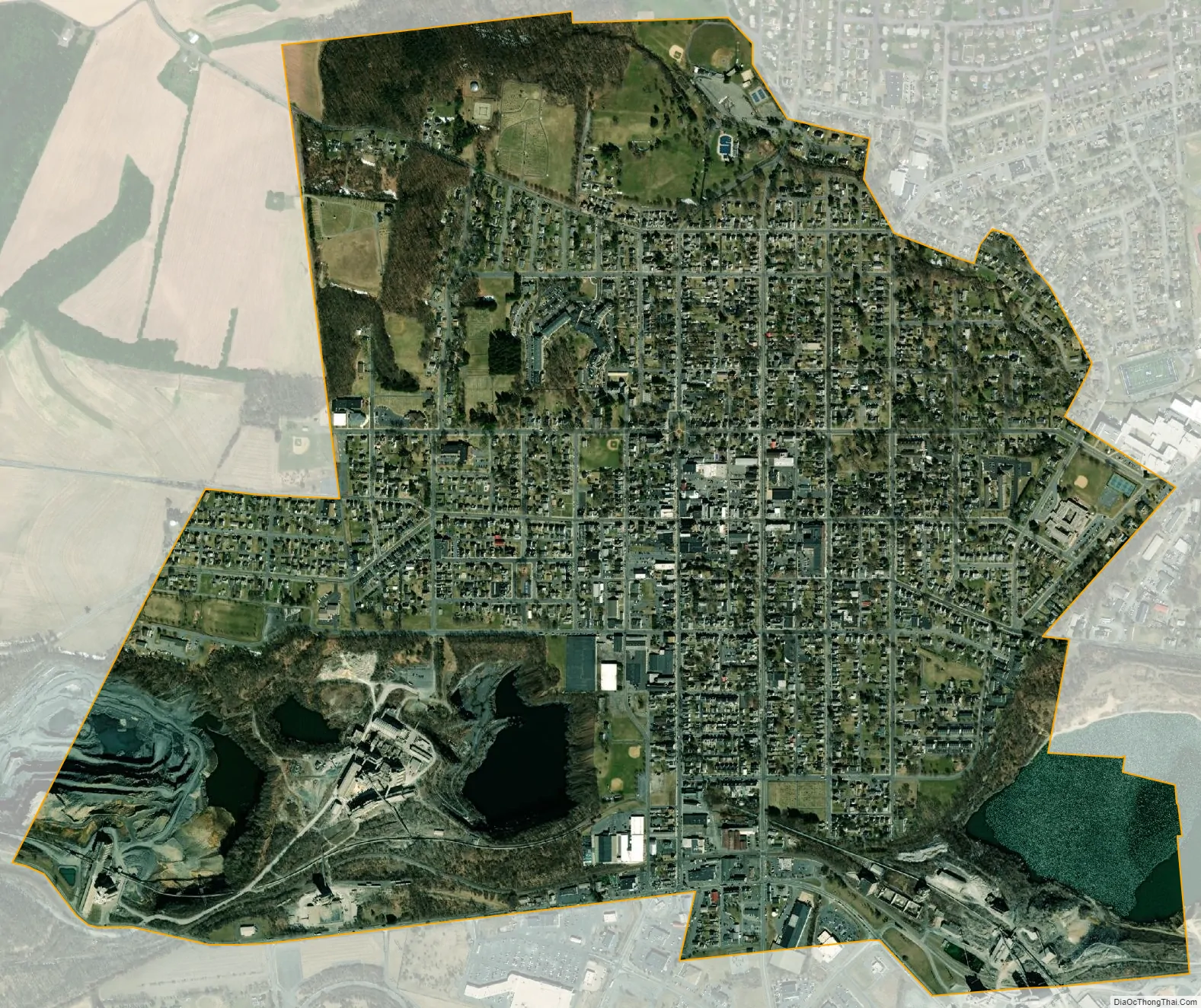
Nazareth city Satellite Map
Geography
Nazareth is located at 40°44′24″N 75°18′40″W / 40.74000°N 75.31111°W / 40.74000; -75.31111 (40.739993, -75.311214). According to the U.S. Census Bureau, the borough has a total area of 1.7 square miles (4.4 km), all land.
Nazareth’s climate is similar to the rest of the Lehigh Valley with four distinct seasons, humid summers, cold winters, and very short and mild springs and falls. This climate is hot-summer humid continental (Dfa) and average monthly temperatures range from 28.1 °F (−2.2 °C) in January to 73.4 °F (23.0 °C) in July. The hardiness zone is 6b. Nazareth’s topography can best be described as hilly, as the town itself sits atop a local outcropping underground of one of the richest veins of limestone in the U.S. Much of the farmland surrounding Nazareth is being converted into close sitting lots of suburban housing, for predominantly commuter households.
See also
Map of Pennsylvania State and its subdivision:- Adams
- Allegheny
- Armstrong
- Beaver
- Bedford
- Berks
- Blair
- Bradford
- Bucks
- Butler
- Cambria
- Cameron
- Carbon
- Centre
- Chester
- Clarion
- Clearfield
- Clinton
- Columbia
- Crawford
- Cumberland
- Dauphin
- Delaware
- Elk
- Erie
- Fayette
- Forest
- Franklin
- Fulton
- Greene
- Huntingdon
- Indiana
- Jefferson
- Juniata
- Lackawanna
- Lancaster
- Lawrence
- Lebanon
- Lehigh
- Luzerne
- Lycoming
- Mc Kean
- Mercer
- Mifflin
- Monroe
- Montgomery
- Montour
- Northampton
- Northumberland
- Perry
- Philadelphia
- Pike
- Potter
- Schuylkill
- Snyder
- Somerset
- Sullivan
- Susquehanna
- Tioga
- Union
- Venango
- Warren
- Washington
- Wayne
- Westmoreland
- Wyoming
- York
- Alabama
- Alaska
- Arizona
- Arkansas
- California
- Colorado
- Connecticut
- Delaware
- District of Columbia
- Florida
- Georgia
- Hawaii
- Idaho
- Illinois
- Indiana
- Iowa
- Kansas
- Kentucky
- Louisiana
- Maine
- Maryland
- Massachusetts
- Michigan
- Minnesota
- Mississippi
- Missouri
- Montana
- Nebraska
- Nevada
- New Hampshire
- New Jersey
- New Mexico
- New York
- North Carolina
- North Dakota
- Ohio
- Oklahoma
- Oregon
- Pennsylvania
- Rhode Island
- South Carolina
- South Dakota
- Tennessee
- Texas
- Utah
- Vermont
- Virginia
- Washington
- West Virginia
- Wisconsin
- Wyoming