Jim Thorpe is a borough and the county seat of Carbon County in the U.S. state of Pennsylvania. It is part of Northeastern Pennsylvania. It is historically known as the burial site of Native American sports legend Jim Thorpe.
Jim Thorpe is located in the Pocono Mountains of northeastern Pennsylvania approximately 29 miles (47 km) northwest of Allentown, 83 miles (134 km) northwest of Philadelphia, and 117 miles (188 km) west of New York City.
| Name: | Jim Thorpe borough |
|---|---|
| LSAD Code: | 21 |
| LSAD Description: | borough (suffix) |
| State: | Pennsylvania |
| County: | Carbon County |
| Founded: | 1818 |
| Elevation: | 730 ft (220 m) |
| Total Area: | 14.92 sq mi (38.64 km²) |
| Land Area: | 14.60 sq mi (37.81 km²) |
| Water Area: | 0.32 sq mi (0.83 km²) |
| Total Population: | 4,507 |
| Population Density: | 308.74/sq mi (119.20/km²) |
| ZIP code: | 18229 |
| Area code: | 570 |
| FIPS code: | 4238200 |
| Website: | www.jimthorpe.org#&www.jtborough.org |
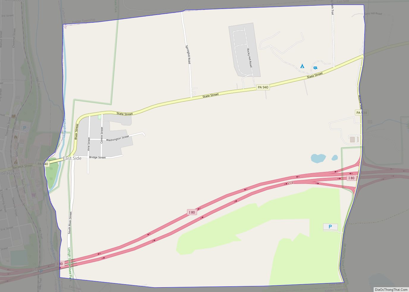
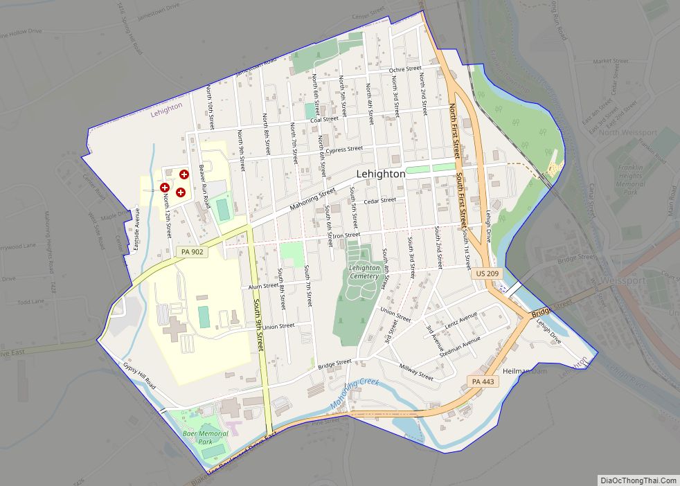
Online Interactive Map
Click on ![]() to view map in "full screen" mode.
to view map in "full screen" mode.
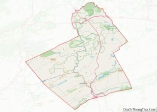
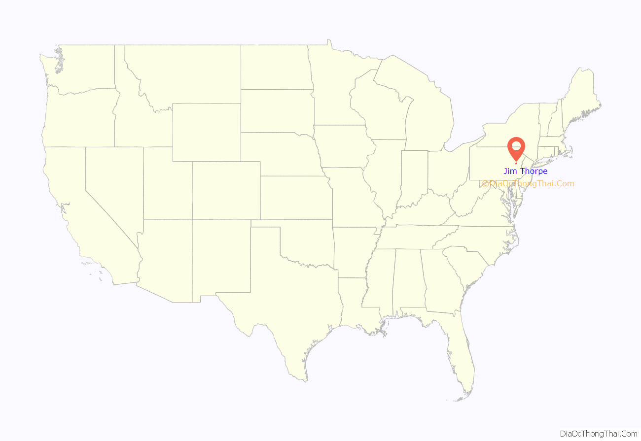
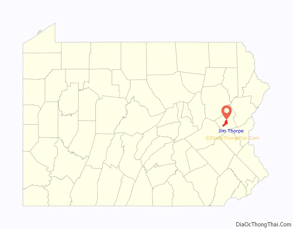
Jim Thorpe location map. Where is Jim Thorpe borough?
History
Founding
Jim Thorpe was founded in 1818 as Mauch Chunk (/ˌmɔːk ˈtʃʌŋk/), a name derived from the term Mawsch Unk (Bear Place) in the language of the native Munsee-Lenape Delaware peoples: possibly a reference to Bear Mountain, an extension of Mauch Chunk Ridge that resembled a sleeping bear, or perhaps the original profile of the ridge, which has since been changed heavily by 220 years of mining. The company town was founded by Josiah White and his two partners, founders of the Lehigh Coal & Navigation Company (LC&N). The town would be the lower terminus of a gravity railroad, the Summit Hill & Mauch Chunk Railroad, which would bring coal to the head of the LC&N Lehigh Canal for transshipment to the confluence of the Delaware River, 43 kilometres (26.7 mi) downstream at Easton. It would thereby ship LC&N’s coal to Philadelphia, Trenton, New York City, and other large cities in New Jersey and Delaware, and by ocean to the whole East Coast. Canal shipping was eventually replaced by railroad shipping.
Coal mining and the LC&N canal
The town grew slowly in its first decade, then rapidly around 1818 grew larger as it became an anthracite coal-shipping center. (The other large city with growing coal mining in the region was Scranton, with a population of over 140,000.) Mauch Chunk is on a Lehigh River west side (right bank) flat where Mahoning Creek enters and is a tributary of the Lehigh River. The river’s left bank community of East Mauch Chunk, which has more of the houses of modern Jim Thorpe, was settled later to support the short-lived Beaver Creek Railroad, the mines which spawned it, and the logging industry. It came into greater growth when the Lehigh Valley Railroad in 1885 pushed up the valley on the river’s east bank to oppose LC&N’s effective transportation monopoly over the region, which extended across to northwest Wilkes-Barre at Pittston on the Susquehanna River/Pennsylvania Canal.
Railroad growth and coal shipping
After the Pennsylvania Canal Commission smoothed the way, Lehigh Coal & Navigation built the Lehigh and Susquehanna Railroad (L&S) from Pittston to Ashley, building the Ashley Planes inclined railway and linked that by rail from Mountain Top to White Haven at the head of the canal’s upper works, referred to as the Grand Lehigh Canal, whose navigations shortened the Lehigh Gorge, now located in the Lehigh Gorge State Park route, cutting the distance from Philadelphia to Wilkes-Barre and the Wyoming Valley coal deposits by over 100 miles (160 km). This placed Mauch Chunk in the center of a nexus of transportation in country tough to travel through. When floods wiped out many of the upper Lehigh Canal works in 1861, the L&S Railroad was extended through the gap to supplant the canal, and the so-called switchback-twisted backtrack through Avoca, with the improved engines of the day, enabled two-way steam locomotive traction and traffic despite the steep grades. Owner LC&N Company’s headquarters was built across the street in Mauch Chunk from the L&S Railroad’s stylish brick passenger station that was soon boarding passengers onto trains from New York and Philadelphia to Buffalo. The Central Railroad of New Jersey eventually took over the L&S and the station. The Lehigh Valley Railroad arrived on the river’s east bank at East Mauch Chunk in 1855.,
Major historical events
Mauch Chunk was the location of one of the trials of the Molly Maguires in 1876, which resulted in the hanging of four men found guilty of murder. The population of the borough in 1900 was 4,020; in 1910, it was 3,952.
Following the 1953 death of renowned athlete and Olympic medal winner Jim Thorpe, Thorpe’s widow and third wife, Patricia, was impatient when, after five months, the planned memorial in Shawnee, Oklahoma had yet to raise the $100,000 to honor him. The town’s citizens had paid for her, a Thorpe son and Jim’s body to be shipped from California, paid and arranged for the funeral service at St. Benedict’s Catholic church, and paid for the mausoleum costs at Fairview Cemetery. Then Gov. Johnston Murray vetoed a bill which would contribute funds to the erection of the memorial at Athletic Park. On Sept. 1st Mrs. Thorpe, saying she feared Jim would be buried in a potter’s field, shipped the body to Tulsa where she said the Chamber of Commerce was going to build a proper memorial, which was not true. When she heard that the boroughs of Mauch Chunk and East Mauch Chunk were desperately seeking to attract business, she made a deal with civic officials. According to Jim Thorpe’s son, Jack, Patricia was motivated by money in seeking the deal.
Renaming to Jim Thorpe
The two cross-river boroughs merged in 1954 and renamed the new municipality Jim Thorpe in his honor then obtained the athlete’s remains from his wife and erected a monument to the Oklahoma native, who began his sports career 100 miles (161 kilometres) southwest, as a student at the Carlisle Indian Industrial School in Carlisle, Pennsylvania. The monument site contains his tomb, two statues of him in athletic poses, and historical markers describing his life story. The grave rests on mounds of soil from Thorpe’s native Oklahoma and from the Stockholm Olympic Stadium in which he won his Olympic medals.
On June 24, 2010, one of Jim Thorpe’s sons, Jack Thorpe, sued the town for his father’s remains, citing the Native American Graves Protection and Repatriation Act, which is designed to return Native American artifacts to their tribal homelands. On February 11, 2011, Judge Richard Caputo ruled that Jack Thorpe could not gain any monetary award, nor any amount for attorney’s fees in the lawsuit and that for the lawsuit to continue other members of the Thorpe family and the Sac and Fox Nation would have to join him as plaintiffs. Before Jack Thorpe could respond to the ruling he died at the age of 73 on February 22, 2011. Because of his death his representatives were given more time to respond to the ruling. On May 2, 2011, William and Richard Thorpe, Jim Thorpe’s remaining sons and the Sac & Fox Nation of Oklahoma joined the lawsuit, allowing it to continue. On April 19, 2013, Caputo ruled in favor of William and Richard Thorpe, ruling that the borough amounts to a museum under the law. This ruling was reversed by the United States Court of Appeals for the Third Circuit on October 23, 2014. The US Supreme Court refused to hear their appeal on October 5, 2015, assuring that Jim Thorpe’s remains will stay in Carbon County.
Architecture
The history of the 1880s Mauch Chunk is reflected in the architecture that makes up its many 19th century styles. A former resident and architectural historian, Hans Egli, noted the vast range of styles: Federalist, Greek Revival, Second Empire, Romanesque Revival, Queen Anne, and Richardsonian Romanesque. Most of these architectural examples remained protected and intact beneath aluminum or vinyl siding that has since been removed. Denise Scott Brown and Robert Venturi, renowned Philadelphia architects, conducted a little-known planning study in the 1970s that attempted to understand the dynamics of historicism and tourism, notions that have come into their own in contemporary times. While Venturi’s planning study was unique at the time, it has since become a critical factor in Jim Thorpe’s rebound as a functioning and economically stable community. Jim Thorpe tourism is based on its vintage architecture, and recreation such as hiking, paintball and white water rafting.
Historic site preservation and modern day use
The Carbon County Section of the Lehigh Canal, Old Mauch Chunk Historic District, Mauch Chunk Switchback Railway, Asa Packer Mansion, Harry Packer Mansion, Carbon County Jail, Central Railroad of New Jersey Station, and St. Mark’s Episcopal Church are listed on the National Register of Historic Places. The former Central Railroad of New Jersey railroad line through the Lehigh gorge and through Jim Thorpe is now operated as a summer tourist railroad by Reading Blue Mountain & Northern Railroad. The former New York City to Buffalo Lehigh Valley Railroad across the river is a present-day very active freight hauling railroad operated by Norfolk Southern.
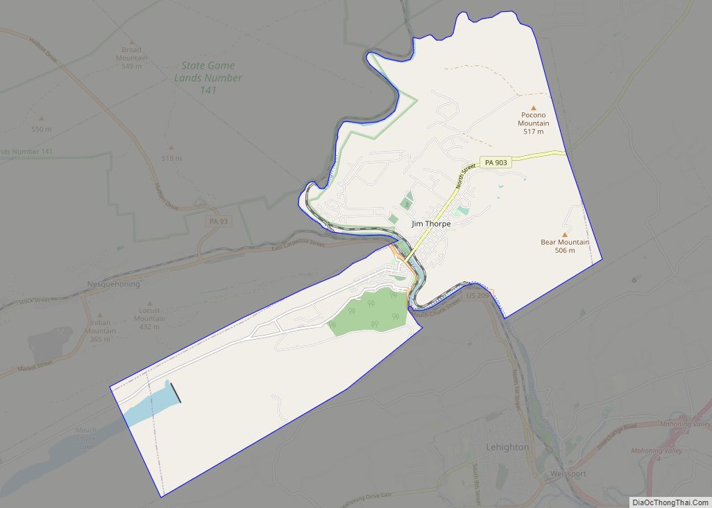
Jim Thorpe Road Map
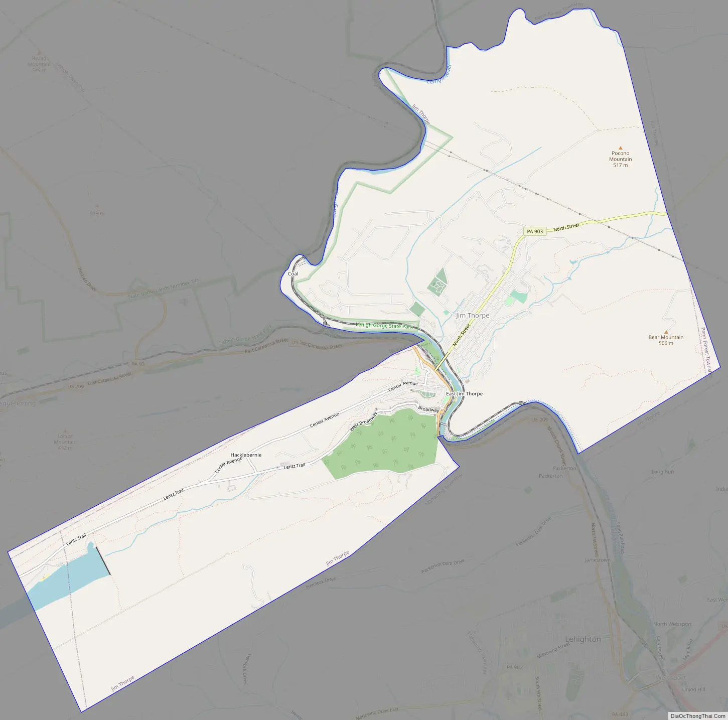
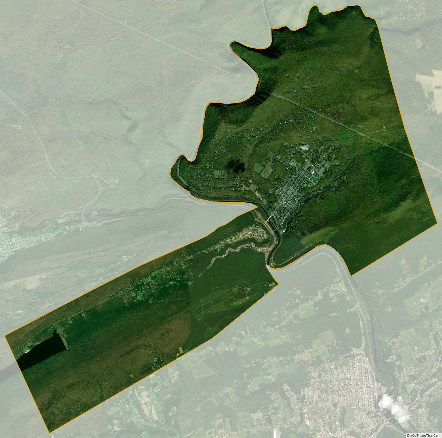
Jim Thorpe city Satellite Map
Geography
Jim Thorpe is located near the center of Carbon County at 40°52′23″N 75°44′11″W / 40.87306°N 75.73639°W / 40.87306; -75.73639.
In the deeps of the geologic timescale the two shorelines of the Lehigh River occupied by the 19th-century towns of Mauch Chunk and East Mauch Chunk were situated on the bottom of an ancient river-fed tarn, a mountain lake which filled the valley on the west bank and covered the relative flatlands on the east bank. The muddy bottom of that high tarn (the range then rivaling the Himalayas in size), where the waters pooled at a lower elevation amongst the twisted folds of four near-parallel ridgelines, created a level region whose settlements became the relatively flat lands on either bank of the Lehigh. The ridgelines, which run east-northeast to west-southwest, are (from north to south) Broad, Nesquehoning, Pisgah, and Mauch Chunk ridges (or Mountains)—each of which runs over 15 miles (24.1 km) west to the gaps cut by the Schuylkill River.
According to the United States Census Bureau, the borough of Jim Thorpe has a total area of 14.9 square miles (38.6 km), of which 14.6 square miles (37.8 km) is land and 0.3 square miles (0.8 km), or 2.15%, is water. Jim Thorpe is 3 miles (5 km) north and upstream of Lehighton, below the Lehigh Gap which sunders Bear Mountain on the east bank from the extended ridge of Mauch Chunk Mountain. The town is 4 miles (6 km) east of Nesquehoning, which is up a steep grade and around the bend along U.S. 209 South, and also butting up against the slopes of Mount Pisgah. This was a key element in the LC&N’s planning, for the grade from the mountain ridge down to the river enabled them to fill barges quickly, using chutes and an elevated entry from a road down the ridge face. Jim Thorpe’s developed elevations range between the river slack water at 540 feet (160 m) above sea level—720 feet (219.5 m) to the town’s upper streets, all below the western peak of Mount Pisgah, which tops out at 1,519 feet (463.0 m) above sea level.
The elevation of the Borough of Jim Thorpe ranges from 540 feet (160 m) at Broadway and Hazard Square downtown to 1,700 feet (520 m) above sea level 3 miles (5 km) northeast of the borough center near the Penn Forest Township line. It has a warm-summer humid continental climate (Dfb) and average downtown monthly temperatures range from 26.5 °F in January to 71.2 °F in July. PRISM Climate Group, Oregon State U The local hardiness zone is 6a.
See also
Map of Pennsylvania State and its subdivision:- Adams
- Allegheny
- Armstrong
- Beaver
- Bedford
- Berks
- Blair
- Bradford
- Bucks
- Butler
- Cambria
- Cameron
- Carbon
- Centre
- Chester
- Clarion
- Clearfield
- Clinton
- Columbia
- Crawford
- Cumberland
- Dauphin
- Delaware
- Elk
- Erie
- Fayette
- Forest
- Franklin
- Fulton
- Greene
- Huntingdon
- Indiana
- Jefferson
- Juniata
- Lackawanna
- Lancaster
- Lawrence
- Lebanon
- Lehigh
- Luzerne
- Lycoming
- Mc Kean
- Mercer
- Mifflin
- Monroe
- Montgomery
- Montour
- Northampton
- Northumberland
- Perry
- Philadelphia
- Pike
- Potter
- Schuylkill
- Snyder
- Somerset
- Sullivan
- Susquehanna
- Tioga
- Union
- Venango
- Warren
- Washington
- Wayne
- Westmoreland
- Wyoming
- York
- Alabama
- Alaska
- Arizona
- Arkansas
- California
- Colorado
- Connecticut
- Delaware
- District of Columbia
- Florida
- Georgia
- Hawaii
- Idaho
- Illinois
- Indiana
- Iowa
- Kansas
- Kentucky
- Louisiana
- Maine
- Maryland
- Massachusetts
- Michigan
- Minnesota
- Mississippi
- Missouri
- Montana
- Nebraska
- Nevada
- New Hampshire
- New Jersey
- New Mexico
- New York
- North Carolina
- North Dakota
- Ohio
- Oklahoma
- Oregon
- Pennsylvania
- Rhode Island
- South Carolina
- South Dakota
- Tennessee
- Texas
- Utah
- Vermont
- Virginia
- Washington
- West Virginia
- Wisconsin
- Wyoming