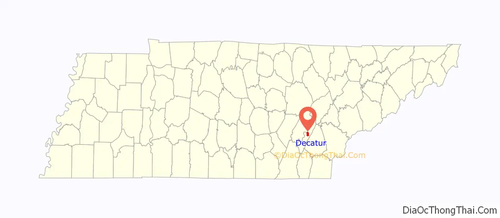
Decatur (/dɪˈkeɪtər/ dih-KAY-tər) is a town in Meigs County, Tennessee, United States. The population was 1,563 at the 2020 census. It is the county seat of Meigs County.
| Name: | Decatur town |
|---|---|
| LSAD Code: | 43 |
| LSAD Description: | town (suffix) |
| State: | Tennessee |
| County: | Meigs County |
| Founded: | 1836 |
| Incorporated: | 1838 |
| Elevation: | 778 ft (237 m) |
| Total Area: | 3.80 sq mi (9.83 km²) |
| Land Area: | 3.80 sq mi (9.83 km²) |
| Water Area: | 0.00 sq mi (0.00 km²) |
| Total Population: | 1,563 |
| Population Density: | 411.75/sq mi (158.99/km²) |
| ZIP code: | 37322 |
| Area code: | 423 |
| FIPS code: | 4719880 |
| GNISfeature ID: | 1306311 |
| Website: | www.decaturtn.net |
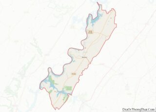
Online Interactive Map
Click on ![]() to view map in "full screen" mode.
to view map in "full screen" mode.
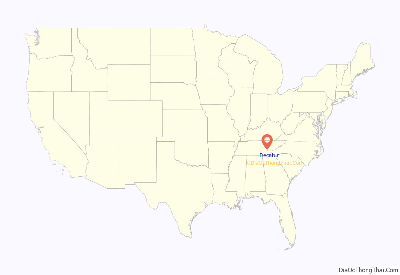
Decatur location map. Where is Decatur town?
History
Decatur was founded in May 1836 as a county seat for Meigs County, which had been formed that same year. The initial 50 acres (0.20 km) for the town were donated by James Lillard and Leonard Brooks. Decatur is named after Commodore Stephen Decatur, Jr., an early 19th-century American naval officer renowned for his exploits in the First Barbary War, the Second Barbary War, and the War of 1812.
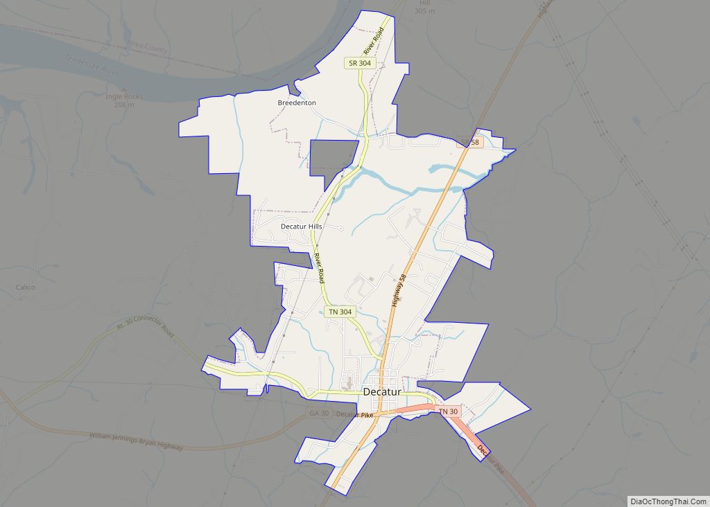
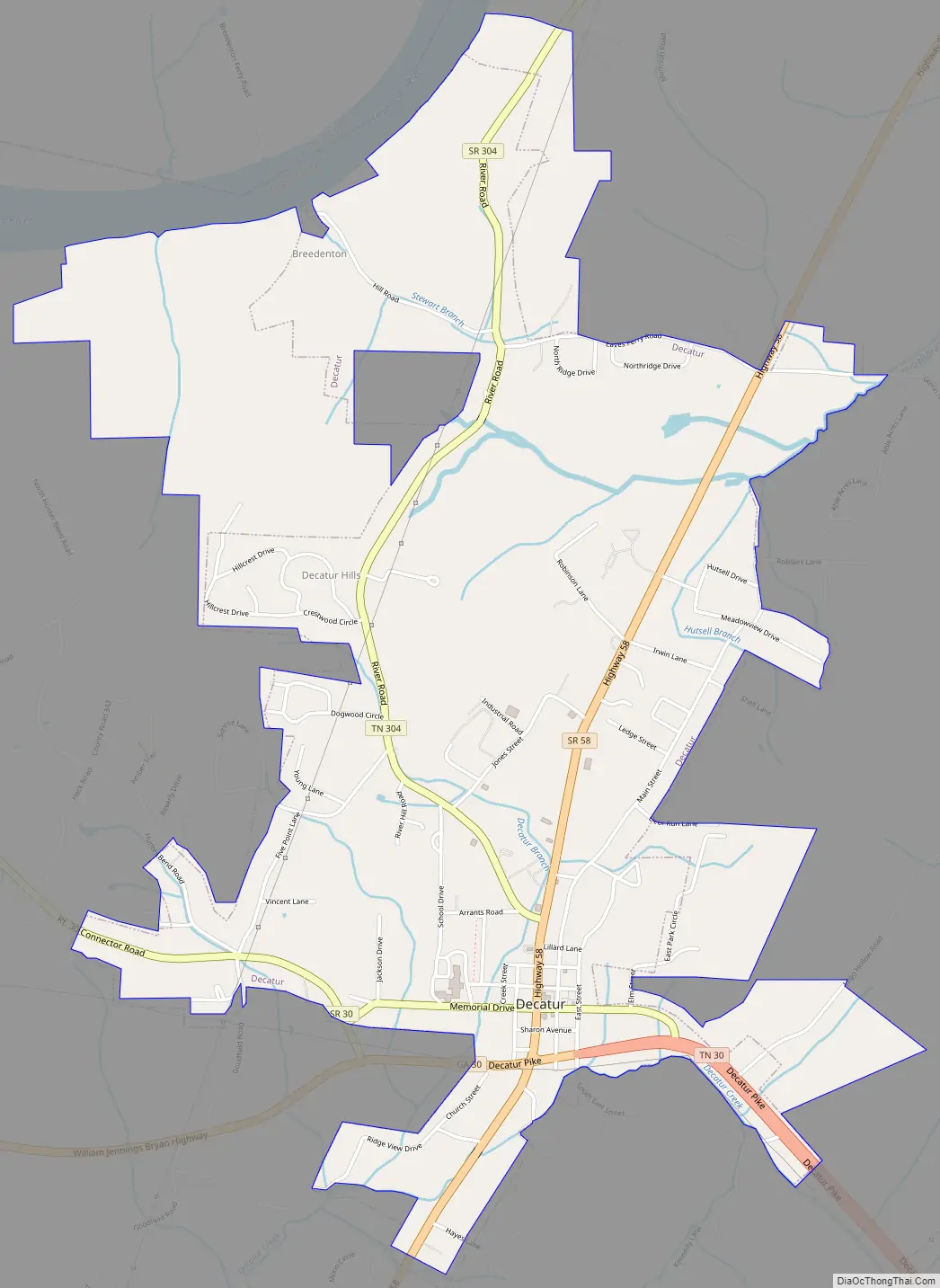
Decatur Road Map
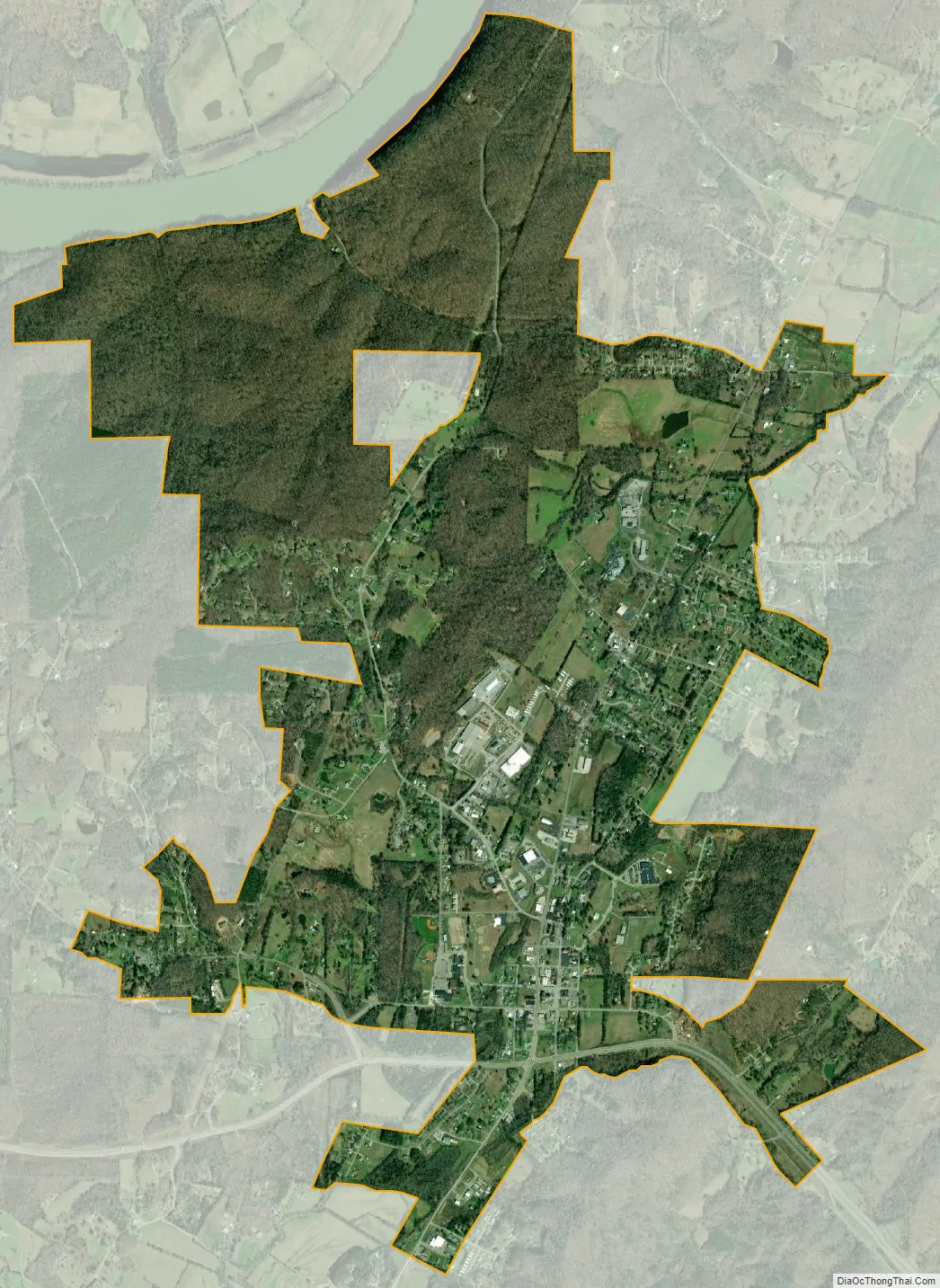
Decatur city Satellite Map
Geography
Decatur is located at 35°31′8″N 84°47′36″W / 35.51889°N 84.79333°W / 35.51889; -84.79333 (35.518871, -84.793201). The town is situated at the western base of No Pone Ridge, an elongate ridge characteristic of the Appalachian Ridge-and-Valley Province. Just west of Decatur, the Tennessee River flows around a blunt peninsula known as Armstrong Bend. This section of the river is part of Chickamauga Lake.
Decatur is situated around the junction of Tennessee State Route 30, which connects the town to Athens to the east and Dayton to the west, and Tennessee State Route 58, which connects Decatur to Kingston to the north and Chattanooga to the south. Interstate 75 passes approximately 15 miles (24 km) east of Decatur.
According to the United States Census Bureau, the town has a total area of 2.6 square miles (6.7 km), all of it land.
See also
Map of Tennessee State and its subdivision:- Anderson
- Bedford
- Benton
- Bledsoe
- Blount
- Bradley
- Campbell
- Cannon
- Carroll
- Carter
- Cheatham
- Chester
- Claiborne
- Clay
- Cocke
- Coffee
- Crockett
- Cumberland
- Davidson
- Decatur
- DeKalb
- Dickson
- Dyer
- Fayette
- Fentress
- Franklin
- Gibson
- Giles
- Grainger
- Greene
- Grundy
- Hamblen
- Hamilton
- Hancock
- Hardeman
- Hardin
- Hawkins
- Haywood
- Henderson
- Henry
- Hickman
- Houston
- Humphreys
- Jackson
- Jefferson
- Johnson
- Knox
- Lake
- Lauderdale
- Lawrence
- Lewis
- Lincoln
- Loudon
- Macon
- Madison
- Marion
- Marshall
- Maury
- McMinn
- McNairy
- Meigs
- Monroe
- Montgomery
- Moore
- Morgan
- Obion
- Overton
- Perry
- Pickett
- Polk
- Putnam
- Rhea
- Roane
- Robertson
- Rutherford
- Scott
- Sequatchie
- Sevier
- Shelby
- Smith
- Stewart
- Sullivan
- Sumner
- Tipton
- Trousdale
- Unicoi
- Union
- Van Buren
- Warren
- Washington
- Wayne
- Weakley
- White
- Williamson
- Wilson
- Alabama
- Alaska
- Arizona
- Arkansas
- California
- Colorado
- Connecticut
- Delaware
- District of Columbia
- Florida
- Georgia
- Hawaii
- Idaho
- Illinois
- Indiana
- Iowa
- Kansas
- Kentucky
- Louisiana
- Maine
- Maryland
- Massachusetts
- Michigan
- Minnesota
- Mississippi
- Missouri
- Montana
- Nebraska
- Nevada
- New Hampshire
- New Jersey
- New Mexico
- New York
- North Carolina
- North Dakota
- Ohio
- Oklahoma
- Oregon
- Pennsylvania
- Rhode Island
- South Carolina
- South Dakota
- Tennessee
- Texas
- Utah
- Vermont
- Virginia
- Washington
- West Virginia
- Wisconsin
- Wyoming