Athens is the county seat of McMinn County, Tennessee, United States and the principal city of the Athens Micropolitan Statistical Area has a population of 53,569. The city is located almost equidistantly between the major cities of Knoxville and Chattanooga. The population was 14,084 at the 2020 census. The population of the zipcode area is at 23,726
| Name: | Athens city |
|---|---|
| LSAD Code: | 25 |
| LSAD Description: | city (suffix) |
| State: | Tennessee |
| County: | McMinn County |
| Founded: | 1822 |
| Incorporated: | 1870 |
| Elevation: | 860 ft (262 m) |
| Total Area: | 15.51 sq mi (40.17 km²) |
| Land Area: | 15.51 sq mi (40.17 km²) |
| Water Area: | 0.00 sq mi (0.00 km²) |
| Total Population: | 14,084 |
| Population Density: | 908.18/sq mi (350.65/km²) |
| ZIP code: | 37303 & 37371 |
| Area code: | 423 |
| FIPS code: | 4702320 |
| GNISfeature ID: | 1304889 |
| Website: | www.cityofathenstn.com |
Online Interactive Map
Click on ![]() to view map in "full screen" mode.
to view map in "full screen" mode.
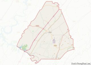
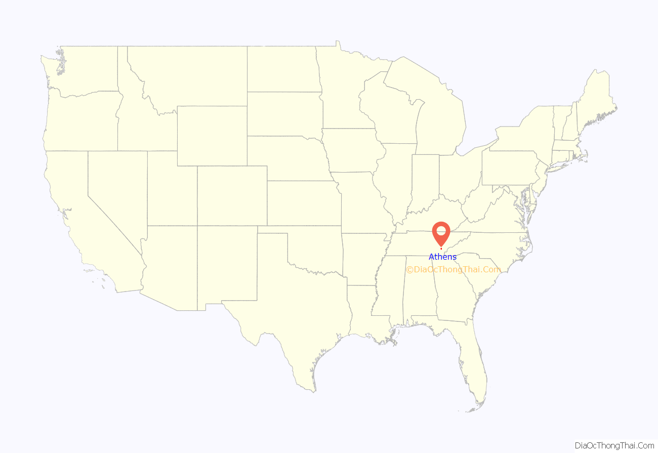
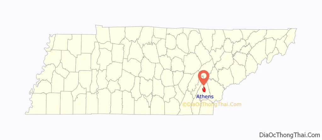
Athens location map. Where is Athens city?
History
Early history and Civil War
The Cherokee were living in McMinn County at the time of the arrival of the first Euro-American explorers. The Athens area was situated nearly halfway between the Overhill Cherokee villages of Great Tellico to the north in Monroe County and Great Hiwassee along the Hiwassee River to the south. In 1819, the Cherokee signed the Calhoun Treaty, selling the land north of the Hiwassee (including all of modern McMinn County) to the United States. McMinn County was organized on November 13, 1819, at the home of John Walker in what is now Calhoun. The Native American village, Pumpkintown (a corruption of Potemkin town), was located on a farm about two miles east of present-day Athens. It is sometimes incorrectly identified as a forerunner of Athens. Athens was laid out and chosen as the county seat in 1822. The name “Athens” may have been chosen due to perceived topographical similarities to Athens, Greece.
By 1834, the population of Athens had grown to over 500. Prominent early settlers included William Henry Cooke, who operated an iron forge near modern Etowah, and Samuel Clegg (or Cleage), a construction entrepreneur. Jesse Mayfield, whose descendants founded Mayfield Dairy Farms, arrived in the early 1820s. The Hiwassee Railroad received a charter in the mid-1830s to build a railroad connecting Knoxville, Tennessee, and Dalton, Georgia. The railroad began construction in 1837, although financial and legal problems delayed its completion until 1851. In 1836, General John Wool arrived in Athens to help coordinate the Cherokee Removal. Although initially voluntary, the operation became a forced removal in 1838 when many Cherokee refused to leave. The removal culminated in the forced march west that became known as the Trail of Tears. Wool set up his headquarters at the Bridges Hotel, which was located across the street from the McMinn County Courthouse.
McMinn County was divided during the American Civil War. The well-established railroad brought numerous pro-secessionist and anti-secessionist speakers to the county, including Andrew Johnson, Horace Maynard, John Bell, and William “Parson” Brownlow. In 1861, McMinn County voted against secession by a narrow 1,144-904 margin. The county sent 12 units to the Union army and 8 units to the Confederate army. General William Tecumseh Sherman was briefly headquartered at the Bridges Hotel in McMinn County while preparing his “March to the Sea.”
Post-Civil War
After the Civil War, the railroad lured business opportunists to McMinn County. In 1887, several investors established the Athens Mining and Manufacturing Company with plans to convert the town into a model industrial community and initiate large-scale mining operations in the area. Textile mills, flour mills, and timber mills dominated the county’s industry by the late 19th century, complemented by furniture and appliance factories in the 1920s.
In 1946, several McMinn County World War II veterans ran for local office in hopes of removing a county government deemed corrupt. On August 1, local authorities locked themselves in the county jail along with the ballot boxes. Suspecting foul play, the veterans armed themselves and assembled on a hill across the street from the jail. After an exchange of gunfire, the county authorities surrendered. The ballots were counted, and the veterans’ ticket was elected, ending the Battle of Athens.
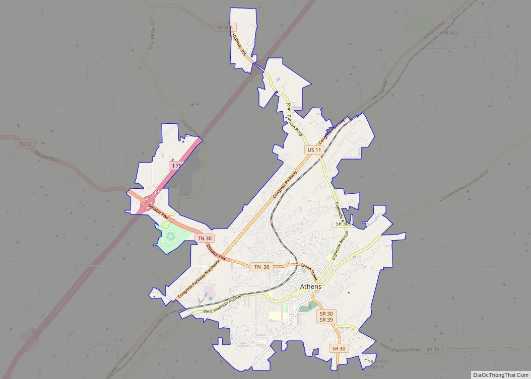
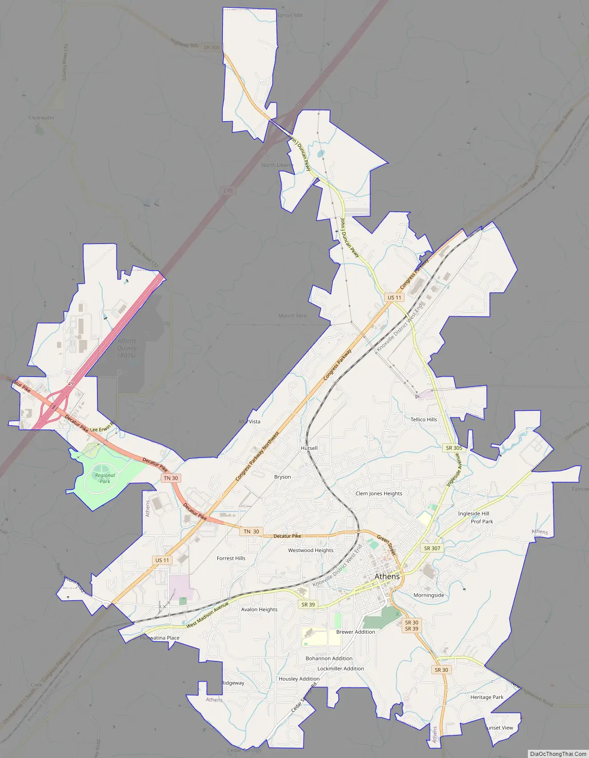
Athens Road Map
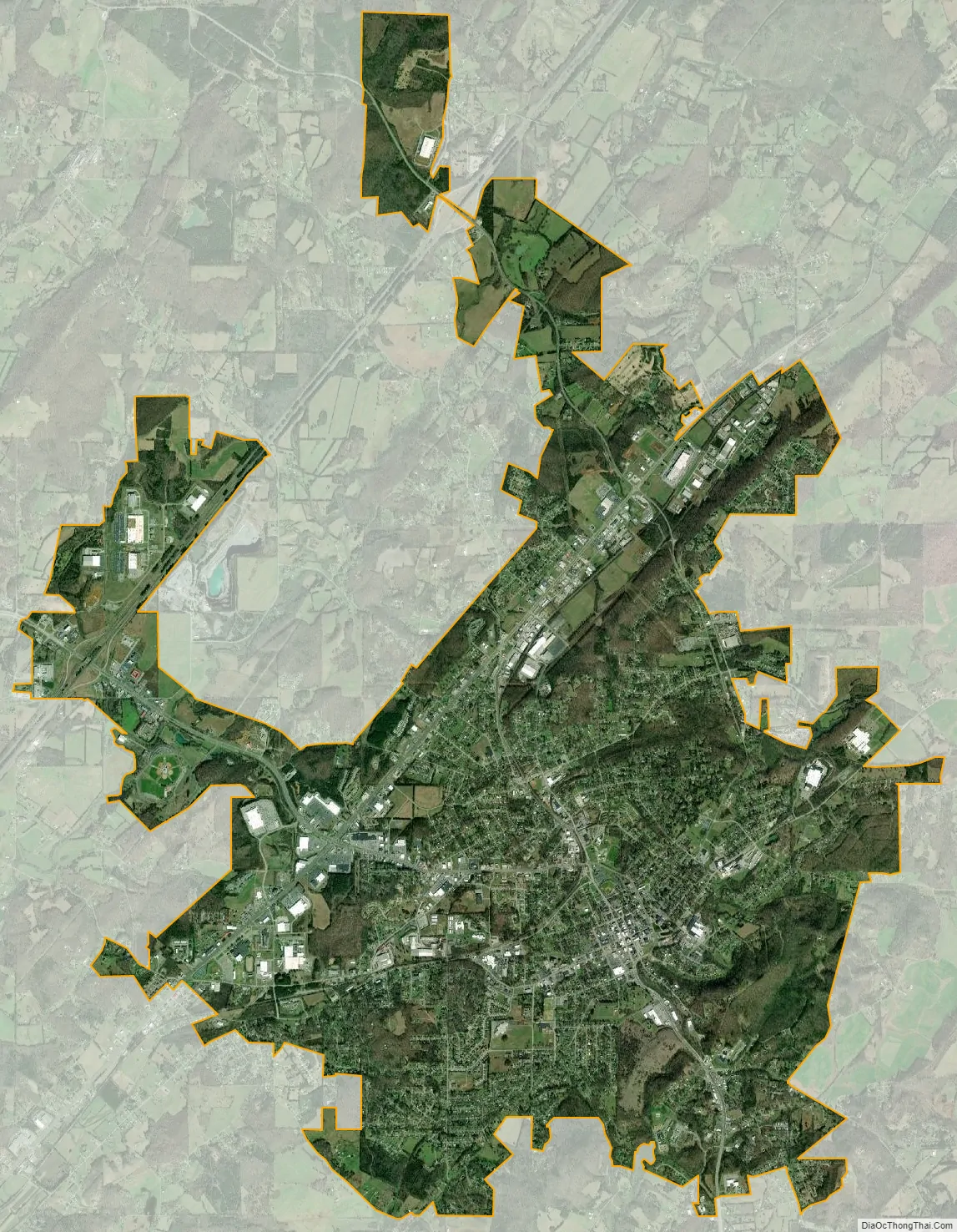
Athens city Satellite Map
Geography
Athens is located at 35°26′53″N 84°36′7″W / 35.44806°N 84.60194°W / 35.44806; -84.60194 (35.448171, -84.602069). The city is situated amidst a series of narrow, elongate ridges and low hills that are characteristic of the Appalachian Ridge-and-Valley Province. The Unicoi Mountains rise roughly 20 miles (32 km) east of Athens, and the Tennessee River flows nearly 20 miles (32 km) to the west. Starr Mountain, one of the more noticeable ridges in McMinn County, is located roughly 15 miles (24 km) southeast of Athens.
Oostanaula Creek (sometimes spelled “Eastanalle” or a similar variation) rises in the hills north of Athens and traverses the city approximately 30 miles (48 km) upstream from its mouth along Hiwassee River. Other major streams in the area include Mouse Creek, which parallels Oostanaula to the west, and Chestuee Creek, which parallels Oostanaula to the east.
Athens is centered around the junction of U.S. Route 11, which connects the city to Sweetwater to the north and Cleveland to the south, and State Route 30, which connects Athens to Etowah and U.S. Route 411 to the southeast and Decatur to the west. Interstate 75 passes west of Athens.
According to the United States Census Bureau, the city has a total area of 13.5 square miles (35 km), all land.
Climate
As is typical for the Southern United States, Athens has a humid subtropical climate (Köppen Cfa) featuring hot, humid summers and cool to cold, though not severe, winters.
See also
Map of Tennessee State and its subdivision:- Anderson
- Bedford
- Benton
- Bledsoe
- Blount
- Bradley
- Campbell
- Cannon
- Carroll
- Carter
- Cheatham
- Chester
- Claiborne
- Clay
- Cocke
- Coffee
- Crockett
- Cumberland
- Davidson
- Decatur
- DeKalb
- Dickson
- Dyer
- Fayette
- Fentress
- Franklin
- Gibson
- Giles
- Grainger
- Greene
- Grundy
- Hamblen
- Hamilton
- Hancock
- Hardeman
- Hardin
- Hawkins
- Haywood
- Henderson
- Henry
- Hickman
- Houston
- Humphreys
- Jackson
- Jefferson
- Johnson
- Knox
- Lake
- Lauderdale
- Lawrence
- Lewis
- Lincoln
- Loudon
- Macon
- Madison
- Marion
- Marshall
- Maury
- McMinn
- McNairy
- Meigs
- Monroe
- Montgomery
- Moore
- Morgan
- Obion
- Overton
- Perry
- Pickett
- Polk
- Putnam
- Rhea
- Roane
- Robertson
- Rutherford
- Scott
- Sequatchie
- Sevier
- Shelby
- Smith
- Stewart
- Sullivan
- Sumner
- Tipton
- Trousdale
- Unicoi
- Union
- Van Buren
- Warren
- Washington
- Wayne
- Weakley
- White
- Williamson
- Wilson
- Alabama
- Alaska
- Arizona
- Arkansas
- California
- Colorado
- Connecticut
- Delaware
- District of Columbia
- Florida
- Georgia
- Hawaii
- Idaho
- Illinois
- Indiana
- Iowa
- Kansas
- Kentucky
- Louisiana
- Maine
- Maryland
- Massachusetts
- Michigan
- Minnesota
- Mississippi
- Missouri
- Montana
- Nebraska
- Nevada
- New Hampshire
- New Jersey
- New Mexico
- New York
- North Carolina
- North Dakota
- Ohio
- Oklahoma
- Oregon
- Pennsylvania
- Rhode Island
- South Carolina
- South Dakota
- Tennessee
- Texas
- Utah
- Vermont
- Virginia
- Washington
- West Virginia
- Wisconsin
- Wyoming