Decherd is a city in Franklin County, Tennessee, United States. The population was 2,379 at the 2020 census and 2,361 at the 2010 census.
| Name: | Decherd city |
|---|---|
| LSAD Code: | 25 |
| LSAD Description: | city (suffix) |
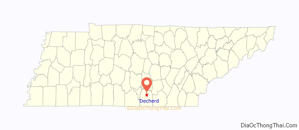
| State: | Tennessee |
| County: | Franklin County |
| Elevation: | 961 ft (293 m) |
| Total Area: | 4.80 sq mi (12.44 km²) |
| Land Area: | 4.79 sq mi (12.42 km²) |
| Water Area: | 0.01 sq mi (0.02 km²) |
| Total Population: | 2,379 |
| Population Density: | 496.14/sq mi (191.55/km²) |
| ZIP code: | 37324 |
| Area code: | 931 |
| FIPS code: | 4719920 |
| GNISfeature ID: | 1282276 |
| Website: | www.decherd.net |
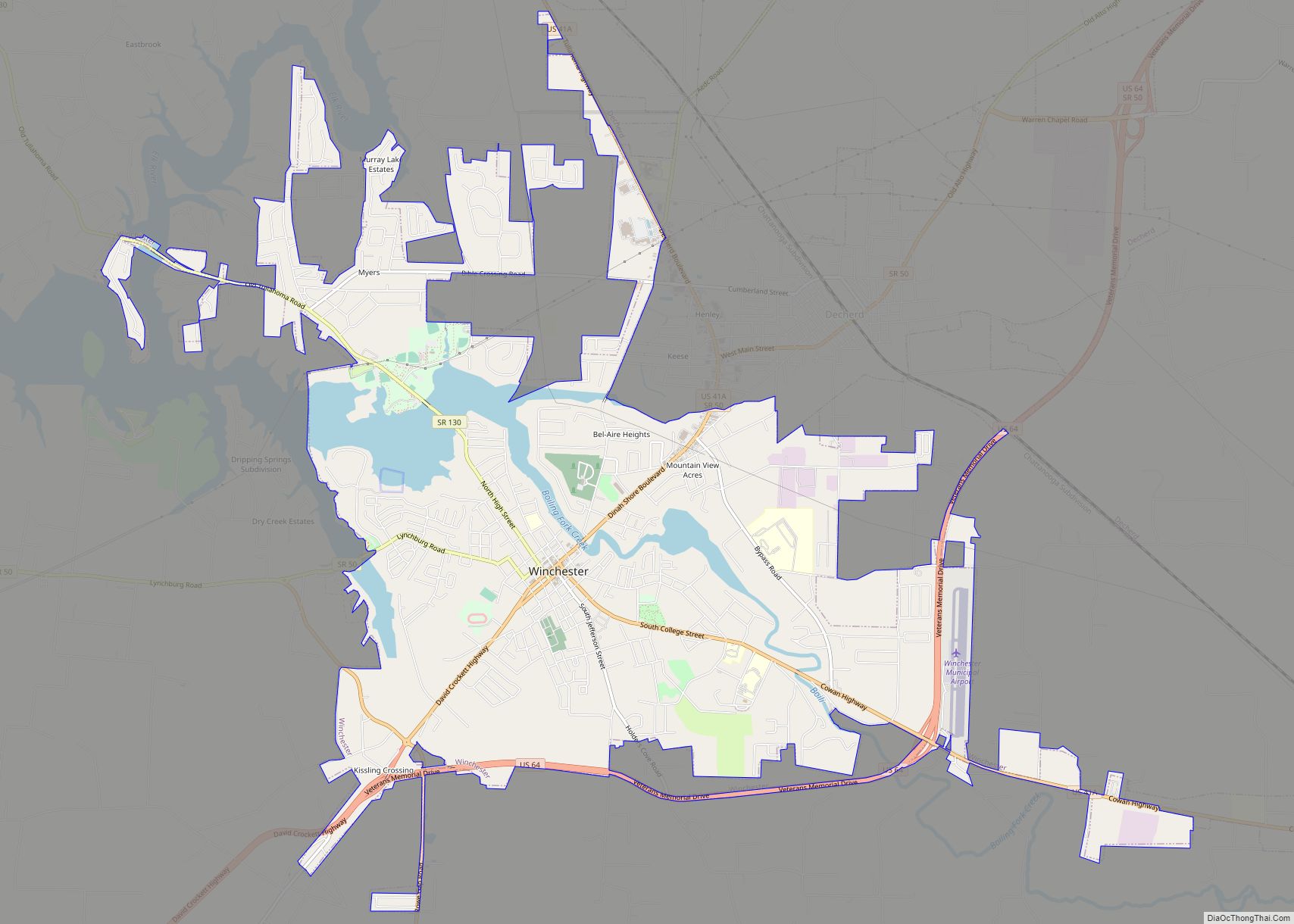
Online Interactive Map
Click on ![]() to view map in "full screen" mode.
to view map in "full screen" mode.
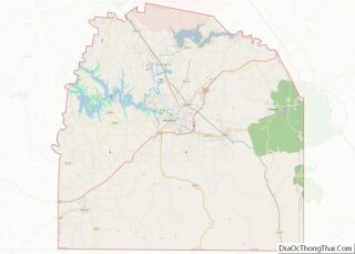
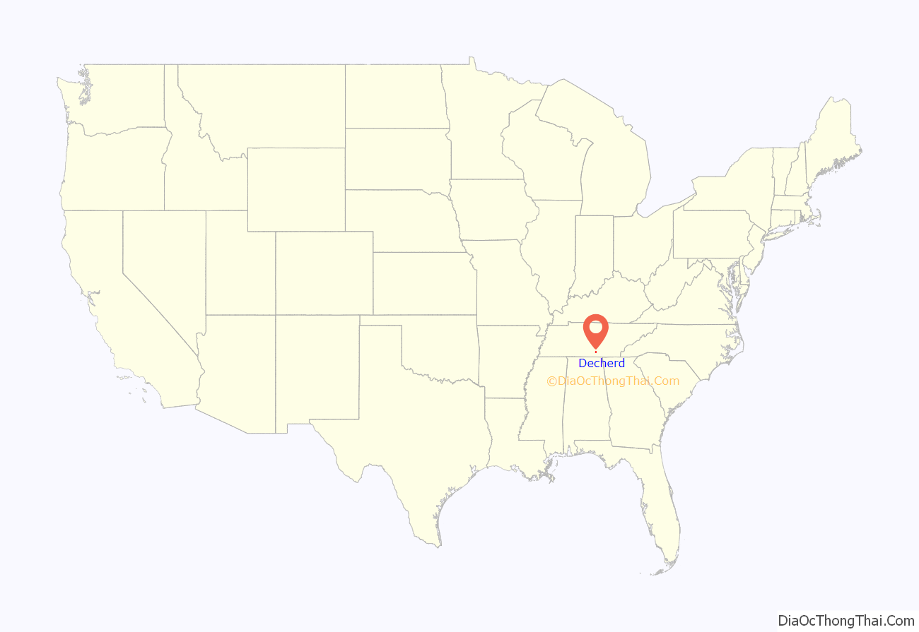
Decherd location map. Where is Decherd city?
History
Peter Decherd came to the area in 1831 from Franklin County, Virginia and set up a plantation in Winchester TN that came to be known as Hundred Oaks. In the 1850s he granted right-of-way to the Nashville and Chattanooga Railroad from property he owned.
On February 14, 1856, the thirty-first General Assembly of the state of Tennessee incorporated the town of Decherd with all the rights and privileges as the town of Cookeville, which was also incorporated at that time.
After the Civil War, Decherd was again incorporated as a town on January 30, 1868. It was unincorporated in 1885 to avoid application of the “Four Mile Law”, which permitted liquor sales within four miles of schools located in incorporated communities. The town was chartered once again by the General Assembly on April 22, 1901. The Haynes House in Decherd is listed on the National Register of Historic Places.
A violent F4 tornado heavily damaged the northern part of the town on February 13, 1952.
The historic Asia School is located in Decherd .
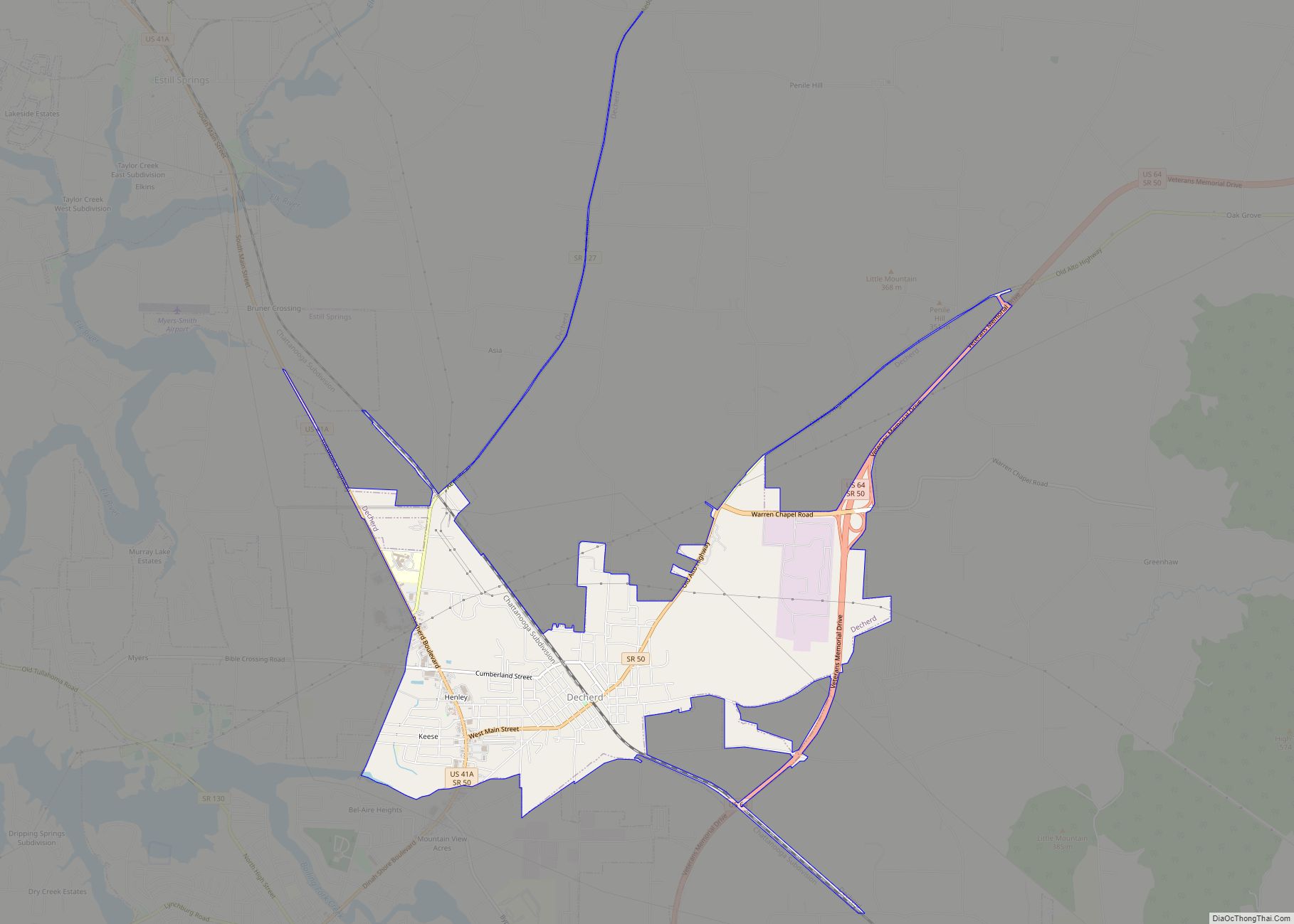
Decherd Road Map
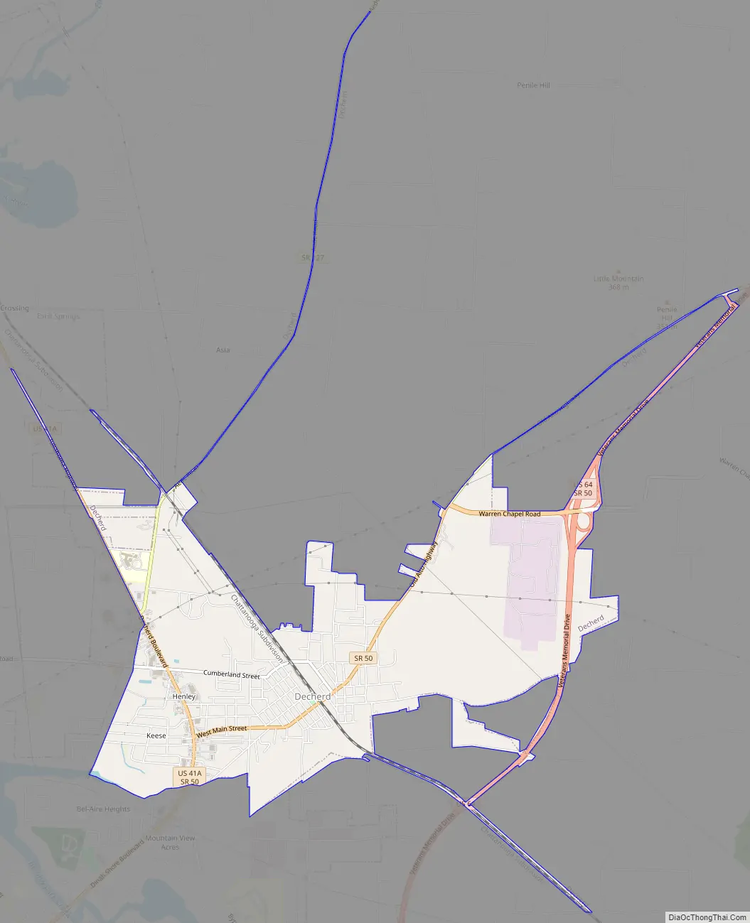
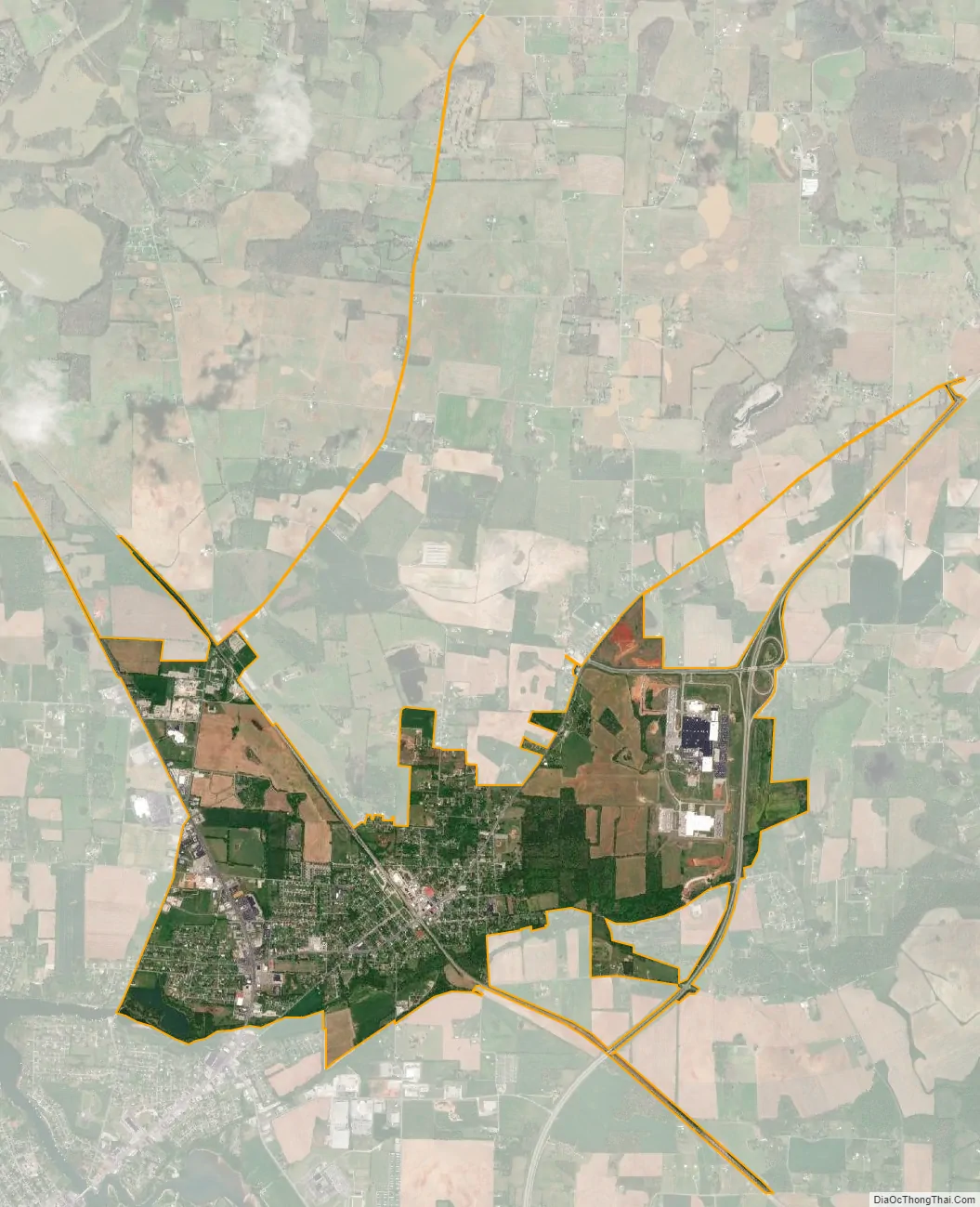
Decherd city Satellite Map
Geography
Decherd is located at 35°12′57″N 86°4′45″W / 35.21583°N 86.07917°W / 35.21583; -86.07917 (35.215767, -86.079183).
According to the United States Census Bureau, the city has a total area of 4.7 square miles (12 km), of which 4.7 square miles (12 km) is land and 0.21% is water which is part of Tims Ford Lake.
Decherd is immediately adjacent to the county seat of Winchester.
See also
Map of Tennessee State and its subdivision:- Anderson
- Bedford
- Benton
- Bledsoe
- Blount
- Bradley
- Campbell
- Cannon
- Carroll
- Carter
- Cheatham
- Chester
- Claiborne
- Clay
- Cocke
- Coffee
- Crockett
- Cumberland
- Davidson
- Decatur
- DeKalb
- Dickson
- Dyer
- Fayette
- Fentress
- Franklin
- Gibson
- Giles
- Grainger
- Greene
- Grundy
- Hamblen
- Hamilton
- Hancock
- Hardeman
- Hardin
- Hawkins
- Haywood
- Henderson
- Henry
- Hickman
- Houston
- Humphreys
- Jackson
- Jefferson
- Johnson
- Knox
- Lake
- Lauderdale
- Lawrence
- Lewis
- Lincoln
- Loudon
- Macon
- Madison
- Marion
- Marshall
- Maury
- McMinn
- McNairy
- Meigs
- Monroe
- Montgomery
- Moore
- Morgan
- Obion
- Overton
- Perry
- Pickett
- Polk
- Putnam
- Rhea
- Roane
- Robertson
- Rutherford
- Scott
- Sequatchie
- Sevier
- Shelby
- Smith
- Stewart
- Sullivan
- Sumner
- Tipton
- Trousdale
- Unicoi
- Union
- Van Buren
- Warren
- Washington
- Wayne
- Weakley
- White
- Williamson
- Wilson
- Alabama
- Alaska
- Arizona
- Arkansas
- California
- Colorado
- Connecticut
- Delaware
- District of Columbia
- Florida
- Georgia
- Hawaii
- Idaho
- Illinois
- Indiana
- Iowa
- Kansas
- Kentucky
- Louisiana
- Maine
- Maryland
- Massachusetts
- Michigan
- Minnesota
- Mississippi
- Missouri
- Montana
- Nebraska
- Nevada
- New Hampshire
- New Jersey
- New Mexico
- New York
- North Carolina
- North Dakota
- Ohio
- Oklahoma
- Oregon
- Pennsylvania
- Rhode Island
- South Carolina
- South Dakota
- Tennessee
- Texas
- Utah
- Vermont
- Virginia
- Washington
- West Virginia
- Wisconsin
- Wyoming