Sewanee (/səˈwɑːni/) is a census-designated place (CDP) in Franklin County, Tennessee, United States. The population was 2,535 at the 2020 census. It is part of the Tullahoma, Tennessee Micropolitan Statistical Area.
Sewanee is best known as the home of The University of the South, commonly known as “Sewanee”.
| Name: | Sewanee CDP |
|---|---|
| LSAD Code: | 57 |
| LSAD Description: | CDP (suffix) |
| State: | Tennessee |
| County: | Franklin County |
| Elevation: | 1,929 ft (588 m) |
| Total Area: | 3.91 sq mi (10.11 km²) |
| Land Area: | 3.89 sq mi (10.07 km²) |
| Water Area: | 0.02 sq mi (0.05 km²) |
| Total Population: | 2,535 |
| Population Density: | 652.34/sq mi (251.85/km²) |
| ZIP code: | 37375, 37383 |
| Area code: | 931 |
| FIPS code: | 4767140 |
| GNISfeature ID: | 1301113 |
Online Interactive Map
Click on ![]() to view map in "full screen" mode.
to view map in "full screen" mode.
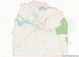
Sewanee location map. Where is Sewanee CDP?


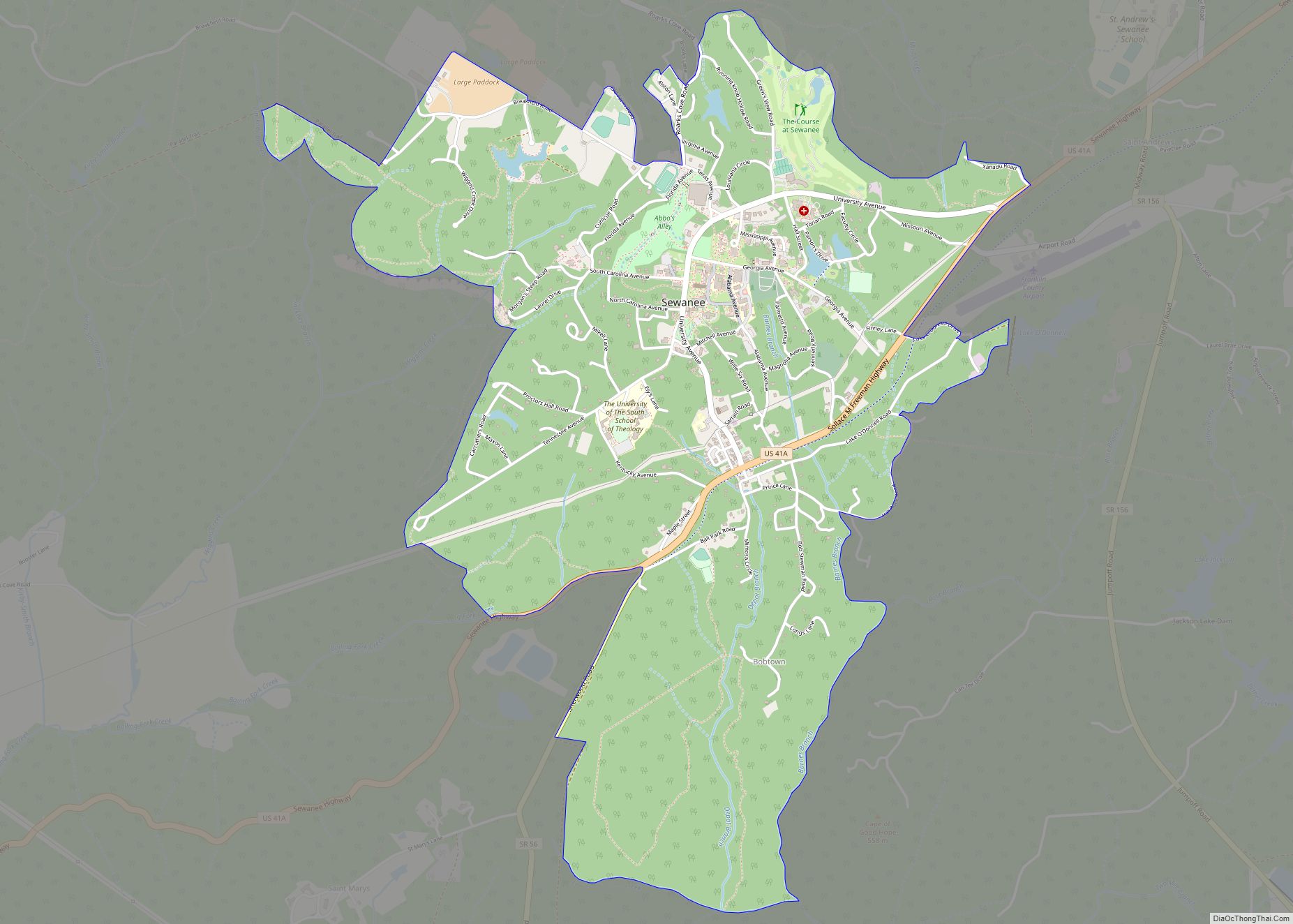
Sewanee Road Map
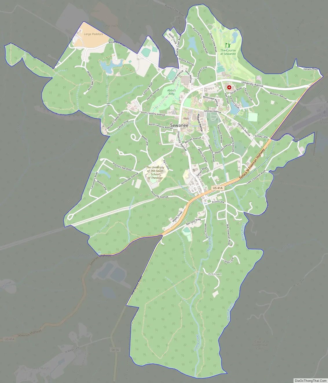
Sewanee city Satellite Map

Geography
Sewanee lies on the western edge of the Cumberland Plateau in the southeastern part of Middle Tennessee. It is located at 35°12′4″N 85°55′17″W / 35.20111°N 85.92139°W / 35.20111; -85.92139 (35.201232, -85.921524). It is at an elevation of 1,929 feet (588 m).
The primary road in Sewanee is a merged section of U.S. Route 41A and Tennessee State Route 56, which connects the community with Monteagle to the east. In the western part of Sewanee, the two highways diverge, with US 41A descending the Plateau to the west and continuing toward Cowan and Winchester, and SR 56 descending the Plateau to the south and continuing toward Sherwood and Alabama.
The University of the South campus occupies most of the northern portion of Sewanee, with several small neighborhoods scattered around it. A small commercial district is concentrated around the intersection of US 41A and University Avenue, the latter being a wide road that connects the highway with the university campus.
According to the United States Census Bureau, the CDP has a total area of 3.9 square miles (10 km), of which 3.9 square miles (10 km) is land and 0.02 square miles (0.052 km) (0.49%) is water.
Climate
The climate is characterized by relatively high temperatures and evenly distributed precipitation throughout the year. The Köppen Climate Classification subtype for this climate is “Cfa” (Humid Subtropical Climate).
See also
Map of Tennessee State and its subdivision:- Anderson
- Bedford
- Benton
- Bledsoe
- Blount
- Bradley
- Campbell
- Cannon
- Carroll
- Carter
- Cheatham
- Chester
- Claiborne
- Clay
- Cocke
- Coffee
- Crockett
- Cumberland
- Davidson
- Decatur
- DeKalb
- Dickson
- Dyer
- Fayette
- Fentress
- Franklin
- Gibson
- Giles
- Grainger
- Greene
- Grundy
- Hamblen
- Hamilton
- Hancock
- Hardeman
- Hardin
- Hawkins
- Haywood
- Henderson
- Henry
- Hickman
- Houston
- Humphreys
- Jackson
- Jefferson
- Johnson
- Knox
- Lake
- Lauderdale
- Lawrence
- Lewis
- Lincoln
- Loudon
- Macon
- Madison
- Marion
- Marshall
- Maury
- McMinn
- McNairy
- Meigs
- Monroe
- Montgomery
- Moore
- Morgan
- Obion
- Overton
- Perry
- Pickett
- Polk
- Putnam
- Rhea
- Roane
- Robertson
- Rutherford
- Scott
- Sequatchie
- Sevier
- Shelby
- Smith
- Stewart
- Sullivan
- Sumner
- Tipton
- Trousdale
- Unicoi
- Union
- Van Buren
- Warren
- Washington
- Wayne
- Weakley
- White
- Williamson
- Wilson
- Alabama
- Alaska
- Arizona
- Arkansas
- California
- Colorado
- Connecticut
- Delaware
- District of Columbia
- Florida
- Georgia
- Hawaii
- Idaho
- Illinois
- Indiana
- Iowa
- Kansas
- Kentucky
- Louisiana
- Maine
- Maryland
- Massachusetts
- Michigan
- Minnesota
- Mississippi
- Missouri
- Montana
- Nebraska
- Nevada
- New Hampshire
- New Jersey
- New Mexico
- New York
- North Carolina
- North Dakota
- Ohio
- Oklahoma
- Oregon
- Pennsylvania
- Rhode Island
- South Carolina
- South Dakota
- Tennessee
- Texas
- Utah
- Vermont
- Virginia
- Washington
- West Virginia
- Wisconsin
- Wyoming