Lynchburg is a city in the south-central region of the U.S. state of Tennessee. It is governed by a consolidated city-county government unit whose boundaries coincide with those of Moore County. Lynchburg is best known as the location of Jack Daniel’s, whose famous Tennessee whiskey is marketed worldwide as the product of a city with only one traffic light. Despite the operational distillery, which is a major tourist attraction, Lynchburg’s home county of Moore is a dry county. Sampling whiskey is permitted in the distillery, however. The population was 6,461 at the 2020 census.
Lynchburg’s connection to Jack Daniel’s is spoofed in a 2018 national television commercial in which the city is nominated for an NBA franchise.
Lynchburg is part of the Tullahoma–Manchester micropolitan area.
The downtown area is listed on the National Register of Historic Places as the Lynchburg Historic District.
| Name: | Lynchburg, Moore County metropolitan government |
|---|---|
| LSAD Code: | MG |
| LSAD Description: | metropolitan government (suffix) |
| State: | Tennessee |
| County: | Moore County |
| Incorporated: | 1841 |
| Elevation: | 804 ft (245 m) |
| Total Area: | 130 sq mi (338 km²) |
| Land Area: | 129 sq mi (335 km²) |
| Water Area: | 1 sq mi (3 km²) |
| Total Population: | 6,461 |
| Population Density: | 44/sq mi (17/km²) |
| ZIP code: | 37352 |
| Area code: | 931 |
| FIPS code: | 4744382 |
| GNISfeature ID: | 1292342 |
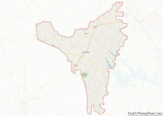
Online Interactive Map
Click on ![]() to view map in "full screen" mode.
to view map in "full screen" mode.
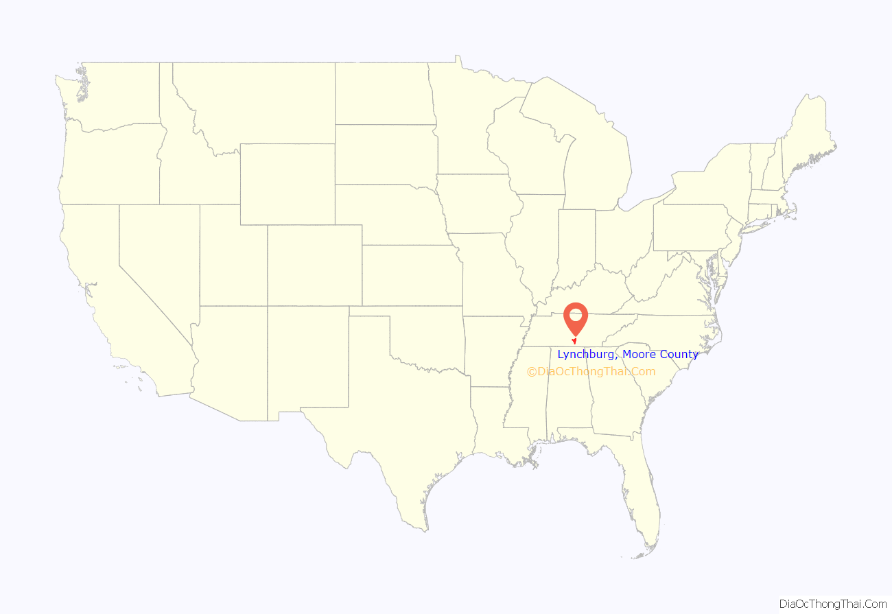
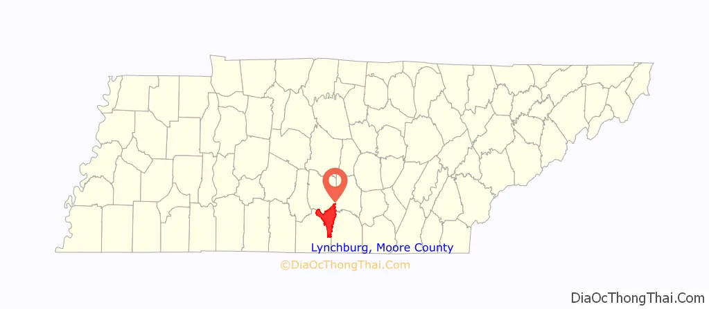
Lynchburg, Moore County location map. Where is Lynchburg, Moore County metropolitan government?
History
White settlers first arrived in the Lynchburg area around 1801. Main Street was originally the main road, and roughly followed the route of East Fork Mulberry Creek. Residences were generally located in the western half of Lynchburg, while industries were situated along the creek in the eastern half. One early settler, Thomas Roundtree, established a cotton mill along the creek in the vicinity of the modern Jack Daniel’s Distillery. By the 1830s, another settler, William P. Long, was operating a gristmill and cotton gin. Early Lynchburg was also home to a large tannery.
The origin of the city’s name is unclear. An article in an 1876 issue of the Lynchburg Sentinel suggests an early settler named the city after his native Lynchburg, Virginia. The WPA Guide to Tennessee (1939) states the city was named after an early resident named Tom Lynch. An article by Jeanne Ridgway Bigger in the spring 1972 issue of the Tennessee Historical Quarterly states that the city was named after a “Judge Lynch”, who presided over a vigilante committee that met in the city sometime after the War of 1812.
During the Civil War, residents of Lynchburg generally supported the Confederacy. Company E of the Confederate Army’s 1st Tennessee Cavalry consisted primarily of Lynchburg residents. A monument to the area’s Confederate soldiers stands on the lawn of the Moore County Courthouse.
In 1871, Moore County was created from parts of Lincoln, Bedford, Coffee, and Franklin counties (Lynchburg had been part of Lincoln). In June 1873, Lynchburg was chosen as the county seat of Moore, due in part to its central location within the new county’s boundaries. The county commissioners established a courthouse square along Main Street, the pattern of which was influenced by the square in nearby Shelbyville. Two schools, the Lynchburg Male and Female Institute and the Lynchburg Normal School, were established during this period, and several church congregations built elaborate new churches.
During the 1870s, Lynchburg was situated at the center of an agrarian economic triangle consisting of Tullahoma to the northeast, Shelbyville to the northwest, and Fayetteville to the south. As such, the city developed into an important mule trading center. The city also had a rising number of distilleries. By the 1880s, fifteen registered distilleries were operating in Moore County, with the most productive being Tom Eaton’s Distillery, and the second-most productive being the now-famous Jack Daniel’s. The distilleries provided a convenient market for local corn growers, and the leftover corn slop (after the alcohol was extracted) was used as feed for hogs and cattle.
On December 4, 1883, a fire destroyed nearly half of Lynchburg, including the courthouse and much of the courthouse square. A new courthouse (the present building) was completed in 1885. A separate jail (now a museum) was erected across the street in 1893. The rise of automobile traffic and the establishment of a state highway system in the early 20th century led to a commercial boom in Lynchburg, and many of the buildings on the courthouse square were built during this period. By 1920, Lynchburg had several schools and churches, a weekly newspaper, two banks, and several “flourishing business establishments”.
The passage of a state law barring the manufacture of liquor in 1909 effectively shut down the city’s distilleries. Although prohibition was repealed at the federal level in 1933, it remained in effect in Tennessee. Lem Motlow (1869–1947), a state senator and nephew of Jack Daniel, led efforts to repeal the state’s prohibition laws. In 1937, the state repealed the law barring the manufacture of alcoholic beverages, and Motlow reopened the Jack Daniel’s Distillery. In 1939, the state passed a “local option” law, allowing each county to choose (via referendum) whether or not to allow the sale of alcoholic beverages.
Motlow State Community College opened its campus in 1969 on 187 acres of land donated by Reagor Motlow and family in the northern part of Moore County in what is today part of Lynchburg.
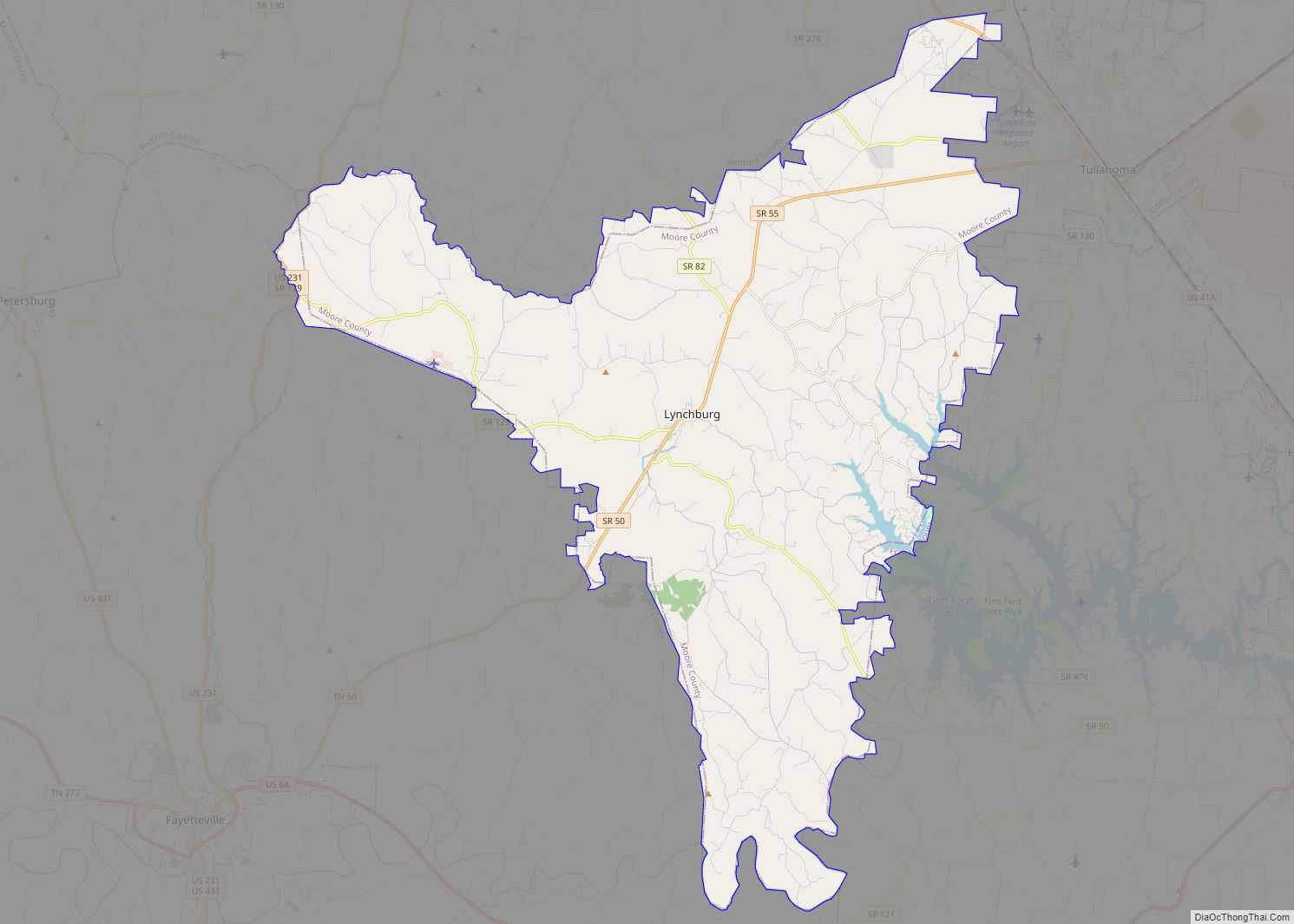
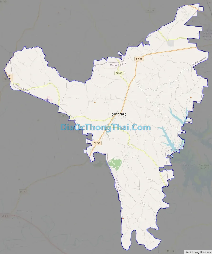
Lynchburg, Moore County Road Map
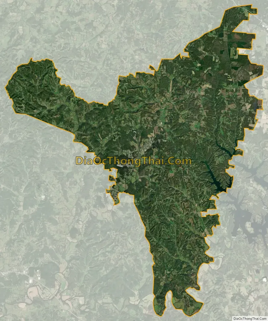
Lynchburg, Moore County city Satellite Map
Geography
Lynchburg is located at 35°17′3″N 86°21′27″W / 35.28417°N 86.35750°W / 35.28417; -86.35750.
According to the United States Census Bureau, the city has a total area of 130.4 square miles (337.7 km), of which 129.2 square miles (334.6 km) is land and 1.2 square miles (3.1 km) (0.93%) is water. The city lies in a valley carved by East Fork Mulberry Creek (part of the Elk River watershed). State Route 55, known as Majors Boulevard in Lynchburg, is the city’s main thoroughfare. Just south of Lynchburg, this highway intersects two other highways: State Route 50 (which continues southwest to Fayetteville) and State Route 129 (which continues westward to Petersburg).
See also
Map of Tennessee State and its subdivision:- Anderson
- Bedford
- Benton
- Bledsoe
- Blount
- Bradley
- Campbell
- Cannon
- Carroll
- Carter
- Cheatham
- Chester
- Claiborne
- Clay
- Cocke
- Coffee
- Crockett
- Cumberland
- Davidson
- Decatur
- DeKalb
- Dickson
- Dyer
- Fayette
- Fentress
- Franklin
- Gibson
- Giles
- Grainger
- Greene
- Grundy
- Hamblen
- Hamilton
- Hancock
- Hardeman
- Hardin
- Hawkins
- Haywood
- Henderson
- Henry
- Hickman
- Houston
- Humphreys
- Jackson
- Jefferson
- Johnson
- Knox
- Lake
- Lauderdale
- Lawrence
- Lewis
- Lincoln
- Loudon
- Macon
- Madison
- Marion
- Marshall
- Maury
- McMinn
- McNairy
- Meigs
- Monroe
- Montgomery
- Moore
- Morgan
- Obion
- Overton
- Perry
- Pickett
- Polk
- Putnam
- Rhea
- Roane
- Robertson
- Rutherford
- Scott
- Sequatchie
- Sevier
- Shelby
- Smith
- Stewart
- Sullivan
- Sumner
- Tipton
- Trousdale
- Unicoi
- Union
- Van Buren
- Warren
- Washington
- Wayne
- Weakley
- White
- Williamson
- Wilson
- Alabama
- Alaska
- Arizona
- Arkansas
- California
- Colorado
- Connecticut
- Delaware
- District of Columbia
- Florida
- Georgia
- Hawaii
- Idaho
- Illinois
- Indiana
- Iowa
- Kansas
- Kentucky
- Louisiana
- Maine
- Maryland
- Massachusetts
- Michigan
- Minnesota
- Mississippi
- Missouri
- Montana
- Nebraska
- Nevada
- New Hampshire
- New Jersey
- New Mexico
- New York
- North Carolina
- North Dakota
- Ohio
- Oklahoma
- Oregon
- Pennsylvania
- Rhode Island
- South Carolina
- South Dakota
- Tennessee
- Texas
- Utah
- Vermont
- Virginia
- Washington
- West Virginia
- Wisconsin
- Wyoming