Mosheim (pronounced Moss-hime) is a town in Greene County, Tennessee, United States. The population was 2,479 at the 2020 census.
| Name: | Mosheim town |
|---|---|
| LSAD Code: | 43 |
| LSAD Description: | town (suffix) |
| State: | Tennessee |
| County: | Greene County |
| Incorporated: | 1974 |
| Elevation: | 1,289 ft (393 m) |
| Total Area: | 6.27 sq mi (16.24 km²) |
| Land Area: | 6.27 sq mi (16.24 km²) |
| Water Area: | 0.00 sq mi (0.00 km²) |
| Total Population: | 2,479 |
| Population Density: | 395.37/sq mi (152.65/km²) |
| ZIP code: | 37571, 37743 and 37818 |
| Area code: | 423 |
| FIPS code: | 4750320 |
| GNISfeature ID: | 1294485 |
| Website: | http://www.mosheim-tn.org |
Online Interactive Map
Click on ![]() to view map in "full screen" mode.
to view map in "full screen" mode.
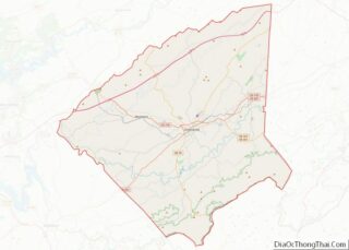
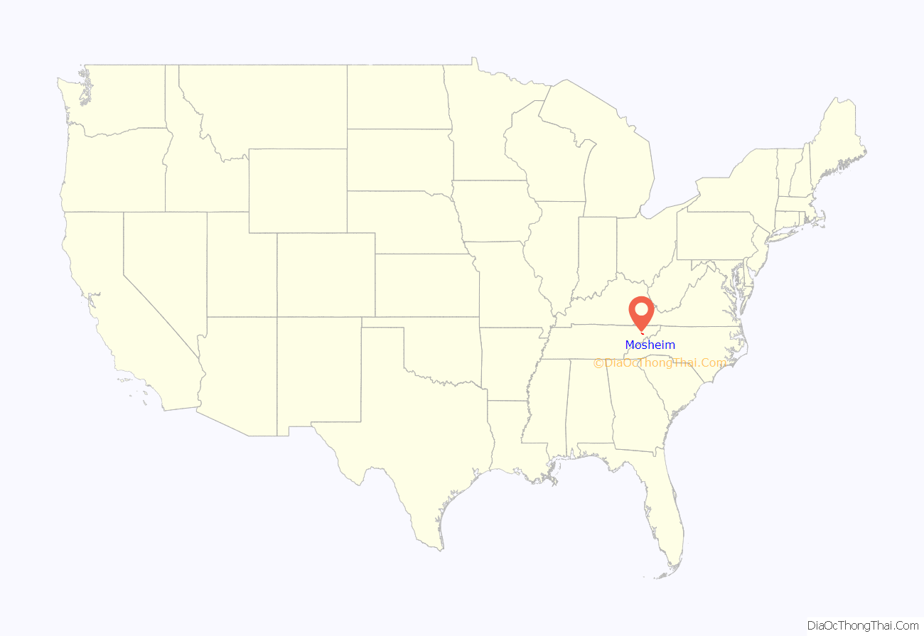
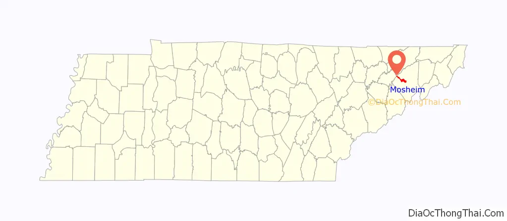
Mosheim location map. Where is Mosheim town?
History
Mosheim (also pronounced “MOSS-eyem” without the “h” sound) originally called “Blue Springs” after a spring that flows through the town, was settled circa 1800. Many of its initial settlers were German Lutherans. In 1872, the Lutherans established a local college at Blue Springs known as Mosheim Institute, after the German theologian, Johann Lorenz von Mosheim (1693–1755). That same year, the name of the town was officially changed to “Mosheim”, after the college.
The Civil War Battle of Blue Springs was fought near Mosheim on October 10, 1863. The town of Mosheim held reenactments of this battle every year from 1991 until 2008, but ceased performing the reenactment due to financial obligations. Several participants of the East Tennessee bridge-burning conspiracy, including noted potter Alex Haun, hailed from a community known as “Pottertown,” which was located just outside Mosheim.
The original Mosheim Volunteer Fire Department station 2700 is the oldest fire department in Greene County being chartered in 1961. In 1998, the Mosheim Volunteer Fire Department station 2700 split into two separate departments. With this major split happening the birth of the Town of Mosheim Volunteer Fire Department station 1100 was on the rise. The new department has a total of five fire apparatuses which are used to serve and protect inside the city limits of the Town Of Mosheim.
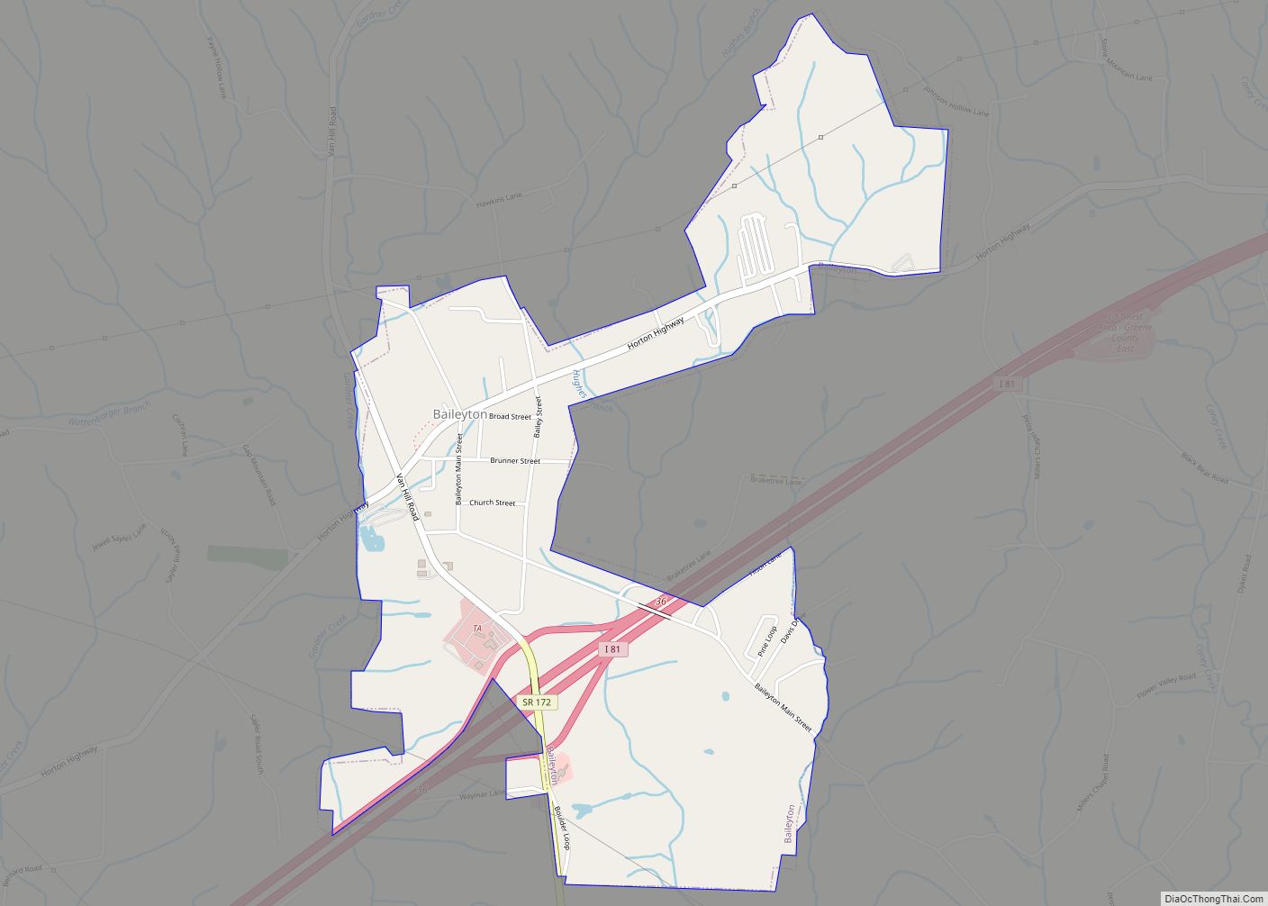
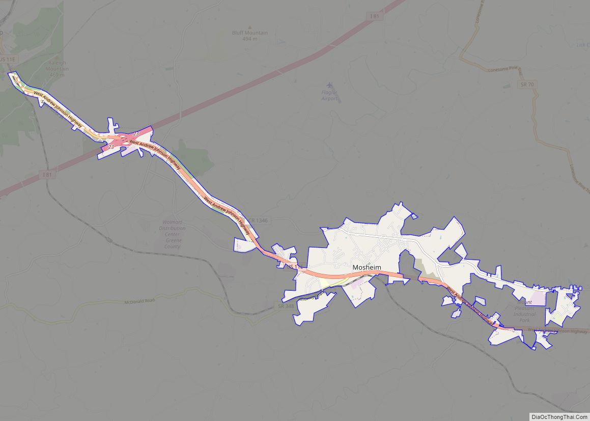
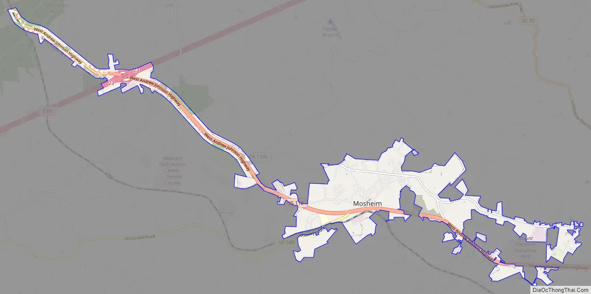
Mosheim Road Map
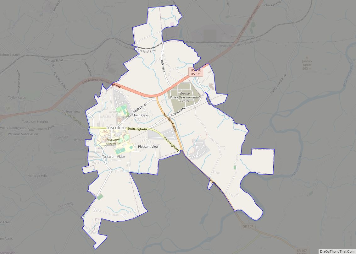
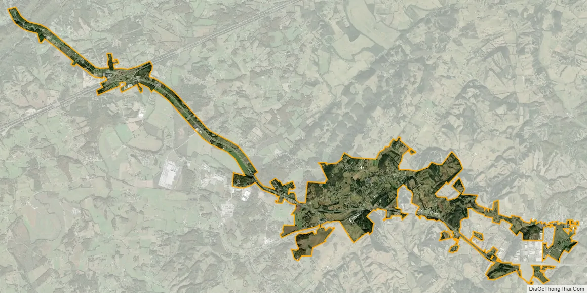
Mosheim city Satellite Map
Geography
Mosheim is located at 36°12′1″N 82°58′22″W / 36.20028°N 82.97278°W / 36.20028; -82.97278 (36.200373, -82.972785). The town is situated along the base and southern slopes of Big Ridge, an elongate ridge that runs roughly parallel to U.S. Route 11E. This area lies within the headwaters of Mosheim Branch, a tributary of Little Chucky Creek. U.S. Route 11E, known locally as Andrew Johnson Highway, connects Mosheim with Interstate 81 and Bulls Gap to the northwest, and Greeneville to the southeast. Tennessee State Route 348 connects Mosheim with Midway and the rural parts of western Greene County.
According to the United States Census Bureau, the town has a total area of 6.1 square miles (15.9 km), all land.
See also
Map of Tennessee State and its subdivision:- Anderson
- Bedford
- Benton
- Bledsoe
- Blount
- Bradley
- Campbell
- Cannon
- Carroll
- Carter
- Cheatham
- Chester
- Claiborne
- Clay
- Cocke
- Coffee
- Crockett
- Cumberland
- Davidson
- Decatur
- DeKalb
- Dickson
- Dyer
- Fayette
- Fentress
- Franklin
- Gibson
- Giles
- Grainger
- Greene
- Grundy
- Hamblen
- Hamilton
- Hancock
- Hardeman
- Hardin
- Hawkins
- Haywood
- Henderson
- Henry
- Hickman
- Houston
- Humphreys
- Jackson
- Jefferson
- Johnson
- Knox
- Lake
- Lauderdale
- Lawrence
- Lewis
- Lincoln
- Loudon
- Macon
- Madison
- Marion
- Marshall
- Maury
- McMinn
- McNairy
- Meigs
- Monroe
- Montgomery
- Moore
- Morgan
- Obion
- Overton
- Perry
- Pickett
- Polk
- Putnam
- Rhea
- Roane
- Robertson
- Rutherford
- Scott
- Sequatchie
- Sevier
- Shelby
- Smith
- Stewart
- Sullivan
- Sumner
- Tipton
- Trousdale
- Unicoi
- Union
- Van Buren
- Warren
- Washington
- Wayne
- Weakley
- White
- Williamson
- Wilson
- Alabama
- Alaska
- Arizona
- Arkansas
- California
- Colorado
- Connecticut
- Delaware
- District of Columbia
- Florida
- Georgia
- Hawaii
- Idaho
- Illinois
- Indiana
- Iowa
- Kansas
- Kentucky
- Louisiana
- Maine
- Maryland
- Massachusetts
- Michigan
- Minnesota
- Mississippi
- Missouri
- Montana
- Nebraska
- Nevada
- New Hampshire
- New Jersey
- New Mexico
- New York
- North Carolina
- North Dakota
- Ohio
- Oklahoma
- Oregon
- Pennsylvania
- Rhode Island
- South Carolina
- South Dakota
- Tennessee
- Texas
- Utah
- Vermont
- Virginia
- Washington
- West Virginia
- Wisconsin
- Wyoming