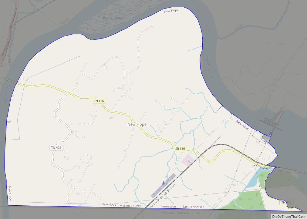
New Hope is a town in Marion County, Tennessee, United States. The population is 987. It is part of the Chattanooga, TN–GA Metropolitan Statistical Area.
| Name: | New Hope city |
|---|---|
| LSAD Code: | 25 |
| LSAD Description: | city (suffix) |
| State: | Tennessee |
| County: | Marion County |
| Elevation: | 715 ft (218 m) |
| Total Area: | 10.4 sq mi (26.9 km²) |
| Land Area: | 10.3 sq mi (26.7 km²) |
| Water Area: | 0.1 sq mi (0.1 km²) |
| Total Population: | 987 |
| Population Density: | 101.1/sq mi (39.0/km²) |
| ZIP code: | 37380 |
| Area code: | 423 |
| FIPS code: | 4752780 |
| GNISfeature ID: | 1310070 |
Online Interactive Map
Click on ![]() to view map in "full screen" mode.
to view map in "full screen" mode.
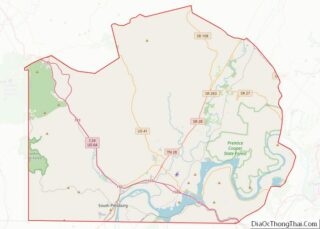
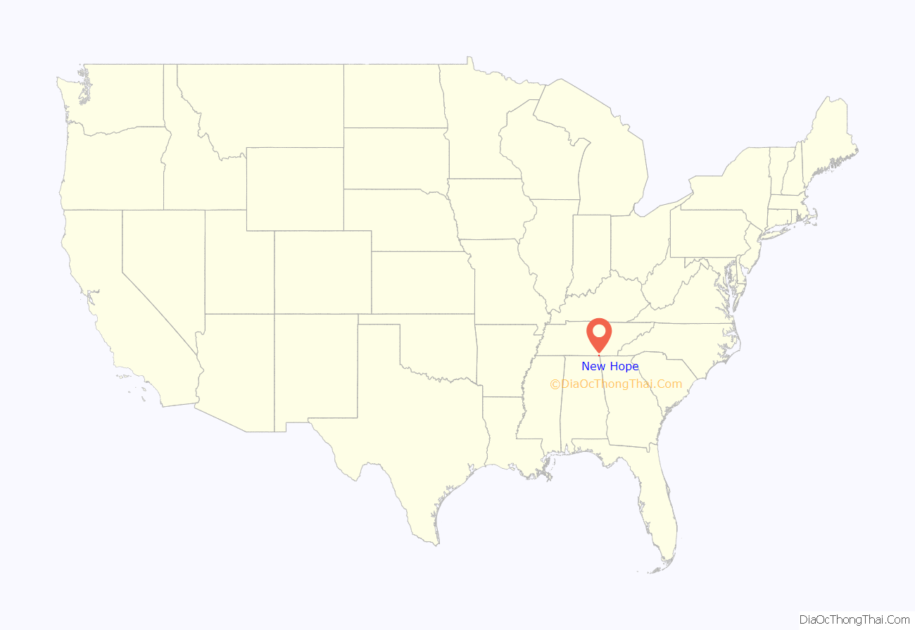
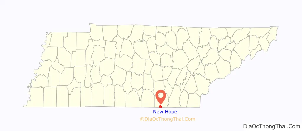
New Hope location map. Where is New Hope city?
History
Originally known as Antioch, New Hope incorporated in 1974 to avoid an annexation attempt by South Pittsburg, which most of the new city’s residents opposed. The name “New Hope” was taken from a local church and cemetery. It is located on the eastern shore of the Tennessee River at the Alabama/Tennessee state line. Early settlers and travelers reached New Hope from the western shore by the South Pittsburg Ferry (called “Sharon”) on the river until the construction of the Shelby Rhinehart Bridge (Blue Bridge) in 1981.
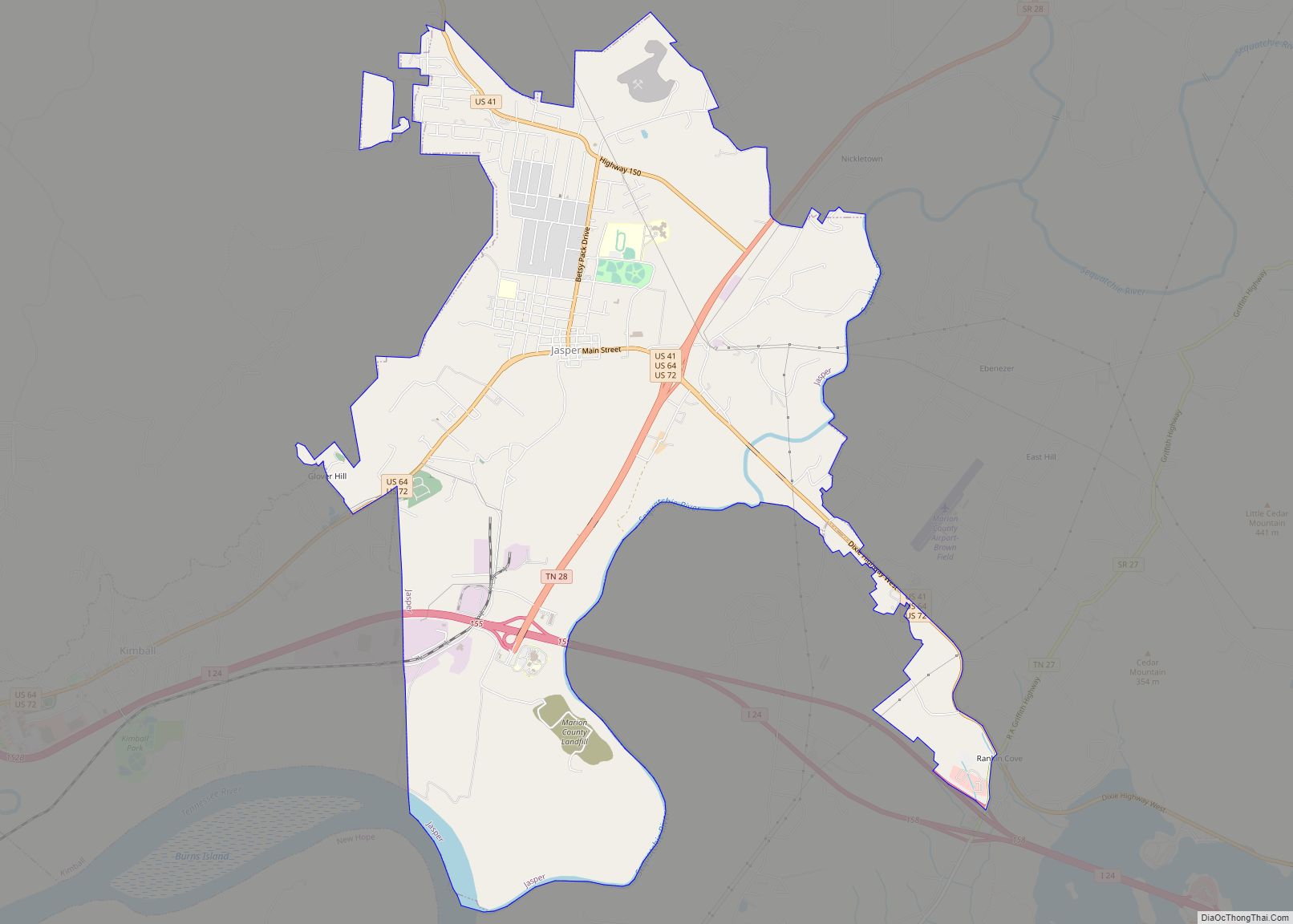
New Hope Road Map
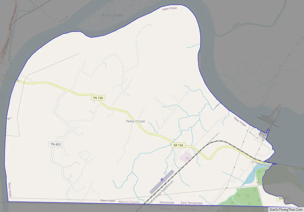
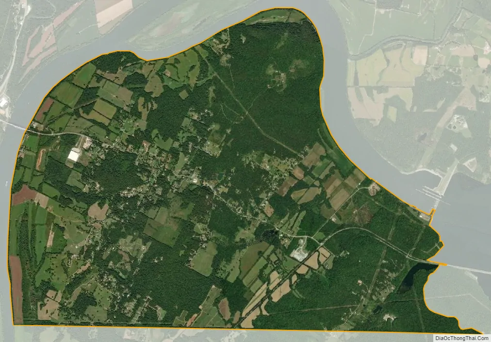
New Hope city Satellite Map
Geography
New Hope is located at 35°0′0″N 85°39′12″W / 35.00000°N 85.65333°W / 35.00000; -85.65333 (35.000112, -85.653332). The city occupies the south side of a U-shaped bend of the Tennessee River, mostly downstream from Nickajack Dam. The city’s municipal boundary stretches southward to the Tennessee-Alabama state line. South Pittsburg lies across the river to the west, Kimball and Jasper lie across the river to the north, and Nickajack Lake lies to the east. State Route 156 spans New Hope from east-to-west, connecting the city with U.S. Route 72 in South Pittsburg and Interstate 24 near Haletown.
According to the United States Census Bureau, the city has a total area of 10.4 square miles (27 km), of which 10.3 square miles (27 km) is land and 0.1 square miles (0.26 km) (0.58%) is water.
See also
Map of Tennessee State and its subdivision:- Anderson
- Bedford
- Benton
- Bledsoe
- Blount
- Bradley
- Campbell
- Cannon
- Carroll
- Carter
- Cheatham
- Chester
- Claiborne
- Clay
- Cocke
- Coffee
- Crockett
- Cumberland
- Davidson
- Decatur
- DeKalb
- Dickson
- Dyer
- Fayette
- Fentress
- Franklin
- Gibson
- Giles
- Grainger
- Greene
- Grundy
- Hamblen
- Hamilton
- Hancock
- Hardeman
- Hardin
- Hawkins
- Haywood
- Henderson
- Henry
- Hickman
- Houston
- Humphreys
- Jackson
- Jefferson
- Johnson
- Knox
- Lake
- Lauderdale
- Lawrence
- Lewis
- Lincoln
- Loudon
- Macon
- Madison
- Marion
- Marshall
- Maury
- McMinn
- McNairy
- Meigs
- Monroe
- Montgomery
- Moore
- Morgan
- Obion
- Overton
- Perry
- Pickett
- Polk
- Putnam
- Rhea
- Roane
- Robertson
- Rutherford
- Scott
- Sequatchie
- Sevier
- Shelby
- Smith
- Stewart
- Sullivan
- Sumner
- Tipton
- Trousdale
- Unicoi
- Union
- Van Buren
- Warren
- Washington
- Wayne
- Weakley
- White
- Williamson
- Wilson
- Alabama
- Alaska
- Arizona
- Arkansas
- California
- Colorado
- Connecticut
- Delaware
- District of Columbia
- Florida
- Georgia
- Hawaii
- Idaho
- Illinois
- Indiana
- Iowa
- Kansas
- Kentucky
- Louisiana
- Maine
- Maryland
- Massachusetts
- Michigan
- Minnesota
- Mississippi
- Missouri
- Montana
- Nebraska
- Nevada
- New Hampshire
- New Jersey
- New Mexico
- New York
- North Carolina
- North Dakota
- Ohio
- Oklahoma
- Oregon
- Pennsylvania
- Rhode Island
- South Carolina
- South Dakota
- Tennessee
- Texas
- Utah
- Vermont
- Virginia
- Washington
- West Virginia
- Wisconsin
- Wyoming