Petersburg is a town in Lincoln and Marshall counties in the U.S. state of Tennessee. The population was 580 at the 2000 census and 544 at the 2010 census. It used to be the location of Morgan school before consolidation
| Name: | Petersburg town |
|---|---|
| LSAD Code: | 43 |
| LSAD Description: | town (suffix) |
| State: | Tennessee |
| County: | Lincoln County, Marshall County |
| Elevation: | 755 ft (230 m) |
| Total Area: | 1.01 sq mi (2.61 km²) |
| Land Area: | 1.01 sq mi (2.61 km²) |
| Water Area: | 0.00 sq mi (0.00 km²) |
| Total Population: | 528 |
| Population Density: | 523.81/sq mi (202.19/km²) |
| ZIP code: | 37144 |
| Area code: | 931 |
| FIPS code: | 4757740 |
| GNISfeature ID: | 1297255 |
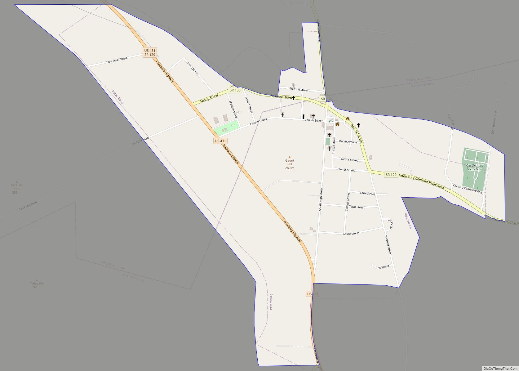
Online Interactive Map
Click on ![]() to view map in "full screen" mode.
to view map in "full screen" mode.
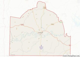
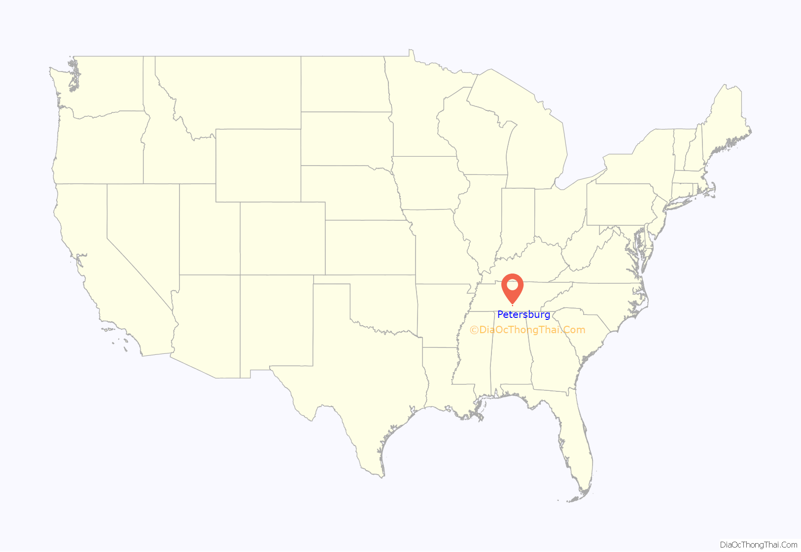
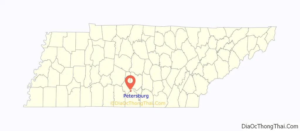
Petersburg location map. Where is Petersburg town?
Petersburg Road Map
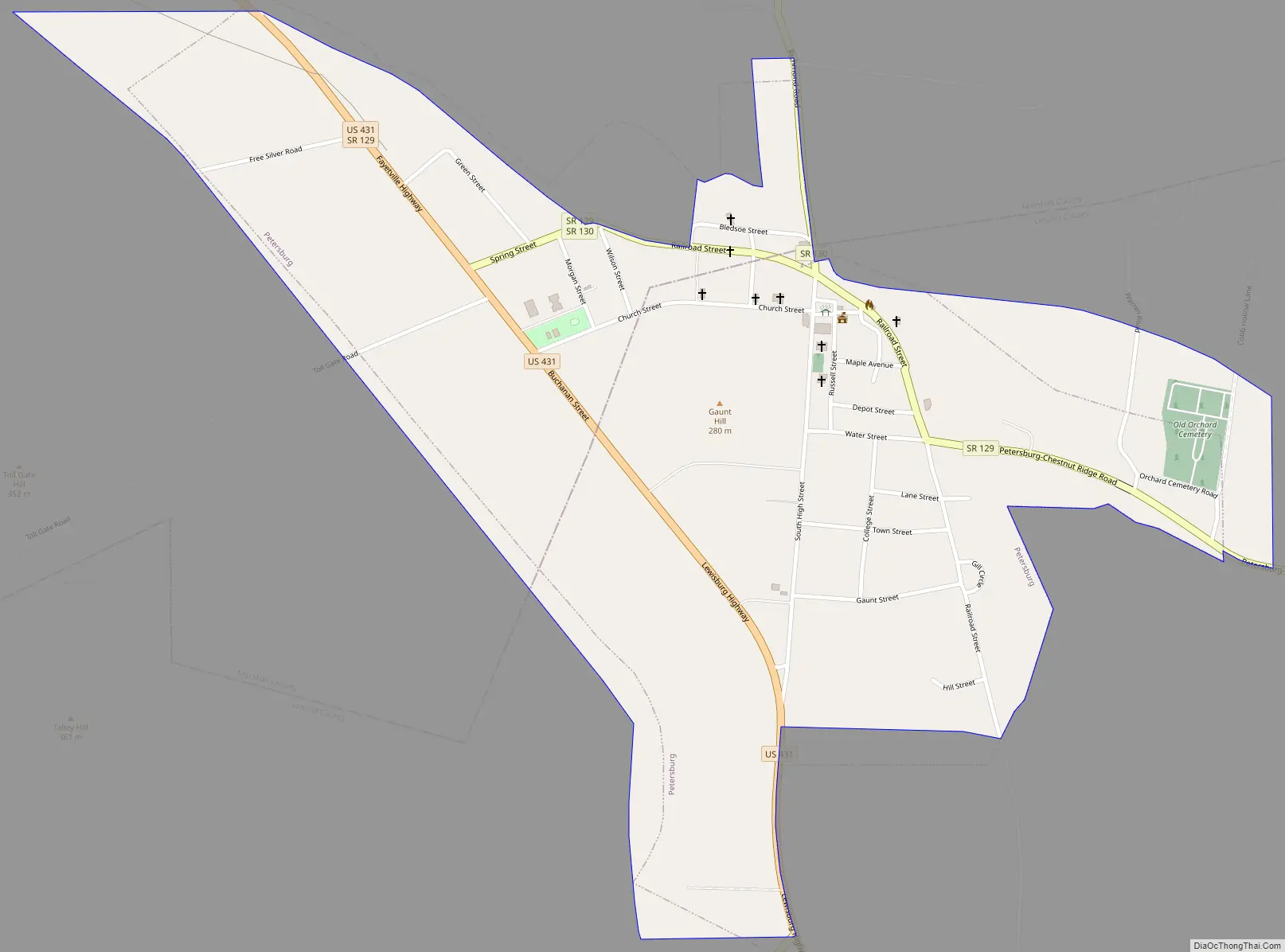
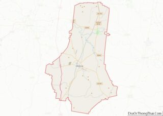
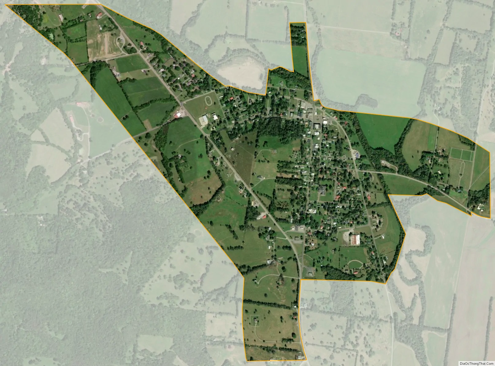
Petersburg city Satellite Map
Geography
Petersburg is located at 35°19′7″N 86°38′15″W / 35.31861°N 86.63750°W / 35.31861; -86.63750 (35.318501, -86.637456). The town is concentrated around a town square that lies at the intersection of Tennessee State Route 130 (SR 130), which connects the town with Shelbyville to the northeast, and Tennessee State Route 129 (SR 129), which connects the town with Cornersville to the west and Lynchburg to the east. U.S. Route 431 (US 431), which connects Petersburg with Lewisburg and Fayetteville, traverses the western part of town.
According to the United States Census Bureau, the town has a total area of 0.9 square miles (2.4 km), all land.
See also
Map of Tennessee State and its subdivision:- Anderson
- Bedford
- Benton
- Bledsoe
- Blount
- Bradley
- Campbell
- Cannon
- Carroll
- Carter
- Cheatham
- Chester
- Claiborne
- Clay
- Cocke
- Coffee
- Crockett
- Cumberland
- Davidson
- Decatur
- DeKalb
- Dickson
- Dyer
- Fayette
- Fentress
- Franklin
- Gibson
- Giles
- Grainger
- Greene
- Grundy
- Hamblen
- Hamilton
- Hancock
- Hardeman
- Hardin
- Hawkins
- Haywood
- Henderson
- Henry
- Hickman
- Houston
- Humphreys
- Jackson
- Jefferson
- Johnson
- Knox
- Lake
- Lauderdale
- Lawrence
- Lewis
- Lincoln
- Loudon
- Macon
- Madison
- Marion
- Marshall
- Maury
- McMinn
- McNairy
- Meigs
- Monroe
- Montgomery
- Moore
- Morgan
- Obion
- Overton
- Perry
- Pickett
- Polk
- Putnam
- Rhea
- Roane
- Robertson
- Rutherford
- Scott
- Sequatchie
- Sevier
- Shelby
- Smith
- Stewart
- Sullivan
- Sumner
- Tipton
- Trousdale
- Unicoi
- Union
- Van Buren
- Warren
- Washington
- Wayne
- Weakley
- White
- Williamson
- Wilson
- Alabama
- Alaska
- Arizona
- Arkansas
- California
- Colorado
- Connecticut
- Delaware
- District of Columbia
- Florida
- Georgia
- Hawaii
- Idaho
- Illinois
- Indiana
- Iowa
- Kansas
- Kentucky
- Louisiana
- Maine
- Maryland
- Massachusetts
- Michigan
- Minnesota
- Mississippi
- Missouri
- Montana
- Nebraska
- Nevada
- New Hampshire
- New Jersey
- New Mexico
- New York
- North Carolina
- North Dakota
- Ohio
- Oklahoma
- Oregon
- Pennsylvania
- Rhode Island
- South Carolina
- South Dakota
- Tennessee
- Texas
- Utah
- Vermont
- Virginia
- Washington
- West Virginia
- Wisconsin
- Wyoming