Rockford is a city in Blount County, Tennessee, United States. Its population was 798 at the 2000 census and 856 at the 2010 census. It is included in the Knoxville, Tennessee Metropolitan Statistical Area.
| Name: | Rockford city |
|---|---|
| LSAD Code: | 25 |
| LSAD Description: | city (suffix) |
| State: | Tennessee |
| County: | Blount County |
| Incorporated: | 1970 |
| Elevation: | 827 ft (252 m) |
| Total Area: | 3.20 sq mi (8.29 km²) |
| Land Area: | 3.18 sq mi (8.24 km²) |
| Water Area: | 0.02 sq mi (0.05 km²) |
| Total Population: | 822 |
| Population Density: | 258.25/sq mi (99.70/km²) |
| ZIP code: | 37853 |
| Area code: | 865 |
| FIPS code: | 4764160 |
| GNISfeature ID: | 1299809 |
| Website: | https://www.rockfordtn.com/ |
Online Interactive Map
Click on ![]() to view map in "full screen" mode.
to view map in "full screen" mode.
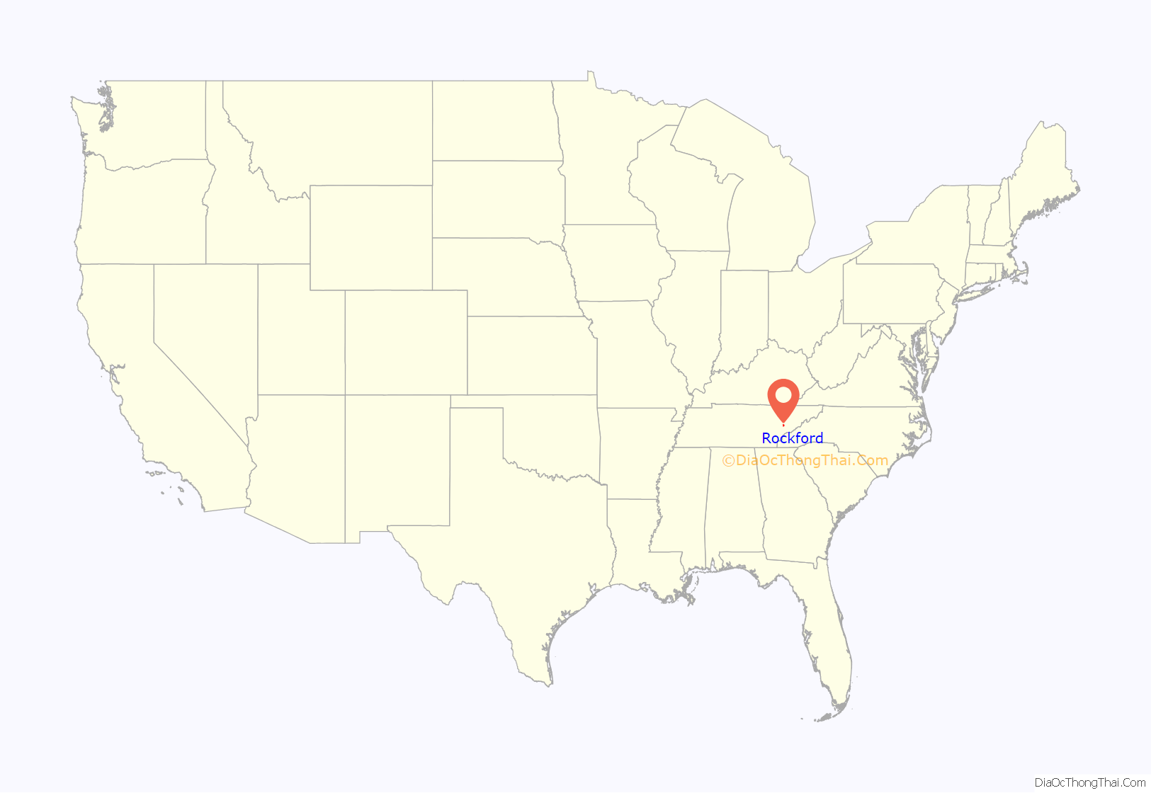
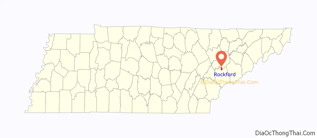
Rockford location map. Where is Rockford city?
History
Rockford is named for a river ford used by early 19th-century settlers and merchants travelling between Knoxville and Maryville. As its name implies, the ford was unusually rocky, and thus preferred by travellers, as large amounts of silt and sand made much of the Little River difficult to cross. The community was called “Rocky Ford” by the early 1800s.
Since the 1900s, the community has been the site of the Rockford Manufacturing Company, a yard cordage factory, and its adjacent and hazardous low head dam, formerly used to power the factory and now poses nothing more than a dangerous feature on the Little River, having been the site of numerous fatalities.
Rockford incorporated as a city in the early 1970s to avoid being annexed by Alcoa or Maryville, both of which were growing rapidly.
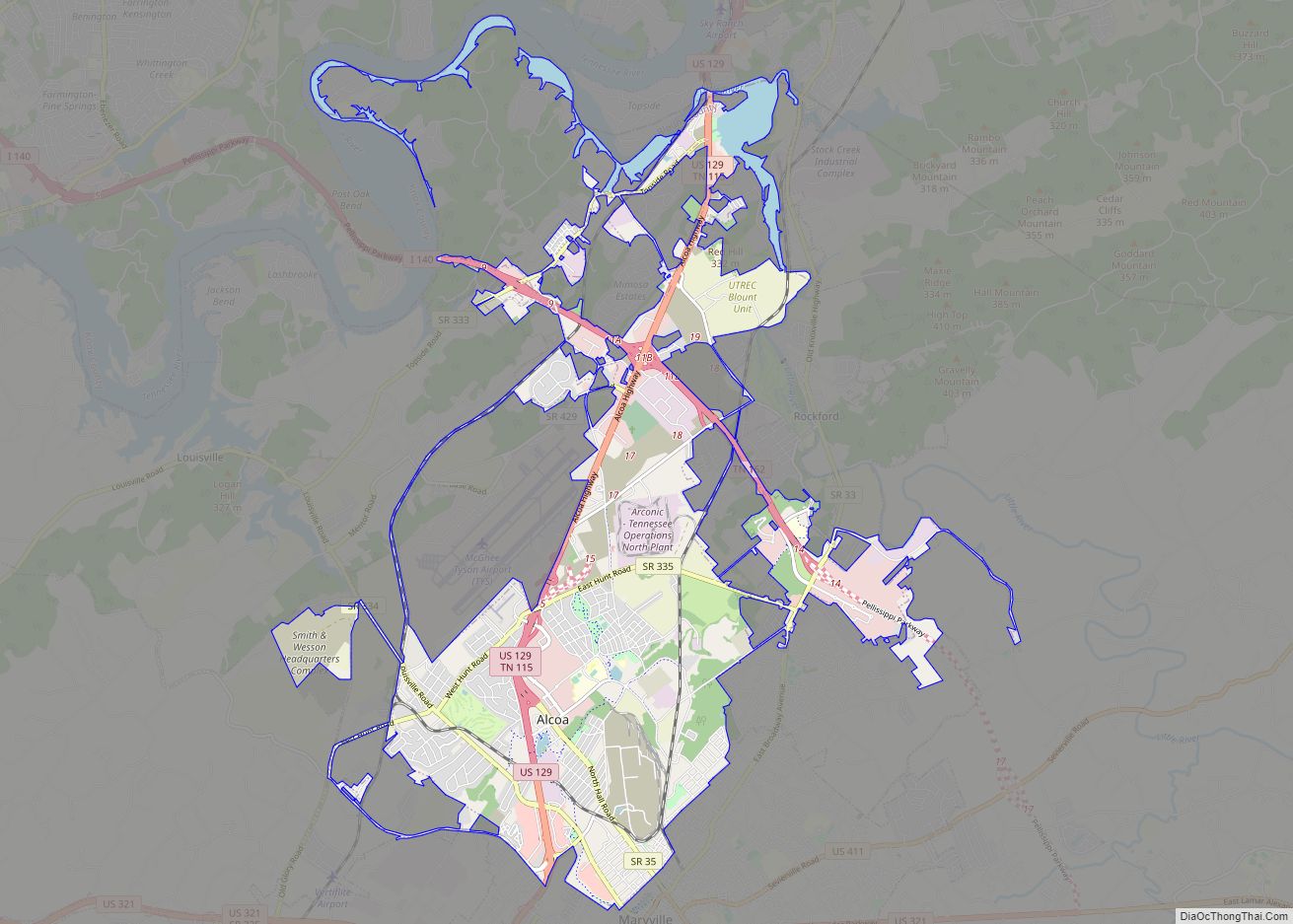
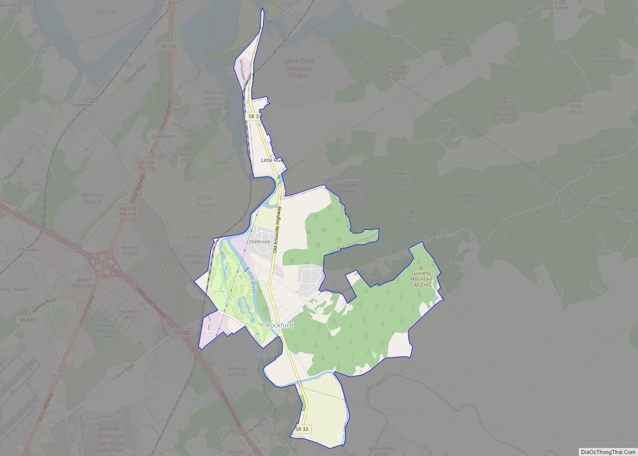
Rockford Road Map
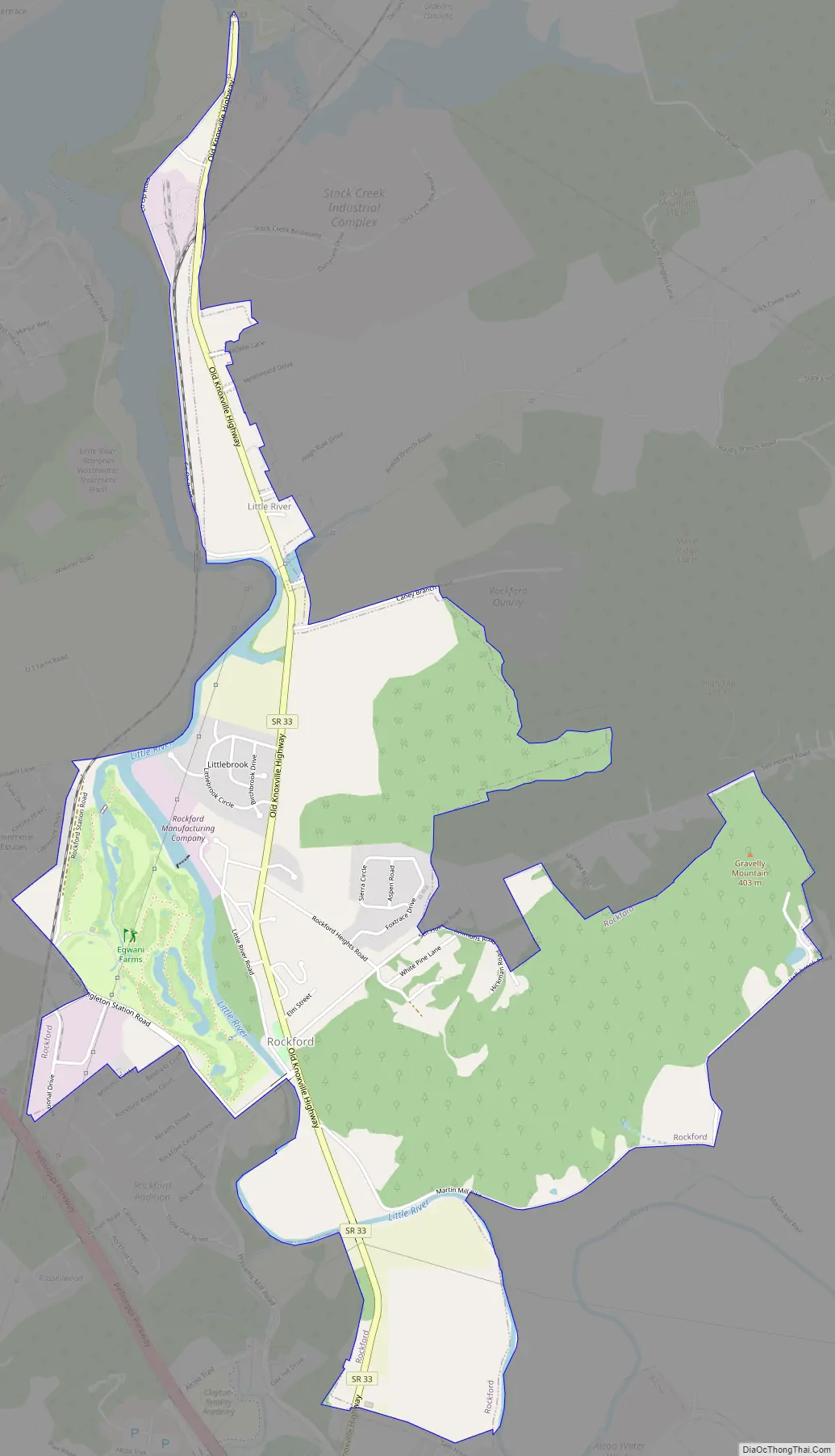
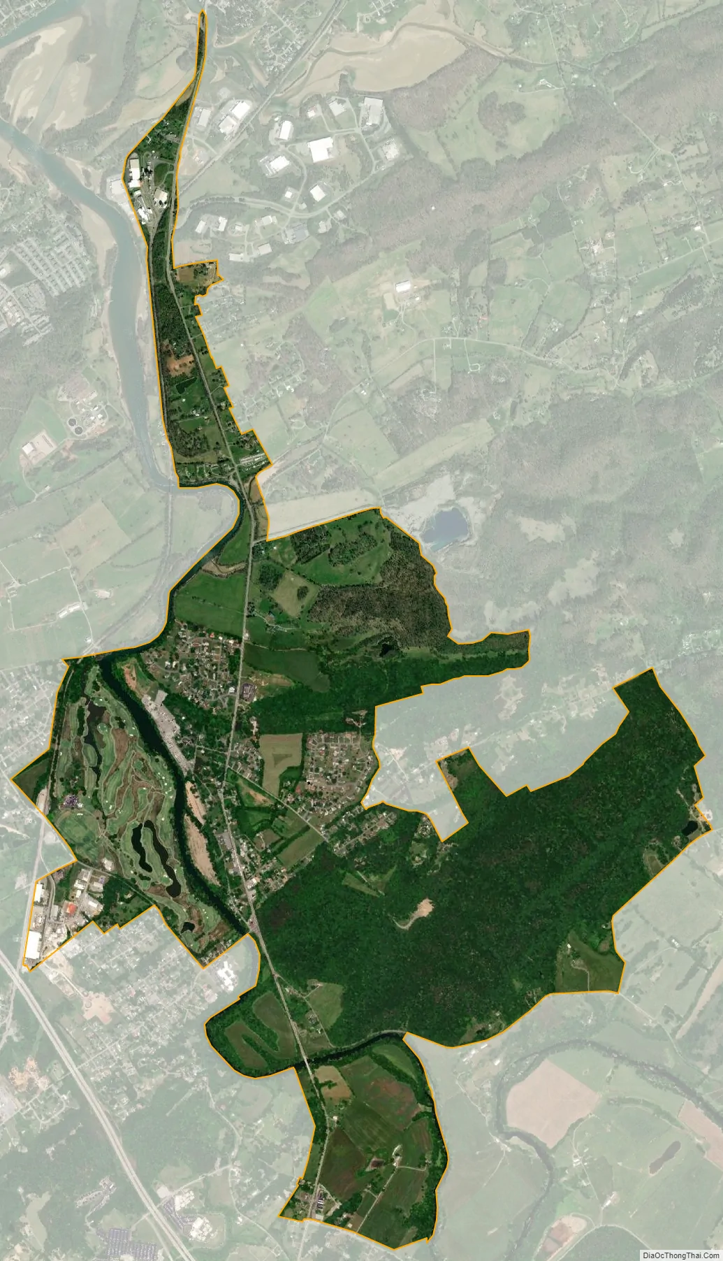
Rockford city Satellite Map
Geography
Rockford is located in northern Blount County at 35°50′21″N 83°56′32″W / 35.83917°N 83.94222°W / 35.83917; -83.94222 (35.839243, -83.942221). The Little River, which rises in the Great Smoky Mountains and empties into the Tennessee River, passes through the city.
According to the United States Census Bureau, the city has a total area of 3.2 square miles (8.3 km), of which 0.023 square miles (0.06 km), or 0.69%, is water.
Climate
The climate in this area is characterized by relatively high temperatures and evenly distributed precipitation throughout the year. According to the Köppen Climate Classification system, Rockford has a Humid subtropical climate, abbreviated “Cfa” on climate maps.
See also
Map of Tennessee State and its subdivision:- Anderson
- Bedford
- Benton
- Bledsoe
- Blount
- Bradley
- Campbell
- Cannon
- Carroll
- Carter
- Cheatham
- Chester
- Claiborne
- Clay
- Cocke
- Coffee
- Crockett
- Cumberland
- Davidson
- Decatur
- DeKalb
- Dickson
- Dyer
- Fayette
- Fentress
- Franklin
- Gibson
- Giles
- Grainger
- Greene
- Grundy
- Hamblen
- Hamilton
- Hancock
- Hardeman
- Hardin
- Hawkins
- Haywood
- Henderson
- Henry
- Hickman
- Houston
- Humphreys
- Jackson
- Jefferson
- Johnson
- Knox
- Lake
- Lauderdale
- Lawrence
- Lewis
- Lincoln
- Loudon
- Macon
- Madison
- Marion
- Marshall
- Maury
- McMinn
- McNairy
- Meigs
- Monroe
- Montgomery
- Moore
- Morgan
- Obion
- Overton
- Perry
- Pickett
- Polk
- Putnam
- Rhea
- Roane
- Robertson
- Rutherford
- Scott
- Sequatchie
- Sevier
- Shelby
- Smith
- Stewart
- Sullivan
- Sumner
- Tipton
- Trousdale
- Unicoi
- Union
- Van Buren
- Warren
- Washington
- Wayne
- Weakley
- White
- Williamson
- Wilson
- Alabama
- Alaska
- Arizona
- Arkansas
- California
- Colorado
- Connecticut
- Delaware
- District of Columbia
- Florida
- Georgia
- Hawaii
- Idaho
- Illinois
- Indiana
- Iowa
- Kansas
- Kentucky
- Louisiana
- Maine
- Maryland
- Massachusetts
- Michigan
- Minnesota
- Mississippi
- Missouri
- Montana
- Nebraska
- Nevada
- New Hampshire
- New Jersey
- New Mexico
- New York
- North Carolina
- North Dakota
- Ohio
- Oklahoma
- Oregon
- Pennsylvania
- Rhode Island
- South Carolina
- South Dakota
- Tennessee
- Texas
- Utah
- Vermont
- Virginia
- Washington
- West Virginia
- Wisconsin
- Wyoming