Summertown is an unincorporated community and census-designated place (CDP) in Lawrence County, Tennessee, United States. The population of Summertown was 866 at the 2010 census. The town has a ZIP Code of 38483. Some rural areas in neighboring Lewis and Maury counties also use a “Summertown” mailing address, but their population is not included in the Census figures.
| Name: | Summertown CDP |
|---|---|
| LSAD Code: | 57 |
| LSAD Description: | CDP (suffix) |
| State: | Tennessee |
| County: | Lawrence County |
| Elevation: | 991 ft (302 m) |
| Total Area: | 2.01 sq mi (5.21 km²) |
| Land Area: | 2.01 sq mi (5.21 km²) |
| Water Area: | 0.00 sq mi (0.00 km²) |
| Total Population: | 856 |
| Population Density: | 425.66/sq mi (164.38/km²) |
| ZIP code: | 38483 |
| Area code: | 931 |
| FIPS code: | 4772040 |
| GNISfeature ID: | 1271843 |
Online Interactive Map
Click on ![]() to view map in "full screen" mode.
to view map in "full screen" mode.
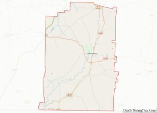
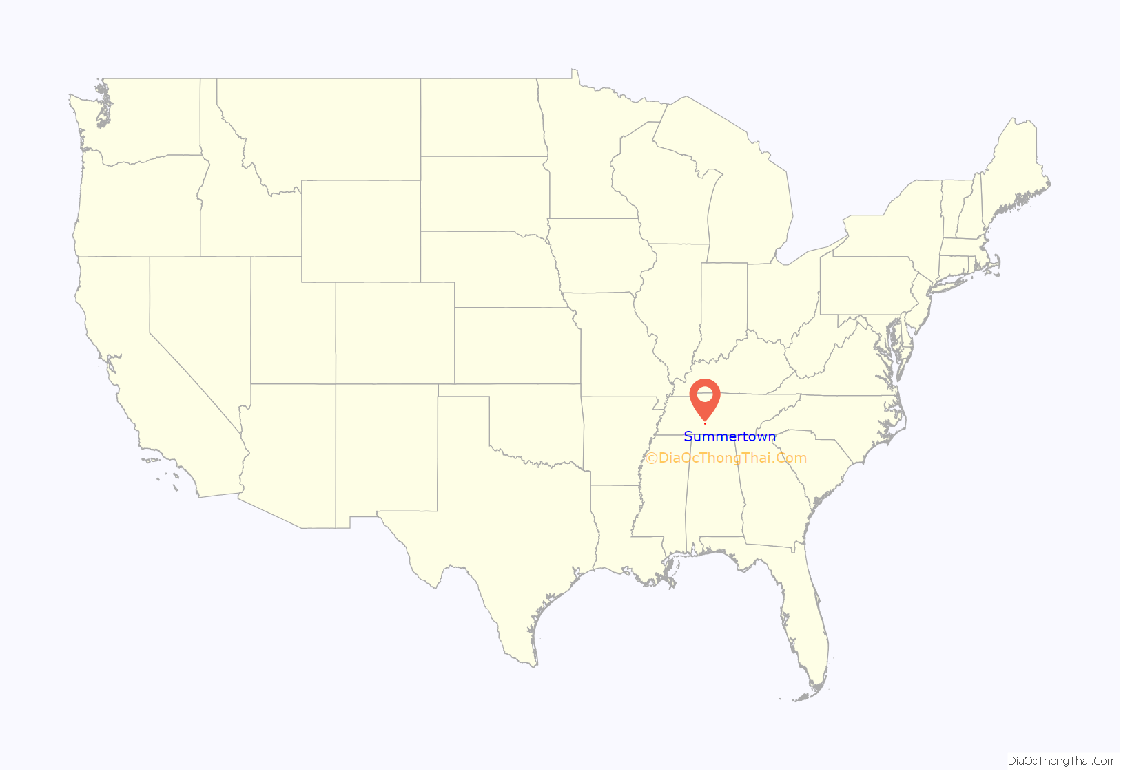
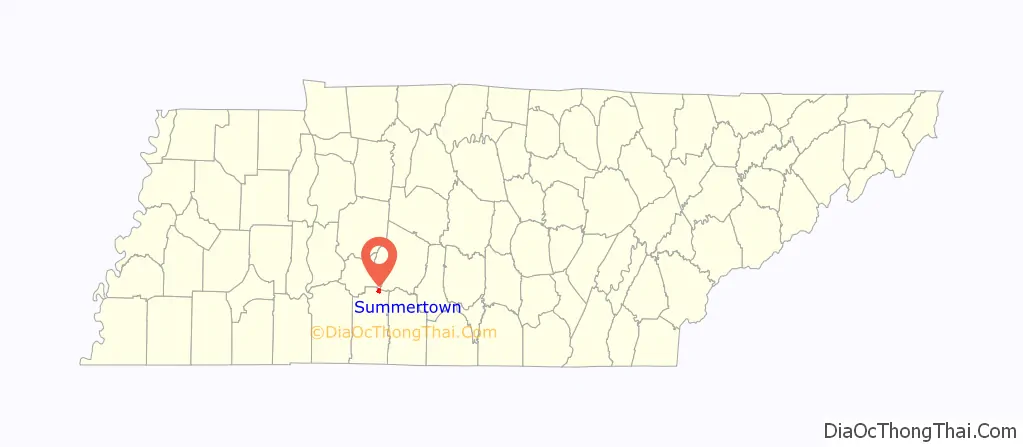
Summertown location map. Where is Summertown CDP?
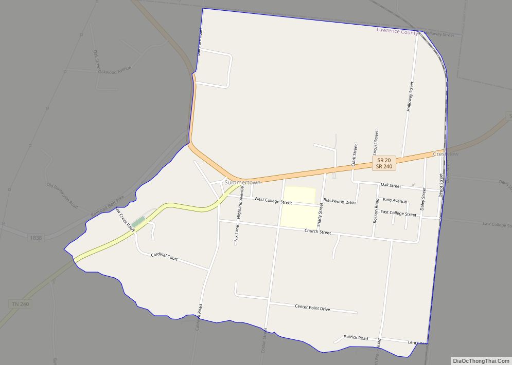
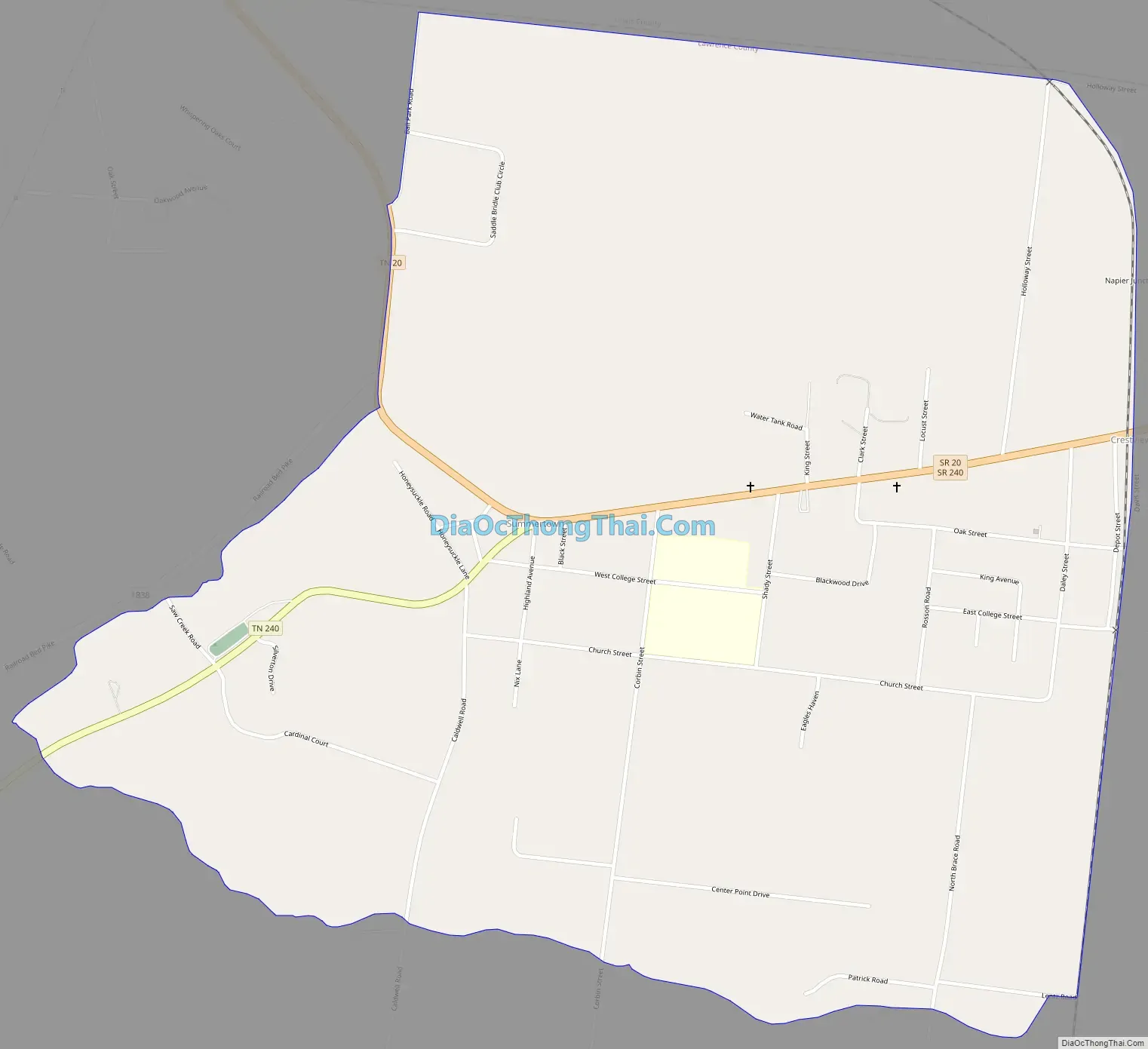
Summertown Road Map
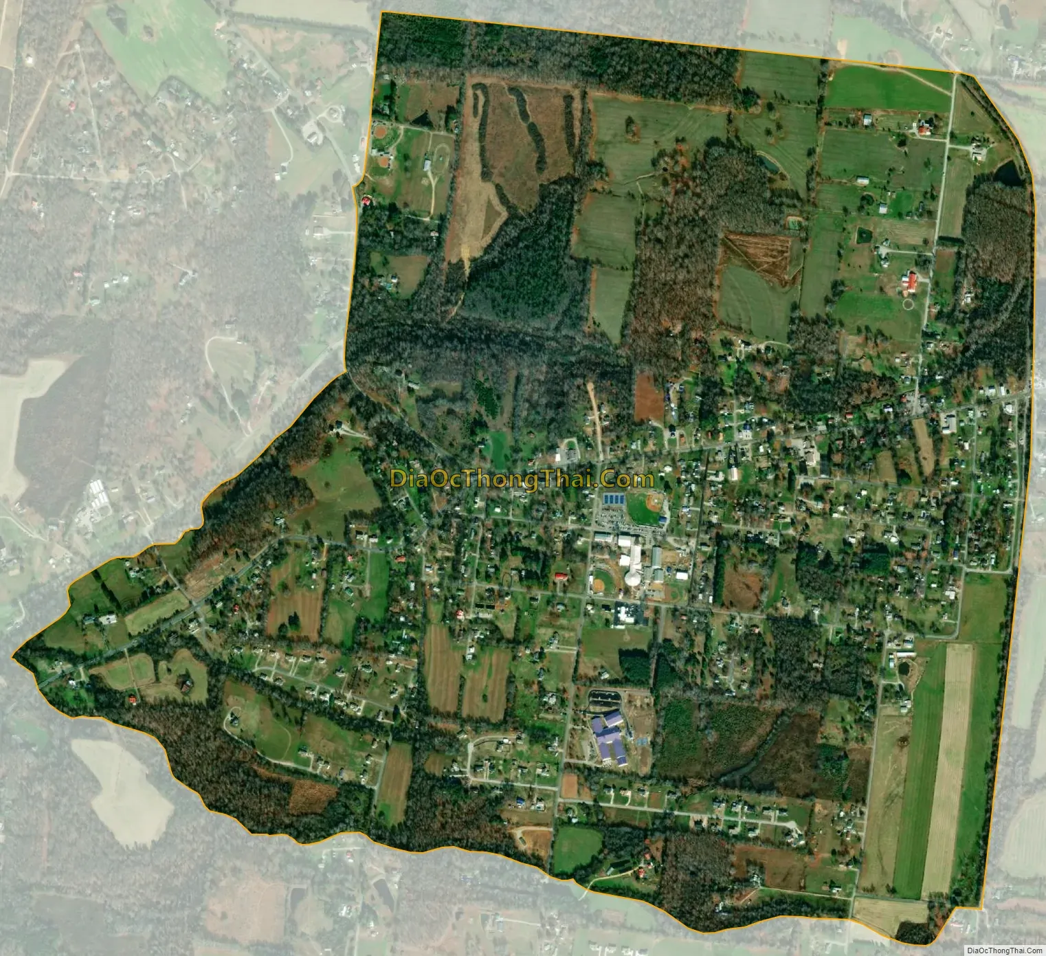
Summertown city Satellite Map
Geography
Summertown is in northeastern Lawrence County and is bordered to the north by Lewis County and to the northeast by Maury County. Tennessee State Route 20 passes through the center of town, leading east 2 miles (3 km) to U.S. Route 43 and northwest 19 miles (31 km) to Hohenwald. US-43 leads south 14 miles (23 km) to Lawrenceburg, the Lawrence county seat, and northeast 20 miles (32 km) to Columbia.
According to the U.S. Census Bureau, the Summertown CDP has an area of 2.0 square miles (5.2 km), all of it recorded as land. The community is drained by the North and South Forks of Saw Creek, a west-flowing tributary of the Buffalo River, which in turn flows northwest to the Duck River shortly before that river’s mouth at the Tennessee River.
See also
Map of Tennessee State and its subdivision:- Anderson
- Bedford
- Benton
- Bledsoe
- Blount
- Bradley
- Campbell
- Cannon
- Carroll
- Carter
- Cheatham
- Chester
- Claiborne
- Clay
- Cocke
- Coffee
- Crockett
- Cumberland
- Davidson
- Decatur
- DeKalb
- Dickson
- Dyer
- Fayette
- Fentress
- Franklin
- Gibson
- Giles
- Grainger
- Greene
- Grundy
- Hamblen
- Hamilton
- Hancock
- Hardeman
- Hardin
- Hawkins
- Haywood
- Henderson
- Henry
- Hickman
- Houston
- Humphreys
- Jackson
- Jefferson
- Johnson
- Knox
- Lake
- Lauderdale
- Lawrence
- Lewis
- Lincoln
- Loudon
- Macon
- Madison
- Marion
- Marshall
- Maury
- McMinn
- McNairy
- Meigs
- Monroe
- Montgomery
- Moore
- Morgan
- Obion
- Overton
- Perry
- Pickett
- Polk
- Putnam
- Rhea
- Roane
- Robertson
- Rutherford
- Scott
- Sequatchie
- Sevier
- Shelby
- Smith
- Stewart
- Sullivan
- Sumner
- Tipton
- Trousdale
- Unicoi
- Union
- Van Buren
- Warren
- Washington
- Wayne
- Weakley
- White
- Williamson
- Wilson
- Alabama
- Alaska
- Arizona
- Arkansas
- California
- Colorado
- Connecticut
- Delaware
- District of Columbia
- Florida
- Georgia
- Hawaii
- Idaho
- Illinois
- Indiana
- Iowa
- Kansas
- Kentucky
- Louisiana
- Maine
- Maryland
- Massachusetts
- Michigan
- Minnesota
- Mississippi
- Missouri
- Montana
- Nebraska
- Nevada
- New Hampshire
- New Jersey
- New Mexico
- New York
- North Carolina
- North Dakota
- Ohio
- Oklahoma
- Oregon
- Pennsylvania
- Rhode Island
- South Carolina
- South Dakota
- Tennessee
- Texas
- Utah
- Vermont
- Virginia
- Washington
- West Virginia
- Wisconsin
- Wyoming