Trenton is the county seat and fourth largest city of Gibson County, Tennessee, United States. The population was 4,264 at the 2010 census, down from 4,683 in 2000.
| Name: | Trenton city |
|---|---|
| LSAD Code: | 25 |
| LSAD Description: | city (suffix) |
| State: | Tennessee |
| County: | Gibson County |
| Incorporated: | 1847 |
| Elevation: | 331 ft (101 m) |
| Total Area: | 8.09 sq mi (20.95 km²) |
| Land Area: | 8.04 sq mi (20.81 km²) |
| Water Area: | 0.05 sq mi (0.14 km²) |
| Total Population: | 4,240 |
| Population Density: | 527.56/sq mi (203.70/km²) |
| ZIP code: | 38382 |
| Area code: | 731 |
| FIPS code: | 4775000 |
| GNISfeature ID: | 1304159 |
| Website: | trentontn.net |
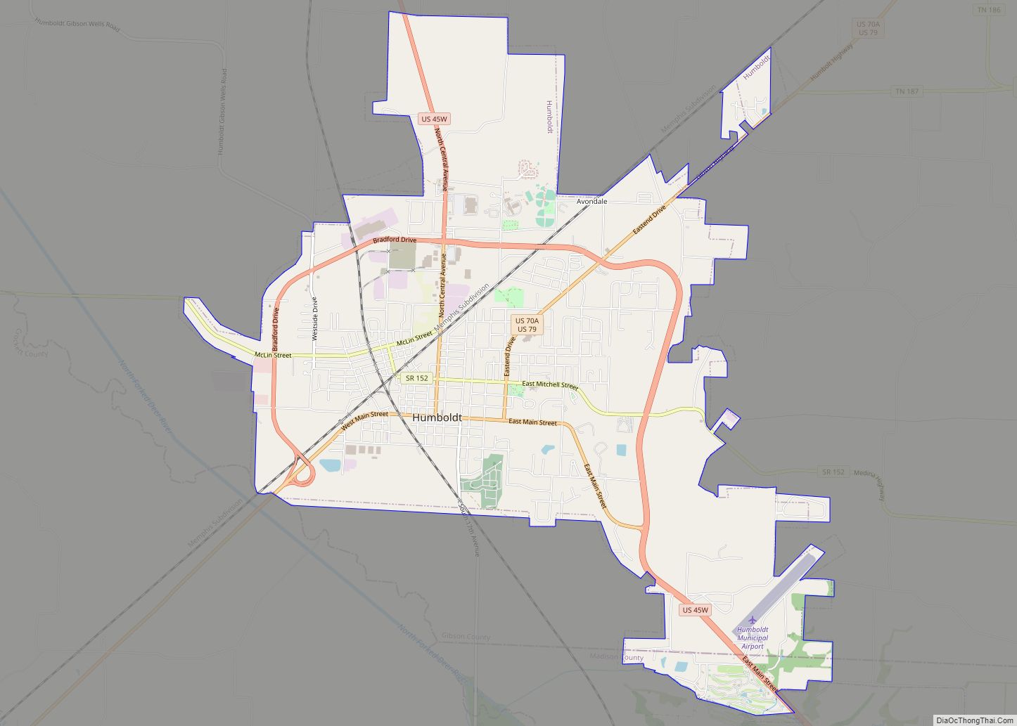
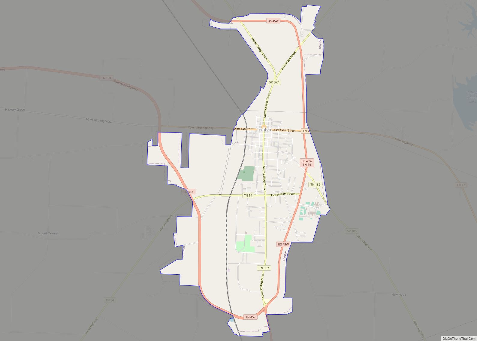
Online Interactive Map
Click on ![]() to view map in "full screen" mode.
to view map in "full screen" mode.
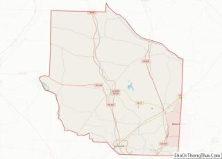
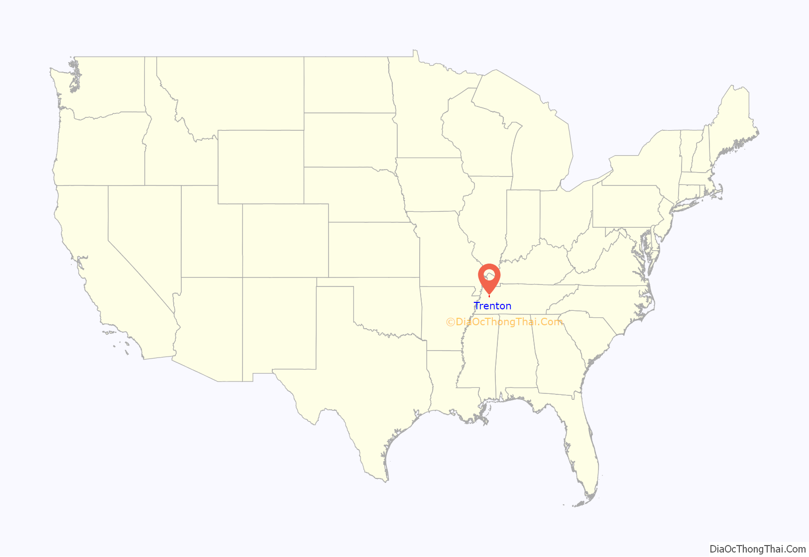
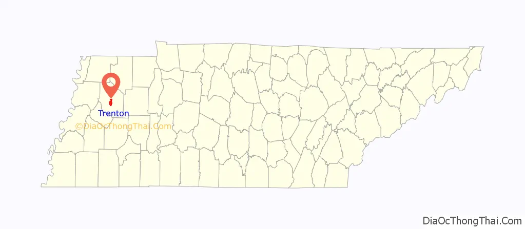
Trenton location map. Where is Trenton city?
History
Trenton was established in 1824 as a county seat for the newly-created Gibson County. The site was initially home to a trading post known as “Gibson-Port” that was operated by Thomas Gibson, a brother of the county’s namesake, Colonel John Gibson. The city is named for Trenton, New Jersey.
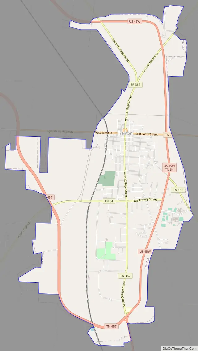
Trenton Road Map
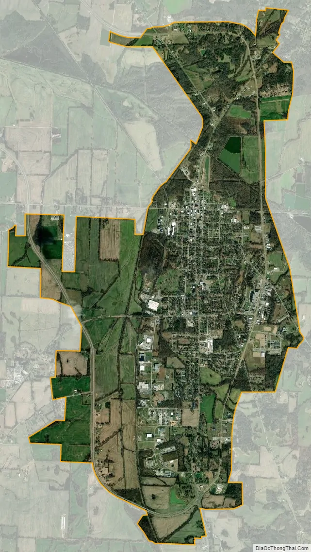
Trenton city Satellite Map
Geography
Trenton is located in central Gibson County at 35°58′25″N 88°56′30″W / 35.97361°N 88.94167°W / 35.97361; -88.94167 (35.973627, −88.941569). U.S. Route 45W passes through the east side of the city, bypassing downtown. It leads north 33 miles (53 km) to Union City and south 30 miles (48 km) to Jackson. Milan is 12 miles (19 km) to the southeast via Tennessee State Route 77, Bradford is 10 miles (16 km) to the northeast via State Route 54, Alamo is 18 miles (29 km) to the southwest, also via State Route 54, and Dyersburg is 26 miles (42 km) to the west via State Route 104.
According to the United States Census Bureau, the city of Trenton has a total area of 8.2 square miles (21.2 km), of which 8.1 square miles (21.1 km) are land and 0.04 square miles (0.1 km), or 0.64%, are water.
See also
Map of Tennessee State and its subdivision:- Anderson
- Bedford
- Benton
- Bledsoe
- Blount
- Bradley
- Campbell
- Cannon
- Carroll
- Carter
- Cheatham
- Chester
- Claiborne
- Clay
- Cocke
- Coffee
- Crockett
- Cumberland
- Davidson
- Decatur
- DeKalb
- Dickson
- Dyer
- Fayette
- Fentress
- Franklin
- Gibson
- Giles
- Grainger
- Greene
- Grundy
- Hamblen
- Hamilton
- Hancock
- Hardeman
- Hardin
- Hawkins
- Haywood
- Henderson
- Henry
- Hickman
- Houston
- Humphreys
- Jackson
- Jefferson
- Johnson
- Knox
- Lake
- Lauderdale
- Lawrence
- Lewis
- Lincoln
- Loudon
- Macon
- Madison
- Marion
- Marshall
- Maury
- McMinn
- McNairy
- Meigs
- Monroe
- Montgomery
- Moore
- Morgan
- Obion
- Overton
- Perry
- Pickett
- Polk
- Putnam
- Rhea
- Roane
- Robertson
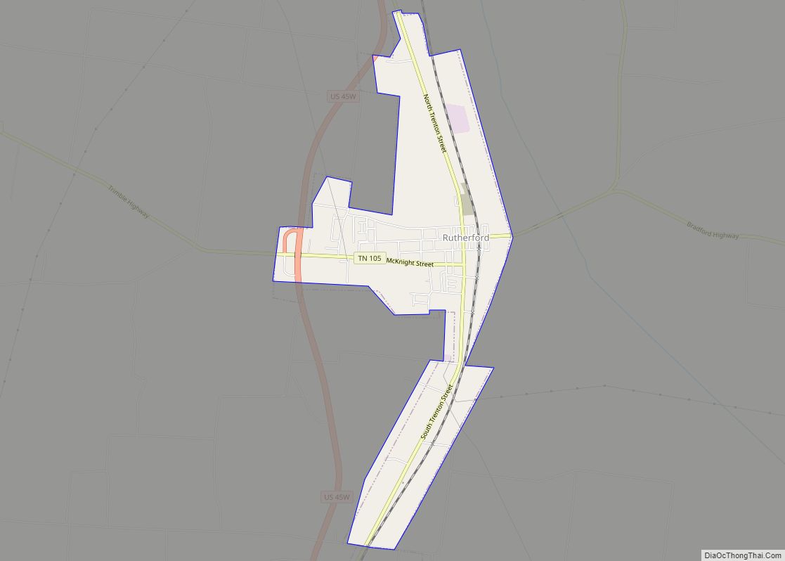
- Rutherford
- Scott
- Sequatchie
- Sevier
- Shelby
- Smith
- Stewart
- Sullivan
- Sumner
- Tipton
- Trousdale
- Unicoi
- Union
- Van Buren
- Warren
- Washington
- Wayne
- Weakley
- White
- Williamson
- Wilson
- Alabama
- Alaska
- Arizona
- Arkansas
- California
- Colorado
- Connecticut
- Delaware
- District of Columbia
- Florida
- Georgia
- Hawaii
- Idaho
- Illinois
- Indiana
- Iowa
- Kansas
- Kentucky
- Louisiana
- Maine
- Maryland
- Massachusetts
- Michigan
- Minnesota
- Mississippi
- Missouri
- Montana
- Nebraska
- Nevada
- New Hampshire
- New Jersey
- New Mexico
- New York
- North Carolina
- North Dakota
- Ohio
- Oklahoma
- Oregon
- Pennsylvania
- Rhode Island
- South Carolina
- South Dakota
- Tennessee
- Texas
- Utah
- Vermont
- Virginia
- Washington
- West Virginia
- Wisconsin
- Wyoming