Bellflower is a village in McLean County, Illinois, United States. The population was 346 at the 2020 census. It is part of the Bloomington–Normal Metropolitan Statistical Area.
| Name: | Bellflower village |
|---|---|
| LSAD Code: | 47 |
| LSAD Description: | village (suffix) |
| State: | Illinois |
| County: | McLean County |
| Elevation: | 787 ft (240 m) |
| Total Area: | 0.36 sq mi (0.93 km²) |
| Land Area: | 0.36 sq mi (0.93 km²) |
| Water Area: | 0.00 sq mi (0.00 km²) |
| Total Population: | 346 |
| Population Density: | 958.45/sq mi (370.56/km²) |
| ZIP code: | 61724 |
| Area code: | 309 |
| FIPS code: | 1704897 |
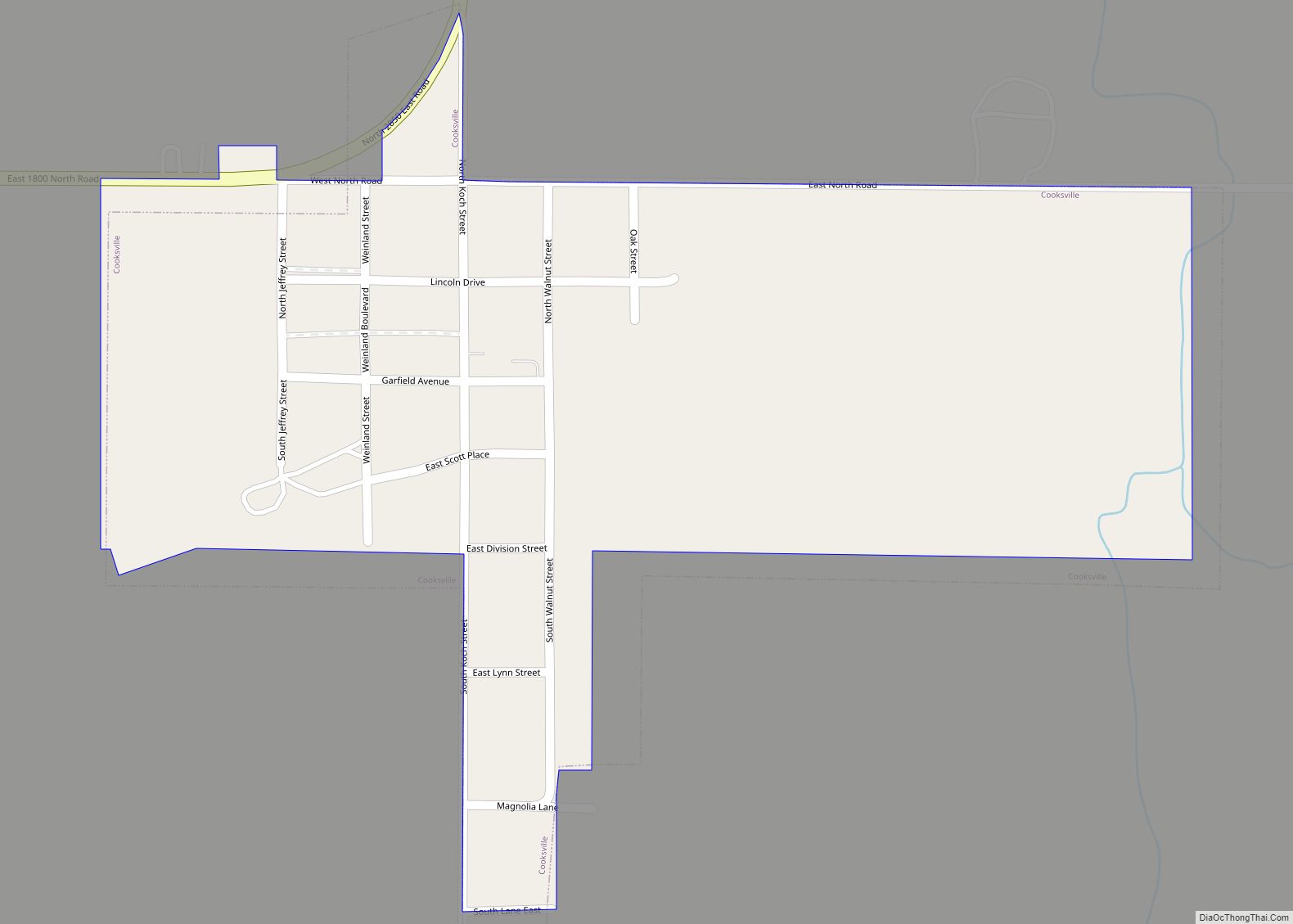
Online Interactive Map
Click on ![]() to view map in "full screen" mode.
to view map in "full screen" mode.
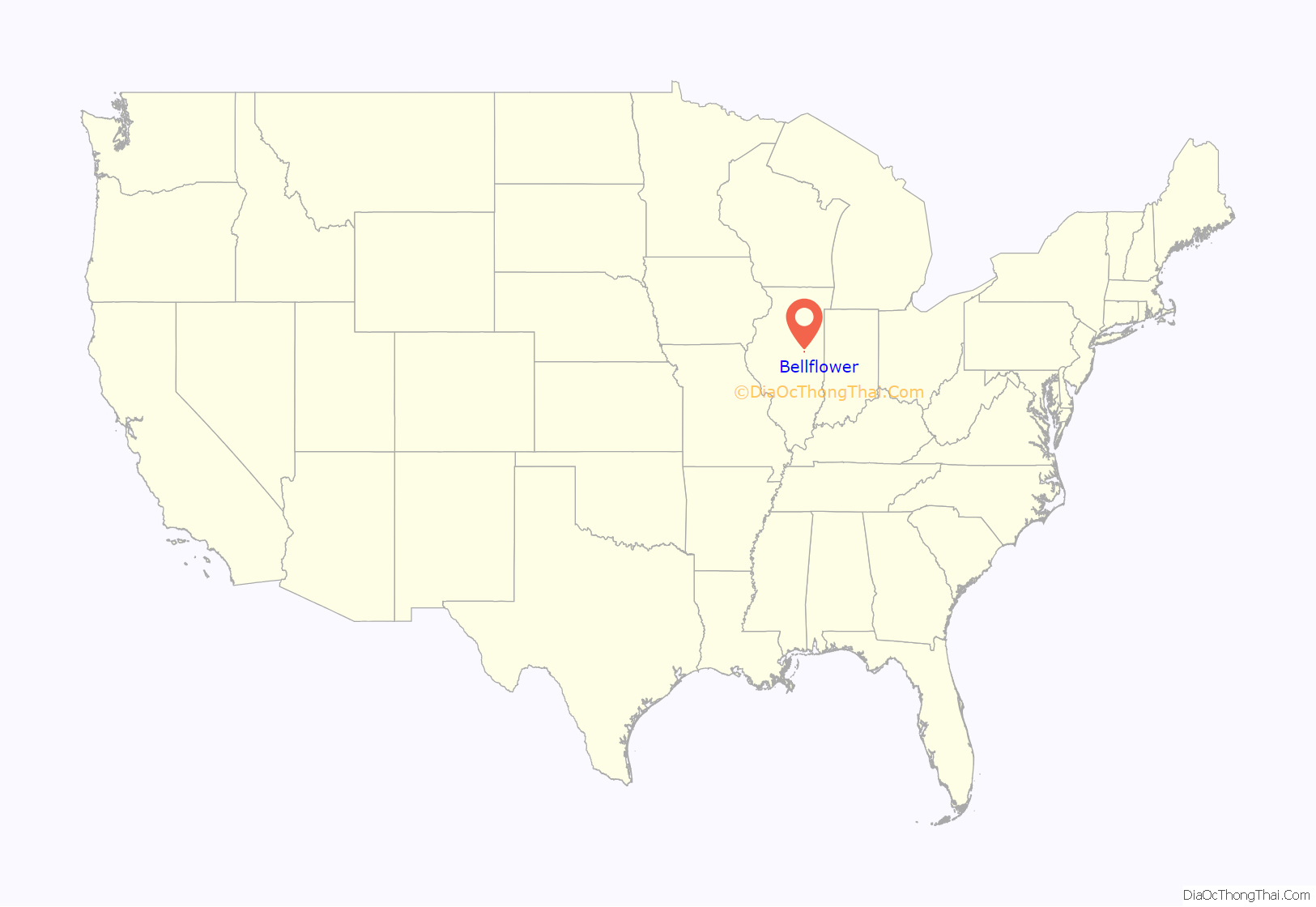
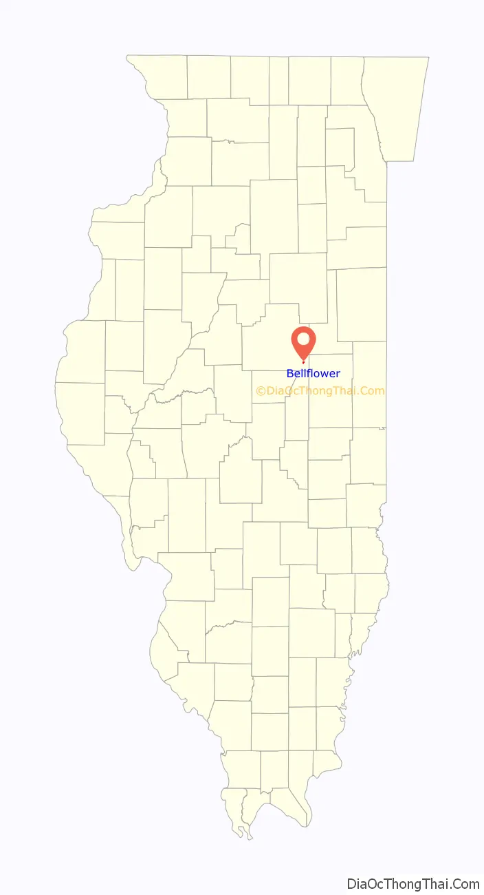
Bellflower location map. Where is Bellflower village?
History
Founding
Bellflower was laid out on August 26, 1871, by George Nelson Black (March 15, 1833 – April 22, 1908) and his wife Louisa J. Black (December 22, 1840 – December 23, 1909). George was born in Berkshire County, Massachusetts, and had come to Springfield, Illinois, in 1850, where he became wealthy through manufacturing, mining, and railroads. Bellflower Township had subscribed $30,000 in twenty-year bonds toward the construction of what was then called the Gilman, Clinton and Springfield Railroad. A condition of the funding was that the township would have a station on the railroad. Black purchased 100 acres (0.40 km) of land, laid 40 acres (160,000 m) out into town lots and then transferred the title to the railroad. When the railroad became property of the Illinois Central Railroad, town lots in Bellflower were not transferred to that railroad. The name of the town came from the name of the township and was selected by Jesse Richards, who was particularly fond of the Bellflower apple. It is perhaps the only town in Illinois named for an apple. In the 1870s it was often spelled “Belle Flower” or “Belle-Flower”.
Original plan and growth
The original plan of the town consisted of two square blocks of land. Most of the western square was divided into sixteen blocks, each usually containing twelve lots, and this part of the town was split diagonally by the 100-foot-wide (30 m) path of the railroad. Unlike many towns found in the 1870s, there was no depot ground. The eastern square of land and a strip along the north edge of the western square was divided into out lots, each of which were several times the size the lots in the western square. The combination of in lots and out lots was fairly common in central Illinois and may be found, for example, at Hudson and Chenoa. The small triangle of land cut off by the railroad from the remainder of block ten became the location of the town jail. The station was located on the south side of the tracks, and the two early elevators were on railroad land. By 1895 both in lots and out lots held residences. R. E. Moreland established the first business. Bellflower quickly became a major grain shipping center serving the fertile surrounding land. By 1879 it was shipping over 350,000 bushels of grain a year. In 1900 the population was 356, nearly the same as today.
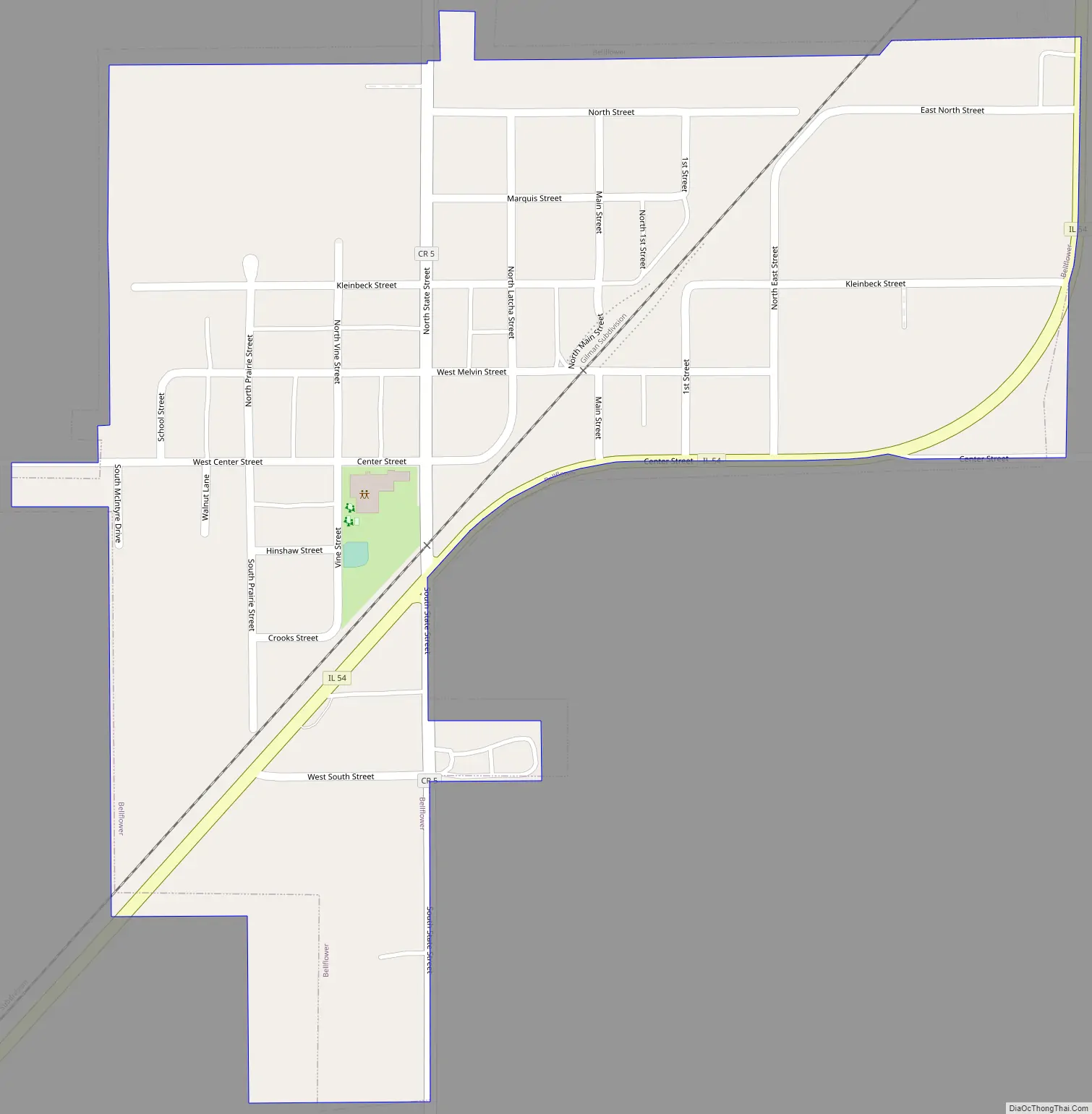
Bellflower Road Map
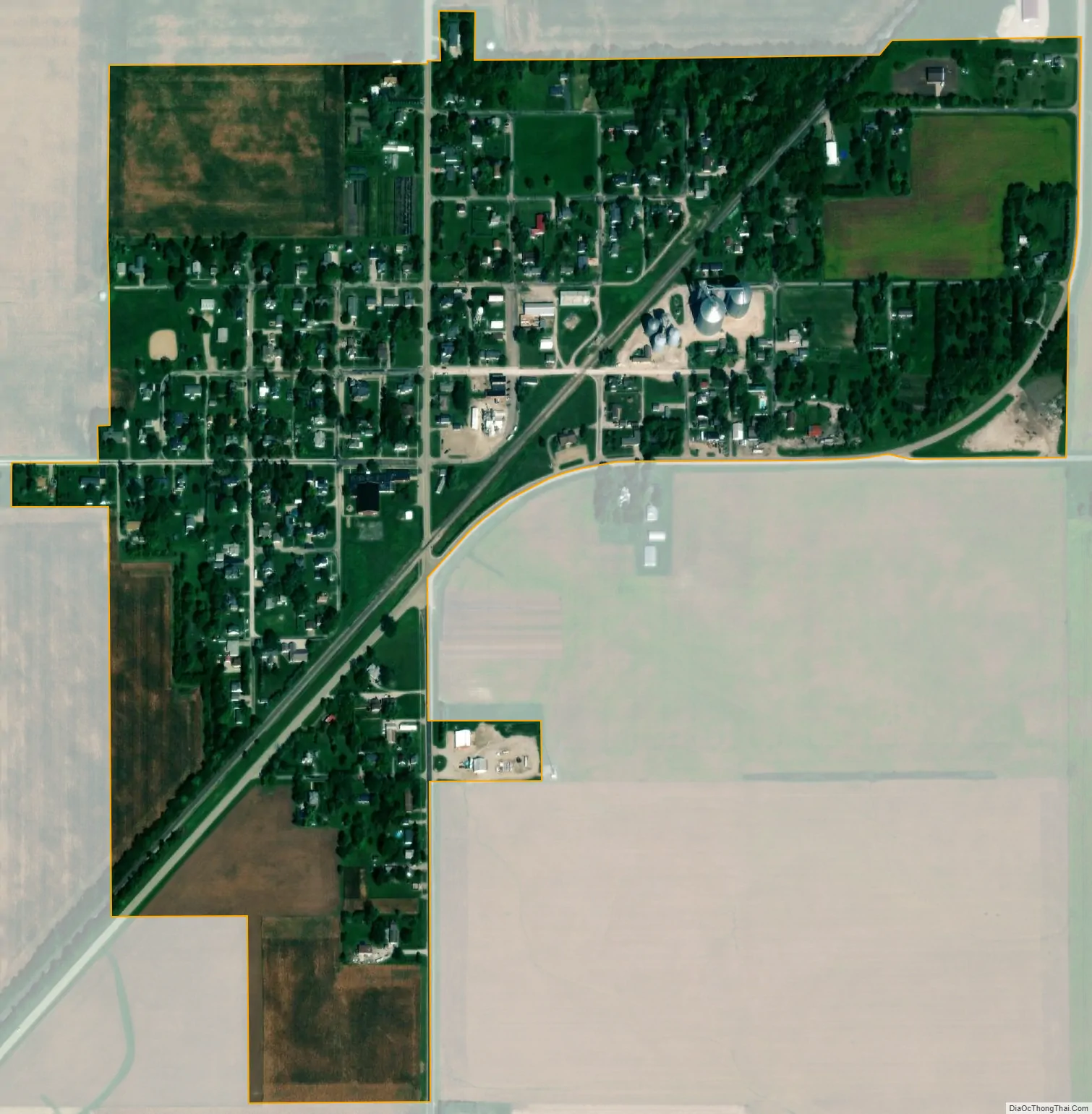
Bellflower city Satellite Map
Geography
Bellflower is in southeastern McLean County, along Illinois Route 54, which leads southwest 9 miles (14 km) to Farmer City and northeast 12 miles (19 km) to Gibson City. Bloomington, the McLean county seat, is 30 miles (48 km) to the northwest, while Champaign is 26 miles (42 km) to the southeast.
According to the U.S. Census Bureau, Bellflower has a total area of 0.36 square miles (0.93 km), all land. The village drains southeast to tributaries of Lone Tree Creek, a northeast-flowing tributary of the Sangamon River and part of the Illinois River watershed.
Students from Bellflower attend the Blue Ridge School District.
See also
Map of Illinois State and its subdivision:- Adams
- Alexander
- Bond
- Boone
- Brown
- Bureau
- Calhoun
- Carroll
- Cass
- Champaign
- Christian
- Clark
- Clay
- Clinton
- Coles
- Cook
- Crawford
- Cumberland
- De Kalb
- De Witt
- Douglas
- Dupage
- Edgar
- Edwards
- Effingham
- Fayette
- Ford
- Franklin
- Fulton
- Gallatin
- Greene
- Grundy
- Hamilton
- Hancock
- Hardin
- Henderson
- Henry
- Iroquois
- Jackson
- Jasper
- Jefferson
- Jersey
- Jo Daviess
- Johnson
- Kane
- Kankakee
- Kendall
- Knox
- La Salle
- Lake
- Lake Michigan
- Lawrence
- Lee
- Livingston
- Logan
- Macon
- Macoupin
- Madison
- Marion
- Marshall
- Mason
- Massac
- McDonough
- McHenry
- McLean
- Menard
- Mercer
- Monroe
- Montgomery
- Morgan
- Moultrie
- Ogle
- Peoria
- Perry
- Piatt
- Pike
- Pope
- Pulaski
- Putnam
- Randolph
- Richland
- Rock Island
- Saint Clair
- Saline
- Sangamon
- Schuyler
- Scott
- Shelby
- Stark
- Stephenson
- Tazewell
- Union
- Vermilion
- Wabash
- Warren
- Washington
- Wayne
- White
- Whiteside
- Will
- Williamson
- Winnebago
- Woodford
- Alabama
- Alaska
- Arizona
- Arkansas
- California
- Colorado
- Connecticut
- Delaware
- District of Columbia
- Florida
- Georgia
- Hawaii
- Idaho
- Illinois
- Indiana
- Iowa
- Kansas
- Kentucky
- Louisiana
- Maine
- Maryland
- Massachusetts
- Michigan
- Minnesota
- Mississippi
- Missouri
- Montana
- Nebraska
- Nevada
- New Hampshire
- New Jersey
- New Mexico
- New York
- North Carolina
- North Dakota
- Ohio
- Oklahoma
- Oregon
- Pennsylvania
- Rhode Island
- South Carolina
- South Dakota
- Tennessee
- Texas
- Utah
- Vermont
- Virginia
- Washington
- West Virginia
- Wisconsin
- Wyoming