Benld /bəˈnɛld/ is a city in Macoupin County, Illinois, United States. The population was 1,464 at the 2020 census, down from 1,556 in 2010. It is located in the Metro-East portion of the Greater St. Louis metropolitan area.
Benld was declared the “most difficult to pronounce” place name in the state of Illinois by Reader’s Digest.
| Name: | Benld city |
|---|---|
| LSAD Code: | 25 |
| LSAD Description: | city (suffix) |
| State: | Illinois |
| County: | Macoupin County |
| Elevation: | 620 ft (190 m) |
| Total Area: | 1.06 sq mi (2.75 km²) |
| Land Area: | 1.06 sq mi (2.75 km²) |
| Water Area: | 0.00 sq mi (0.00 km²) |
| Total Population: | 1,464 |
| Population Density: | 1,381.13/sq mi (533.24/km²) |
| ZIP code: | 62009 |
| Area code: | 217 |
| FIPS code: | 1705209 |
| GNISfeature ID: | 2394134 |
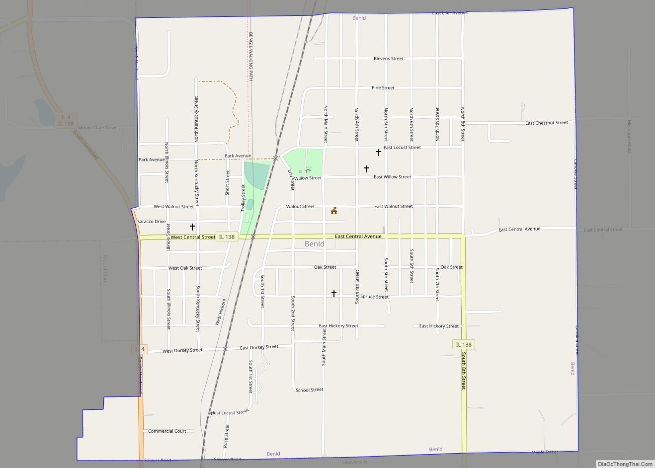
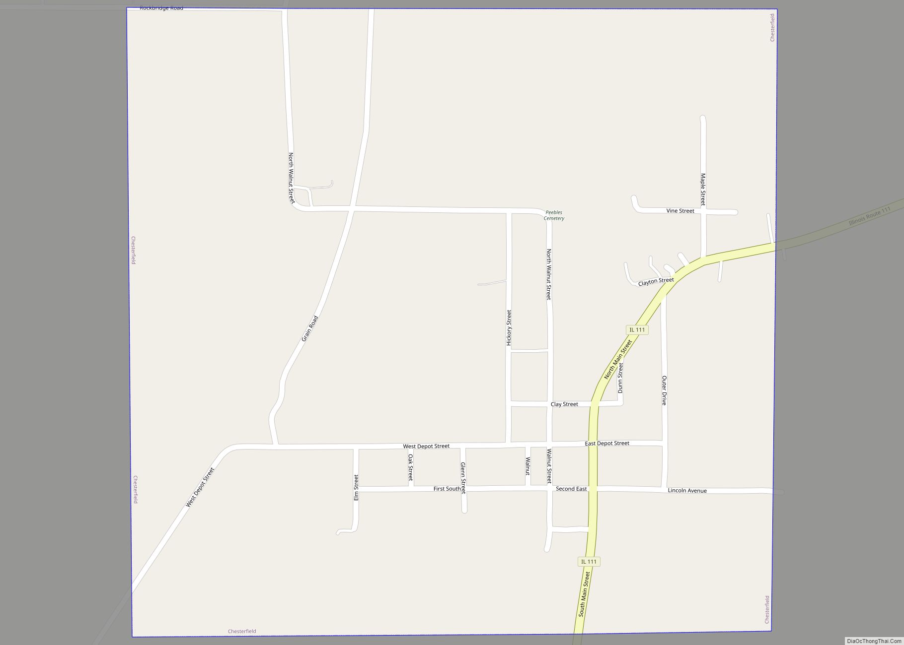
Online Interactive Map
Click on ![]() to view map in "full screen" mode.
to view map in "full screen" mode.
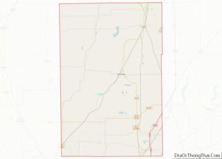
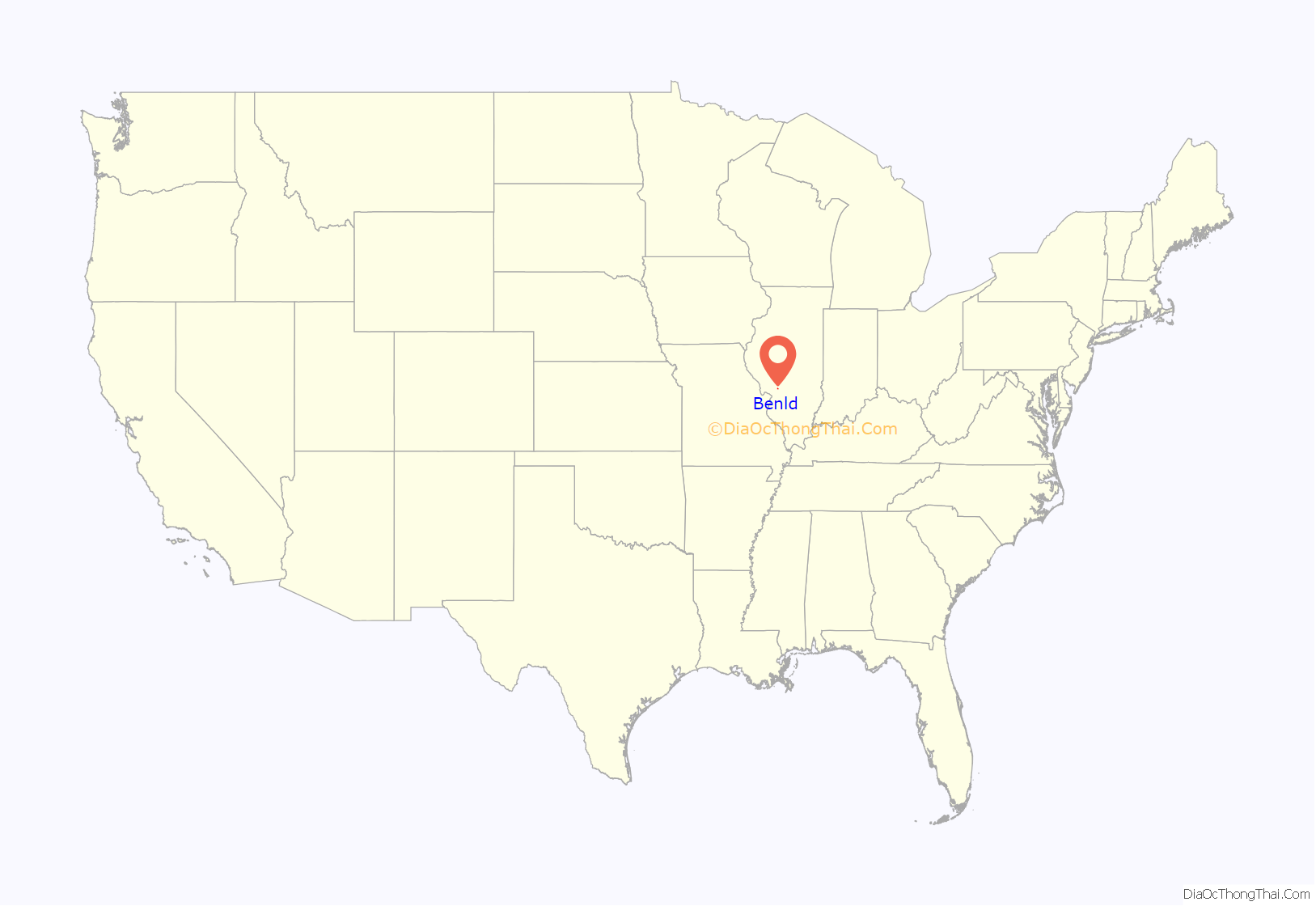
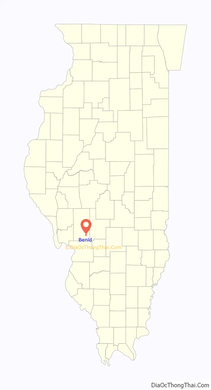
Benld location map. Where is Benld city?
History
Benld was established in 1903. The name derives from founder Benjamin L. Dorsey (d. June 19, 1895), who was responsible for gaining the land on which the town was built and coal mining rights. “Benld” is the combination of Dorsey’s first name and his middle and last initial.
On September 29, 1938, a meteorite landed in Benld, marking only the third meteorite landing in Illinois since records were kept. It is one of the few known meteorites to strike a man-made object, punching a hole in the roof of Edward McCain’s garage and embedding itself in the seat of his 1928 Pontiac coupe. A neighbor, Mrs. Carl Crum, was standing about fifty feet from the impact and may be the individual who came closest to being struck by a meteorite in history up to that time. The meteorite and portions of the car are now on display at the Field Museum of Natural History in Chicago.
In March 2009, the seven-year-old Benld Elementary school was damaged beyond repair and ultimately condemned. The damage was caused by mine subsidence and left more than 700 students without a school. The students were moved to the Gillespie High School and Middle School campus, where they finished the remainder of the year on a split shift schedule. High school and middle school students attended school from 6:30am to noon, and elementary aged students attended from 12:30pm until 5:00 pm. The students started the 2010 school year on the split shift. On November 2, 2010, all students returned to a normal schedule, with the elementary children attending class in three different locations (modular units, middle school classrooms, and the S.S. Simon & Jude Catholic School). The district was allowed to collect only $350,000 in mine subsidence insurance due to limits imposed by the state of Illinois. The district is in line to receive funding from the Capital Development Board to help with the construction of a new elementary school. The school is responsible for 20% of the $22 million budget to build a new school. The school district is actively pursuing grants to fulfill their responsibility. The Ben-Gil Boosters, an organization formed to help raise funds for the construction of the new school, won $250,000 in April 2010 through Pepsi’s Refresh Everything Campaign. The new school is adjacent to the district’s middle school and high school in Gillespie. Its name has been changed to Ben-Gil Elementary School, to reflect both communities.
At a special CUSD 7 Board of Education meeting on August 16, 2017, the board approved a $4 million settlement with the Union Pacific Railroad, legal owners of the assets of the former Superior Coal Company, in connection with the subsidence. Originally, the district had been awarded $9.85 million in 2014, but Union Pacific appealed that ruling.
Benld Road Map
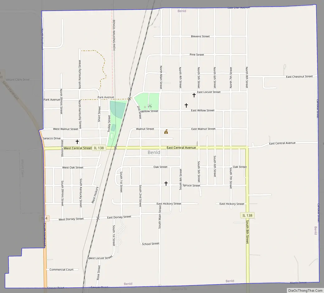
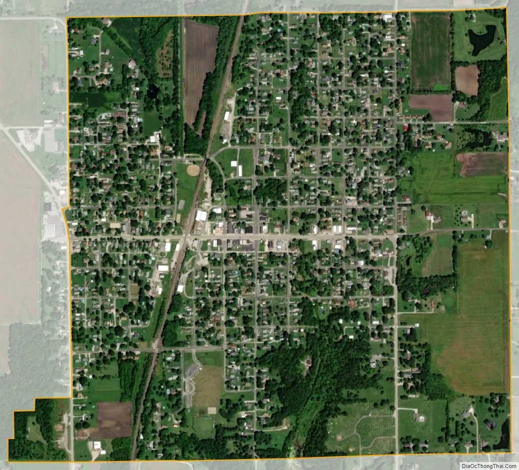
Benld city Satellite Map
Geography
Benld is located in southeastern Macoupin County in the southwest corner of Cahokia Township. It is bordered to the south by the village of Sawyerville and to the northwest by the village of Mount Clare.
Illinois Route 4 runs along the western border of Benld, leading north 2.5 miles (4.0 km) to Gillespie and south 6 miles (10 km) to Staunton. Route 4 leads north 15 miles (24 km) to Carlinville, the Macoupin county seat. Illinois Route 138 passes through the center of Benld as Central Street and South 8th Street, leading southeast 4 miles (6 km) to White City and Interstate 55. St. Louis is 45 miles (72 km) southwest of Benld.
According to the U.S. Census Bureau, Benld has a total area of 1.06 square miles (2.75 km), all land. A small unnamed runs through the center of Benld, flowing south to Cahokia Creek, a southwest-flowing direct tributary of the Mississippi River.
See also
Map of Illinois State and its subdivision:- Adams
- Alexander
- Bond
- Boone
- Brown
- Bureau
- Calhoun
- Carroll
- Cass
- Champaign
- Christian
- Clark
- Clay
- Clinton
- Coles
- Cook
- Crawford
- Cumberland
- De Kalb
- De Witt
- Douglas
- Dupage
- Edgar
- Edwards
- Effingham
- Fayette
- Ford
- Franklin
- Fulton
- Gallatin
- Greene
- Grundy
- Hamilton
- Hancock
- Hardin
- Henderson
- Henry
- Iroquois
- Jackson
- Jasper
- Jefferson
- Jersey
- Jo Daviess
- Johnson
- Kane
- Kankakee
- Kendall
- Knox
- La Salle
- Lake
- Lake Michigan
- Lawrence
- Lee
- Livingston
- Logan
- Macon
- Macoupin
- Madison
- Marion
- Marshall
- Mason
- Massac
- McDonough
- McHenry
- McLean
- Menard
- Mercer
- Monroe
- Montgomery
- Morgan
- Moultrie
- Ogle
- Peoria
- Perry
- Piatt
- Pike
- Pope
- Pulaski
- Putnam
- Randolph
- Richland
- Rock Island
- Saint Clair
- Saline
- Sangamon
- Schuyler
- Scott
- Shelby
- Stark
- Stephenson
- Tazewell
- Union
- Vermilion
- Wabash
- Warren
- Washington
- Wayne
- White
- Whiteside
- Will
- Williamson
- Winnebago
- Woodford
- Alabama
- Alaska
- Arizona
- Arkansas
- California
- Colorado
- Connecticut
- Delaware
- District of Columbia
- Florida
- Georgia
- Hawaii
- Idaho
- Illinois
- Indiana
- Iowa
- Kansas
- Kentucky
- Louisiana
- Maine
- Maryland
- Massachusetts
- Michigan
- Minnesota
- Mississippi
- Missouri
- Montana
- Nebraska
- Nevada
- New Hampshire
- New Jersey
- New Mexico
- New York
- North Carolina
- North Dakota
- Ohio
- Oklahoma
- Oregon
- Pennsylvania
- Rhode Island
- South Carolina
- South Dakota
- Tennessee
- Texas
- Utah
- Vermont
- Virginia
- Washington
- West Virginia
- Wisconsin
- Wyoming