Burlington is a village in Kane County, Illinois, United States. The population was 535 at the 2020 census, down from 618 in 2010. It was incorporated as a village on November 6, 1990.
| Name: | Burlington village |
|---|---|
| LSAD Code: | 47 |
| LSAD Description: | village (suffix) |
| State: | Illinois |
| County: | Kane County |
| Founded: | 1906 |
| Incorporated: | November 6, 1990 |
| Total Area: | 6.86 sq mi (17.75 km²) |
| Land Area: | 6.86 sq mi (17.75 km²) |
| Water Area: | 0.00 sq mi (0.00 km²) |
| Total Population: | 535 |
| Population Density: | 78.05/sq mi (30.13/km²) |
| ZIP code: | 60109 |
| Area code: | 847 |
| FIPS code: | 1709759 |
| Website: | www.vil.burlington.il.us |
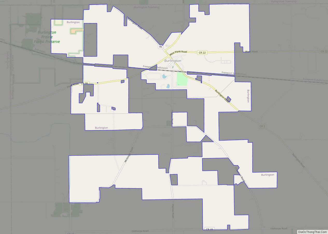
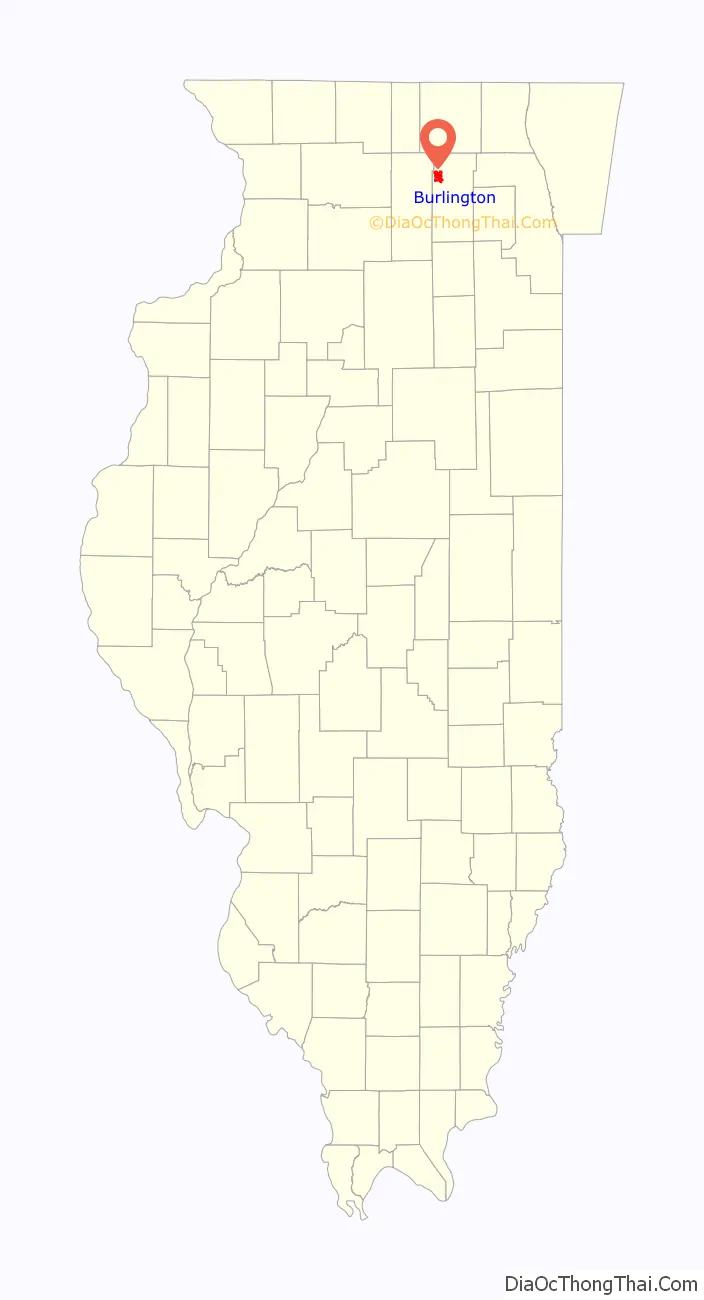
Online Interactive Map
Click on ![]() to view map in "full screen" mode.
to view map in "full screen" mode.
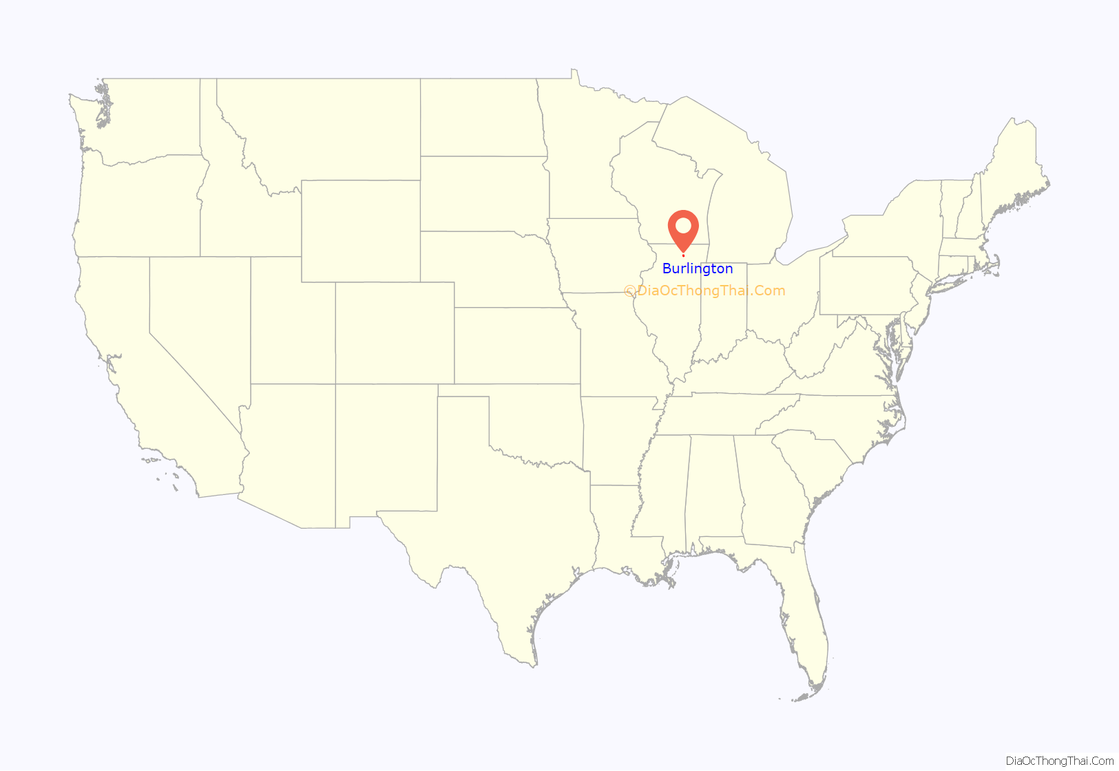
Burlington location map. Where is Burlington village?
History
Burlington was platted by Andrew Pingree in 1851. It is located on the former Illinois Central Railroad which runs through the south edge of the village. In 1878, the area had three cheese factories, a general store, a hotel and a saloon. A post office under the name “Burlington” has been in operation since 1865. The last dairy plant closed in the 1970s.
Since the early 1990s, Burlington has been home to two small plastics companies. Concerns have been raised over the environmental impact these plants will have on the town and surrounding areas in the future. On November 6, 1990, Burlington was incorporated as a village, along with nearby Lily Lake and Virgil, in an effort to establish stricter guidelines in regards to plastic manufacturing and chemical dumping in the area.
From 1910 to 2019, Burlington held an annual fall festival on the first week of September every year. Burlington is one of 4 villages in the State of Illinois that allow the use of snowmobiles in town during the winter season.
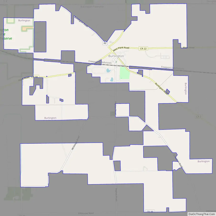
Burlington Road Map
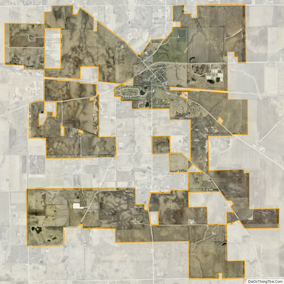
Burlington city Satellite Map
Geography
Burlington is located at 42°3′8″N 88°32′54″W / 42.05222°N 88.54833°W / 42.05222; -88.54833 (42.052112, -88.548290) near the intersection of Plank Road and Burlington Road. The village cosists of a small “downtown” section, and is surrounded mostly by horse ranches and cornfields. It lies approximately halfway between Elgin and Sycamore, and is 20 miles north of the City of Aurora.
According to the 2010 census, Burlington has a total area of 7.15 square miles (18.52 km), all land.
See also
Map of Illinois State and its subdivision:- Adams
- Alexander
- Bond
- Boone
- Brown
- Bureau
- Calhoun
- Carroll
- Cass
- Champaign
- Christian
- Clark
- Clay
- Clinton
- Coles
- Cook
- Crawford
- Cumberland
- De Kalb
- De Witt
- Douglas
- Dupage
- Edgar
- Edwards
- Effingham
- Fayette
- Ford
- Franklin
- Fulton
- Gallatin
- Greene
- Grundy
- Hamilton
- Hancock
- Hardin
- Henderson
- Henry
- Iroquois
- Jackson
- Jasper
- Jefferson
- Jersey
- Jo Daviess
- Johnson
- Kane
- Kankakee
- Kendall
- Knox
- La Salle
- Lake
- Lake Michigan
- Lawrence
- Lee
- Livingston
- Logan
- Macon
- Macoupin
- Madison
- Marion
- Marshall
- Mason
- Massac
- McDonough
- McHenry
- McLean
- Menard
- Mercer
- Monroe
- Montgomery
- Morgan
- Moultrie
- Ogle
- Peoria
- Perry
- Piatt
- Pike
- Pope
- Pulaski
- Putnam
- Randolph
- Richland
- Rock Island
- Saint Clair
- Saline
- Sangamon
- Schuyler
- Scott
- Shelby
- Stark
- Stephenson
- Tazewell
- Union
- Vermilion
- Wabash
- Warren
- Washington
- Wayne
- White
- Whiteside
- Will
- Williamson
- Winnebago
- Woodford
- Alabama
- Alaska
- Arizona
- Arkansas
- California
- Colorado
- Connecticut
- Delaware
- District of Columbia
- Florida
- Georgia
- Hawaii
- Idaho
- Illinois
- Indiana
- Iowa
- Kansas
- Kentucky
- Louisiana
- Maine
- Maryland
- Massachusetts
- Michigan
- Minnesota
- Mississippi
- Missouri
- Montana
- Nebraska
- Nevada
- New Hampshire
- New Jersey
- New Mexico
- New York
- North Carolina
- North Dakota
- Ohio
- Oklahoma
- Oregon
- Pennsylvania
- Rhode Island
- South Carolina
- South Dakota
- Tennessee
- Texas
- Utah
- Vermont
- Virginia
- Washington
- West Virginia
- Wisconsin
- Wyoming