Burnham is a village in Cook County, Illinois, United States. The population was 4,046 at the 2020 census. The ZIP code is 60633.
Burnham has a Chicago ZIP code, and is often mistakenly considered part of Chicago. It is, however, an independent municipality lying just south of the Chicago city limits.
Burnham was named for Telford Burnham who drew its plat; not, as is widely assumed, by Chicago city planner and architect Daniel Burnham.
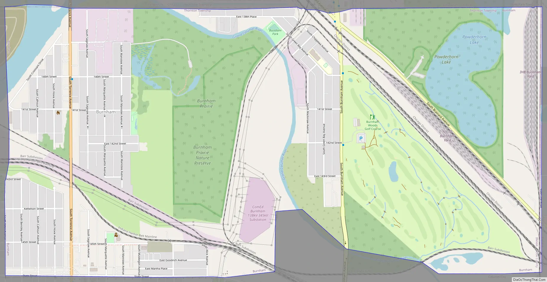
There are two sections of Burnham. The westernmost section surrounds Torrence Avenue, a north–south street. Torrence Avenue leaves this part of Burnham via a bridge, with Chicago on the other side. The eastern section surrounds Burnham Avenue, another north–south street. This section of Burnham ends at Brainard Avenue, where the Hegewisch neighborhood of Chicago lies on the other side. Upon entering Chicago, Burnham Avenue becomes Avenue O.
| Name: | Burnham village |
|---|---|
| LSAD Code: | 47 |
| LSAD Description: | village (suffix) |
| State: | Illinois |
| County: | Cook County |
| Incorporated: | 1907 |
| Total Area: | 1.94 sq mi (5.02 km²) |
| Land Area: | 1.85 sq mi (4.80 km²) |
| Water Area: | 0.09 sq mi (0.22 km²) 4.62% |
| Total Population: | 4,046 |
| Population Density: | 2,181.13/sq mi (842.19/km²) |
| Area code: | 708 |
| FIPS code: | 1709798 |
| Website: | https://burnham-il.gov |
Online Interactive Map
Click on ![]() to view map in "full screen" mode.
to view map in "full screen" mode.
Burnham location map. Where is Burnham village?


Burnham Road Map
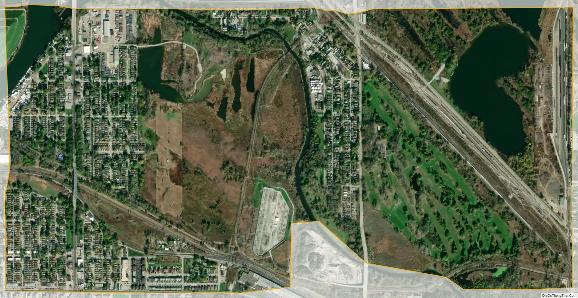
Burnham city Satellite Map
Geography
Burnham is located at 41°38′8″N 87°33′5″W / 41.63556°N 87.55139°W / 41.63556; -87.55139 (41.635535, -87.551284).
According to the 2021 census gazetteer files, Burnham has a total area of 1.94 square miles (5.02 km), of which 1.86 square miles (4.82 km) (or 95.62%) is land and 0.09 square miles (0.23 km) (or 4.38%) is water.
Surrounding areas
Burnham is bordered by Chicago to the north, Calumet City to the south and west, and Hammond, Indiana, to the east.
See also
Map of Illinois State and its subdivision:- Adams
- Alexander
- Bond
- Boone
- Brown
- Bureau
- Calhoun
- Carroll
- Cass
- Champaign
- Christian
- Clark
- Clay
- Clinton
- Coles
- Cook
- Crawford
- Cumberland
- De Kalb
- De Witt
- Douglas
- Dupage
- Edgar
- Edwards
- Effingham
- Fayette
- Ford
- Franklin
- Fulton
- Gallatin
- Greene
- Grundy
- Hamilton
- Hancock
- Hardin
- Henderson
- Henry
- Iroquois
- Jackson
- Jasper
- Jefferson
- Jersey
- Jo Daviess
- Johnson
- Kane
- Kankakee
- Kendall
- Knox
- La Salle
- Lake
- Lake Michigan
- Lawrence
- Lee
- Livingston
- Logan
- Macon
- Macoupin
- Madison
- Marion
- Marshall
- Mason
- Massac
- McDonough
- McHenry
- McLean
- Menard
- Mercer
- Monroe
- Montgomery
- Morgan
- Moultrie
- Ogle
- Peoria
- Perry
- Piatt
- Pike
- Pope
- Pulaski
- Putnam
- Randolph
- Richland
- Rock Island
- Saint Clair
- Saline
- Sangamon
- Schuyler
- Scott
- Shelby
- Stark
- Stephenson
- Tazewell
- Union
- Vermilion
- Wabash
- Warren
- Washington
- Wayne
- White
- Whiteside
- Will
- Williamson
- Winnebago
- Woodford
- Alabama
- Alaska
- Arizona
- Arkansas
- California
- Colorado
- Connecticut
- Delaware
- District of Columbia
- Florida
- Georgia
- Hawaii
- Idaho
- Illinois
- Indiana
- Iowa
- Kansas
- Kentucky
- Louisiana
- Maine
- Maryland
- Massachusetts
- Michigan
- Minnesota
- Mississippi
- Missouri
- Montana
- Nebraska
- Nevada
- New Hampshire
- New Jersey
- New Mexico
- New York
- North Carolina
- North Dakota
- Ohio
- Oklahoma
- Oregon
- Pennsylvania
- Rhode Island
- South Carolina
- South Dakota
- Tennessee
- Texas
- Utah
- Vermont
- Virginia
- Washington
- West Virginia
- Wisconsin
- Wyoming


