Caledonia is a village in Caledonia Township, Boone County, Illinois, United States. It is part of the Rockford, Illinois Metropolitan Statistical Area. The population was 183 at the 2020 census.
| Name: | Caledonia village |
|---|---|
| LSAD Code: | 47 |
| LSAD Description: | village (suffix) |
| State: | Illinois |
| County: | Boone County |
| Total Area: | 1.03 sq mi (2.68 km²) |
| Land Area: | 1.03 sq mi (2.68 km²) |
| Water Area: | 0.00 sq mi (0.00 km²) 0% |
| Total Population: | 183 |
| Population Density: | 176.81/sq mi (68.28/km²) |
| ZIP code: | 61011 |
| Area code: | 815 |
| FIPS code: | 1710422 |
| Website: | www.villageofcaledonia.com |
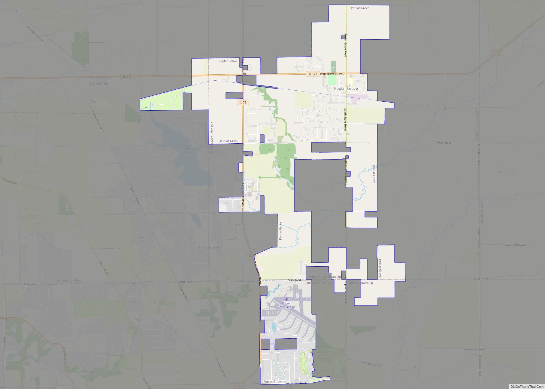
Online Interactive Map
Click on ![]() to view map in "full screen" mode.
to view map in "full screen" mode.
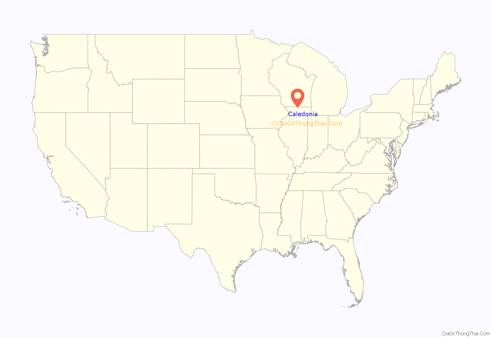
Caledonia location map. Where is Caledonia village?
History
A post office was established as Caledonia Station in 1853 and renamed Caledonia in 1883. Caledonia is a literary name of Scotland. Caledonia Congregational Church was founded in 1894.
Caledonia was struck by an EF-2 tornado on November 22, 2010, around 3:04 pm; several homes were destroyed, a grain bin collapsed, the local Elementary school was set on lockdown, and six minor injuries were reported when a bus was blown over near Argyle and Harlem Roads.
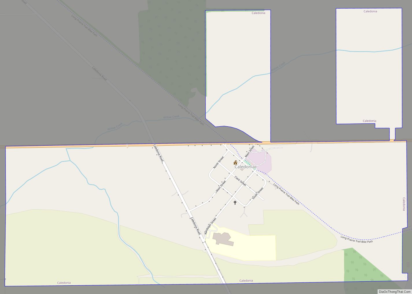
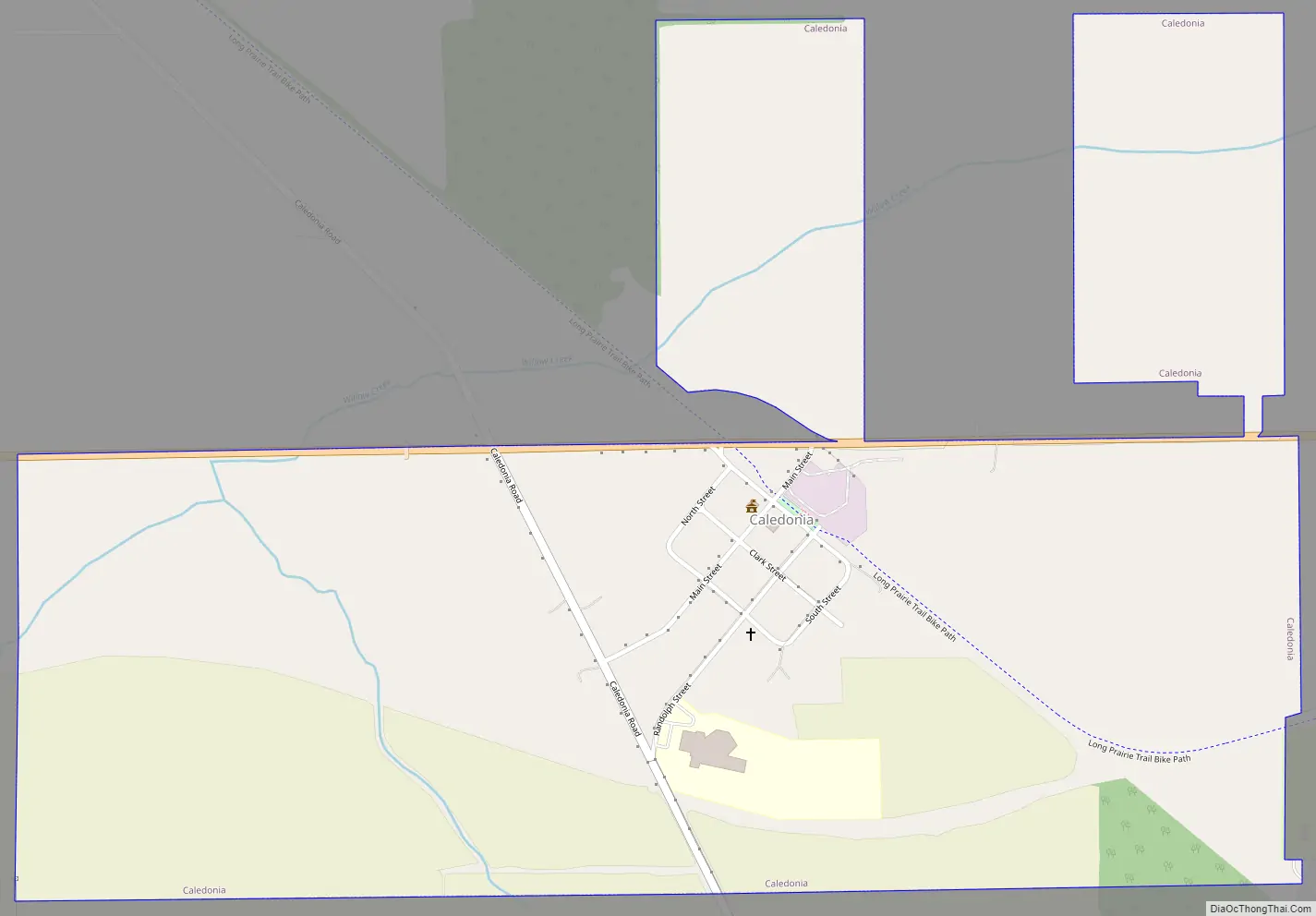
Caledonia Road Map
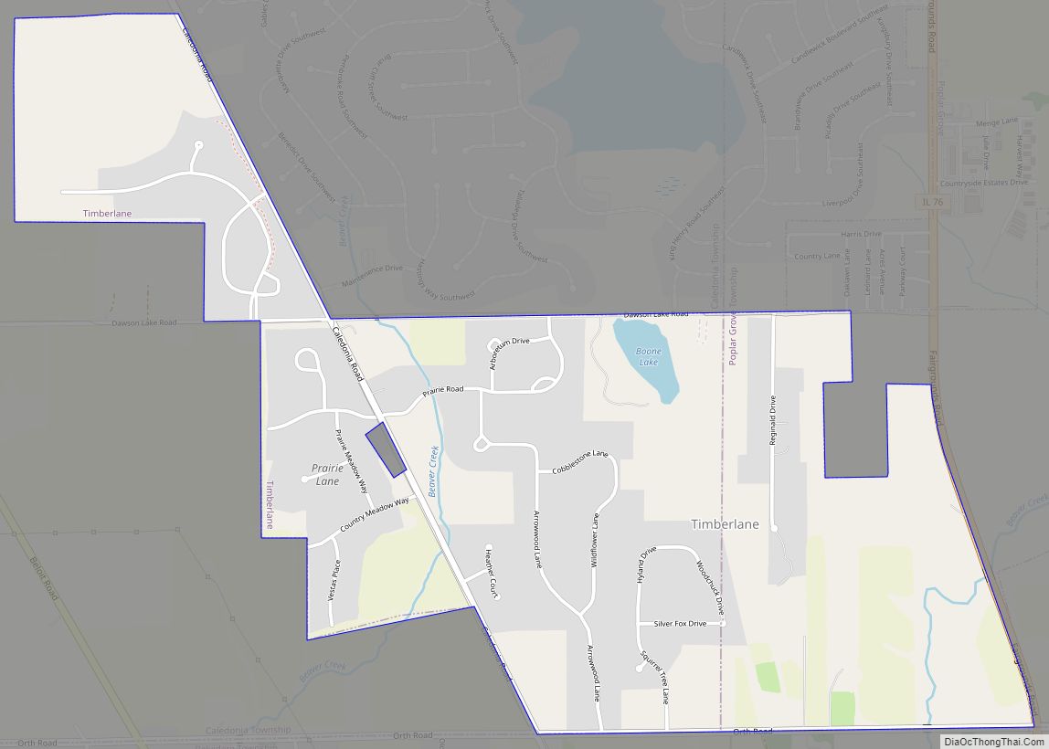
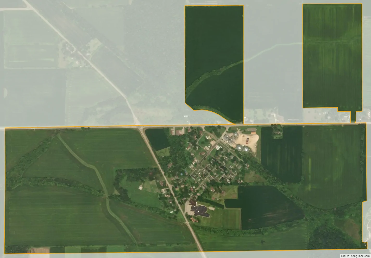
Caledonia city Satellite Map
Geography
Caledonia is located at 42°22′04″N 88°53′33″W / 42.36778°N 88.89250°W / 42.36778; -88.89250 (42.367850, -88.892538).
According to the 2021 census gazetteer files, Caledonia has a total area of 1.04 square miles (2.69 km), all land.
See also
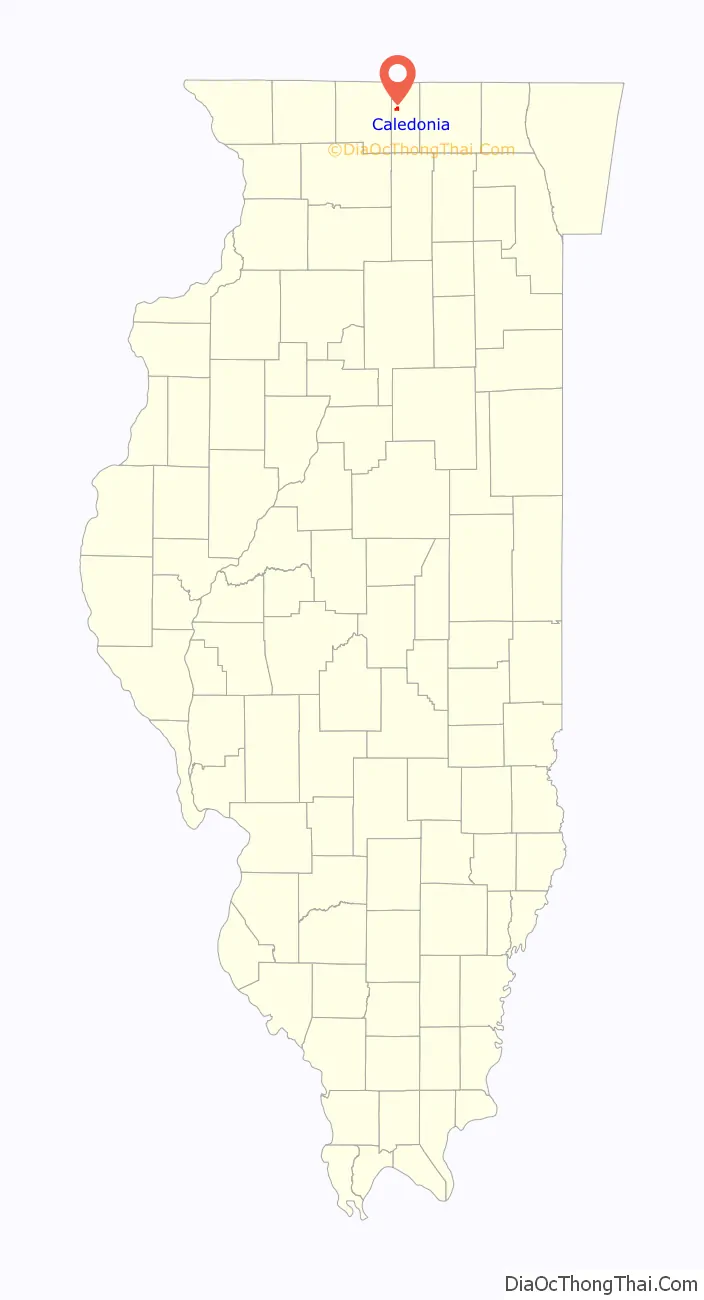
Map of Illinois State and its subdivision:- Adams
- Alexander
- Bond
- Boone
- Brown
- Bureau
- Calhoun
- Carroll
- Cass
- Champaign
- Christian
- Clark
- Clay
- Clinton
- Coles
- Cook
- Crawford
- Cumberland
- De Kalb
- De Witt
- Douglas
- Dupage
- Edgar
- Edwards
- Effingham
- Fayette
- Ford
- Franklin
- Fulton
- Gallatin
- Greene
- Grundy
- Hamilton
- Hancock
- Hardin
- Henderson
- Henry
- Iroquois
- Jackson
- Jasper
- Jefferson
- Jersey
- Jo Daviess
- Johnson
- Kane
- Kankakee
- Kendall
- Knox
- La Salle
- Lake
- Lake Michigan
- Lawrence
- Lee
- Livingston
- Logan
- Macon
- Macoupin
- Madison
- Marion
- Marshall
- Mason
- Massac
- McDonough
- McHenry
- McLean
- Menard
- Mercer
- Monroe
- Montgomery
- Morgan
- Moultrie
- Ogle
- Peoria
- Perry
- Piatt
- Pike
- Pope
- Pulaski
- Putnam
- Randolph
- Richland
- Rock Island
- Saint Clair
- Saline
- Sangamon
- Schuyler
- Scott
- Shelby
- Stark
- Stephenson
- Tazewell
- Union
- Vermilion
- Wabash
- Warren
- Washington
- Wayne
- White
- Whiteside
- Will
- Williamson
- Winnebago
- Woodford
- Alabama
- Alaska
- Arizona
- Arkansas
- California
- Colorado
- Connecticut
- Delaware
- District of Columbia
- Florida
- Georgia
- Hawaii
- Idaho
- Illinois
- Indiana
- Iowa
- Kansas
- Kentucky
- Louisiana
- Maine
- Maryland
- Massachusetts
- Michigan
- Minnesota
- Mississippi
- Missouri
- Montana
- Nebraska
- Nevada
- New Hampshire
- New Jersey
- New Mexico
- New York
- North Carolina
- North Dakota
- Ohio
- Oklahoma
- Oregon
- Pennsylvania
- Rhode Island
- South Carolina
- South Dakota
- Tennessee
- Texas
- Utah
- Vermont
- Virginia
- Washington
- West Virginia
- Wisconsin
- Wyoming