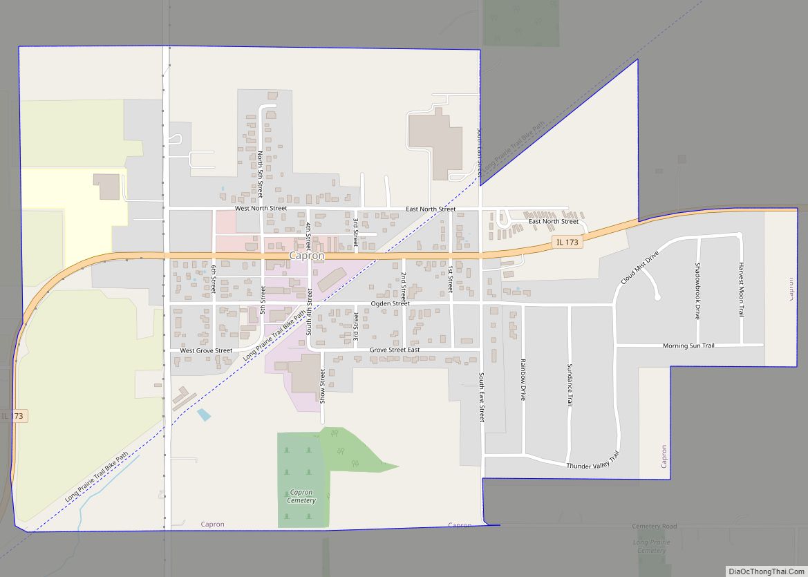
Capron is a village in Boone County, Illinois, United States. It is part of the Rockford, Illinois Metropolitan Statistical Area. The population was 1395 at the 2020 census, up from 1,376 at the 2010 census.
| Name: | Capron village |
|---|---|
| LSAD Code: | 47 |
| LSAD Description: | village (suffix) |
| State: | Illinois |
| County: | Boone County |
| Total Area: | 0.77 sq mi (2.00 km²) |
| Land Area: | 0.77 sq mi (2.00 km²) |
| Water Area: | 0.00 sq mi (0.00 km²) 0% |
| Total Population: | 1,395 |
| Population Density: | 1,806.7/sq mi (697.57/km²) |
| Area code: | 815 & 779 |
| FIPS code: | 1711124 |
| Website: | http://www.villageofcapron.net/ |
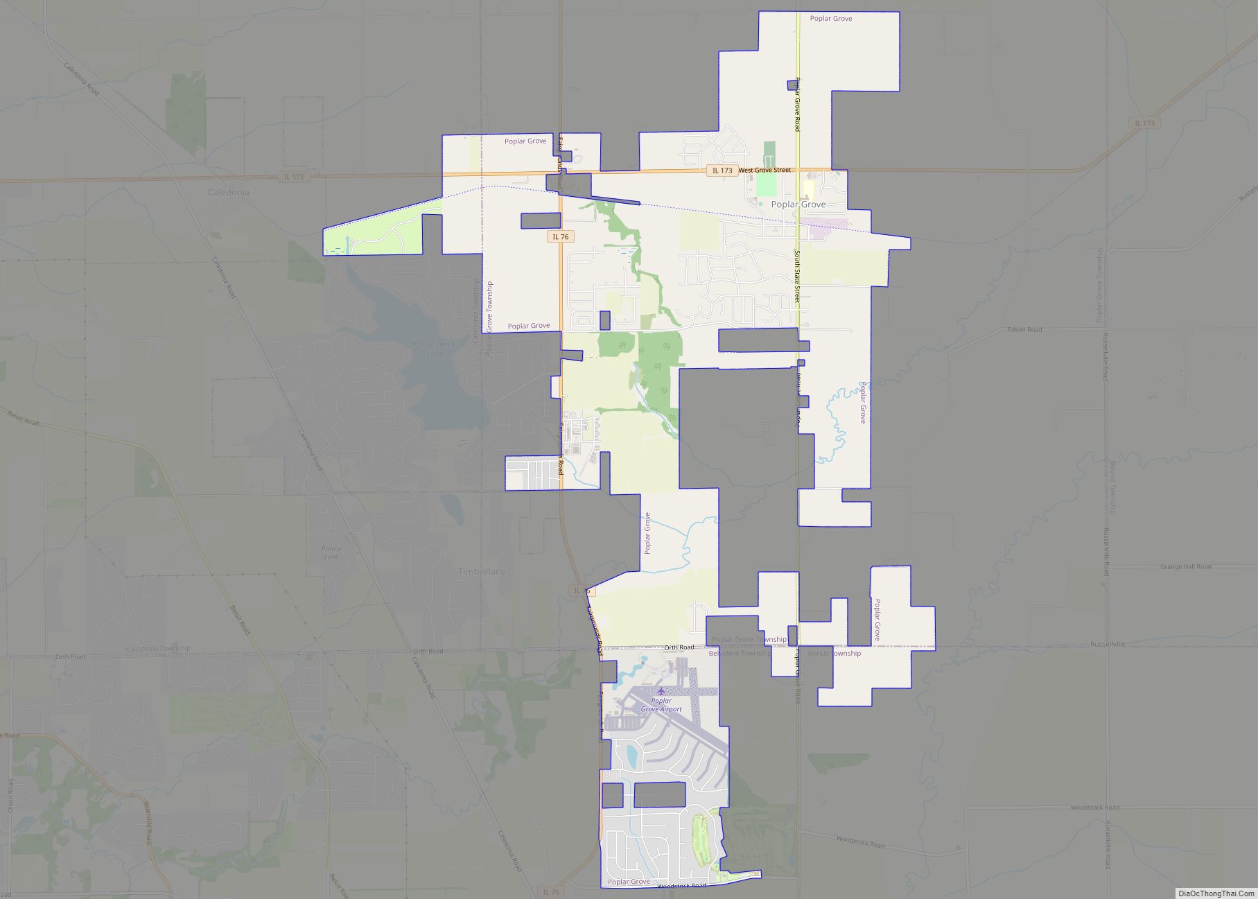
Online Interactive Map
Click on ![]() to view map in "full screen" mode.
to view map in "full screen" mode.
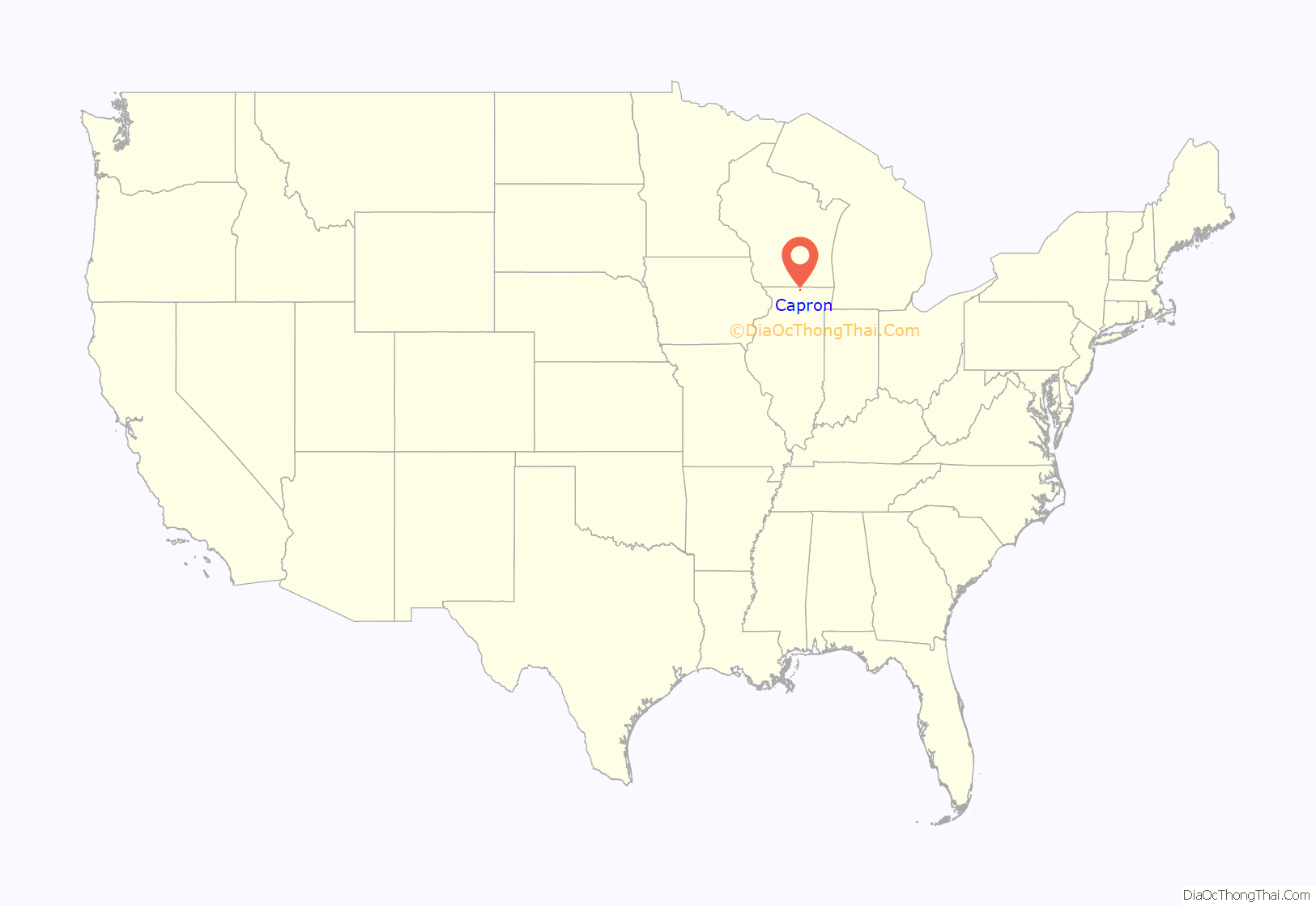
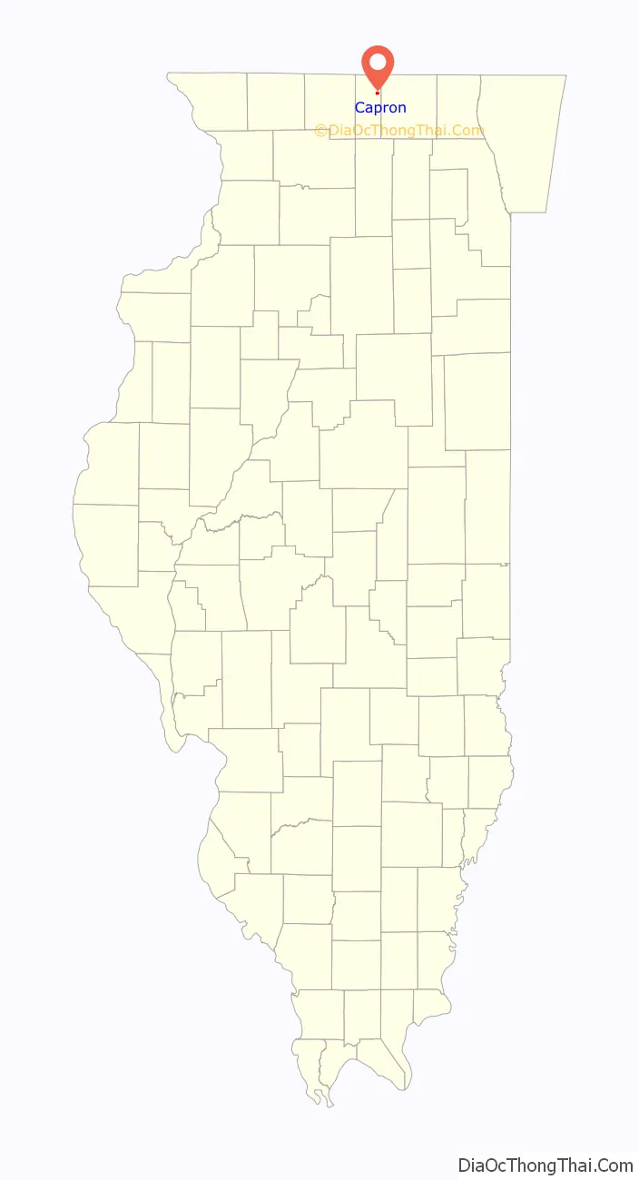
Capron location map. Where is Capron village?
History
Capron John was the founder.a post office has operated under the name Capron since 1861. Capron was named for John Capron, a pioneer settler.
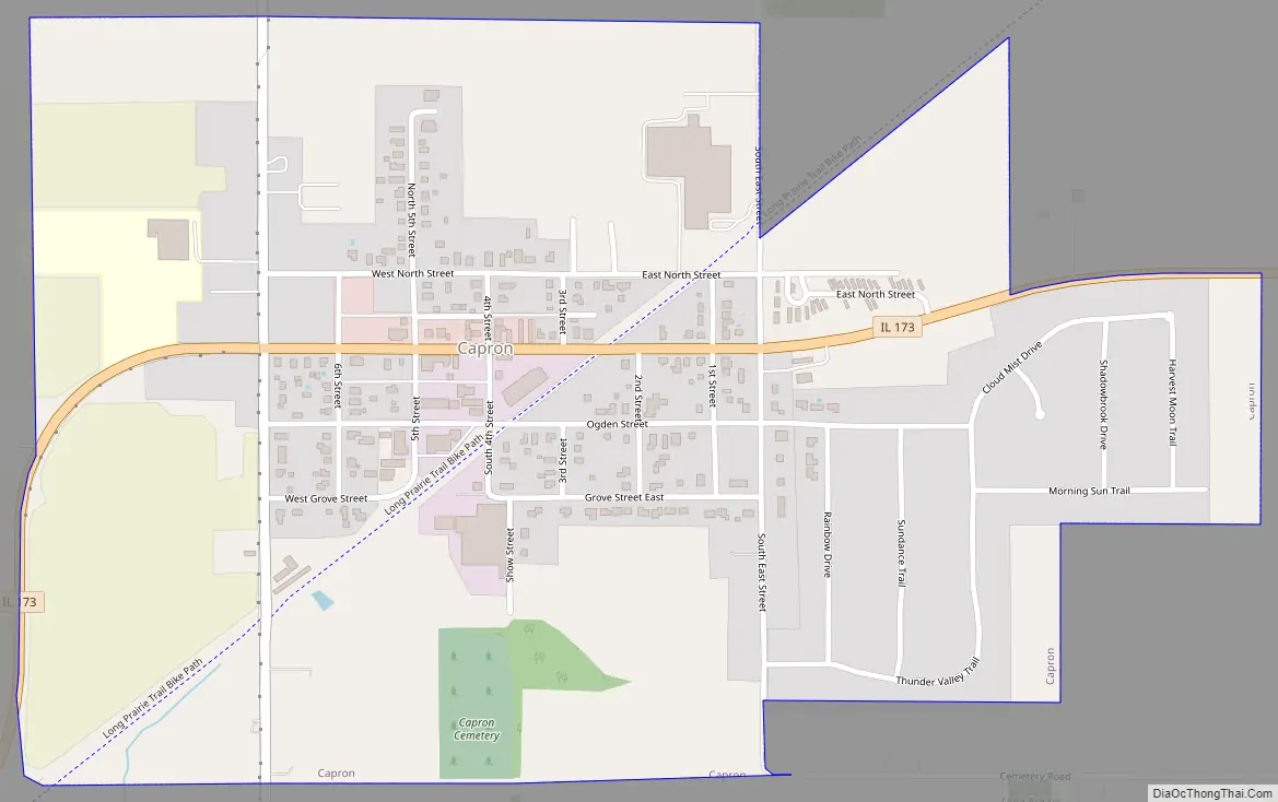
Capron Road Map
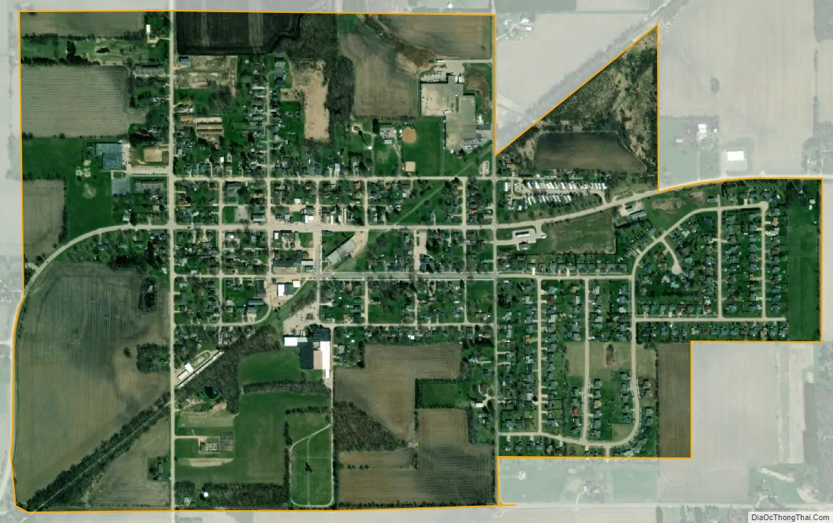
Capron city Satellite Map
Geography
Capron is located at 42°23′52″N 88°44′23″W / 42.39778°N 88.73972°W / 42.39778; -88.73972 (42.397729, -88.739684).
According to the 2021 census gazetteer files, Capron has a total area of 0.77 square miles (1.99 km), of which 0.77 square miles (1.99 km) (or 99.87%) is land and 0.00 square miles (0.00 km) (or 0.13%) is water.
Route 173 runs through the town.
See also
Map of Illinois State and its subdivision:- Adams
- Alexander
- Bond
- Boone
- Brown
- Bureau
- Calhoun
- Carroll
- Cass
- Champaign
- Christian
- Clark
- Clay
- Clinton
- Coles
- Cook
- Crawford
- Cumberland
- De Kalb
- De Witt
- Douglas
- Dupage
- Edgar
- Edwards
- Effingham
- Fayette
- Ford
- Franklin
- Fulton
- Gallatin
- Greene
- Grundy
- Hamilton
- Hancock
- Hardin
- Henderson
- Henry
- Iroquois
- Jackson
- Jasper
- Jefferson
- Jersey
- Jo Daviess
- Johnson
- Kane
- Kankakee
- Kendall
- Knox
- La Salle
- Lake
- Lake Michigan
- Lawrence
- Lee
- Livingston
- Logan
- Macon
- Macoupin
- Madison
- Marion
- Marshall
- Mason
- Massac
- McDonough
- McHenry
- McLean
- Menard
- Mercer
- Monroe
- Montgomery
- Morgan
- Moultrie
- Ogle
- Peoria
- Perry
- Piatt
- Pike
- Pope
- Pulaski
- Putnam
- Randolph
- Richland
- Rock Island
- Saint Clair
- Saline
- Sangamon
- Schuyler
- Scott
- Shelby
- Stark
- Stephenson
- Tazewell
- Union
- Vermilion
- Wabash
- Warren
- Washington
- Wayne
- White
- Whiteside
- Will
- Williamson
- Winnebago
- Woodford
- Alabama
- Alaska
- Arizona
- Arkansas
- California
- Colorado
- Connecticut
- Delaware
- District of Columbia
- Florida
- Georgia
- Hawaii
- Idaho
- Illinois
- Indiana
- Iowa
- Kansas
- Kentucky
- Louisiana
- Maine
- Maryland
- Massachusetts
- Michigan
- Minnesota
- Mississippi
- Missouri
- Montana
- Nebraska
- Nevada
- New Hampshire
- New Jersey
- New Mexico
- New York
- North Carolina
- North Dakota
- Ohio
- Oklahoma
- Oregon
- Pennsylvania
- Rhode Island
- South Carolina
- South Dakota
- Tennessee
- Texas
- Utah
- Vermont
- Virginia
- Washington
- West Virginia
- Wisconsin
- Wyoming