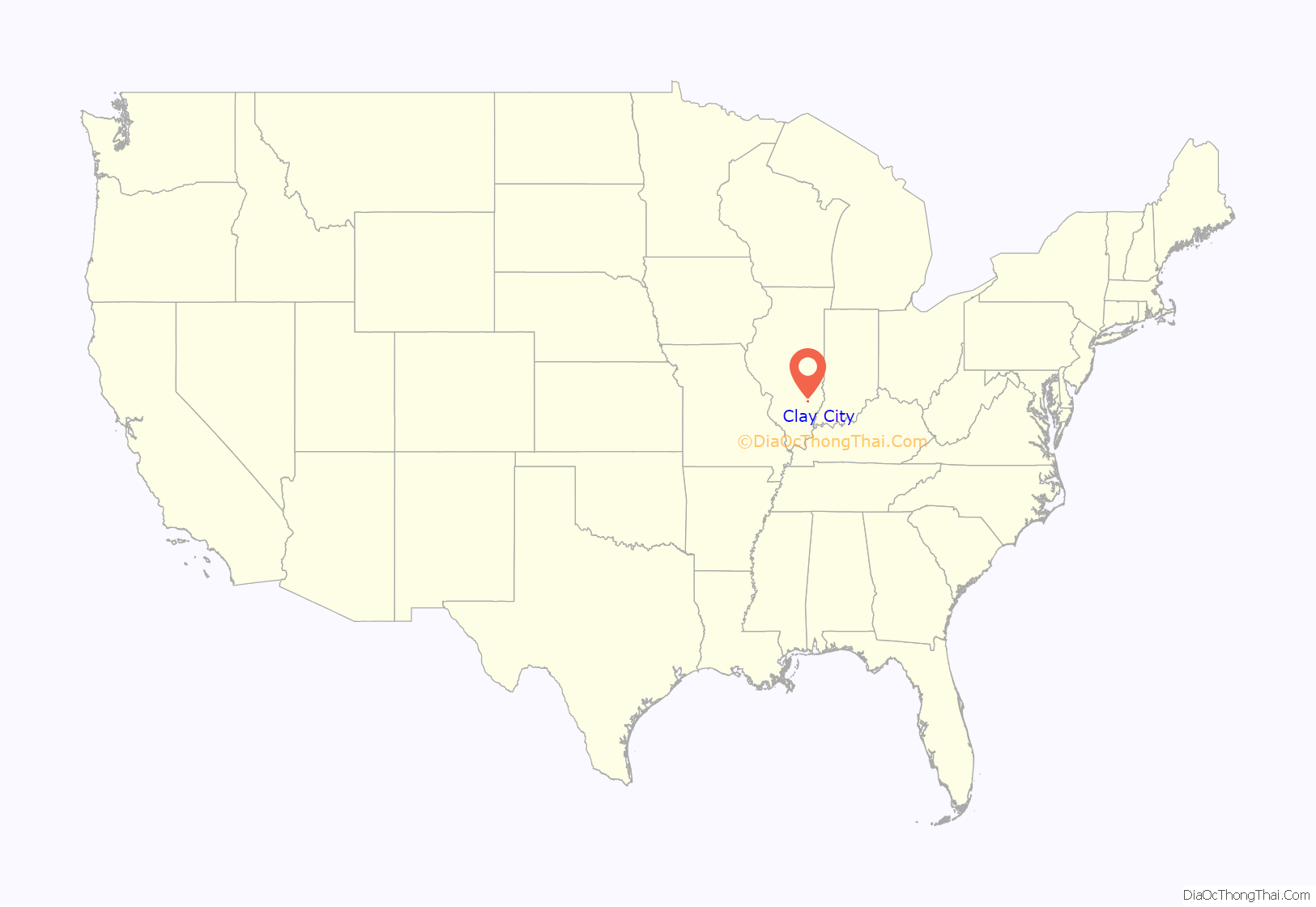
Clay City is a village in Clay County, Illinois, United States. The population was 847 at the 2020 census. Clay City was named for the Kentucky statesman Henry Clay.
| Name: | Clay City village |
|---|---|
| LSAD Code: | 47 |
| LSAD Description: | village (suffix) |
| State: | Illinois |
| County: | Clay County |
| Total Area: | 1.78 sq mi (4.61 km²) |
| Land Area: | 1.78 sq mi (4.61 km²) |
| Water Area: | 0.00 sq mi (0.00 km²) |
| Total Population: | 847 |
| Population Density: | 475.31/sq mi (183.56/km²) |
| Area code: | 618 |
| FIPS code: | 1714715 |
| Website: | https://www.villageofclaycityil.com/ |
Online Interactive Map
Click on ![]() to view map in "full screen" mode.
to view map in "full screen" mode.
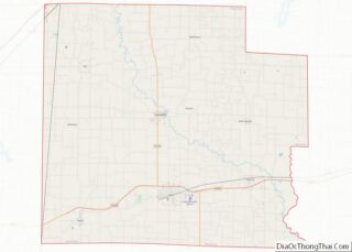
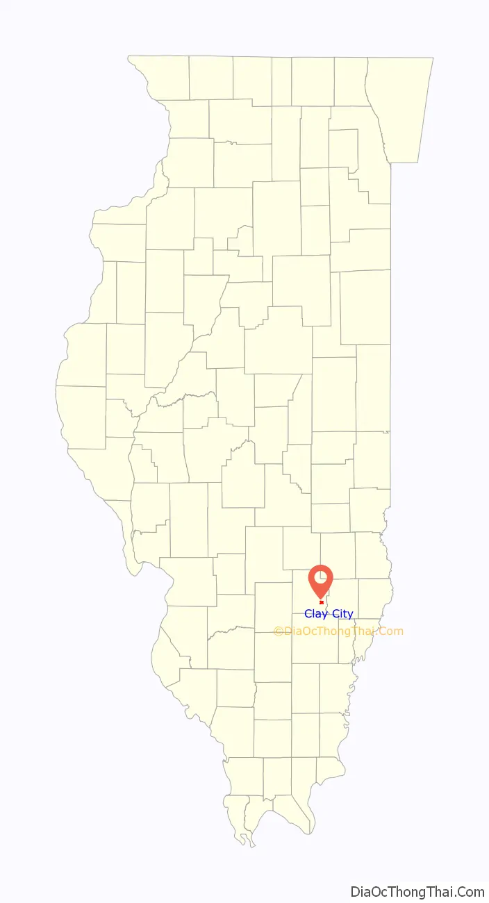
Clay City location map. Where is Clay City village?
History
In the early 1800s Solomon Harter Mueller (later Miller) came to Clay City, IL. with his Cherokee wife (later Ida) and 6 children, from W. Virginia to establish a farm and grinding Mill. He later built a smokehouse, general store and Milinary shop. Solomon also brought his brother George C with wife Caroline and 5 children. Solomon and Ida had children : Isom, Mary, Otto, Roy, Louise and Zella all born in Clay City. Great-grandchildren of Louise: Wallace, and Caroline left Clay City, for St. Louis, Mo. Paul George left for Ohio, and ultimately lost oil and mineral rights in Clay City/C
In 1810 John McCawley and Seth Evans were traveling west from Fort Vincennes along the old Buffalo Trace when one of their horses died. McCawley sent his companion back for another horse. McCawley stayed behind in a cabin built on the west bank of the Little Wabash River just south and east of the future Clay City. This made McCawley the first white man to settle in this area. McCawley later decided to build a stagecoach stop and trading center on the location which was known as McCawley’s Tavern. It provided a place for travelers to stop, eat, and spend the night.
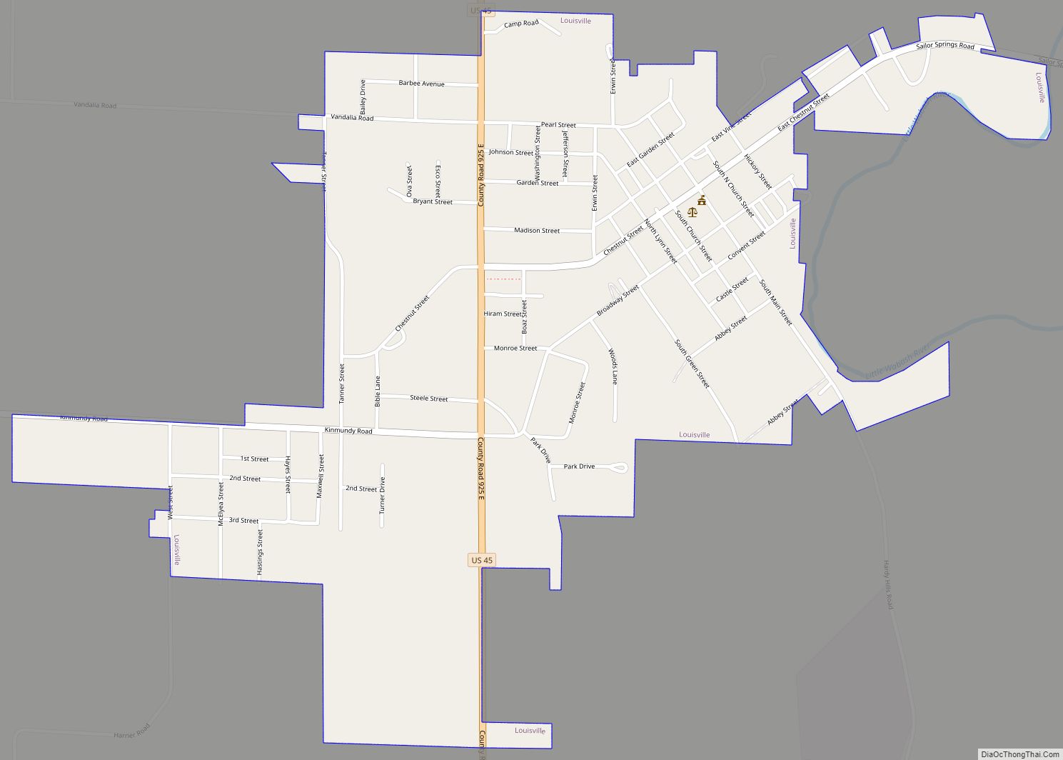
Clay County was created by an act of the legislature on December 23, 1824. On Tuesday, March 8, 1825, at John McCawley’s place, the first county commissioners’ court assembled for the new county of Clay. In 1825 Daniel May donated 20 acres (81,000 m) of land, just over 2 miles (3 km) west of McCawley’s Tavern, to the county for the purpose of constructing a courthouse. This land is one block south of US 50 and to the west of what is now South Main Street. This area had previously been known as Hubbardsville but was renamed Maysville. A two-room courthouse was constructed in 1825, and court was held at Maysville until 1841 when it was moved to the new and present county seat, Louisville.
In 1855, after the O&M Railroad was located about 1 mile (1.6 km) north of Maysville, Clay City was established by Mr. J.D. Perkey on the north side of the tracks and mostly to the east of the present North Main Street. The business district soon developed to the south of the tracks where it is presently located. Maysville was made a part of the Village of Clay City in 1862.
Clay City served as a trading center for the surrounding countryside. Farmers could bring their produce to town and trade it for dry goods, etc. and very little money would change hands. With the passenger trains stopping in Clay City it also served as a source of transportation for the surrounding area. Many of the tourists who traveled to the once famous resort of Sailor Springs would take the train to Clay City and then use local transportation on up to Sailor Springs.
In 1936 oil was discovered in this area, and oil-related businesses continue to thrive in Clay City today.
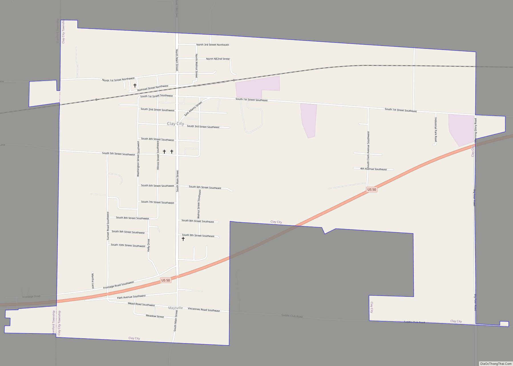
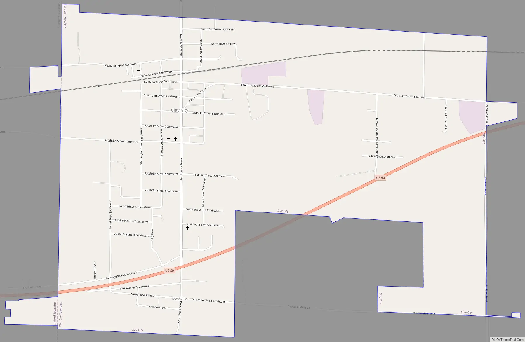
Clay City Road Map
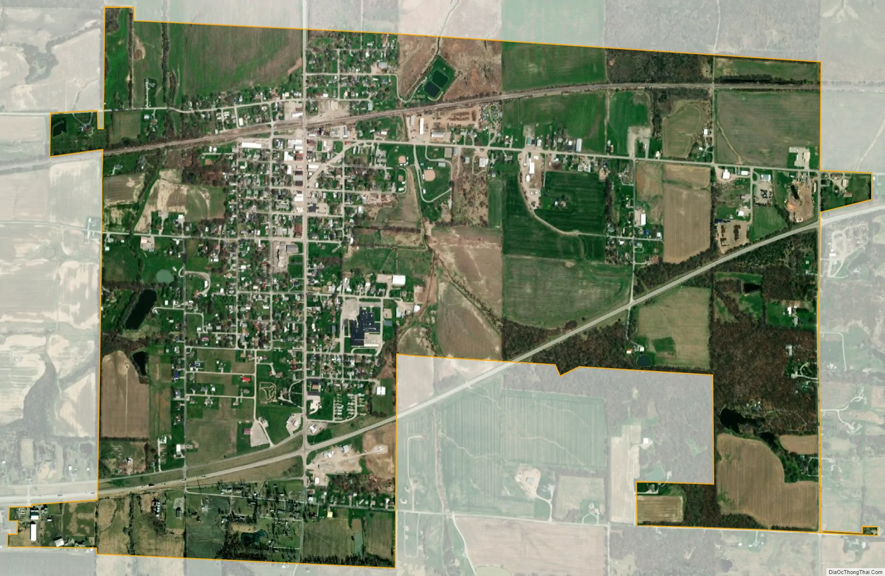
Clay City city Satellite Map
Geography
Clay City is located in southeastern Clay County at 38°41′13″N 88°21′11″W / 38.68694°N 88.35306°W / 38.68694; -88.35306 (38.686883, -88.353121), about 1 mile (1.6 km) southwest of the Little Wabash River. U.S. Route 50 passes through the southern side of the village, leading west 7 miles (11 km) to Flora and east 15 miles (24 km) to Olney. Louisville, the Clay County seat, is 14 miles (23 km) to the northwest.
According to the 2021 census gazetteer files, Clay City has a total area of 1.78 square miles (4.61 km), all land.
See also
Map of Illinois State and its subdivision:- Adams
- Alexander
- Bond
- Boone
- Brown
- Bureau
- Calhoun
- Carroll
- Cass
- Champaign
- Christian
- Clark
- Clay
- Clinton
- Coles
- Cook
- Crawford
- Cumberland
- De Kalb
- De Witt
- Douglas
- Dupage
- Edgar
- Edwards
- Effingham
- Fayette
- Ford
- Franklin
- Fulton
- Gallatin
- Greene
- Grundy
- Hamilton
- Hancock
- Hardin
- Henderson
- Henry
- Iroquois
- Jackson
- Jasper
- Jefferson
- Jersey
- Jo Daviess
- Johnson
- Kane
- Kankakee
- Kendall
- Knox
- La Salle
- Lake
- Lake Michigan
- Lawrence
- Lee
- Livingston
- Logan
- Macon
- Macoupin
- Madison
- Marion
- Marshall
- Mason
- Massac
- McDonough
- McHenry
- McLean
- Menard
- Mercer
- Monroe
- Montgomery
- Morgan
- Moultrie
- Ogle
- Peoria
- Perry
- Piatt
- Pike
- Pope
- Pulaski
- Putnam
- Randolph
- Richland
- Rock Island
- Saint Clair
- Saline
- Sangamon
- Schuyler
- Scott
- Shelby
- Stark
- Stephenson
- Tazewell
- Union
- Vermilion
- Wabash
- Warren
- Washington
- Wayne
- White
- Whiteside
- Will
- Williamson
- Winnebago
- Woodford
- Alabama
- Alaska
- Arizona
- Arkansas
- California
- Colorado
- Connecticut
- Delaware
- District of Columbia
- Florida
- Georgia
- Hawaii
- Idaho
- Illinois
- Indiana
- Iowa
- Kansas
- Kentucky
- Louisiana
- Maine
- Maryland
- Massachusetts
- Michigan
- Minnesota
- Mississippi
- Missouri
- Montana
- Nebraska
- Nevada
- New Hampshire
- New Jersey
- New Mexico
- New York
- North Carolina
- North Dakota
- Ohio
- Oklahoma
- Oregon
- Pennsylvania
- Rhode Island
- South Carolina
- South Dakota
- Tennessee
- Texas
- Utah
- Vermont
- Virginia
- Washington
- West Virginia
- Wisconsin
- Wyoming