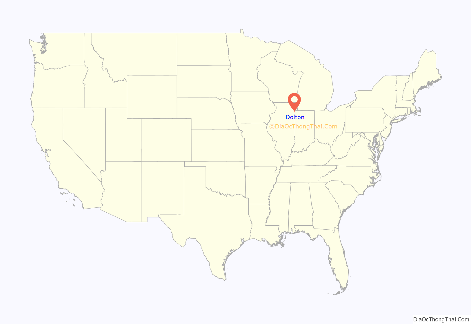
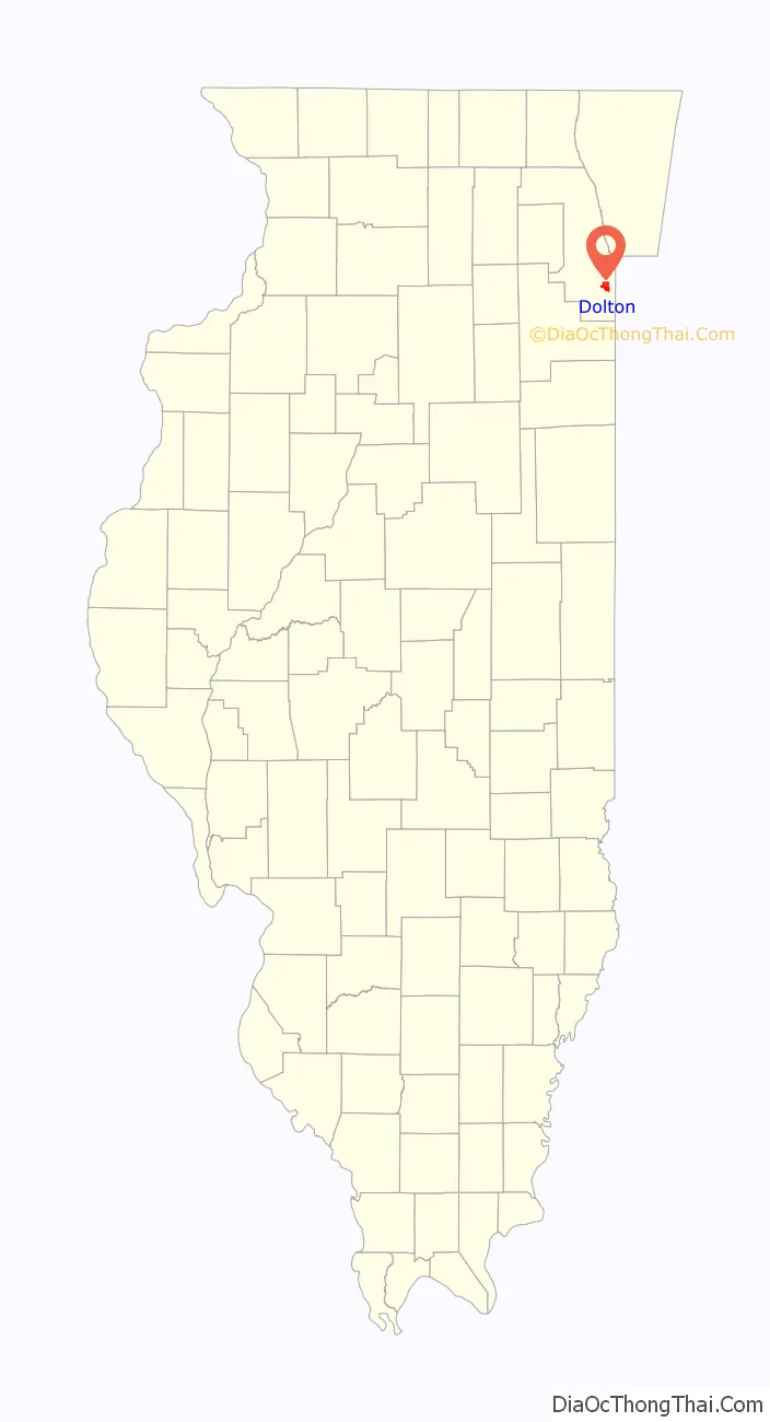
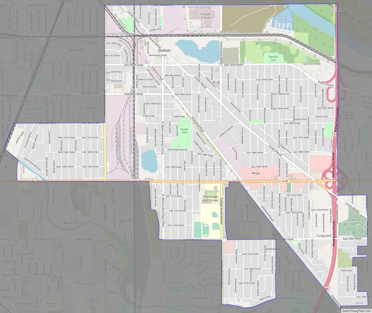
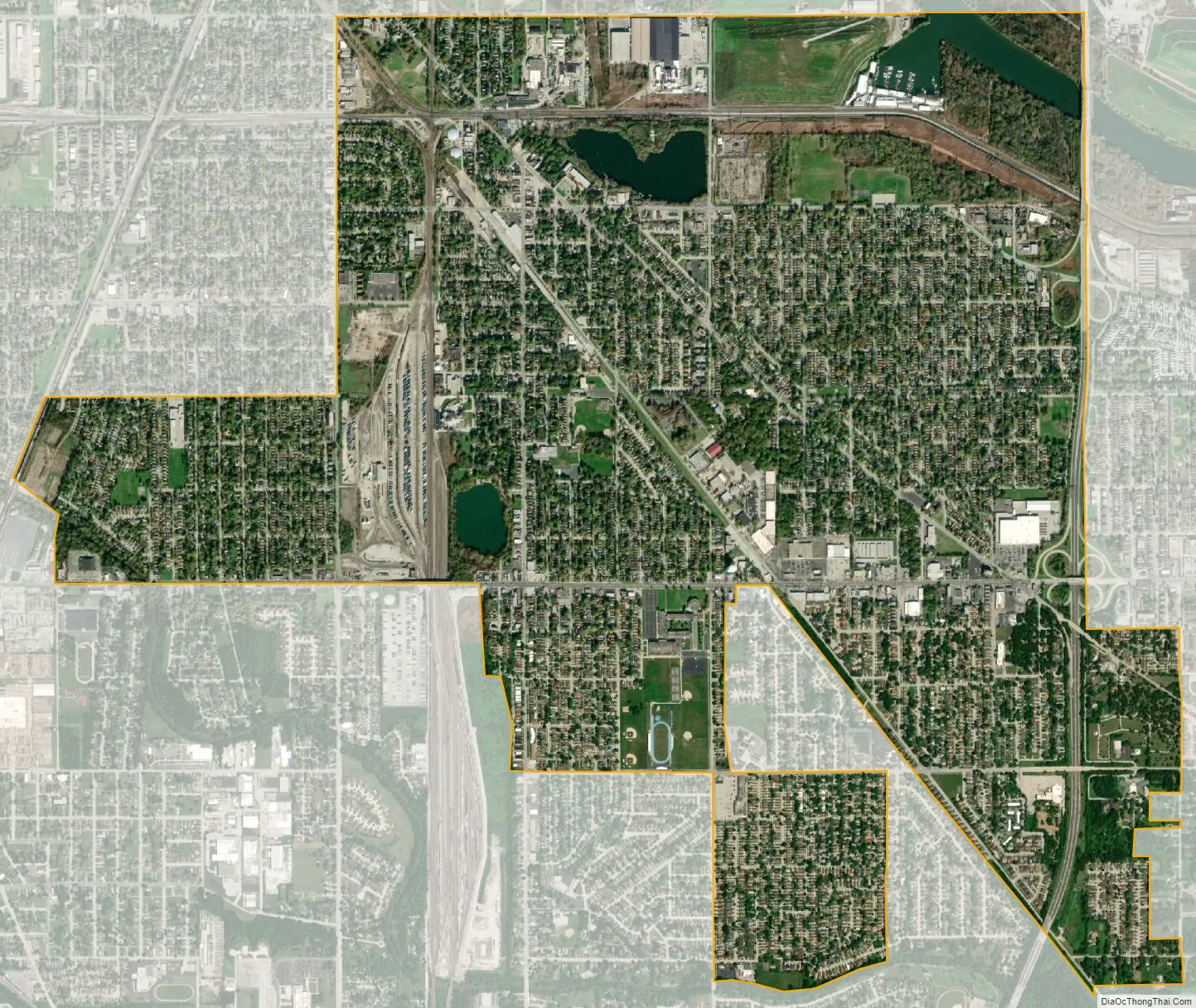
Dolton (pronounced “DAWL-ton”) is a village in Cook County, Illinois, United States. The population was 21,426 at the 2020 census. Dolton is located just west of the expressway Interstate 94 and immediately south of the city limits of Chicago. Its most common ZIP code is 60419.
Dolton is bordered by Chicago to the north, Riverdale and Harvey to the west, South Holland to the south and Calumet City to the east.
| Name: | Dolton village |
|---|---|
| LSAD Code: | 47 |
| LSAD Description: | village (suffix) |
| State: | Illinois |
| County: | Cook County |
| Incorporated: | 1893 |
| Total Area: | 4.69 sq mi (12.14 km²) |
| Land Area: | 4.57 sq mi (11.84 km²) |
| Water Area: | 0.12 sq mi (0.30 km²) 2.56% |
| Total Population: | 21,426 |
| Population Density: | 4,687.38/sq mi (1,809.94/km²) |
| Area code: | 708 |
| FIPS code: | 1720292 |
| Website: | vodolton.org |
Online Interactive Map
Click on ![]() to view map in "full screen" mode.
to view map in "full screen" mode.
Dolton location map. Where is Dolton village?
History
A post office has been in operation in Dolton since 1854. The village was named for a family of early settlers.
Dolton Road Map
Dolton city Satellite Map
Geography
Dolton is located at 41°37′39″N 87°35′55″W / 41.62750°N 87.59861°W / 41.62750; -87.59861 (41.627509, -87.598512).
According to the 2021 census gazetteer files, Dolton has a total area of 4.69 square miles (12.15 km), of which 4.57 square miles (11.84 km) (or 97.50%) is land and 0.12 square miles (0.31 km) (or 2.50%) is water.
Surrounding areas
See also
Map of Illinois State and its subdivision:- Adams
- Alexander
- Bond
- Boone
- Brown
- Bureau
- Calhoun
- Carroll
- Cass
- Champaign
- Christian
- Clark
- Clay
- Clinton
- Coles
- Cook
- Crawford
- Cumberland
- De Kalb
- De Witt
- Douglas
- Dupage
- Edgar
- Edwards
- Effingham
- Fayette
- Ford
- Franklin
- Fulton
- Gallatin
- Greene
- Grundy
- Hamilton
- Hancock
- Hardin
- Henderson
- Henry
- Iroquois
- Jackson
- Jasper
- Jefferson
- Jersey
- Jo Daviess
- Johnson
- Kane
- Kankakee
- Kendall
- Knox
- La Salle
- Lake
- Lake Michigan
- Lawrence
- Lee
- Livingston
- Logan
- Macon
- Macoupin
- Madison
- Marion
- Marshall
- Mason
- Massac
- McDonough
- McHenry
- McLean
- Menard
- Mercer
- Monroe
- Montgomery
- Morgan
- Moultrie
- Ogle
- Peoria
- Perry
- Piatt
- Pike
- Pope
- Pulaski
- Putnam
- Randolph
- Richland
- Rock Island
- Saint Clair
- Saline
- Sangamon
- Schuyler
- Scott
- Shelby
- Stark
- Stephenson
- Tazewell
- Union
- Vermilion
- Wabash
- Warren
- Washington
- Wayne
- White
- Whiteside
- Will
- Williamson
- Winnebago
- Woodford
- Alabama
- Alaska
- Arizona
- Arkansas
- California
- Colorado
- Connecticut
- Delaware
- District of Columbia
- Florida
- Georgia
- Hawaii
- Idaho
- Illinois
- Indiana
- Iowa
- Kansas
- Kentucky
- Louisiana
- Maine
- Maryland
- Massachusetts
- Michigan
- Minnesota
- Mississippi
- Missouri
- Montana
- Nebraska
- Nevada
- New Hampshire
- New Jersey
- New Mexico
- New York
- North Carolina
- North Dakota
- Ohio
- Oklahoma
- Oregon
- Pennsylvania
- Rhode Island
- South Carolina
- South Dakota
- Tennessee
- Texas
- Utah
- Vermont
- Virginia
- Washington
- West Virginia
- Wisconsin
- Wyoming


