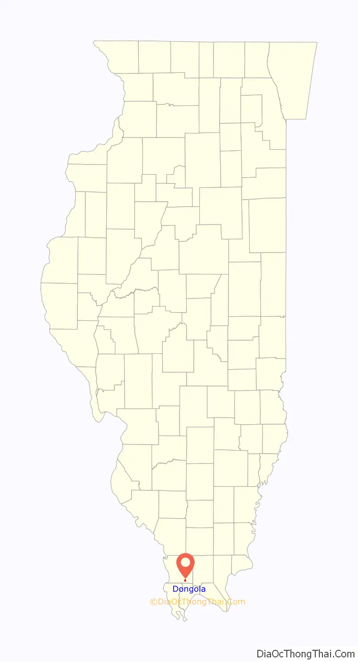
Dongola is a village in Union County, Illinois, United States. The population was 726 at the 2010 census.
| Name: | Dongola village |
|---|---|
| LSAD Code: | 47 |
| LSAD Description: | village (suffix) |
| State: | Illinois |
| County: | Union County |
| Elevation: | 397 ft (121 m) |
| Total Area: | 1.15 sq mi (2.97 km²) |
| Land Area: | 1.09 sq mi (2.82 km²) |
| Water Area: | 0.06 sq mi (0.15 km²) |
| Total Population: | 661 |
| Population Density: | 607.54/sq mi (234.49/km²) |
| Area code: | 618 |
| FIPS code: | 1720305 |
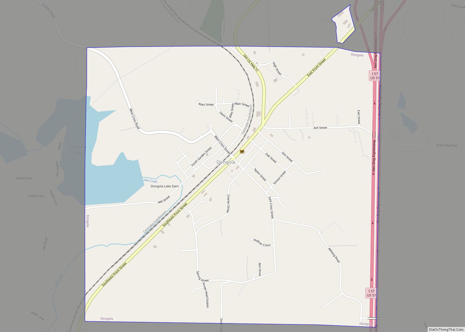
Online Interactive Map
Click on ![]() to view map in "full screen" mode.
to view map in "full screen" mode.
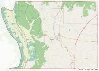
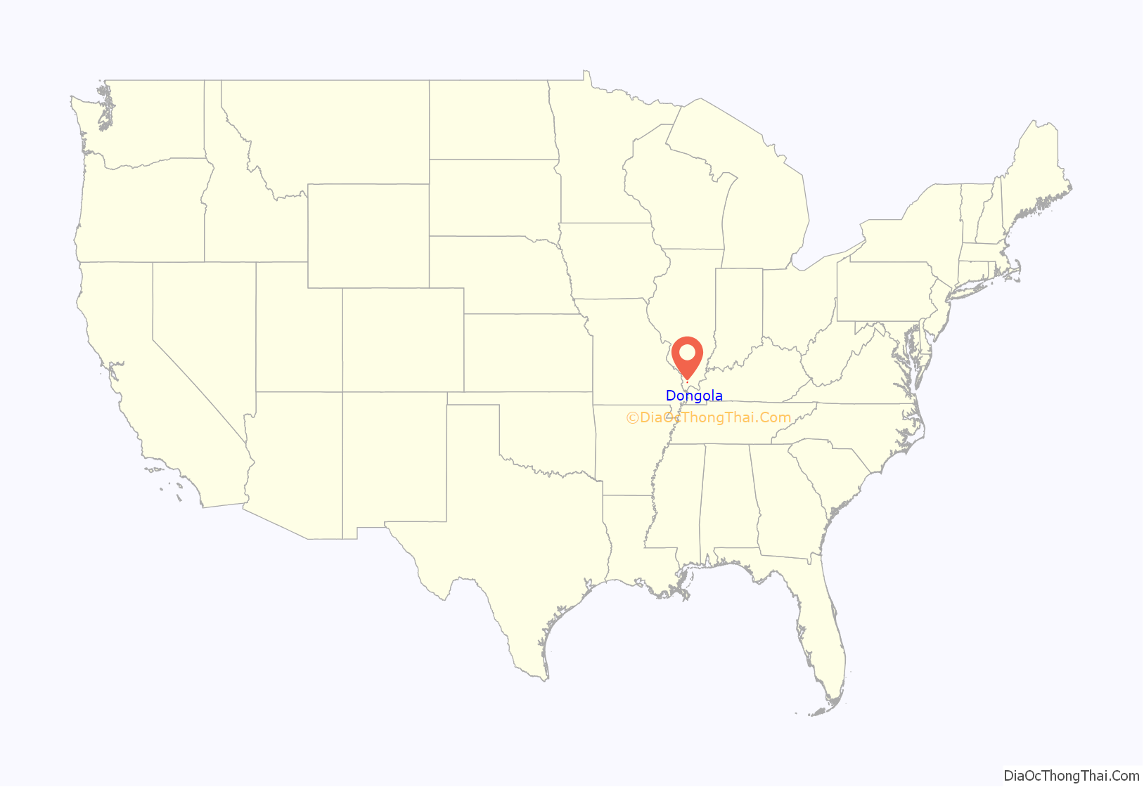
Dongola location map. Where is Dongola village?
History
Dongola was laid out in 1857 as a stop along the Illinois Central Railroad. A post office known as “Unionville” had been established in 1855, but the name was changed to “Dongola,” after Dongola, Sudan.
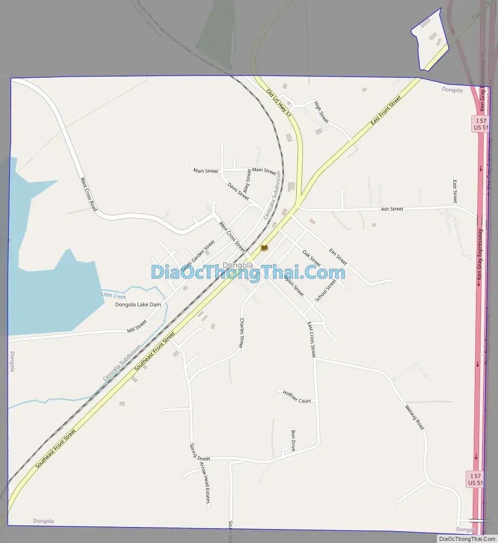
Dongola Road Map
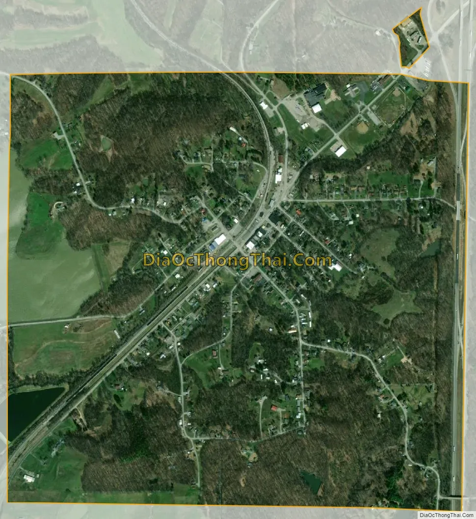
Dongola city Satellite Map
Geography
Dongola is located at 37°21′40″N 89°9′52″W / 37.36111°N 89.16444°W / 37.36111; -89.16444 (37.361243, -89.164574). The village is situated north of Cairo at the intersection of Old U.S. Highway 51 (signed as Front Street in Dongola) and Interstate 57. The point at which Union, Pulaski, and Alexander counties meet is located just to the southwest. Dongola Lake, created by a small dam along Little Creek, lies to the west of Dongola.
According to the 2010 census, Dongola has a total area of 1.147 square miles (2.97 km), of which 1.09 square miles (2.82 km) (or 95.03%) is land and 0.057 square miles (0.15 km) (or 4.97%) is water.
See also
Map of Illinois State and its subdivision:- Adams
- Alexander
- Bond
- Boone
- Brown
- Bureau
- Calhoun
- Carroll
- Cass
- Champaign
- Christian
- Clark
- Clay
- Clinton
- Coles
- Cook
- Crawford
- Cumberland
- De Kalb
- De Witt
- Douglas
- Dupage
- Edgar
- Edwards
- Effingham
- Fayette
- Ford
- Franklin
- Fulton
- Gallatin
- Greene
- Grundy
- Hamilton
- Hancock
- Hardin
- Henderson
- Henry
- Iroquois
- Jackson
- Jasper
- Jefferson
- Jersey
- Jo Daviess
- Johnson
- Kane
- Kankakee
- Kendall
- Knox
- La Salle
- Lake
- Lake Michigan
- Lawrence
- Lee
- Livingston
- Logan
- Macon
- Macoupin
- Madison
- Marion
- Marshall
- Mason
- Massac
- McDonough
- McHenry
- McLean
- Menard
- Mercer
- Monroe
- Montgomery
- Morgan
- Moultrie
- Ogle
- Peoria
- Perry
- Piatt
- Pike
- Pope
- Pulaski
- Putnam
- Randolph
- Richland
- Rock Island
- Saint Clair
- Saline
- Sangamon
- Schuyler
- Scott
- Shelby
- Stark
- Stephenson
- Tazewell
- Union
- Vermilion
- Wabash
- Warren
- Washington
- Wayne
- White
- Whiteside
- Will
- Williamson
- Winnebago
- Woodford
- Alabama
- Alaska
- Arizona
- Arkansas
- California
- Colorado
- Connecticut
- Delaware
- District of Columbia
- Florida
- Georgia
- Hawaii
- Idaho
- Illinois
- Indiana
- Iowa
- Kansas
- Kentucky
- Louisiana
- Maine
- Maryland
- Massachusetts
- Michigan
- Minnesota
- Mississippi
- Missouri
- Montana
- Nebraska
- Nevada
- New Hampshire
- New Jersey
- New Mexico
- New York
- North Carolina
- North Dakota
- Ohio
- Oklahoma
- Oregon
- Pennsylvania
- Rhode Island
- South Carolina
- South Dakota
- Tennessee
- Texas
- Utah
- Vermont
- Virginia
- Washington
- West Virginia
- Wisconsin
- Wyoming