Dupo is a village in St. Clair County, Illinois, United States. The population was 4,138 at the 2010 census, an increase from 3,933 in 2000. The village was settled in about 1750 and was incorporated in 1907. Its modern name, adopted in the early 20th century, is shortened from Prairie du Pont (“Bridge Prairie”).
| Name: | Dupo village |
|---|---|
| LSAD Code: | 47 |
| LSAD Description: | village (suffix) |
| State: | Illinois |
| County: | St. Clair County |
| Elevation: | 410 ft (120 m) |
| Total Area: | 6.42 sq mi (16.64 km²) |
| Land Area: | 6.40 sq mi (16.58 km²) |
| Water Area: | 0.02 sq mi (0.06 km²) |
| Total Population: | 3,996 |
| Population Density: | 624.08/sq mi (240.96/km²) |
| Area code: | 618 |
| FIPS code: | 1721254 |
| Website: | www.villageofdupo.org |
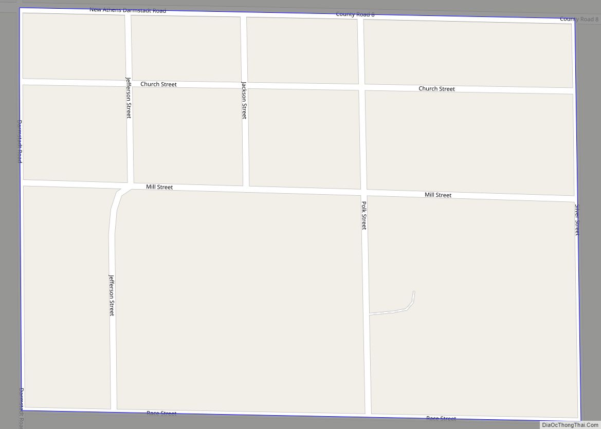
Online Interactive Map
Click on ![]() to view map in "full screen" mode.
to view map in "full screen" mode.
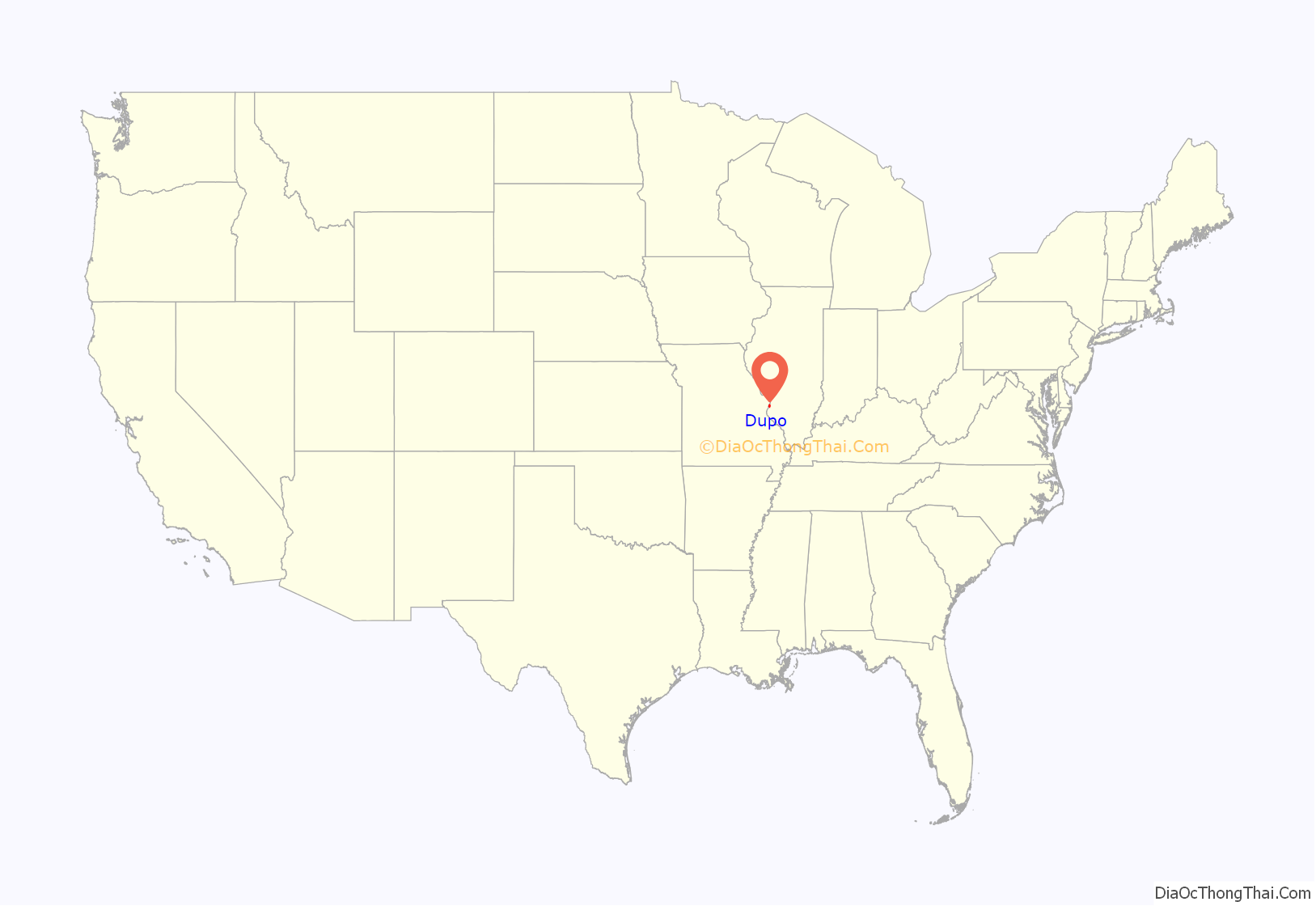
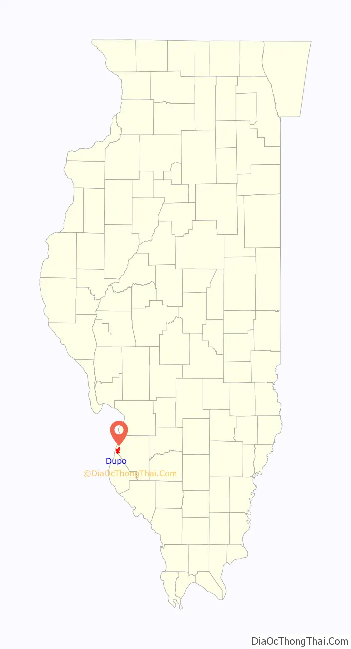
Dupo location map. Where is Dupo village?
History
In the Mississippian period, Dupo was the site of one of several multi-mound communities in the floodplain near Cahokia. These mounds remained standing at least as recently as 1915.
The French village of Prairie du Pont was first settled around 1750 by townspeople moving out of Cahokia. It was located at a bridge over what is now known as Prairie du Pont Creek, on the trail from Cahokia to Kaskaskia, which was the first wagon road in Illinois. The settlement may have been motivated by Dupo being located 10-12 feet higher than Cahokia and thus being more protected from floods on the Mississippi River. The Sulpician mission established a mill near the bridge, which became the core of the town’s development. By 1765 fourteen families lived in Prairie du Pont. The village’s growth was further spurred by the prominent local citizen Antoine Girardin, who parceled off parts of the Cahokia commons to residents of Prairie du Pont.
The early French village at Prairie du Pont followed a tripartite system of land ownership that was common in the Illinois country: private houses in a row, “common fields” enclosed by a shared fence but divided into narrow strips owned and farmed by a particular family, and the actual commons used jointly by the inhabitants for grazing their livestock. The village elected a village council, or syndic, to maintain the fence around the common fields.
Among the early inhabitants of Prairie du Pont was the noted gunsmith Philip Creamer, who settled in the area in 1805. Some parts of the historic Prairie du Pont community, such as the Pierre Martin House, are now located in unincorporated North Dupo, Illinois.
A Prairie du Pont school district was established by legislative enactment in 1847, to be funded by leases of the village commons, but no school was actually held in the village until 1861, due to inadequate funds.
In the 1880s, the town of Prairie du Pont had about 50 inhabitants, of whom about 20% were African American.
The modern town of Dupo was platted in 1905 and incorporated in 1907. It grew around the Missouri Pacific Railroad switching yards. At the instigation of the railroad, the name was shortened from Prairie du Pont to Dupo.
In 1928, the Ohio Oil Company discovered oil in Dupo. This led to an oil boom in the town, in which oil wells were sunk in people’s front yards. However, the oil boom was short-lived and the economy of the town returned to depending primarily on the rail yard.
In 1997, the town considered switching its name back to Prairie Du Pont to put the industrial period behind it and better attract tourism, but ultimately left its name unchanged.
In 2019, a Union Pacific freight train derailed at the Dupo Yard, leading to the evacuation of several neighborhoods in Dupo. The crash was caused by a 1.5 miles (2.4 km)-long freight train breaking in half and the two halves then colliding. A tank car full of methyl isobutyl ketone caught fire.
Dupo Road Map
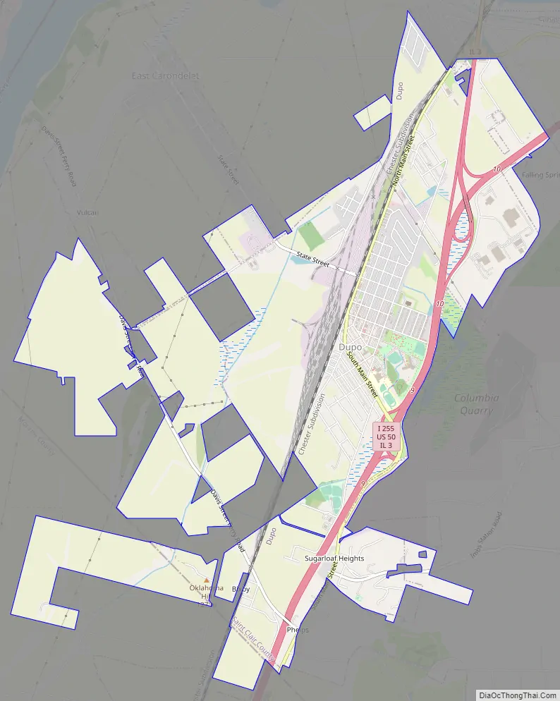
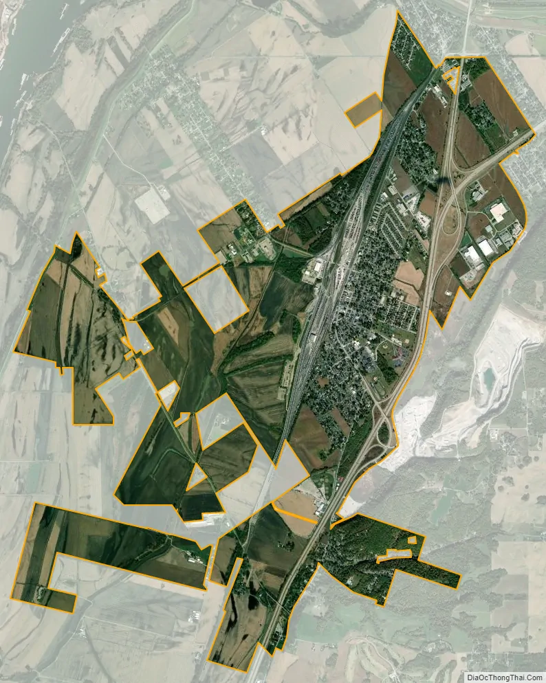
Dupo city Satellite Map
Geography
Dupo is located at 38°30′57″N 90°12′29″W / 38.51583°N 90.20806°W / 38.51583; -90.20806 (38.515702, -90.207992). It is located in the American Bottom floodplain of the Mississippi River.
According to the 2010 census, Dupo has a total area of 4.42 square miles (11.45 km), all land.
See also
Map of Illinois State and its subdivision:- Adams
- Alexander
- Bond
- Boone
- Brown
- Bureau
- Calhoun
- Carroll
- Cass
- Champaign
- Christian
- Clark
- Clay
- Clinton
- Coles
- Cook
- Crawford
- Cumberland
- De Kalb
- De Witt
- Douglas
- Dupage
- Edgar
- Edwards
- Effingham
- Fayette
- Ford
- Franklin
- Fulton
- Gallatin
- Greene
- Grundy
- Hamilton
- Hancock
- Hardin
- Henderson
- Henry
- Iroquois
- Jackson
- Jasper
- Jefferson
- Jersey
- Jo Daviess
- Johnson
- Kane
- Kankakee
- Kendall
- Knox
- La Salle
- Lake
- Lake Michigan
- Lawrence
- Lee
- Livingston
- Logan
- Macon
- Macoupin
- Madison
- Marion
- Marshall
- Mason
- Massac
- McDonough
- McHenry
- McLean
- Menard
- Mercer
- Monroe
- Montgomery
- Morgan
- Moultrie
- Ogle
- Peoria
- Perry
- Piatt
- Pike
- Pope
- Pulaski
- Putnam
- Randolph
- Richland
- Rock Island
- Saint Clair
- Saline
- Sangamon
- Schuyler
- Scott
- Shelby
- Stark
- Stephenson
- Tazewell
- Union
- Vermilion
- Wabash
- Warren
- Washington
- Wayne
- White
- Whiteside
- Will
- Williamson
- Winnebago
- Woodford
- Alabama
- Alaska
- Arizona
- Arkansas
- California
- Colorado
- Connecticut
- Delaware
- District of Columbia
- Florida
- Georgia
- Hawaii
- Idaho
- Illinois
- Indiana
- Iowa
- Kansas
- Kentucky
- Louisiana
- Maine
- Maryland
- Massachusetts
- Michigan
- Minnesota
- Mississippi
- Missouri
- Montana
- Nebraska
- Nevada
- New Hampshire
- New Jersey
- New Mexico
- New York
- North Carolina
- North Dakota
- Ohio
- Oklahoma
- Oregon
- Pennsylvania
- Rhode Island
- South Carolina
- South Dakota
- Tennessee
- Texas
- Utah
- Vermont
- Virginia
- Washington
- West Virginia
- Wisconsin
- Wyoming