Elkhart is a village in Logan County, Illinois, United States. The population was 405 at the 2010 census.
| Name: | Elkhart village |
|---|---|
| LSAD Code: | 47 |
| LSAD Description: | village (suffix) |
| State: | Illinois |
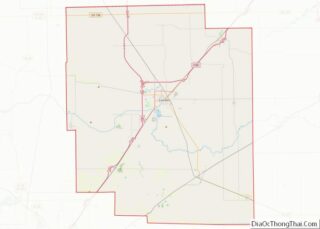
| County: | Logan County |
| Elevation: | 640 ft (200 m) |
| Total Area: | 1.95 sq mi (5.05 km²) |
| Land Area: | 1.94 sq mi (5.03 km²) |
| Water Area: | 0.01 sq mi (0.02 km²) |
| Total Population: | 450 |
| Population Density: | 231.72/sq mi (89.46/km²) |
| ZIP code: | 62634 |
| Area code: | 217 |
| FIPS code: | 1723269 |
| Website: | elkhartillinois.us |
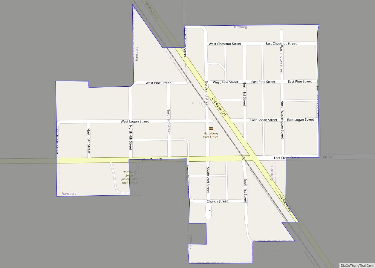
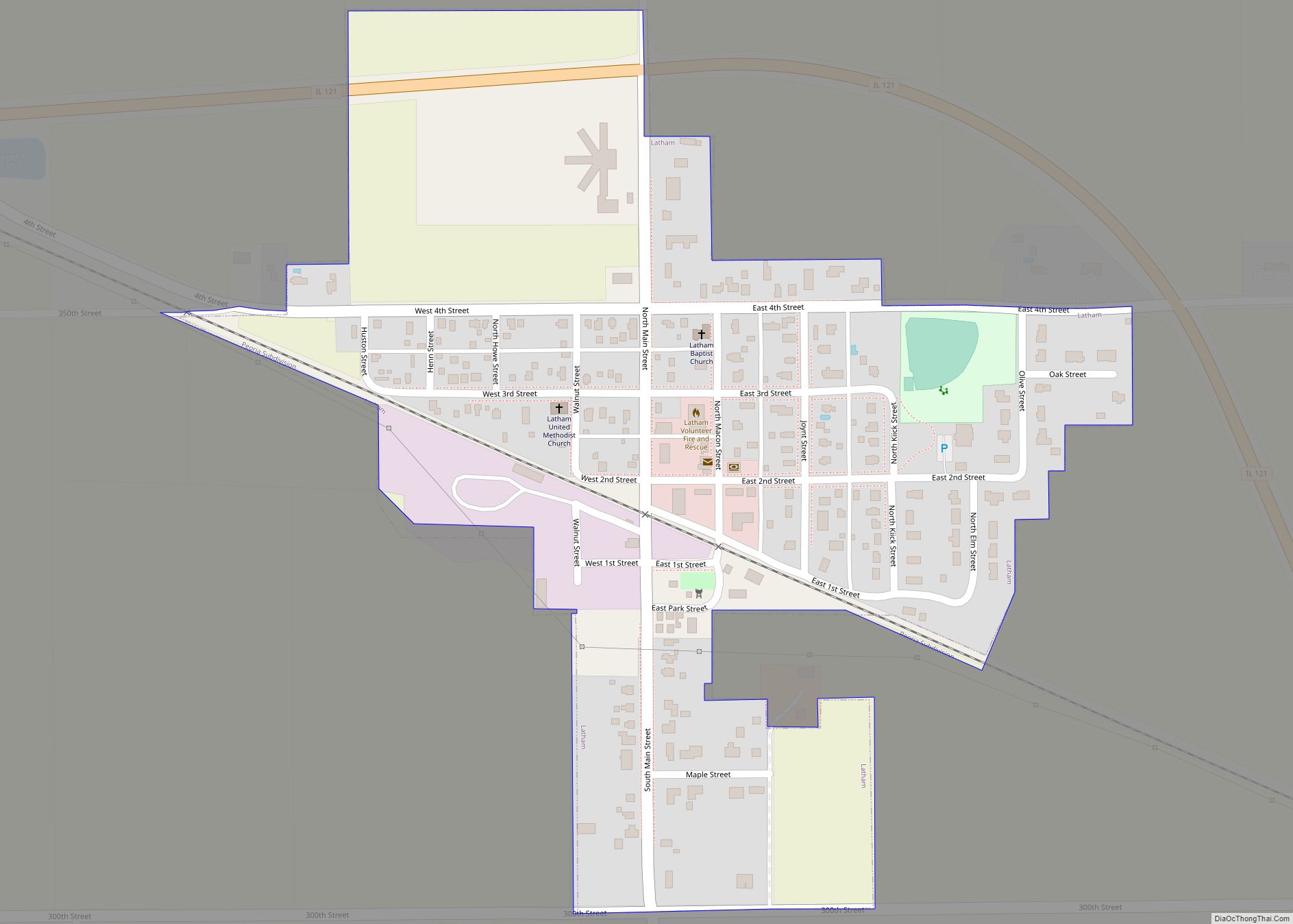
Online Interactive Map
Click on ![]() to view map in "full screen" mode.
to view map in "full screen" mode.
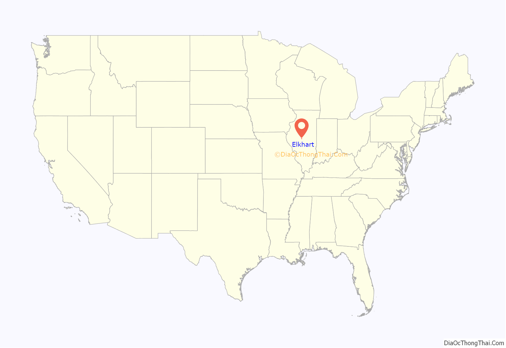
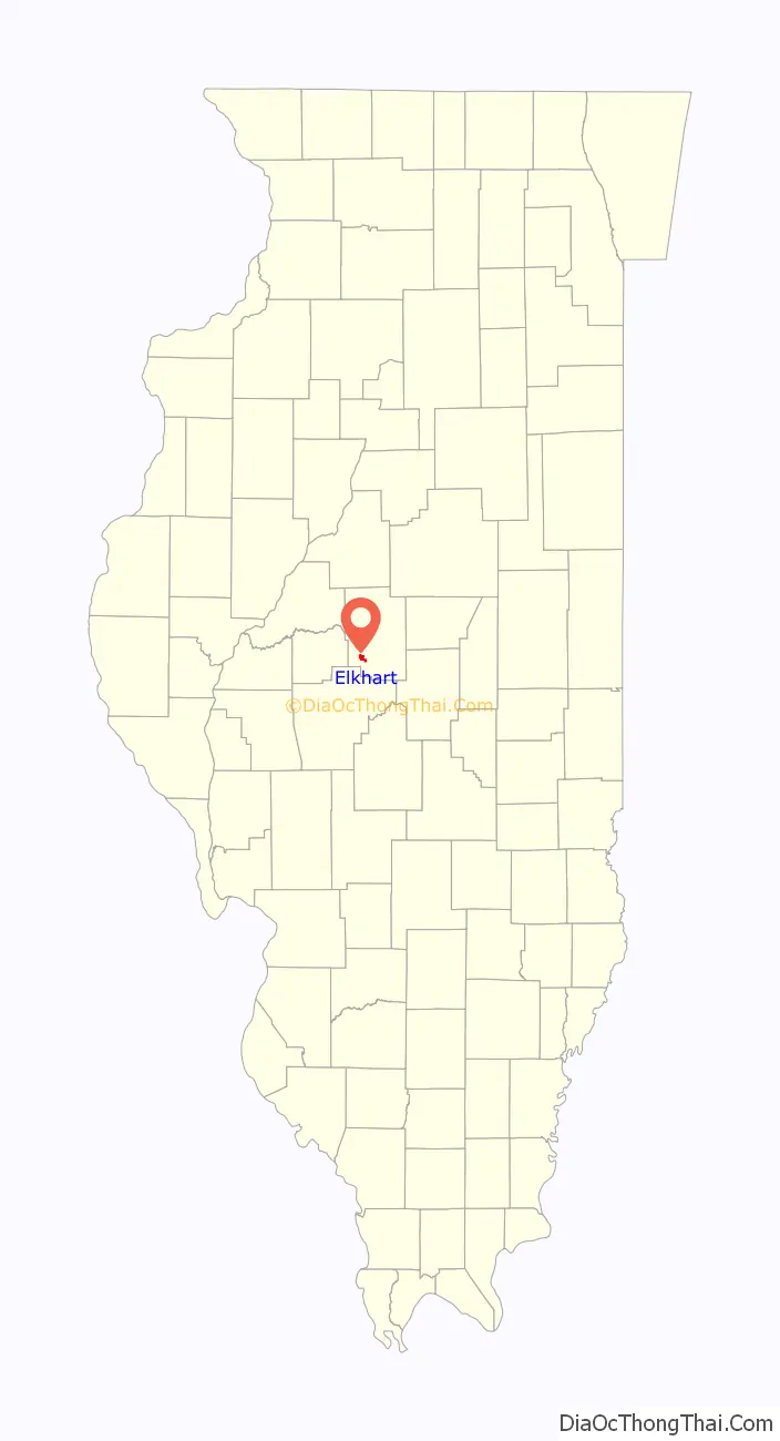
Elkhart location map. Where is Elkhart village?
History
Elkhart takes its name from Elkhart (or “Elk Heart”) Grove, which along with Buffalo Hart was an area of woodland along the Edwards Trace. The grove’s name has been attributed to its shape, resembling the heart of an elk. Prior to the forced expulsion of indigenous peoples from Illinois, a Kickapoo village was located at the grove.
The history of non-indigenous settlement at Elkhart dates from the arrival of James Latham and his family at Elkhart Grove in the spring of 1819. James Latham’s house, and later his son Richard Latham’s place on the brow of the hill further south, were stops on the early stage routes from Springfield to Bloomington. Around 1822, James and Richard Latham built a horse mill at the foot of Elkhart Hill. Before this, the early settlers had been compelled to go to Edwardsville to mill. During the mill’s existence, settlers came a great distance to get their grinding done and frequently camped overnight waiting their turn.
In later days, Abraham Lincoln, David Davis, John T. Stuart and others frequently spent the night at Elkhart Grove when traveling the 8th Judicial Circuit.
A town site at Elkhart Grove had been laid out by early settler Aquilla Davis in the 1820s. However, nothing definite was done in that direction until the Alton & Sangamon (now the Chicago & Alton) railroad came through in 1853. Once the tracks were laid, an old horse mill, owned by Seneca Woods, was brought from Springfield by William Mozee and converted into a warehouse. This was the first building in the town of Elkhart. In 1855, John Shockey, of Franklin County, Pennsylvania, laid out the town, and County Surveyor Conaway Pence surveyed it on April 11 of that year. The town was given the name of Elkhart City to distinguish it from the nearby locations of Elkhart Hill and Elkhart Grove.
Also in 1855, John Shockey erected a large frame hotel. J. R. Saunders also built a brick store and offered the first general stock of goods for sale in the town. A few goods had been for sale in the old warehouse, but no regular stock had been kept. Quite a number of houses were built that same summer, and the town experienced quite a growth spurt during the later 1850s. The Elkhart City post office was established in 1856. J. R. Saunders served as the first postmaster and railroad agent, and William Rankin was his assistant. In 1858, John Gibbs erected a warehouse. Shockey’s 16-acre (65,000 m) addition was added to the original town in January 1858. Rigney’s addition was laid out in 1863, and Thompson’s addition was added in 1865. A small district school house was moved into the town in 1856, which gave way to a larger structure in 1865.
For many years Elkhart was one of the largest shipping points on the Chicago & Alton Railroad. This was due in part to the large stock farms of John D. Gillett. The town was incorporated February 22, 1861, by special legislative charter. The first officers were James Rigney, president; W. M. Helm, clerk; T. H. Cantrall, treasurer; L. D. Dana, justice; Martin Buzzard, constable; and A. H. Bogardus, street commissioner. A Methodist church was built in the village in 1863, a Catholic church in 1864, and a Christian church in 1867.
The name of the post office was changed from Elkhart City to Elkhart in 1883. A new rail depot was built at Elkhart in 1888.
Like many frontier towns, Elkhart had its share of fires. The nearby residence of the rancher John D. Gillett was destroyed by fire on February 14, 1871, although he rebuilt on the same site. On May 24, 1889, lightning struck the Crang Building, which was occupied by the Hughes & Mendenhall General Store. The fire spread to adjacent buildings and destroyed most of Elkhart’s commercial buildings, wiping out ten businesses and one home.On March 2, 1891, Governor Richard J. Oglesby’s residence was consumed by fire. A new residence was erected by Gov. Oglesby but on a site further to the south and east, now known as Oglehurst. Gov. Oglesby died in this home on April 24, 1899.
In 1885, the town was incorporated as a village under the general laws of the state, relinquishing the special legislative charter. The first board under the new incorporation consisted of Henry Stahl, C. P. Bridges, A. H. Bogardus, C. B. Taylor, David Lippott and Luther Wood. A new library building was erected in 1904, the gift of the Gillett family.
Elkhart was a station on the Illinois Traction System, an interurban railroad providing passenger service between Peoria and St. Louis that was built through the village in 1904. It continued in service until the 1950s.
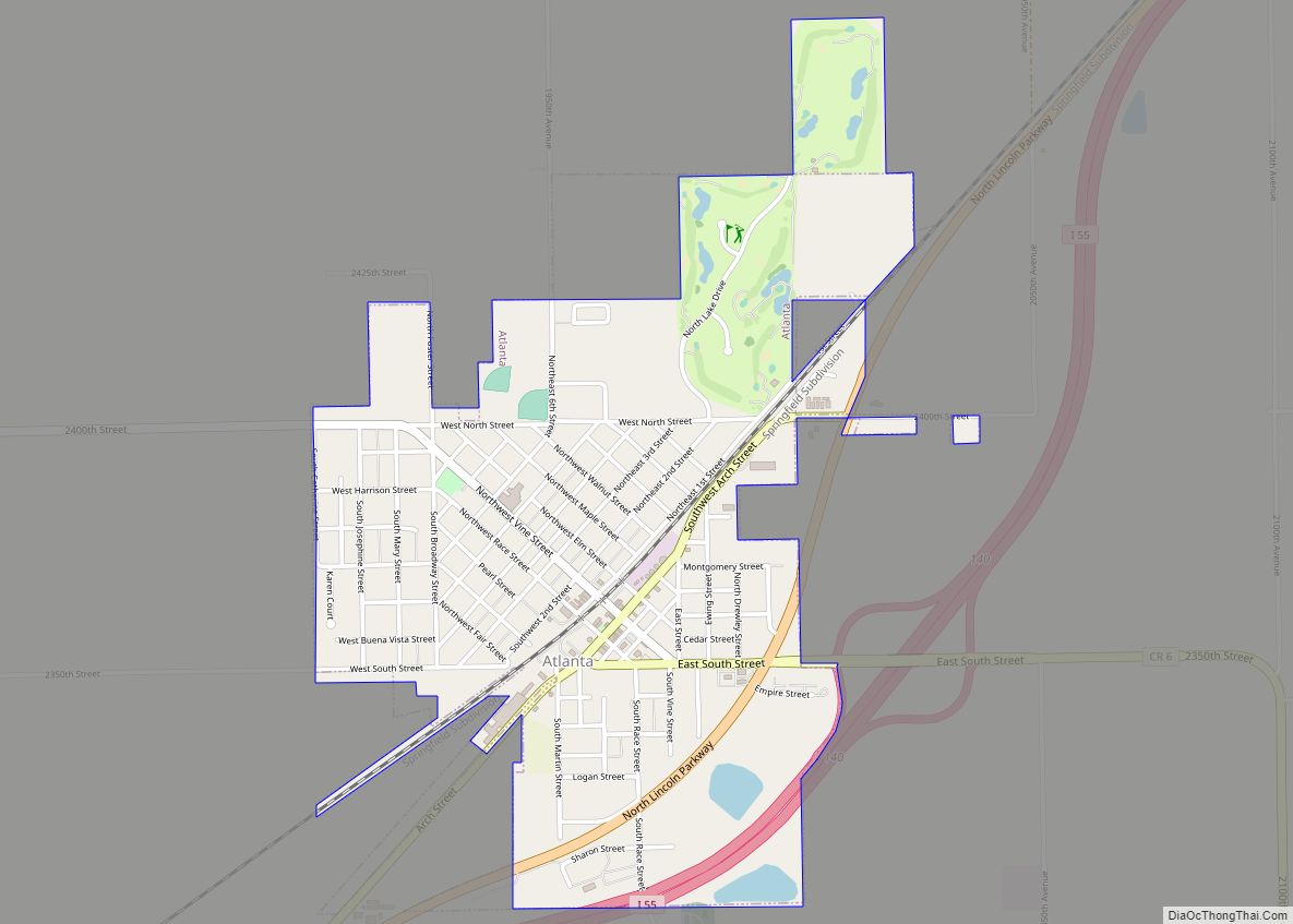
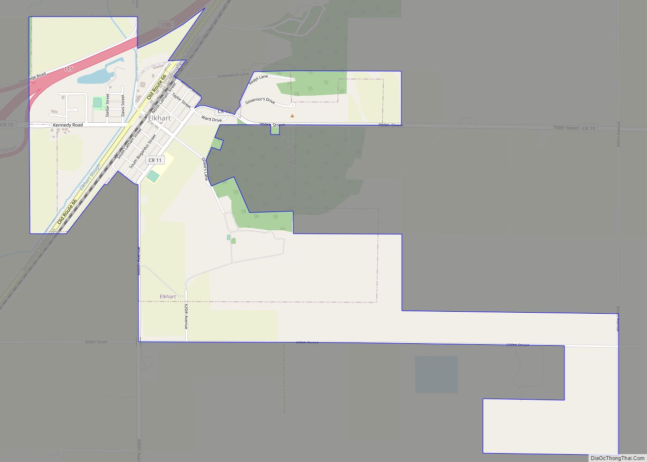
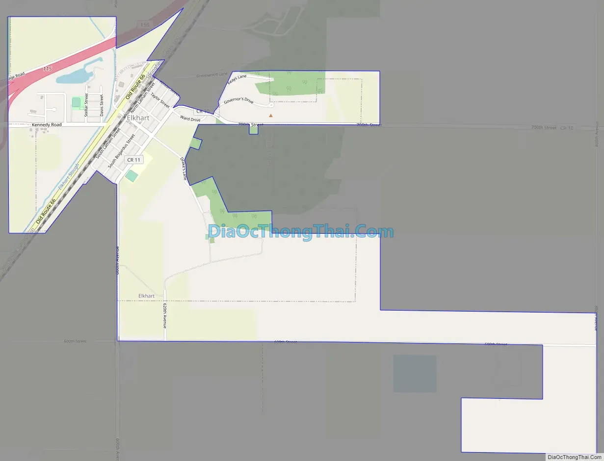
Elkhart Road Map
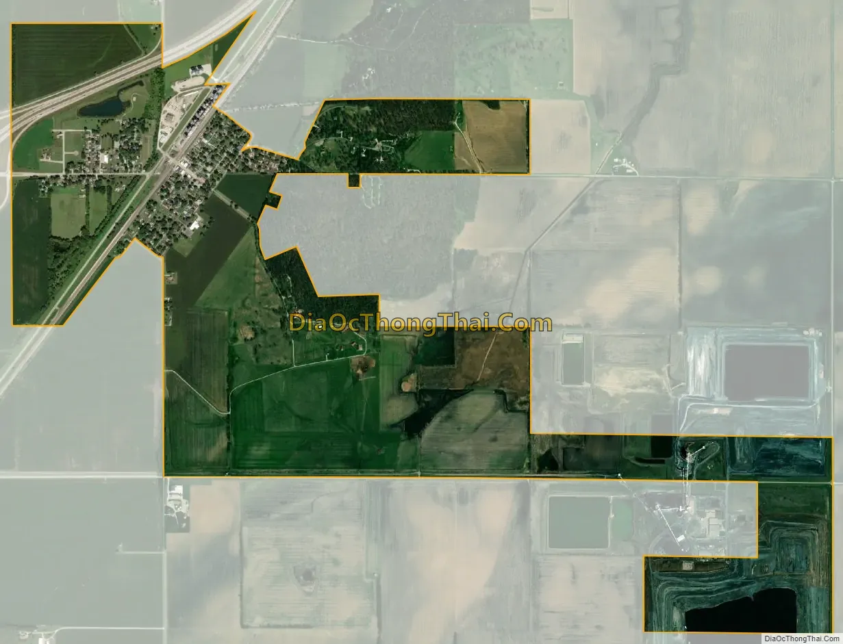
Elkhart city Satellite Map
Geography
Elkhart is located in southwestern Logan County is in Elkhart and Hurlbut townships, with the geographic center of the village slightly east of the township border, in Elkhart Township.
Interstate 55 passes through the northwest part of the village, with access from Exit 115. I-55 leads northeast 11 miles (18 km) to Lincoln, the county seat, and southwest 20 miles (32 km) to Springfield, the state capital.
According to the 2010 census, Elkhart has a total area of 1.459 square miles (3.78 km), of which 1.45 square miles (3.76 km) (or 99.38%) is land and 0.009 square miles (0.02 km) (or 0.62%) is water. Elkhart Hill, with a summit elevation of 771 feet (235 m), is in the southeast part of the village, rising 180 feet (55 m) above the village center and the surrounding flatlands.
See also
Map of Illinois State and its subdivision:- Adams
- Alexander
- Bond
- Boone
- Brown
- Bureau
- Calhoun
- Carroll
- Cass
- Champaign
- Christian
- Clark
- Clay
- Clinton
- Coles
- Cook
- Crawford
- Cumberland
- De Kalb
- De Witt
- Douglas
- Dupage
- Edgar
- Edwards
- Effingham
- Fayette
- Ford
- Franklin
- Fulton
- Gallatin
- Greene
- Grundy
- Hamilton
- Hancock
- Hardin
- Henderson
- Henry
- Iroquois
- Jackson
- Jasper
- Jefferson
- Jersey
- Jo Daviess
- Johnson
- Kane
- Kankakee
- Kendall
- Knox
- La Salle
- Lake
- Lake Michigan
- Lawrence
- Lee
- Livingston
- Logan
- Macon
- Macoupin
- Madison
- Marion
- Marshall
- Mason
- Massac
- McDonough
- McHenry
- McLean
- Menard
- Mercer
- Monroe
- Montgomery
- Morgan
- Moultrie
- Ogle
- Peoria
- Perry
- Piatt
- Pike
- Pope
- Pulaski
- Putnam
- Randolph
- Richland
- Rock Island
- Saint Clair
- Saline
- Sangamon
- Schuyler
- Scott
- Shelby
- Stark
- Stephenson
- Tazewell
- Union
- Vermilion
- Wabash
- Warren
- Washington
- Wayne
- White
- Whiteside
- Will
- Williamson
- Winnebago
- Woodford
- Alabama
- Alaska
- Arizona
- Arkansas
- California
- Colorado
- Connecticut
- Delaware
- District of Columbia
- Florida
- Georgia
- Hawaii
- Idaho
- Illinois
- Indiana
- Iowa
- Kansas
- Kentucky
- Louisiana
- Maine
- Maryland
- Massachusetts
- Michigan
- Minnesota
- Mississippi
- Missouri
- Montana
- Nebraska
- Nevada
- New Hampshire
- New Jersey
- New Mexico
- New York
- North Carolina
- North Dakota
- Ohio
- Oklahoma
- Oregon
- Pennsylvania
- Rhode Island
- South Carolina
- South Dakota
- Tennessee
- Texas
- Utah
- Vermont
- Virginia
- Washington
- West Virginia
- Wisconsin
- Wyoming